Christiana, Pennsylvania

Last updated
Christiana, Pennsylvania
Zercher Hotel 1830.JPG
Zercher Hotel
Lancaster County Pennsylvania Incorporated and Unincorporated areas Christiana Highlighted.svg
USA Pennsylvania location map.svg
Red pog.svg
Christiana
Location in Pennsylvania
Usa edcp location map.svg
Red pog.svg
Christiana
Location in the United States
Coordinates: 39°57′19″N75°59′46″W / 39.95528°N 75.99611°W / 39.95528; -75.99611
CountryUnited States
State Pennsylvania
County Lancaster
Incorporated1894
Area
[1]
  Total0.53 sq mi (1.37 km2)
  Land0.53 sq mi (1.37 km2)
  Water0.00 sq mi (0.01 km2)
Elevation
489 ft (149 m)
Population
 (2020) [2]
  Total1,112
  Density2,110.06/sq mi (814.29/km2)
Time zone UTC-5 (EST)
  Summer (DST) UTC-4 (EDT)
ZIP Code
17509
Area code(s) 610
FIPS code 42-13512
Website www.christianaboro.com

Christiana is a borough in Lancaster County, Pennsylvania, United States. The population was 1,100 at the time of the 2020 census. [3]

Contents

In 1851, it was the site of the Battle of Christiana, also called the Christiana riot.

History

The Christiana railroad depot constructed by the Pennsylvania Railroad Christiana PA Station.JPG
The Christiana railroad depot constructed by the Pennsylvania Railroad

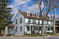
Present-day Christiana was once known as Nobleville. [4] The present name is after Christiana Noble, the wife of a first settler. [5]

On September 11, 1851, Christiana was the site of the Battle of Christiana (also called the Christiana Riot), in which the local residents defended with firearms a fugitive slave, killing the slaveowner. Southerners demanded the hanging of those responsible, who were accused of treason and making war on the United States, but after the first defendant was acquitted, the government dropped the case. The trial was the first nationally covered challenge to the Fugitive Slave Act of 1850. [6]

Geography

Christiana is located in eastern Lancaster County at 39°57′19″N75°59′46″W / 39.95528°N 75.99611°W / 39.95528; -75.99611 (39.955262, -75.996208). [7]

It is bordered to the north, west, and south by Sadsbury Township and to the east by West Sadsbury Township in Chester County.

Pennsylvania Route 372 passes through the center of the borough, leading east 5 miles (8 km) to Parkesburg and west 11 miles (18 km) to Quarryville. Lancaster is 19 miles (31 km) to the northwest via Pennsylvania Route 41, and U.S. Route 30.

According to the U.S. Census Bureau, the borough has a total area of 0.53 square miles (1.37 km2), all land. [8]

The borough is in the valley of Pine Creek, which forms the Lancaster County/Chester County line, and which flows south to form Octoraro Creek, a southward-flowing tributary of the Susquehanna River.

Demographics

Historical population
CensusPop.Note
1880 469
1900 828
1910 93412.8%
1920 9855.5%
1930 959−2.6%
1940 1,06210.7%
1950 1,043−1.8%
1960 1,0692.5%
1970 1,1315.8%
1980 1,1834.6%
1990 1,045−11.7%
2000 1,1247.6%
2010 1,1683.9%
2020 1,100−5.8%
2021 (est.)1,094 [3] −0.5%
Sources: [9] [10] [11] [12] [2]

Christiana is the least populous borough in Lancaster County. [13]

As of the 2000 census, [10] there were 1,124 people, 383 households, and 284 families residing in the borough.

The population density was 2,121.6 inhabitants per square mile (819.2/km2). There were 391 housing units at an average density of 738.0 units per square mile (284.9 units/km2).

The racial makeup of the borough was 96.09% White, 1.87% Black or African American, 0.18% Native American, 0.27% from other races, and 1.60% from two or more races. 4.00% of the population were Hispanic or Latino of any race.

There were 383 households, out of which 33.2% had children under the age of eighteen living with them; 58.7% were married couples living together, 11.5% had a female householder with no husband present, and 25.6% were non-families. 22.2% of all households were made up of individuals, and 9.1% had someone living alone who was sixty-five years of age or older.

The average household size was 2.55 and the average family size was 3.00.

In the borough, the population was spread out, with 22.8% under the age of eighteen, 7.3% from eighteen to twenty-four, 26.8% from twenty-five to forty-four, 20.3% from forty-five to sixty-four, and 22.9% who were sixty-five years of age or older. The median age was forty years.

For every one hundred females, there were 85.2 males. For every one hundred females who were aged eighteen or older, there were 78.2 males.

The median income for a household in the borough was $48,333, and the median income for a family was $50,583. Males had a median income of $35,125 compared with that of $25,000 for females.

The per capita income for the borough was $18,764.

Roughly 3.8% of families and 6.3% of the population were living below the poverty line, including 13.5% of those who were under the age of eighteen and 1.6% of those who were aged sixty-five or older.

Education

The borough is served by the Octorara Area School District.

Notable people

Related Research Articles

<span class="mw-page-title-main">Eden Township, Lancaster County, Pennsylvania</span> Township in Pennsylvania, United States

Eden Township is a township in southeastern Lancaster County, Pennsylvania, United States. At the 2020 census, the population was 2,248. It is part of the Solanco School District.

<span class="mw-page-title-main">Atglen, Pennsylvania</span> Borough in Pennsylvania, United States

Atglen is a borough in Chester County, Pennsylvania, United States. According to the 2020 census, its population is 1,311.

<span class="mw-page-title-main">South Coatesville, Pennsylvania</span> Borough in Pennsylvania, United States

South Coatesville is a borough that is located in Chester County, Pennsylvania, United States. The population was 1,604 at the ime of the 2020 census.

<span class="mw-page-title-main">Jermyn, Pennsylvania</span> Borough in Pennsylvania, United States

Jermyn, known as "The Birthplace of First Aid in America", is a borough which is located in Lackawanna County, Pennsylvania, United States. Located on the Lackawanna River, it is 12 miles (19 km) northeast of Scranton.

<span class="mw-page-title-main">Paradise Township, Lancaster County, Pennsylvania</span> Township in Pennsylvania, United States

Paradise Township is a township that is located in east-central Lancaster County, Pennsylvania, United States. The population was 5,696 at the time of the 2020 census.

<span class="mw-page-title-main">Penn Township, Lancaster County, Pennsylvania</span> Township in Pennsylvania, United States

Penn Township is a township that is located in north central Lancaster County, Pennsylvania, United States. The population was 10,224 at the time of the 2020 census.

<span class="mw-page-title-main">Pequea Township, Pennsylvania</span> Township in Pennsylvania, United States

Pequea Township is a township that is located in central Lancaster County, Pennsylvania, United States. The population was 5,493 at the time of the 2020 census.

<span class="mw-page-title-main">Sadsbury Township, Lancaster County, Pennsylvania</span> Township in Pennsylvania, United States

Sadsbury Township is a township in east central Lancaster County, Pennsylvania, United States. The population was 3,547 at the 2020 census.

<span class="mw-page-title-main">Laurel Run, Pennsylvania</span> Borough in Pennsylvania, United States

Laurel Run is a borough that is located in Luzerne County, Pennsylvania, United States. The population was 560 at the time of the 2020 census.

<span class="mw-page-title-main">Pringle, Pennsylvania</span> Borough in Pennsylvania, United States

Pringle is a borough in Luzerne County, Pennsylvania, United States. As of the 2020 census, the borough population was eight hundred and ninety-one.

<span class="mw-page-title-main">Sugar Notch, Pennsylvania</span> Borough in Pennsylvania, United States

Sugar Notch is a borough in Luzerne County, Pennsylvania, United States. The population was nine hundred and ninety-six at the time of the 2020 census.

<span class="mw-page-title-main">New Ringgold, Pennsylvania</span> Borough in Pennsylvania, United States

New Ringgold is a borough in Schuylkill County, Pennsylvania, United States. The population was 253 at the time of the 2020 census.

<span class="mw-page-title-main">Wellersburg, Pennsylvania</span> Borough in Pennsylvania, United States

Wellersburg is a borough that is located in Somerset County, Pennsylvania, United States. It is part of the Johnstown, Pennsylvania, Metropolitan Statistical Area.

<span class="mw-page-title-main">Midway, Washington County, Pennsylvania</span> Borough in Pennsylvania, United States

Midway is a borough that is located in Washington County, Pennsylvania, United States. The population was 921 at the time of the 2020 census.

<span class="mw-page-title-main">Prompton, Pennsylvania</span> Borough in Pennsylvania, United States

Prompton is a borough that is located in Wayne County, Pennsylvania, United States. The population was 250 at the time of the 2010 census.

<span class="mw-page-title-main">Railroad, Pennsylvania</span> Borough in Pennsylvania, United States

Railroad is a borough in York County, Pennsylvania, United States. The population was two hundred fifty-nine at the time of the 2020 census.

<span class="mw-page-title-main">Shrewsbury, Pennsylvania</span> Borough in Pennsylvania, United States

Shrewsbury is a borough in York County, Pennsylvania, United States. The population was 3,848 at the time of the 2020 census.

<span class="mw-page-title-main">Winterstown, Pennsylvania</span> Borough in Pennsylvania, United States

Winterstown is a borough in York County, Pennsylvania, United States. The population was 609 at the time of the 2020 census.

<span class="mw-page-title-main">Yoe, Pennsylvania</span> Borough in Pennsylvania, United States

Yoe is a borough in York County, Pennsylvania, United States. The population was 1,058 at the time of the 2020 census.

<span class="mw-page-title-main">Adamstown, Pennsylvania</span> Place in Pennsylvania, United States

Adamstown is a borough that is located in Lancaster County and Berks County in the U.S. state of Pennsylvania.

References

  1. "ArcGIS REST Services Directory". United States Census Bureau. Retrieved October 12, 2022.
  2. 1 2 "Census Population API". United States Census Bureau. Retrieved Oct 12, 2022.
  3. 1 2 Bureau, US Census. "City and Town Population Totals: 2020-2021". Census.gov. US Census Bureau. Retrieved 9 July 2022.
  4. "Penn Biographies: D. Hayes (David Hayes) Agnew (1818-1892)". University of Pennsylvania . Archived from the original on 2015-12-20. Retrieved 2015-08-07.
  5. Espenshade, Abraham Howry (1925). Pennsylvania Place Names. Evangelical Press. p. 307. ISBN   978-0-8063-0416-8.
  6. James M. McPherson, Battle Cry of Freedom: The Civil War Era (New York: Bantam Books, 1989), pp. 84-85.
  7. "US Gazetteer files: 2010, 2000, and 1990". United States Census Bureau. 2011-02-12. Retrieved 2011-04-23.
  8. "Total Population: 2010 Census DEC Summary File 1 (P1), Christiana borough, Pennsylvania". data.census.gov. U.S. Census Bureau. Retrieved September 1, 2020.
  9. "Census of Population and Housing". U.S. Census Bureau. Retrieved 11 December 2013.
  10. 1 2 "U.S. Census website". United States Census Bureau . Retrieved 2008-01-31.
  11. "Incorporated Places and Minor Civil Divisions Datasets: Subcounty Resident Population Estimates: April 1, 2010 to July 1, 2012". Population Estimates. U.S. Census Bureau. Archived from the original on 11 June 2013. Retrieved 11 December 2013.
  12. "Census of Population and Housing". Census.gov. Retrieved June 4, 2016.
  13. Wolf, Paula (2010-03-28). "Terre Hill tops early Census returns". Intelligencer Journal . Archived from the original on 2013-01-03. Retrieved 2010-04-07.