According to the U.S. Census Bureau, the township has a total area of 24.2square miles (62.7km2), all land. It is drained by the Schuylkill River via its tributaries of the Manatawny Creek and Monocacy Creek. The township's villages include Limekiln (also in Exeter Township), Oley, Oley Furnace, Pleasantville, Spangsville, and Yellow House (also in Amity Township).
PA 73 eastbound and PA 662 southbound in Oley Township
As of 2019, there were 76.57 miles (123.23km) of public roads in Oley Township, of which 25.70 miles (41.36km) were maintained by the Pennsylvania Department of Transportation (PennDOT) and 50.87 miles (81.87km) were maintained by the township.[7]
Numbered highways serving Oley Township include Pennsylvania Route 73, Pennsylvania Route 562 and Pennsylvania Route 662. PA 73 follows an east-west alignment across the northern portion of the township. PA 562 follows Boyertown Pike along an east-west alignment on the southern edge of the township. Finally, PA 662 follows Memorial Highway along a northwest-southeast alignment through the center of the township, including a concurrency with PA 73 in the northwestern part of the township.
Demographics
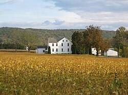
Kaufman barns
As of the census[8] of 2000, there were 3,583 people, 1,382 households, and 1,029 families residing in the township. The population density was 148.1 inhabitants per square mile (57.2/km2). There were 1,425 housing units at an average density of 58.9 per square mile (22.7/km2).
There were 1,382 households, out of which 33.1% had children under the age of 18 living with them, 62.8% were married couples living together, 7.5% had a female householder with no husband present, and 25.5% were non-families. 19.8% of all households were made up of individuals, and 8.0% had someone living alone who was 65 years of age or older. The average household size was 2.58 and the average family size was 3.00.
In the township, the population was spread out, with 23.7% under the age of 18, 6.9% from 18 to 24, 30.8% from 25 to 44, 24.4% from 45 to 64, and 14.2% who were 65 years of age or older. The median age was 39 years. For every 100 females, there were 99.6 males. For every 100 females age 18 and over, there were 96.8 males.
The median income for a household in the township was $52,151, and the median income for a family was $58,045. Males had a median income of $40,882 versus $27,795 for females. The per capita income for the township was $21,565. About 0.9% of families and 2.0% of the population were below the poverty line, including none of those under age 18 and 4.8% of those age 65 or over.
This page is based on this Wikipedia article Text is available under the CC BY-SA 4.0 license; additional terms may apply. Images, videos and audio are available under their respective licenses.