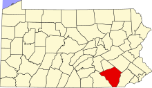
[3] Name on the Register Image Date listed [4] Location Municipality Description 1 Abbeville Abbeville December 14, 1978 (# 78002414 1140 Columbia Avenue 40°02′16″N 76°20′07″W / 40.037778°N 76.335278°W / 40.037778; -76.335278 (Abbeville ) Lancaster Township 2 Andrews Bridge Historic District Andrews Bridge Historic District December 22, 1988 (# 88003046 Junction of Pennsylvania Route 896 and Sproul and Creek Roads 39°52′15″N 76°00′20″W / 39.870833°N 76.005556°W / 39.870833; -76.005556 (Andrews Bridge Historic District ) Colerain Township 3 Ashley and Bailey Silk Mill Ashley and Bailey Silk Mill June 27, 1980 (# 80003533 East Walnut and Pine Streets 40°03′33″N 76°32′51″W / 40.059167°N 76.5475°W / 40.059167; -76.5475 (Ashley and Bailey Silk Mill ) Marietta 4 Bachman and Forry Tobacco Warehouse Bachman and Forry Tobacco Warehouse March 29, 1979 (# 79002252 125 Bank Alley 40°01′45″N 76°30′10″W / 40.029167°N 76.502778°W / 40.029167; -76.502778 (Bachman and Forry Tobacco Warehouse ) Columbia 5 Bangor Episcopal Church Bangor Episcopal Church April 30, 1987 (# 87000664 Northwestern corner of Main and Water Streets, Churchtown 40°08′01″N 75°57′42″W / 40.133611°N 75.961667°W / 40.133611; -75.961667 (Bangor Episcopal Church ) Caernarvon Township 6 Baumgardner's Mill Covered Bridge Baumgardner's Mill Covered Bridge December 11, 1980 (# 80003541 Southwest of Willow Street on Township 425 39°55′50″N 76°17′44″W / 39.930556°N 76.295556°W / 39.930556; -76.295556 (Baumgardner's Mill Covered Bridge ) Martic and Pequea Townships 7 Bausman Farmstead Bausman Farmstead August 30, 1994 (# 94001061 1630 and 1631 Pennsylvania Route 999 (Millersville Pike) 40°01′18″N 76°20′00″W / 40.021583°N 76.333333°W / 40.021583; -76.333333 (Bausman Farmstead ) Lancaster Township 8 John Berger & Son Company Tobacco Warehouse John Berger & Son Company Tobacco Warehouse August 1, 2014 (# 14000468 191 Broad St. 40°05′52″N 76°24′48″W / 40.0979°N 76.4133°W / 40.0979; -76.4133 (John Berger & Son Company Tobacco Warehouse ) East Hempfield Township 9 Big and Little Indian Rock Petroglyphs Big and Little Indian Rock Petroglyphs April 3, 1978 (# 78002421 In the Susquehanna River , south of Safe Harbor [5] 39°55′15″N 76°23′05″W / 39.9208°N 76.3847°W / 39.9208; -76.3847 (Big and Little Indian Rock Petroglyphs ) Conestoga Township 10 Bird-in-Hand Hotel Bird-in-Hand Hotel July 24, 1992 (# 92000950 2695 Old Philadelphia Pike (Pennsylvania Route 340 ), Bird-in-Hand 40°02′19″N 76°10′48″W / 40.038611°N 76.18°W / 40.038611; -76.18 (Bird-in-Hand Hotel ) East Lampeter Township 11 Bitzer's Mill Covered Bridge Bitzer's Mill Covered Bridge December 11, 1980 (# 80003516 Southeast of Ephrata on Legislative Route 36122 40°08′25″N 76°09′08″W / 40.140278°N 76.152222°W / 40.140278; -76.152222 (Bitzer's Mill Covered Bridge ) West Earl Township 12 Bowmansville Roller Mill Bowmansville Roller Mill January 19, 1990 (# 89001821 Junction of Pennsylvania Route 625 and Von Nieda Street, Bowmansville 40°11′24″N 76°00′43″W / 40.19°N 76.011944°W / 40.19; -76.011944 (Bowmansville Roller Mill ) Brecknock Township 13 Bridge in West Earl Township Bridge in West Earl Township June 22, 1988 (# 88000875 Legislative Route 36032 over Conestoga Creek, Brownstown 40°07′42″N 76°12′01″W / 40.128333°N 76.200278°W / 40.128333; -76.200278 (Bridge in West Earl Township ) West Earl Township 14 George Brown's Sons Cotton and Woolen Mill George Brown's Sons Cotton and Woolen Mill July 21, 1995 (# 95000881 324– 360 East Main Street 40°06′32″N 76°29′47″W / 40.108889°N 76.496389°W / 40.108889; -76.496389 (George Brown's Sons Cotton and Woolen Mill ) Mount Joy 15 Bucher Thal Historic District Bucher Thal Historic District December 31, 1987 (# 87002207 Weaver Road 40°13′33″N 76°07′57″W / 40.225833°N 76.1325°W / 40.225833; -76.1325 (Bucher Thal Historic District ) East Cocalico Township 16 James Buchanan House James Buchanan House October 15, 1966 (# 66000669 1120 Marietta Avenue 40°02′36″N 76°19′49″W / 40.043333°N 76.330278°W / 40.043333; -76.330278 (James Buchanan House ) Lancaster Township 17 Joseph Bucher House Joseph Bucher House September 7, 1979 (# 79002260 104 East Front St 40°03′19″N 76°33′17″W / 40.055278°N 76.554722°W / 40.055278; -76.554722 (Joseph Bucher House ) Marietta 18 Buck Hill Farm Covered Bridge Buck Hill Farm Covered Bridge December 10, 1980 (# 80003528 South of Lititz, east of Pennsylvania Route 501 , near Lititz 40°07′55″N 76°18′03″W / 40.131944°N 76.300833°W / 40.131944; -76.300833 (Buck Hill Farm Covered Bridge ) Warwick Township 19 Butcher's Mill Covered Bridge Butcher's Mill Covered Bridge December 11, 1980 (# 80003514 South of Denver on Township 955, East Cocalico Township 40°12′28″N 76°08′05″W / 40.207778°N 76.134722°W / 40.207778; -76.134722 (Butcher's Mill Covered Bridge ) Denver 20 Byers-Muma House Byers-Muma House February 22, 2002 (# 02000070 1402 Trout Run Road 40°05′12″N 76°33′04″W / 40.086667°N 76.551111°W / 40.086667; -76.551111 (Byers-Muma House ) East Donegal Township 21 Caernarvon Presbyterian Church Caernarvon Presbyterian Church August 18, 2015 (# 15000534 2148 Main St. 40°08′02″N 75°57′28″W / 40.1339°N 75.9579°W / 40.1339; -75.9579 (Caernarvon Presbyterian Church ) Caernarvon Township 22 Cameron Estate Cameron Estate November 3, 1975 (# 75001646 2 miles (3.2 km) west of Mount Joy on Donegal Springs Road 40°06′10″N 76°34′00″W / 40.102778°N 76.566667°W / 40.102778; -76.566667 (Cameron Estate ) East Donegal Township 23 Central Hotel Central Hotel June 4, 1973 (# 73001637 102 North Market Street 40°06′41″N 76°30′12″W / 40.111389°N 76.503333°W / 40.111389; -76.503333 (Central Hotel ) Mount Joy 24 Chickies Historic District Chickies Historic District December 28, 2005 (# 05001488 Roughly bounded by the Susquehanna River , Chickies Creek, Bank Street and Long Lane 40°03′27″N 76°31′35″W / 40.0575°N 76.526389°W / 40.0575; -76.526389 (Chickies Historic District ) East Donegal Township , West Hempfield Township , and Marietta 25 Colemanville Covered Bridge Colemanville Covered Bridge December 11, 1980 (# 80003534 Northeast of Pequea on Township 408 39°53′55″N 76°20′32″W / 39.898611°N 76.342222°W / 39.898611; -76.342222 (Colemanville Covered Bridge ) Conestoga and Martic Townships 26 Columbia Historic District Columbia Historic District May 6, 1983 (# 83002249 Roughly bounded by the Susquehanna River , Union, Cedar, 4th, and 5th Streets, Chestnut to 9th Street 40°02′02″N 76°30′12″W / 40.033889°N 76.503333°W / 40.033889; -76.503333 (Columbia Historic District ) Columbia 27 Columbia Wagon Works Columbia Wagon Works February 2, 2001 (# 01000057 920 Plane Street 40°01′29″N 76°29′35″W / 40.024722°N 76.493056°W / 40.024722; -76.493056 (Columbia Wagon Works ) Columbia 28 Combination Baggage and Mail Car No. 5403 Combination Baggage and Mail Car No. 5403 December 17, 1979 (# 79002261 Railroad Museum of Pennsylvania 39°58′56″N 76°09′40″W / 39.982222°N 76.161111°W / 39.982222; -76.161111 (Combination Baggage and Mail Car No. 5403 ) Strasburg Township 29 Conestoga Town Conestoga Town June 18, 1973 (# 73001636 Junction of Safe Harbor and Indian Marker Roads [6] 39°57′35″N 76°24′01″W / 39.9598°N 76.4004°W / 39.9598; -76.4004 (Conestoga Town ) Manor Township 30 Congregational Store Congregational Store January 6, 1983 (# 83002250 120– 122 East Main Street 40°09′23″N 76°18′14″W / 40.156389°N 76.303889°W / 40.156389; -76.303889 (Congregational Store ) Lititz 31 Connell Mansion Connell Mansion January 19, 1979 (# 79002254 249 West Main Street 40°10′51″N 76°10′53″W / 40.180833°N 76.181389°W / 40.180833; -76.181389 (Connell Mansion ) Ephrata 32 Consolidation Freight Locomotive No. 1187 Consolidation Freight Locomotive No. 1187 December 17, 1979 (# 79002262 Railroad Museum of Pennsylvania 39°58′56″N 76°09′40″W / 39.982222°N 76.161111°W / 39.982222; -76.161111 (Consolidation Freight Locomotive No. 1187 ) Strasburg Township 33 Consolidation Freight Locomotive No. 2846 Consolidation Freight Locomotive No. 2846 December 17, 1979 (# 79002263 Railroad Museum of Pennsylvania 39°58′56″N 76°09′40″W / 39.982222°N 76.161111°W / 39.982222; -76.161111 (Consolidation Freight Locomotive No. 2846 ) Strasburg Township 34 Consolidation Freight Locomotive No. 7688 Consolidation Freight Locomotive No. 7688 December 17, 1979 (# 79002264 Railroad Museum of Pennsylvania 39°58′56″N 76°09′40″W / 39.982222°N 76.161111°W / 39.982222; -76.161111 (Consolidation Freight Locomotive No. 7688 ) Strasburg Township 35 Cumberland Valley Car Cumberland Valley Car December 17, 1979 (# 79002265 Railroad Museum of Pennsylvania 39°58′56″N 76°09′40″W / 39.982222°N 76.161111°W / 39.982222; -76.161111 (Cumberland Valley Car ) Strasburg Township 36 Edward Davies House Edward Davies House September 6, 1991 (# 91001122 West of Water Street on the southern side of Pennsylvania Route 23 , Churchtown 40°08′01″N 75°57′38″W / 40.133611°N 75.960556°W / 40.133611; -75.960556 (Edward Davies House ) Caernarvon Township 37 David Davis Farm David Davis Farm August 30, 1994 (# 94001060 737 Spruce Road 40°07′23″N 76°04′46″W / 40.123056°N 76.079444°W / 40.123056; -76.079444 (David Davis Farm ) Earl Township 38 DDI Electric Locomotive No. 36 DDI Electric Locomotive No. 36 December 17, 1979 (# 79002266 Railroad Museum of Pennsylvania 39°58′56″N 76°09′40″W / 39.982222°N 76.161111°W / 39.982222; -76.161111 (DDI Electric Locomotive No. 36 ) Strasburg Township 39 Michael Dohner Farmhouse Michael Dohner Farmhouse June 27, 1980 (# 80003523 South of U.S. Route 30 , east of the intersection with Pennsylvania Route 896 40°01′39″N 76°13′49″W / 40.0275°N 76.230278°W / 40.0275; -76.230278 (Michael Dohner Farmhouse ) East Lampeter Township 40 Donegal Mills Plantation Donegal Mills Plantation January 20, 1978 (# 78002418 Southwest of Mount Joy on Trout Run Road 40°05′06″N 76°32′26″W / 40.085°N 76.540556°W / 40.085; -76.540556 (Donegal Mills Plantation ) East Donegal Township 41 Donegal Presbyterian Church Complex Donegal Presbyterian Church Complex July 2, 1985 (# 85001482 Donegal Springs Road 40°06′04″N 76°34′00″W / 40.101111°N 76.566667°W / 40.101111; -76.566667 (Donegal Presbyterian Church Complex ) East Donegal Township 42 John Douglass House John Douglass House September 5, 1990 (# 90001411 Sproul Road, south of Pennsylvania Route 896 , Kirkwood 39°51′55″N 76°00′30″W / 39.865278°N 76.008333°W / 39.865278; -76.008333 (John Douglass House ) Colerain Township 43 Duncan Island (36LA60,61) Duncan Island (36LA60,61) May 10, 1984 (# 84003428 In the Susquehanna River [7] 39°51′41″N 76°21′49″W / 39.8614°N 76.3636°W / 39.8614; -76.3636 (Duncan Island (36LA60,61) ) Martic Township 44 Eby Shoe Corporation Eby Shoe Corporation August 18, 1989 (# 89001050 136 North State Street 40°10′50″N 76°10′29″W / 40.180556°N 76.174722°W / 40.180556; -76.174722 (Eby Shoe Corporation ) Ephrata 45 Ephrata Cloister Ephrata Cloister December 24, 1967 (# 67000026 Junction of U.S. Routes 222 and 322 40°10′59″N 76°11′21″W / 40.183056°N 76.189167°W / 40.183056; -76.189167 (Ephrata Cloister ) Ephrata 46 Ephrata Commercial Historic District Ephrata Commercial Historic District November 8, 2006 (# 06001005 Portions of West Main, East Main, North State, South State Streets, and Washington Avenue 40°10′41″N 76°10′39″W / 40.178056°N 76.1775°W / 40.178056; -76.1775 (Ephrata Commercial Historic District ) Ephrata 47 Erb's Covered Bridge Erb's Covered Bridge December 10, 1980 (# 80003536 North of Rothsville on Township 634 40°10′03″N 76°14′39″W / 40.1675°N 76.244167°W / 40.1675; -76.244167 (Erb's Covered Bridge ) Ephrata and Warwick Township 48 Ann Cunningham Evans House Ann Cunningham Evans House May 9, 2002 (# 02000475 6132 Twenty-eighth Division Highway 40°06′44″N 75°59′00″W / 40.112222°N 75.983333°W / 40.112222; -75.983333 (Ann Cunningham Evans House ) Caernarvon Township 49 Flat Car No. 473567 Flat Car No. 473567 December 17, 1979 (# 79002267 Railroad Museum of Pennsylvania 39°58′56″N 76°09′40″W / 39.982222°N 76.161111°W / 39.982222; -76.161111 (Flat Car No. 473567 ) Strasburg Township This flat car is outside the main train yard; the numbers on the side are extremely weathered and barely legible. 50 Forry's Mill Covered Bridge Forry's Mill Covered Bridge December 11, 1980 (# 80003512 Northeast of Columbia on Township 362, Rapho/West Hempfield Townships 40°03′59″N 76°28′42″W / 40.066389°N 76.478333°W / 40.066389; -76.478333 (Forry's Mill Covered Bridge ) Rapho and West Hempfield Townships 51 Freight Locomotive No. 5741 Freight Locomotive No. 5741 December 17, 1979 (# 79002268 Railroad Museum of Pennsylvania 39°58′56″N 76°09′40″W / 39.982222°N 76.161111°W / 39.982222; -76.161111 (Freight Locomotive No. 5741 ) Strasburg Township 52 Frey-Haverstick Site (36LA6) Frey-Haverstick Site (36LA6) January 15, 1986 (# 86000819 Eastern side of the Susquehanna River , north of Staman's Run [8] 39°59′42″N 76°28′14″W / 39.995°N 76.4705°W / 39.995; -76.4705 (Frey-Haverstick Site (36LA6) ) Washington Boro 53 Robert Fulton Birthplace Robert Fulton Birthplace October 15, 1966 (# 66000670 8 miles (13 km) south of Quarryville on U.S. Route 222 39°48′17″N 76°09′37″W / 39.804722°N 76.160278°W / 39.804722; -76.160278 (Robert Fulton Birthplace ) Fulton Township 54 Furnace Hills Tenant House Furnace Hills Tenant House May 20, 2005 (# 05000451 Unpaved road approximately 500 feet (150 m) east of Project Drive 40°15′55″N 76°12′21″W / 40.265278°N 76.205833°W / 40.265278; -76.205833 (Furnace Hills Tenant House ) West Cocalico Township 55 John B. Good House John B. Good House February 8, 1980 (# 80003507 Pennsylvania Route 625 in Bowmansville 40°11′48″N 76°01′03″W / 40.196667°N 76.0175°W / 40.196667; -76.0175 (John B. Good House ) Brecknock Township 56 Grove Mansion Grove Mansion April 21, 1983 (# 83002251 133 River Road, Maytown 40°04′21″N 76°34′49″W / 40.0725°N 76.580278°W / 40.0725; -76.580278 (Grove Mansion ) East Donegal Township 57 Christian Habeck Farm Christian Habeck Farm August 30, 1994 (# 94001063 2301 Spring Valley Road 40°03′41″N 76°21′52″W / 40.061389°N 76.364444°W / 40.061389; -76.364444 (Christian Habeck Farm ) East Hempfield Township 58 Hammer Creek Bridge Hammer Creek Bridge June 22, 1988 (# 88000872 Legislative Route 36011 over Hammer Creek 40°11′48″N 76°16′45″W / 40.196667°N 76.279167°W / 40.196667; -76.279167 (Hammer Creek Bridge ) Elizabeth and Warwick Townships 59 Gen. Edward Hand House Gen. Edward Hand House November 21, 1976 (# 76001646 881 Rock Ford Road 40°01′12″N 76°17′17″W / 40.02°N 76.288056°W / 40.02; -76.288056 (Gen. Edward Hand House ) West Lampeter Township 60 Johannes Harnish Farmstead Johannes Harnish Farmstead March 12, 1999 (# 99000327 202 Woodfield Crossing 40°00′05″N 76°17′11″W / 40.001389°N 76.286389°W / 40.001389; -76.286389 (Johannes Harnish Farmstead ) West Lampeter Township 61 Christian and Emma Herr Farm Christian and Emma Herr Farm August 30, 1994 (# 94001059 2131 and 2133 South View Road 39°58′16″N 76°14′20″W / 39.971111°N 76.238889°W / 39.971111; -76.238889 (Christian and Emma Herr Farm ) West Lampeter Township 62 Hans Herr House Hans Herr House May 3, 1971 (# 71000708 1851 Hans Herr Drive 39°58′48″N 76°15′43″W / 39.980083°N 76.261944°W / 39.980083; -76.261944 (Hans Herr House ) West Lampeter Township 63 Herr's Mill Covered Bridge Herr's Mill Covered Bridge December 10, 1980 (# 80003537 Southwest of Soundersburg on Township 696 40°00′35″N 76°09′44″W / 40.009722°N 76.162222°W / 40.009722; -76.162222 (Herr's Mill Covered Bridge ) East Lampeter and Paradise Townships 64 Hibshman Farm Hibshman Farm June 27, 1980 (# 80003517 Springville Road 40°12′18″N 76°10′33″W / 40.205°N 76.175833°W / 40.205; -76.175833 (Hibshman Farm ) Ephrata Township 65 Kagerise Store and House Kagerise Store and House November 3, 1988 (# 88002174 84– 86 West Main Street 40°14′33″N 76°03′30″W / 40.2425°N 76.058333°W / 40.2425; -76.058333 (Kagerise Store and House ) Adamstown 66 Kauffman's Distillery Covered Bridge Kauffman's Distillery Covered Bridge December 11, 1980 (# 80003529 Southwest of Manheim on Township 889 40°08′53″N 76°24′37″W / 40.148056°N 76.410278°W / 40.148056; -76.410278 (Kauffman's Distillery Covered Bridge ) Penn and Rapho Townships 67 Keller's Covered Bridge Keller's Covered Bridge December 10, 1980 (# 80003518 Middle Creek Road (TR 660) over Cocalico Creek 40°09′51″N 76°13′57″W / 40.164167°N 76.2325°W / 40.164167; -76.2325 (Keller's Covered Bridge ) Ephrata Township 68 Jacob Keller Farm Jacob Keller Farm July 17, 1986 (# 86001679 900 Rettew Mill Road 40°10′13″N 76°12′21″W / 40.170278°N 76.205833°W / 40.170278; -76.205833 (Jacob Keller Farm ) Ephrata Township 69 Kirks Mills Historic District Kirks Mills Historic District July 17, 1978 (# 78002420 West of Nottingham , Chester County off Pennsylvania Route 272 39°45′11″N 76°06′27″W / 39.753056°N 76.1075°W / 39.753056; -76.1075 (Kirks Mills Historic District ) Little Britain Township 70 Kreider Shoe Manufacturing Company Kreider Shoe Manufacturing Company June 27, 1980 (# 80003515 155 South Poplar Street 40°08′56″N 76°36′21″W / 40.148806°N 76.605833°W / 40.148806; -76.605833 (Kreider Shoe Manufacturing Company ) Elizabethtown 71 Lancaster City Historic District Lancaster City Historic District September 7, 2001 (# 01000956 Roughly bounded by Liberty Street, Broad Street, Greenwood Avenue, Race Avenue, 40°02′29″N 76°18′25″W / 40.041389°N 76.306944°W / 40.041389; -76.306944 (Lancaster City Historic District ) All neighborhoods Extends into Lancaster 72 Lancaster County House of Employment Lancaster County House of Employment April 17, 1980 (# 80003525 900 East King Street 40°02′17″N 76°17′08″W / 40.038056°N 76.285556°W / 40.038056; -76.285556 (Lancaster County House of Employment ) Lancaster Township 73 Landis Mill Covered Bridge Landis Mill Covered Bridge December 10, 1980 (# 80003526 Shreiner Station Road near the Park City Center 40°04′07″N 76°20′42″W / 40.068611°N 76.345°W / 40.068611; -76.345 (Landis Mill Covered Bridge ) East Hempfield and Manheim Townships 74 Landis Valley Museum Landis Valley Museum January 3, 2000 (# 99001578 2451 Kissel Hill Road 40°05′36″N 76°16′48″W / 40.093333°N 76.28°W / 40.093333; -76.28 (Landis Valley Museum ) Manheim Township 75 Leaman Place Covered Bridge Leaman Place Covered Bridge December 11, 1980 (# 80003519 South of Intercourse on Township 684 40°00′44″N 76°06′30″W / 40.012222°N 76.108333°W / 40.012222; -76.108333 (Leaman Place Covered Bridge ) Leacock and Paradise Townships 76 Lime Valley Covered Bridge Lime Valley Covered Bridge December 10, 1980 (# 80003535 North of Refton on Township 498 39°57′38″N 76°14′06″W / 39.960556°N 76.235°W / 39.960556; -76.235 (Lime Valley Covered Bridge ) Strasburg and West Lampeter Townships 77 Linden House Linden House January 6, 1983 (# 83002254 606 East Market Street 40°03′35″N 76°32′30″W / 40.059722°N 76.541667°W / 40.059722; -76.541667 (Linden House ) Marietta 78 Lititz Moravian Historic District Lititz Moravian Historic District May 9, 1986 (# 86001030 Roughly bounded by East Main, Willow and Locust, Marion and Orange, and South Cedar and South and North Broad Streets 40°09′17″N 76°18′06″W / 40.154722°N 76.301667°W / 40.154722; -76.301667 (Lititz Moravian Historic District ) Lititz 79 Locomotive No. 6755 Locomotive No. 6755 December 17, 1979 (# 01000519 Railroad Museum of Pennsylvania 39°58′56″N 76°09′40″W / 39.982222°N 76.161111°W / 39.982222; -76.161111 (Locomotive No. 6755 ) Strasburg Township 80 Locust Grove Locust Grove August 3, 1977 (# 77001171 South of Bainbridge off Pennsylvania Route 441 40°04′44″N 76°39′38″W / 40.078889°N 76.660556°W / 40.078889; -76.660556 (Locust Grove ) Conoy Township 81 Locust Grove Archaeological District Upload image May 28, 2020 (# 100003391 Address Restricted Bainbridge vicinity 82 Manheim Borough Historic District Manheim Borough Historic District February 4, 2000 (# 00000058 Roughly bounded by Colebrook, Laurel, Fuller Dr., And Fulton Streets 40°09′45″N 76°23′45″W / 40.1625°N 76.395833°W / 40.1625; -76.395833 (Manheim Borough Historic District ) Manheim 83 Manor Street Elementary School Manor Street Elementary School April 2, 1987 (# 87000572 Tenth and Manor Streets 40°01′40″N 76°29′23″W / 40.027778°N 76.489722°W / 40.027778; -76.489722 (Manor Street Elementary School ) Columbia 84 Marietta Historic District Marietta Historic District July 18, 1978 (# 78002417 Roughly bounded by Market, Front, Biddle, and Waterford Streets 40°03′22″N 76°33′28″W / 40.056111°N 76.557778°W / 40.056111; -76.557778 (Marietta Historic District ) Marietta 85 Mascot Roller Mills Mascot Roller Mills September 29, 1983 (# 83002255 Newport and Stumptown Roads, Mascot 40°03′46″N 76°09′26″W / 40.062778°N 76.157222°W / 40.062778; -76.157222 (Mascot Roller Mills ) Upper Leacock Township 86 David M. Mayer House David M. Mayer House August 31, 2017 (# 100001571 1580 Fruitville Pike 40°03′54″N 76°18′55″W / 40.065000°N 76.315278°W / 40.065000; -76.315278 (David M. Mayer House ) Manheim Township 87 Mentzer Building Mentzer Building March 7, 1985 (# 85000466 3 West Main Street 40°10′47″N 76°10′44″W / 40.179722°N 76.178889°W / 40.179722; -76.178889 (Mentzer Building ) Ephrata 88 Mercer's Mill Covered Bridge Mercer's Mill Covered Bridge December 11, 1980 (# 80003509 South of Christiana 39°55′53″N 75°58′54″W / 39.931389°N 75.981667°W / 39.931389; -75.981667 (Mercer's Mill Covered Bridge ) Sadsbury Township Extends into Chester County 89 Mikado Freight Locomotive No. 520 Mikado Freight Locomotive No. 520 December 17, 1979 (# 79002269 Railroad Museum of Pennsylvania 39°58′56″N 76°09′40″W / 39.982222°N 76.161111°W / 39.982222; -76.161111 (Mikado Freight Locomotive No. 520 ) Strasburg Township 90 Mount Hope Estate Mount Hope Estate December 1, 1980 (# 80003530 Northwest of Manheim on Pennsylvania Route 72 ; also roughly along Shearer's Creek, east of Mansion House Road and north of the Pennsylvania Turnpike 40°13′37″N 76°25′47″W / 40.226944°N 76.429722°W / 40.226944; -76.429722 (Mount Hope Estate ) Penn and Rapho Townships Second set of boundaries represents a boundary increase of September 6, 1991 91 Mountain Springs Hotel Mountain Springs Hotel March 2, 1982 (# 82003791 320 East Main Street 40°10′31″N 76°10′21″W / 40.175278°N 76.1725°W / 40.175278; -76.1725 (Mountain Springs Hotel ) Ephrata 92 Samuel N. Mumma Tobacco Warehouse Samuel N. Mumma Tobacco Warehouse May 30, 1997 (# 97000517 Elizabeth Street junction with Emily Avenue 40°05′46″N 76°25′08″W / 40.096111°N 76.418889°W / 40.096111; -76.418889 (Samuel N. Mumma Tobacco Warehouse ) East Hempfield Township 93 Murry Site Murry Site December 10, 1980 (# 80003540 2 miles (3.2 km) south of Washington Boro [9] 39°58′44″N 76°27′11″W / 39.979°N 76.453°W / 39.979; -76.453 (Murry Site ) Manor Township 94 Neff's Mill Covered Bridge Neff's Mill Covered Bridge December 11, 1980 (# 80003538 West of Strasburg on Township 559 39°58′43″N 76°13′33″W / 39.978611°N 76.225833°W / 39.978611; -76.225833 (Neff's Mill Covered Bridge ) Strasburg and West Lampeter Townships 95 New Holland Machine Company New Holland Machine Company August 9, 2000 (# 00000846 146 East Franklin Street 40°06′03″N 76°05′19″W / 40.100833°N 76.088611°W / 40.100833; -76.088611 (New Holland Machine Company ) New Holland 96 Nissly Swiss Chocolate Company Nissly Swiss Chocolate Company June 28, 1996 (# 96000709 951 Wood Street 40°06′48″N 76°31′38″W / 40.113333°N 76.527222°W / 40.113333; -76.527222 (Nissly Swiss Chocolate Company ) Mount Joy 97 Northeast Lancaster Township Historic District Northeast Lancaster Township Historic District March 20, 1986 (# 86000464 Roughly bounded by Marietta, Race, and Wheatland Avenues and Wilson Drive 40°02′32″N 76°19′56″W / 40.042222°N 76.332222°W / 40.042222; -76.332222 (Northeast Lancaster Township Historic District ) Lancaster Township 98 Old Columbia-Wrightsville Bridge Old Columbia-Wrightsville Bridge June 22, 1988 (# 88000764 Legislative Route 128 over the Susquehanna River and a railroad 40°01′50″N 76°30′41″W / 40.030556°N 76.511389°W / 40.030556; -76.511389 (Old Columbia-Wrightsville Bridge ) Columbia Extends into York County 99 Oregon Mill Complex Oregon Mill Complex June 27, 1985 (# 85001389 1415 Oregon Road 40°06′48″N 76°15′00″W / 40.113333°N 76.25°W / 40.113333; -76.25 (Oregon Mill Complex ) Manheim Township 100 Park Site 36La96 Park Site 36La96 April 4, 1985 (# 85000698 On a knoll in Central Park, midway between the Conestoga River and Mill Creek [10] 40°01′07″N 76°17′04″W / 40.018631°N 76.284353°W / 40.018631; -76.284353 (Park Site 36La96 ) West Lampeter Township 101 Passenger and Baggage Car No. 4639 Passenger and Baggage Car No. 4639 December 17, 1979 (# 79002276 Railroad Museum of Pennsylvania 39°58′56″N 76°09′40″W / 39.982222°N 76.161111°W / 39.982222; -76.161111 (Passenger and Baggage Car No. 4639 ) Strasburg Township 102 Passenger Coach No. 3556 Passenger Coach No. 3556 December 17, 1979 (# 79002270 Railroad Museum of Pennsylvania 39°58′56″N 76°09′40″W / 39.982222°N 76.161111°W / 39.982222; -76.161111 (Passenger Coach No. 3556 ) Strasburg Township 103 Passenger Day Coach No. 8177 Passenger Day Coach No. 8177 December 17, 1979 (# 79002271 Railroad Museum of Pennsylvania 39°58′56″N 76°09′40″W / 39.982222°N 76.161111°W / 39.982222; -76.161111 (Passenger Day Coach No. 8177 ) Strasburg Township 104 Passenger Locomotive No. 1223 Passenger Locomotive No. 1223 December 17, 1979 (# 79002272 Railroad Museum of Pennsylvania 39°58′56″N 76°09′40″W / 39.982222°N 76.161111°W / 39.982222; -76.161111 (Passenger Locomotive No. 1223 ) Strasburg Township 105 Passenger Locomotive No. 1737 Passenger Locomotive No. 1737 December 17, 1979 (# 79002273 Railroad Museum of Pennsylvania 39°58′56″N 76°09′40″W / 39.982222°N 76.161111°W / 39.982222; -76.161111 (Passenger Locomotive No. 1737 ) Strasburg Township 106 Passenger Locomotive No. 460 Passenger Locomotive No. 460 December 17, 1979 (# 79002274 Railroad Museum of Pennsylvania 39°58′56″N 76°09′40″W / 39.982222°N 76.161111°W / 39.982222; -76.161111 (Passenger Locomotive No. 460 ) Strasburg Township 107 Passenger Locomotive No. 7002 Passenger Locomotive No. 7002 December 17, 1979 (# 79002275 Railroad Museum of Pennsylvania 39°58′56″N 76°09′40″W / 39.982222°N 76.161111°W / 39.982222; -76.161111 (Passenger Locomotive No. 7002 ) Strasburg Township 108 Pine Grove Covered Bridge Pine Grove Covered Bridge December 11, 1980 (# 80003521 Southeast of Kirkwood on Legislative Route 36018 39°47′37″N 76°02′41″W / 39.793611°N 76.044722°W / 39.793611; -76.044722 (Pine Grove Covered Bridge ) Little Britain Township Extends into Chester County 109 Pinetown Covered Bridge Pinetown Covered Bridge December 11, 1980 (# 80003527 East of Lancaster on Township 620 40°06′20″N 76°14′55″W / 40.105556°N 76.248611°W / 40.105556; -76.248611 (Pinetown Covered Bridge ) Upper Leacock and Manheim Townships 110 Pool Forge Covered Bridge Pool Forge Covered Bridge December 11, 1980 (# 80003510 Northwest of Churchtown on Township 773 40°08′27″N 76°00′00″W / 40.140833°N 76.0°W / 40.140833; -76.0 (Pool Forge Covered Bridge ) Caernarvon Township 111 Poole Forge Poole Forge April 29, 1993 (# 93000351 1936, 1938, 1940 and 1942 Main Street, Narvon 40°07′50″N 75°58′35″W / 40.130556°N 75.976389°W / 40.130556; -75.976389 (Poole Forge ) Caernarvon Township 112 Red Run Covered Bridge Red Run Covered Bridge December 11, 1980 (# 80003539 Northwest of Terre Hill west of Township 816 40°10′32″N 76°04′55″W / 40.175556°N 76.081944°W / 40.175556; -76.081944 (Red Run Covered Bridge ) Brecknock Township 113 Reinholds Station Trinity Chapel Reinholds Station Trinity Chapel September 5, 1990 (# 90001412 114 East Main Street 40°15′57″N 76°06′45″W / 40.265833°N 76.1125°W / 40.265833; -76.1125 (Reinholds Station Trinity Chapel ) Reinholds 114 Peter and Catherine Reyer Farmhouse Peter and Catherine Reyer Farmhouse November 7, 1996 (# 96001314 Trout Run Road, west of junction with Pennsylvania Route 272 40°11′39″N 76°10′45″W / 40.194167°N 76.179167°W / 40.194167; -76.179167 (Peter and Catherine Reyer Farmhouse ) Ephrata Township 115 Roberts Farm Site (36LA1) Upload image April 3, 1986 (# 86000830 On a knoll above the Conestoga River , just before its confluence with the Susquehanna River [11] 39°56′42″N 76°22′27″W / 39.9451°N 76.3741°W / 39.9451; -76.3741 (Roberts Farm Site (36LA1) ) Manor Township 116 Siegrist's Mill Covered Bridge Siegrist's Mill Covered Bridge December 10, 1980 (# 80003513 Northeast of Columbia on Township 360 40°04′33″N 76°28′17″W / 40.075833°N 76.471389°W / 40.075833; -76.471389 (Siegrist's Mill Covered Bridge ) Rapho and West Hempfield Townships Damaged by Tropical Storm Lee in 2011 117 Shearer's Covered Bridge Shearer's Covered Bridge December 10, 1980 (# 80003532 High School Memorial Park 40°10′19″N 76°23′25″W / 40.171944°N 76.390278°W / 40.171944; -76.390278 (Shearer's Covered Bridge ) Manheim 118 Shenk's Mill Covered Bridge Shenk's Mill Covered Bridge December 10, 1980 (# 80003531 South of Manheim on Township 372, East Hempfield/Rapho Townships 40°06′56″N 76°25′32″W / 40.115556°N 76.425556°W / 40.115556; -76.425556 (Shenk's Mill Covered Bridge ) East Hempfield and Rapho Townships 119 Shenks Ferry Site (36LA2) Upload image March 3, 1982 (# 82004655 Along Grubbs Creek, ¾ mile above the Susquehanna River [12] 39°54′18″N 76°21′37″W / 39.905°N 76.3602°W / 39.905; -76.3602 (Shenks Ferry Site (36LA2) ) Martic Township 120 Shreiner Farm Shreiner Farm August 30, 1994 (# 94001058 Oregon Pike north side, .3 miles (0.48 km) east of Suncrest Road 40°06′03″N 76°15′59″W / 40.100833°N 76.266389°W / 40.100833; -76.266389 (Shreiner Farm ) Manheim Township 121 Shultz-Funk Site (36LA7 and 36LA9) Shultz-Funk Site (36LA7 and 36LA9) March 3, 1982 (# 82003796 Above the Susquehanna River near Washington Boro , immediately south of Witmer's Run [13] 39°58′36″N 76°27′34″W / 39.976667°N 76.459444°W / 39.976667; -76.459444 (Shultz-Funk Site (36LA7 and 36LA9) ) Manor Township 122 Speedwell Forge Speedwell Forge May 24, 2006 (# 06000429 465 Speedwell Forge Road 40°13′07″N 76°19′51″W / 40.218611°N 76.330833°W / 40.218611; -76.330833 (Speedwell Forge ) Elizabeth Township 123 Spring Grove Forge Mansion Spring Grove Forge Mansion July 11, 1984 (# 84003447 Spring Grove Road 40°08′41″N 76°01′17″W / 40.144722°N 76.021389°W / 40.144722; -76.021389 (Spring Grove Forge Mansion ) East Earl Township 124 Christian Stauffer House Christian Stauffer House October 16, 1986 (# 86002889 Millcross Road 40°03′36″N 76°15′17″W / 40.06°N 76.254722°W / 40.06; -76.254722 (Christian Stauffer House ) East Lampeter Township 125 Steel Hopper Car No. 33164 Steel Hopper Car No. 33164 December 17, 1979 (# 79002277 Railroad Museum of Pennsylvania 39°58′56″N 76°09′40″W / 39.982222°N 76.161111°W / 39.982222; -76.161111 (Steel Hopper Car No. 33164 ) Strasburg Township 126 Steel Passenger Coach No. 1650 Steel Passenger Coach No. 1650 December 17, 1979 (# 79002278 Railroad Museum of Pennsylvania 39°58′56″N 76°09′40″W / 39.982222°N 76.161111°W / 39.982222; -76.161111 (Steel Passenger Coach No. 1650 ) Strasburg Township 127 Steel Passenger Coach No. 1651 Steel Passenger Coach No. 1651 December 17, 1979 (# 79002279 Railroad Museum of Pennsylvania 39°58′56″N 76°09′40″W / 39.982222°N 76.161111°W / 39.982222; -76.161111 (Steel Passenger Coach No. 1651 ) Strasburg Township 128 Stiegel-Coleman House Stiegel-Coleman House November 13, 1966 (# 66000668 Pennsylvania Route 501 and U.S. Route 322 , Brickerville 40°14′16″N 76°17′44″W / 40.237778°N 76.295556°W / 40.237778; -76.295556 (Stiegel-Coleman House ) Elizabeth Township 129 Stehli Silk Mill Stehli Silk Mill April 29, 2014 (# 14000195 701 Martha Avenue 40°03′16″N 76°17′42″W / 40.054528°N 76.295011°W / 40.054528; -76.295011 (Stehli Silk Mill ) Manheim Township 130 John Casper Stoever Log House John Casper Stoever Log House January 6, 1987 (# 86003561 200 West Main Street 40°06′04″N 76°05′33″W / 40.101111°N 76.0925°W / 40.101111; -76.0925 (John Casper Stoever Log House ) New Holland 131 Strasburg Historic District Strasburg Historic District March 3, 1983 (# 83002258 East and West Main, West Miller, South Decatur Streets 39°58′51″N 76°11′15″W / 39.980833°N 76.1875°W / 39.980833; -76.1875 (Strasburg Historic District ) Strasburg 132 Strickler Site Strickler Site June 18, 1973 (# 73001638 ¾ mile north of Creswell Station, and 1 mile south of Washington Boro [14] [15] 39°58′48″N 76°27′40″W / 39.98°N 76.4611°W / 39.98; -76.4611 (Strickler Site ) Manor Township 133 Julius Sturgis Pretzel House Julius Sturgis Pretzel House December 16, 1974 (# 74001789 219– 221 East Main Street 40°09′23″N 76°18′02″W / 40.156389°N 76.300556°W / 40.156389; -76.300556 (Julius Sturgis Pretzel House ) Lititz 134 Johann Agust Sutter House Johann Agust Sutter House April 20, 1982 (# 82003795 17– 19 East Main Street 40°09′26″N 76°18′24″W / 40.157222°N 76.306667°W / 40.157222; -76.306667 (Johann Agust Sutter House ) Lititz 135 John and Elizabeth Swarr House John and Elizabeth Swarr House April 24, 2020 (# 100005207 3000 Crossings Blvd. 40°03′30″N 76°20′28″W / 40.0584°N 76.3412°W / 40.0584; -76.3412 (John and Elizabeth Swarr House ) Manheim Township 136 Switcher No. 1670 Switcher No. 1670 December 17, 1979 (# 79002280 Railroad Museum of Pennsylvania 39°58′56″N 76°09′40″W / 39.982222°N 76.161111°W / 39.982222; -76.161111 (Switcher No. 1670 ) Strasburg Township 137 Switcher No. 94 Switcher No. 94 December 17, 1979 (# 79002281 Railroad Museum of Pennsylvania 39°58′56″N 76°09′40″W / 39.982222°N 76.161111°W / 39.982222; -76.161111 (Switcher No. 94 ) Strasburg Township 138 Totten House Totten House February 3, 1989 (# 89000003 1049 East King Street 40°02′22″N 76°16′56″W / 40.039444°N 76.282222°W / 40.039444; -76.282222 (Totten House ) Lancaster Township 139 Henry Walter House Henry Walter House July 26, 1984 (# 84003449 Greenville Road 40°16′14″N 76°09′17″W / 40.270556°N 76.154722°W / 40.270556; -76.154722 (Henry Walter House ) West Cocalico Township 140 Weaver's Mill Covered Bridge Weaver's Mill Covered Bridge December 11, 1980 (# 80003511 Southwest of Churchtown on Township 773 40°07′47″N 75°58′35″W / 40.129722°N 75.976389°W / 40.129722; -75.976389 (Weaver's Mill Covered Bridge ) Caernarvon Township 141 Henry Weaver Farmstead Henry Weaver Farmstead December 15, 1978 (# 78002422 South of Terre Hill off U.S. Route 322 40°08′04″N 76°03′38″W / 40.134444°N 76.060556°W / 40.134444; -76.060556 (Henry Weaver Farmstead ) East Earl Township 142 Weber-Weaver Farm Weber-Weaver Farm May 27, 1999 (# 99000646 1835 Pioneer Road 40°00′14″N 76°13′59″W / 40.003889°N 76.233056°W / 40.003889; -76.233056 (Weber-Weaver Farm ) West Lampeter Township 143 William Werner House William Werner House May 10, 1984 (# 84003451 66 East Main Street 40°09′24″N 76°18′19″W / 40.156667°N 76.305278°W / 40.156667; -76.305278 (William Werner House ) Lititz 144 White Chimneys White Chimneys April 1, 1975 (# 75001644 1 mile (1.6 km) northwest of Gap on U.S. Route 30 39°59′43″N 76°02′24″W / 39.995278°N 76.04°W / 39.995278; -76.04 (White Chimneys ) Salisbury Township 145 White Rock Forge Covered Bridge White Rock Forge Covered Bridge December 10, 1980 (# 80003522 South of Kirkwood on Township 337 39°49′29″N 76°05′25″W / 39.824722°N 76.090278°W / 39.824722; -76.090278 (White Rock Forge Covered Bridge ) Colerain and Little Britain Townships 146 Windom Mill Farm Windom Mill Farm August 30, 1994 (# 94001062 3407 Blue Rock Road 40°00′38″N 76°23′55″W / 40.010556°N 76.398611°W / 40.010556; -76.398611 (Windom Mill Farm ) Manor Township 147 Windsor Forge Mansion Windsor Forge Mansion January 4, 1990 (# 89002283 Windsor Road south of Bootjack Road 40°07′40″N 75°57′35″W / 40.127778°N 75.959722°W / 40.127778; -75.959722 (Windsor Forge Mansion ) Caernarvon Township 148 Witmer's Tavern Witmer's Tavern December 1, 1978 (# 78002416 2014 Old Philadelphia Pike 40°02′25″N 76°14′30″W / 40.040139°N 76.241667°W / 40.040139; -76.241667 (Witmer's Tavern ) East Lampeter Township 149 Wooden Baggage Express No. 6 Wooden Baggage Express No. 6 December 17, 1979 (# 79002282 Railroad Museum of Pennsylvania 39°58′56″N 76°09′40″W / 39.982222°N 76.161111°W / 39.982222; -76.161111 (Wooden Baggage Express No. 6 ) Strasburg Township 150 Wooden Express Baggage No. 6076 Wooden Express Baggage No. 6076 December 17, 1979 (# 79002283 Railroad Museum of Pennsylvania 39°58′56″N 76°09′40″W / 39.982222°N 76.161111°W / 39.982222; -76.161111 (Wooden Express Baggage No. 6076 ) Strasburg Township 151 Wooden Hopper Gondola No. 1818 Wooden Hopper Gondola No. 1818 December 17, 1979 (# 79002284 Railroad Museum of Pennsylvania 39°58′56″N 76°09′40″W / 39.982222°N 76.161111°W / 39.982222; -76.161111 (Wooden Hopper Gondola No. 1818 ) Strasburg Township 152 Wright's Ferry Mansion Wright's Ferry Mansion November 20, 1979 (# 79002253 38 South 2nd Street 40°01′46″N 76°30′12″W / 40.029444°N 76.503333°W / 40.029444; -76.503333 (Wright's Ferry Mansion ) Columbia 153 Zook's Mill Covered Bridge Zook's Mill Covered Bridge December 11, 1980 (# 80003508 West of Brownstown on Township 797 40°07′50″N 76°13′54″W / 40.130556°N 76.231667°W / 40.130556; -76.231667 (Zook's Mill Covered Bridge ) Warwick and West Earl Townships