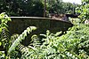
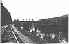
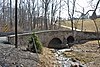
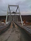
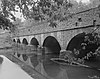
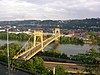
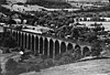
Name Image Built Listed Location County Type Adams Avenue Bridge in Philadelphia 1901 June 22, 1988 Philadelphia Tacony Creek 40°2′31″N 75°6′48″W / 40.04194°N 75.11333°W / 40.04194; -75.11333 (Adams Avenue Bridge in Philadelphia ) Philadelphia Multi-span stone arch Allenwood River Bridge 1895 June 22, 1988 Allenwood , Union 41°6′28″N 76°53′25″W / 41.10778°N 76.89028°W / 41.10778; -76.89028 (Allenwood River Bridge ) Northumberland , Union Pratt through truss Armstrong Tunnel 1926, 1927 January 7, 1986 Pittsburgh 40°26′5″N 79°59′25″W / 40.43472°N 79.99028°W / 40.43472; -79.99028 (Armstrong Tunnel ) Allegheny Askew Bridge 1857 March 1, 1973 Reading 40°20′37″N 75°55′34″W / 40.34361°N 75.92611°W / 40.34361; -75.92611 (Askew Bridge ) Berks Atkinson Road Bridge 1873 March 20, 2002 Solebury Twp 40°19′38″N 74°58′44″W / 40.32722°N 74.97889°W / 40.32722; -74.97889 (Atkinson Road Bridge ) Bucks Three-span arch Baker Bridge 1917 March 20, 1990 Newburg 40°17′10″N 78°7′17″W / 40.28611°N 78.12139°W / 40.28611; -78.12139 (Baker Bridge ) Huntingdon Concrete arch Barto Bridge 1908 June 22, 1988 Barto 40°23′46″N 75°36′31″W / 40.39611°N 75.60861°W / 40.39611; -75.60861 (Barto Bridge ) Berks Single-span barrel arch Belmont Avenue Bridge in Philadelphia 1896 June 22, 1988 Philadelphia 39°59′36″N 75°13′6″W / 39.99333°N 75.21833°W / 39.99333; -75.21833 (Belmont Avenue Bridge in Philadelphia ) Philadelphia Single-span stone arch Birmingham Bridge 1898 March 20, 1990 Birmingham 40°38′56″N 78°11′57″W / 40.64889°N 78.19917°W / 40.64889; -78.19917 (Birmingham Bridge ) Huntingdon Pratt through truss Black Rock Bridge 1927 June 22, 1988 Mont Clare 40°9′32″N 75°30′44″W / 40.15889°N 75.51222°W / 40.15889; -75.51222 (Black Rock Bridge ) Chester , Montgomery Multi-span spandrel arch W. Bollman and Company Bridge 1871 November 8, 1978 Meyersdale 39°49′48″N 79°2′34″W / 39.83000°N 79.04278°W / 39.83000; -79.04278 (W. Bollman and Company Bridge ) Somerset Warren truss Bridge 182+42, Northern Central Railway ca. 1871 May 4, 1995 Glen Rock 39°46′39″N 76°43′25″W / 39.77750°N 76.72361°W / 39.77750; -76.72361 (Bridge 182+42, Northern Central Railway ) York Masonry arch Bridge 5+92, Northern Central Railway 1900 May 4, 1995 Seven Valleys 39°51′15″N 76°46′18″W / 39.85417°N 76.77167°W / 39.85417; -76.77167 (Bridge 5+92, Northern Central Railway ) York Girder Bridge 634, Northern Central Railway ca. 1871 May 4, 1995 Railroad 39°46′23″N 76°43′14″W / 39.77306°N 76.72056°W / 39.77306; -76.72056 (Bridge 634, Northern Central Railway ) York Masonry arch Bridge between East Manchester and Newberry Townships 1889 May 10, 1988 Conewago Heights York Pennsylvania (petit) truss Bridge between Guilford and Hamilton Townships June 22, 1988 Social Island 39°53′9″N 77°42′48″W / 39.88583°N 77.71333°W / 39.88583; -77.71333 (Bridge between Guilford and Hamilton Townships ) Franklin Multi-span stone arch Bridge between Madison and Mahoning Townships 1895 June 22, 1988 Deanville 40°55′52″N 79°23′18″W / 40.93111°N 79.38833°W / 40.93111; -79.38833 (Bridge between Madison and Mahoning Townships ) Armstrong Solid spandrel arch Bridge between Monroe and Penn Townships 1919 June 22, 1988 Selinsgrove 40°49′32″N 76°52′17″W / 40.82556°N 76.87139°W / 40.82556; -76.87139 (Bridge between Monroe and Penn Townships ) Snyder Multi-span barrel arch Bridge in Albany Township 1841 June 22, 1988 Steinsville 40°38′7″N 75°51′21″W / 40.63528°N 75.85583°W / 40.63528; -75.85583 (Bridge in Albany Township ) Berks Multiple span stone arch Bridge in Bangor Borough 1915 June 22, 1988 Bangor 40°52′10″N 75°12′28″W / 40.86944°N 75.20778°W / 40.86944; -75.20778 (Bridge in Bangor Borough ) Northampton Bridge in Brown Township 1890 June 22, 1988 Hillborn 41°29′43″N 77°29′51″W / 41.49528°N 77.49750°W / 41.49528; -77.49750 (Bridge in Brown Township ) Lycoming Lattice truss Bridge in Buckingham Township 1905 June 22, 1988 Wycombe 40°16′53″N 75°1′19″W / 40.28139°N 75.02194°W / 40.28139; -75.02194 (Bridge in Buckingham Township ) Bucks Multi-span stone arch Bridge in Cherrytree Township 1882 June 22, 1988 Titusville 41°37′2″N 79°39′27″W / 41.61722°N 79.65750°W / 41.61722; -79.65750 (Bridge in Cherrytree Township ) Venango Pratt through truss Bridge in City of Wilkes-Barre 1885 June 22, 1988 Wilkes-Barre 41°15′36″N 75°52′2″W / 41.26000°N 75.86722°W / 41.26000; -75.86722 (Bridge in City of Wilkes-Barre ) Luzerne Single-span stone arch Bridge in Clinton Township 1887 June 22, 1988 Kennerdell 41°14′17″N 79°51′16″W / 41.23806°N 79.85444°W / 41.23806; -79.85444 (Bridge in Clinton Township ) Venango Pratt through truss Bridge in Cumberland Township 1894 June 22, 1988 Greenmount 39°45′27″N 77°17′6″W / 39.75750°N 77.28500°W / 39.75750; -77.28500 (Bridge in Cumberland Township ) Adams Three truss Bridge in Dreher Township 1934 June 22, 1988 Haags Mill 41°17′17″N 75°19′52″W / 41.28806°N 75.33111°W / 41.28806; -75.33111 (Bridge in Dreher Township ) Wayne High-rise stone arch Bridge in East Fallowfield Township 1894 June 22, 1988 Atlantic 41°32′6″N 80°20′14″W / 41.53500°N 80.33722°W / 41.53500; -80.33722 (Bridge in East Fallowfield Township ) Crawford Pratt through truss ; et al. Bridge in East Fallowfield Township ca. 1826 June 22, 1988 Mortonville 39°56′46″N 75°46′43″W / 39.94611°N 75.77861°W / 39.94611; -75.77861 (Bridge in East Fallowfield Township ) Chester Bridge in Fishing Creek Township 1915 June 22, 1988 Bendertown 41°9′5″N 76°17′45″W / 41.15139°N 76.29583°W / 41.15139; -76.29583 (Bridge in Fishing Creek Township ) Columbia Open-spandrel arch Bridge in Franconia Township 1837 June 22, 1988 Elvoy 40°17′18″N 75°20′20″W / 40.28833°N 75.33889°W / 40.28833; -75.33889 (Bridge in Franconia Township ) Montgomery Multi-span stone arch Bridge in Franklin Township 1919, 1920 June 22, 1988 Morrisville 39°53′37″N 80°10′47″W / 39.89361°N 80.17972°W / 39.89361; -80.17972 (Bridge in Franklin Township ) Greene Open-spandrel arch Bridge in French Creek Township 1898 June 22, 1988 Carlton 41°28′17″N 80°1′7″W / 41.47139°N 80.01861°W / 41.47139; -80.01861 (Bridge in French Creek Township ) Mercer Pratt through truss Bridge in Gibson Borough June 22, 1988 South Gibson 41°44′32″N 75°37′51″W / 41.74222°N 75.63083°W / 41.74222; -75.63083 (Bridge in Gibson Borough ) Susquehanna Primitive corbelled arch Bridge in Greenwood Township 1892 June 22, 1988 Bells Landing 40°54′39″N 78°38′51″W / 40.91083°N 78.64750°W / 40.91083; -78.64750 (Bridge in Greenwood Township ) Clearfield Pratt through truss Bridge in Hatfield Township 1874 June 22, 1988 Unionville 40°17′2″N 75°16′23″W / 40.28389°N 75.27306°W / 40.28389; -75.27306 (Bridge in Hatfield Township ) Montgomery Multi-span stone arch Bridge in Heidelberg Township ca. 1887 June 22, 1988 Germansville 40°42′3″N 75°42′37″W / 40.70083°N 75.71028°W / 40.70083; -75.71028 (Bridge in Heidelberg Township ) Lehigh Single-span stone arch Bridge in Jefferson Borough 1901 June 22, 1988 Cochrans Mill 40°17′34.48″N 79°58′12.75″W / 40.2929111°N 79.9702083°W / 40.2929111; -79.9702083 (Bridge in Jefferson Borough ) Allegheny Single-span stone arch Bridge in Jenner Township 1908 June 22, 1988 Pilltown 40°10′18″N 79°0′49″W / 40.17167°N 79.01361°W / 40.17167; -79.01361 (Bridge in Jenner Township ) Somerset Single-span stone arch Bridge in Johnstown City 1890 June 22, 1988 Johnstown 40°19′36″N 78°55′39″W / 40.32667°N 78.92750°W / 40.32667; -78.92750 (Bridge in Johnstown City ) Cambria Pennsylvania (petit) truss Bridge in Lewis Township 1890 June 22, 1988 Bodines 41°26′54″N 76°58′52″W / 41.44833°N 76.98111°W / 41.44833; -76.98111 (Bridge in Lewis Township ) Lycoming Pratt through truss Bridge in Lykens Township No. 1 June 22, 1988 Edman 40°38′38″N 76°41′34″W / 40.64389°N 76.69278°W / 40.64389; -76.69278 (Bridge in Lykens Township No. 1 ) Dauphin Multi-span stone arch Bridge in Lykens Township No. 2 1872 June 22, 1988 Fearnot 40°37′58″N 76°39′52″W / 40.63278°N 76.66444°W / 40.63278; -76.66444 (Bridge in Lykens Township No. 2 ) Dauphin Single-span stone arch Bridge in Metal Township 1907 June 22, 1988 Willow Hill 40°7′13″N 77°46′39″W / 40.12028°N 77.77750°W / 40.12028; -77.77750 (Bridge in Metal Township ) Franklin Camelback-shaped arch Bridge in Newport Borough 1929 June 22, 1988 Newport 40°28′27″N 77°7′48″W / 40.47417°N 77.13000°W / 40.47417; -77.13000 (Bridge in Newport Borough ) Perry Multi-span stone arch Bridge in Nicholson Township 1876 June 22, 1988 Starkville 41°36′17″N 75°49′24″W / 41.60472°N 75.82333°W / 41.60472; -75.82333 (Bridge in Nicholson Township ) Wyoming Lenticular truss Bridge in Oil Creek Township 1896 June 22, 1988 Titusville 41°37′46″N 79°42′10″W / 41.62944°N 79.70278°W / 41.62944; -79.70278 (Bridge in Oil Creek Township ) Crawford Pratt through truss Bridge in Portage Township 1832 June 22, 1988 Oil City 40°24′8″N 78°38′22″W / 40.40222°N 78.63944°W / 40.40222; -78.63944 (Bridge in Portage Township ) Cambria Circular arch Bridge in Porter Township 1889 June 22, 1988 Jersey Shore 41°10′51″N 77°16′43″W / 41.18083°N 77.27861°W / 41.18083; -77.27861 (Bridge in Porter Township ) Lycoming Lenticular truss Bridge in Radnor Township No. 1 1905 June 22, 1988 Broomall 40°0′13″N 75°22′19″W / 40.00361°N 75.37194°W / 40.00361; -75.37194 (Bridge in Radnor Township No. 1 ) Delaware Multi-span stone arch Bridge in Radnor Township No. 2 1905 June 22, 1988 Villanova 40°0′41″N 75°20′39″W / 40.01139°N 75.34417°W / 40.01139; -75.34417 (Bridge in Radnor Township No. 2 ) Delaware Single-span stone arch Bridge in Reed Township 1860 June 22, 1988 Inglenook 40°24′35″N 76°59′6″W / 40.40972°N 76.98500°W / 40.40972; -76.98500 (Bridge in Reed Township ) Dauphin Multi-span stone arch Bridge in Rockdale Township 1887 June 22, 1988 Millers Station 41°48′37″N 79°59′3″W / 41.81028°N 79.98417°W / 41.81028; -79.98417 (Bridge in Rockdale Township ) Crawford Pratt truss Bridge in Shaler Township 1915 June 22, 1988 Shaler Township 40°32′42.03″N 79°57′45.49″W / 40.5450083°N 79.9626361°W / 40.5450083; -79.9626361 (Bridge in Shaler Township ) Allegheny Single-span stone arch Bridge in Snake Spring Township 1934, 1935 June 22, 1988 Bedford 40°0′49″N 78°28′18″W / 40.01361°N 78.47167°W / 40.01361; -78.47167 (Bridge in Snake Spring Township ) Bedford Skewed open-spandrel arch Bridge in Solebury Township 1854 June 22, 1988 Carversville 40°23′9″N 75°3′50″W / 40.38583°N 75.06389°W / 40.38583; -75.06389 (Bridge in Solebury Township ) Bucks Multi-span stone arch Bridge in South Beaver Township 1878 June 22, 1988 Cannelton 40°47′29″N 80°29′31″W / 40.79139°N 80.49194°W / 40.79139; -80.49194 (Bridge in South Beaver Township ) Beaver Pin-connected Pratt truss Bridge in Tinicum Township 1877 June 22, 1988 Point Pleasant 40°25′24″N 75°3′55″W / 40.42333°N 75.06528°W / 40.42333; -75.06528 (Bridge in Tinicum Township ) Bucks Pratt pony truss Bridge in Upper Frederick Township 1888 June 22, 1988 Fagleysville 40°16′28″N 75°29′7″W / 40.27444°N 75.48528°W / 40.27444; -75.48528 (Bridge in Upper Frederick Township ) Montgomery Pratt through truss Bridge in Upper Fredrick Township 1854 June 22, 1988 Zieglersville 40°17′10″N 75°32′39″W / 40.28611°N 75.54417°W / 40.28611; -75.54417 (Bridge in Upper Fredrick Township ) Montgomery Multi-span stone arch Bridge in Upper Merion Township 1789 June 22, 1988 Gulph Mills 40°4′8″N 75°20′28″W / 40.06889°N 75.34111°W / 40.06889; -75.34111 (Bridge in Upper Merion Township ) Montgomery Small-span stone arch Bridge in Washington Township 1884 June 22, 1988 Kralltown 40°0′31″N 76°58′29″W / 40.00861°N 76.97472°W / 40.00861; -76.97472 (Bridge in Washington Township ) York Pratt truss Bridge in West Earl Township 1917 June 22, 1988 Brownstown 40°7′42″N 76°12′1″W / 40.12833°N 76.20028°W / 40.12833; -76.20028 (Bridge in West Earl Township ) Lancaster Cantilevered concrete girder Bridge in West Fallowfield Township 1885 June 22, 1988 Steelville 39°52′58″N 75°59′31″W / 39.88278°N 75.99194°W / 39.88278; -75.99194 (Bridge in West Fallowfield Township ) Chester Pratt pony truss Bridge in West Mead Township 1888 June 22, 1988 Center Road Corners 41°35′21″N 80°9′2″W / 41.58917°N 80.15056°W / 41.58917; -80.15056 (Bridge in West Mead Township ) Crawford Pratt through truss Bridge in West Wheatfield Township 1911 June 22, 1988 Robinson 40°24′11″N 79°7′45″W / 40.40306°N 79.12917°W / 40.40306; -79.12917 (Bridge in West Wheatfield Township ) Indiana Single-span camelback arch Bridge in Westover Borough 1917 June 22, 1988 Westover 40°45′9″N 78°40′3″W / 40.75250°N 78.66750°W / 40.75250; -78.66750 (Bridge in Westover Borough ) Clearfield Open-spandrel arch Bridge in Williams Township 1857 June 22, 1988 Stouts 40°36′39″N 75°13′54″W / 40.61083°N 75.23167°W / 40.61083; -75.23167 (Bridge in Williams Township ) Northampton Multi-span camelback arch Bridge in Yardley Borough 1889 June 22, 1988 Scammells Corner 40°14′3″N 74°50′2″W / 40.23417°N 74.83389°W / 40.23417; -74.83389 (Bridge in Yardley Borough ) Bucks Single-span stone arch Bridge Valley Bridge 1804 May 10, 1984 Hartsville 40°16′34″N 75°5′1″W / 40.27611°N 75.08361°W / 40.27611; -75.08361 (Bridge Valley Bridge ) Bucks Neo-classical arch Brower's Bridge 1904 June 22, 1988 Warwick 40°8′51″N 75°46′10″W / 40.14750°N 75.76944°W / 40.14750; -75.76944 (Brower's Bridge ) Chester Stone arch Brownsville Bridge 1913 June 22, 1988 Brownsville , West Brownsville 40°1′20″N 79°53′26″W / 40.02222°N 79.89056°W / 40.02222; -79.89056 (Brownsville Bridge ) Fayette , Washington Pennsylvania petit truss Bryn Athyn-Lower Moreland Bridge 1828 June 22, 1988 Lower Moreland 40°9′31″N 75°4′30″W / 40.15861°N 75.07500°W / 40.15861; -75.07500 (Bryn Athyn-Lower Moreland Bridge ) Montgomery Multi-span stone arch Cambridge Springs Bridge 1896 June 22, 1988 Cambridge Springs 41°48′23″N 80°3′41″W / 41.80639°N 80.06139°W / 41.80639; -80.06139 (Cambridge Springs Bridge ) Crawford Baltimore truss Campbell's Bridge 1906 June 22, 1988 Milford Square 40°25′42″N 75°23′54″W / 40.42833°N 75.39833°W / 40.42833; -75.39833 (Campbell's Bridge ) Bucks Camelback open-spandrel arch Centennial Bridge 1876 June 22, 1988 Center Valley 40°31′43″N 75°23′31″W / 40.52861°N 75.39194°W / 40.52861; -75.39194 (Centennial Bridge ) Lehigh Multi-span stone arch Chain Bridge 1856, 1857 February 12, 1974 Easton 40°39′14″N 75°14′56″W / 40.65389°N 75.24889°W / 40.65389; -75.24889 (Chain Bridge ) Northampton Chandler Mill Bridge 1910 January 11, 2010 Kennett 39°48′41″N 75°42′48″W / 39.81139°N 75.71333°W / 39.81139; -75.71333 (Chandler Mill Bridge ) Chester Charleroi-Monessen Bridge 1906 June 22, 1988 Charleroi , Monessen 40°9′6″N 79°54′15″W / 40.15167°N 79.90417°W / 40.15167; -79.90417 (Charleroi-Monessen Bridge ) Washington Multi-span Pennsylvania truss City Line Avenue Bridge 1913 June 22, 1988 Philadelphia 39°59′7″N 75°15′33″W / 39.98528°N 75.25917°W / 39.98528; -75.25917 (City Line Avenue Bridge ) Philadelphia Single-span solid barrel arch Claysville S Bridge 1818 April 4, 1975 Washington 40°8′22″N 80°21′0″W / 40.13944°N 80.35000°W / 40.13944; -80.35000 ("S" Bridge ) Washington Cold Spring Bridge 1930 June 22, 1988 North Hampton 40°42′3″N 75°31′1″W / 40.70083°N 75.51694°W / 40.70083; -75.51694 (Cold Spring Bridge ) Lehigh Open-spandrel arch Colwell Cut Viaduct 1922 June 22, 1988 Seminole 40°56′13″N 79°21′47″W / 40.93694°N 79.36306°W / 40.93694; -79.36306 (Colwell Cut Viaduct ) Armstrong Open-spandrel arch Cope's Bridge 1807 March 7, 1985 Marshallton Chester Coraopolis Bridge 1892, 1927 January 7, 1986 Coraopolis 40°30′58″N 80°9′7″W / 40.51611°N 80.15194°W / 40.51611; -80.15194 (Coraopolis Bridge ) Allegheny Bowstring truss Corbin Bridge 1937 March 20, 1990 Huntingdon 40°27′16″N 77°59′0″W / 40.45444°N 77.98333°W / 40.45444; -77.98333 (Corbin Bridge ) Huntingdon Suspension County Bridge No. 101 1918 June 22, 1988 Rock Run 39°59′29″N 75°49′52″W / 39.99139°N 75.83111°W / 39.99139; -75.83111 (County Bridge No. 101 ) Chester Stilted arch County Bridge No. 124 1916 June 22, 1988 Downingtown 40°0′38″N 75°44′39″W / 40.01056°N 75.74417°W / 40.01056; -75.74417 (County Bridge No. 124 ) Chester Three-span Arch County Bridge No. 148 1911 June 22, 1988 Westtown 39°55′54″N 75°33′6″W / 39.93167°N 75.55167°W / 39.93167; -75.55167 (County Bridge No. 148 ) Chester County Bridge No. 171 1907 June 22, 1988 Malvern 40°3′12″N 75°30′3″W / 40.05333°N 75.50083°W / 40.05333; -75.50083 (County Bridge No. 171 ) Chester Stone arch County Bridge No. 36 1907 June 22, 1988 Portland 40°55′7″N 75°5′37″W / 40.91861°N 75.09361°W / 40.91861; -75.09361 (County Bridge No. 36 ) Northampton Reinforced concrete arch County Bridge No. 54 1841, 1916 June 22, 1988 Prospectville 40°8′22″N 75°13′1″W / 40.13944°N 75.21694°W / 40.13944; -75.21694 (County Bridge No. 54 ) Montgomery Multi-span stone arch Dauberville Bridge 1908 June 22, 1988 Dauberville 40°27′25″N 75°58′37″W / 40.45694°N 75.97694°W / 40.45694; -75.97694 (Dauberville Bridge ) Berks Humpback multiple span arch Dauphin County Bridge No. 27 1896 August 2, 1993 Pillow 40°38′5″N 76°51′23″W / 40.63472°N 76.85639°W / 40.63472; -76.85639 (Dauphin County Bridge No. 27 ) Dauphin , Northumberland Metal truss Deer Creek Bridge, Stewartstown Railroad ca. 1895 May 4, 1995 Shrewsbury 39°45′30″N 76°38′55″W / 39.75833°N 76.64861°W / 39.75833; -76.64861 (Deer Creek Bridge, Stewartstown Railroad ) York Girder Delaware Division of the Pennsylvania Canal 1831, 1931 October 29, 1974 Bristol , Easton 40°5′43″N 74°51′40″W / 40.09528°N 74.86111°W / 40.09528; -74.86111 (Delaware Division of the Pennsylvania Canal ) 40°41′17″N 75°12′17″W / 40.68806°N 75.20472°W / 40.68806; -75.20472 (Delaware Division of the Pennsylvania Canal ) Bucks , Northampton Delta Trestle Bridge, Maryland and Pennsylvania Railroad ca. 1875 May 4, 1995 Delta 39°43′44″N 76°19′49″W / 39.72889°N 76.33028°W / 39.72889; -76.33028 (Delta Trestle Bridge, Maryland and Pennsylvania Railroad ) York Trestle Dunlap's Creek Bridge 1836, 1839 July 31, 1978 Brownsville 40°1′17″N 79°53′19″W / 40.02139°N 79.88861°W / 40.02139; -79.88861 (Dunlap's Creek Bridge ) Fayette Cast iron arch English Center Suspension Bridge 1891 December 14, 1978 English Center 41°26′5″N 77°17′21″W / 41.43472°N 77.28917°W / 41.43472; -77.28917 (English Center Suspension Bridge ) Lycoming Suspension Etters Bridge 1889 February 27, 1986 Lower Allen Township , Fairview Township 40°13′26″N 76°53′51″W / 40.22389°N 76.89750°W / 40.22389; -76.89750 (Etters Bridge ) Cumberland , York Pratt truss Fortieth Street Bridge 1924 June 22, 1988 Millvale , Pittsburgh 40°28′25″N 79°58′12″W / 40.47361°N 79.97000°W / 40.47361; -79.97000 (Fortieth Street Bridge ) Allegheny Long-span deck arch Frankford Avenue Bridge (over Pennypack Creek ) 1697 June 22, 1988 Philadelphia 40°2′37″N 75°1′15″W / 40.04361°N 75.02083°W / 40.04361; -75.02083 (Frankford Avenue Bridge ) Philadelphia Three-span stone arch , filled barrel arch Frankford Avenue Bridge over Poquessing Creek 1904 June 22, 1988 Philadelphia 40°3′53″N 74°58′53″W / 40.06472°N 74.98139°W / 40.06472; -74.98139 (Frankford Avenue Bridge ) Philadelphia and Bucks Single-span concrete arch Frantz's Bridge 1887 June 22, 1988 Weidasville 40°39′3″N 75°39′2″W / 40.65083°N 75.65056°W / 40.65083; -75.65056 (Frantz's Bridge ) Lehigh Multi-span stone arch replaced in 2011 Frehn Bridge ca. 1890 March 20, 1990 Springfield 40°8′0″N 77°59′29″W / 40.13333°N 77.99139°W / 40.13333; -77.99139 (Frehn Bridge ) Huntingdon Pratt through truss Gilbert Bridge 1899 May 5, 1989 Grantham , Siddonsburg 40°9′13″N 76°58′57″W / 40.15361°N 76.98250°W / 40.15361; -76.98250 (Gilbert Bridge ) Cumberland , York Pratt through truss Hammer Creek Bridge 1904 June 22, 1988 Brunnerville 40°11′48″N 76°16′45″W / 40.19667°N 76.27917°W / 40.19667; -76.27917 (Brunnerville Road Bridge over Hammer Creek ) Lancaster Hare's Hill Road Bridge 1867 March 28, 1978 Phoenixville 40°8′28.22″N 75°34′04.24″W / 40.1411722°N 75.5678444°W / 40.1411722; -75.5678444 (Hare's Hill Road Bridge ) Chester Wrought iron Bow string truss Harrison Avenue Bridge 1922 June 22, 1988 Scranton 41°24′0″N 75°39′6″W / 41.40000°N 75.65167°W / 41.40000; -75.65167 (Harrison Avenue Bridge ) Lackawanna Open-spandrel Hays Bridge Historic District ca. 1820, 1883 July 31, 1978 Mercersburg Franklin Burr truss High Bridge 1904 March 26, 1976 Coatesville 39°59′2″N 75°49′39″W / 39.98389°N 75.82750°W / 39.98389; -75.82750 (High Bridge ) Chester Hogback Bridge 1893 June 22, 1988 Curwensville 40°58′25″N 78°29′26″W / 40.97361°N 78.49056°W / 40.97361; -78.49056 (Hogback Bridge ) Clearfield Pennsylvania petit truss Holme Avenue Bridge 1921 June 22, 1988 Philadelphia 40°3′23″N 75°1′24″W / 40.05639°N 75.02333°W / 40.05639; -75.02333 (Holme Avenue Bridge ) Philadelphia Single-span concrete arch Homestead High-Level Bridge 1934, 1937 January 7, 1986 Pittsburgh 40°24′40″N 79°55′9″W / 40.41111°N 79.91917°W / 40.41111; -79.91917 (Homestead High-Level Bridge ) Allegheny Wichert continuous truss Horse Valley Bridge June 22, 1988 Upper Strasburg 40°3′57″N 77°45′34″W / 40.06583°N 77.75944°W / 40.06583; -77.75944 (Horse Valley Bridge ) Franklin Multi-span stone arch Horsham-Montgomery Bridge 1839 June 22, 1988 Fort Washington 40°14′15″N 75°11′31″W / 40.23750°N 75.19194°W / 40.23750; -75.19194 (Horsham-Montgomery Bridge ) Montgomery Multi-span stone arch Howard Tunnel, Northern Central Railway 1840, 1868 May 19, 1995 New Salem 39°53′28″N 76°45′2″W / 39.89111°N 76.75056°W / 39.89111; -76.75056 (Howard Tunnel, Northern Central Railway ) York Ironstone Bridge 1907 June 22, 1988 Morysville 40°19′12″N 75°39′8″W / 40.32000°N 75.65222°W / 40.32000; -75.65222 (Ironstone Bridge ) Berks Single-span arch Jerome Street Bridge 1935, 1937 June 22, 1988 McKeesport 40°21′1.8″N 79°52′11.84″W / 40.350500°N 79.8699556°W / 40.350500; -79.8699556 (Jerome Street Bridge ) Allegheny Two-hinged through arch John's Burnt Mill Bridge 1800, 1823 December 16, 1974 New Oxford 39°49′56″N 77°4′47″W / 39.83222°N 77.07972°W / 39.83222; -77.07972 (John's Burnt Mill Bridge ) Adams Camelback Kise Mill Bridge 1915 June 22, 1988 Woodside 40°6′56″N 76°48′38″W / 40.11556°N 76.81056°W / 40.11556; -76.81056 (Kise Mill Bridge ) York Camelback single span arch Layton Bridge 1899 June 22, 1988 Layton 40°5′21″N 79°43′49″W / 40.08917°N 79.73028°W / 40.08917; -79.73028 (Layton Bridge ) Fayette Pratt truss Lenape Bridge 1911, 1912 June 22, 1988 Lenape 39°54′54″N 75°37′47″W / 39.91500°N 75.62972°W / 39.91500; -75.62972 (Lenape Bridge ) Chester Multi-span stone arch Liberty Bridge 1928 June 22, 1988 Pittsburgh 40°25′58″N 79°59′50″W / 40.43278°N 79.99722°W / 40.43278; -79.99722 (Liberty Bridge ) Allegheny Multi-span Pratt truss Lilly Bridge 1832 June 22, 1988 Lilly 40°25′25″N 78°37′3″W / 40.42361°N 78.61750°W / 40.42361; -78.61750 (Lilly Bridge ) Cambria Single-span stone arch Lindbergh Viaduct 1927 June 22, 1988 Reading 40°19′52″N 75°54′0″W / 40.33111°N 75.90000°W / 40.33111; -75.90000 (Lindbergh Viaduct ) Berks Open-spandrel arch Marion Bridge 1930 June 22, 1988 Point Marion 39°44′22″N 79°54′19″W / 39.73944°N 79.90528°W / 39.73944; -79.90528 (Marion Bridge ) Fayette , Greene Warren through truss Market Street Bridge 1926, 1929 June 22, 1988 Kingston , Wilkes-Barre 41°14′55″N 75°53′7″W / 41.24861°N 75.88528°W / 41.24861; -75.88528 (Market Street Bridge ) Luzerne Market Street Bridge 1928 June 22, 1988 Harrisburg 40°15′0″N 76°53′27″W / 40.25000°N 76.89083°W / 40.25000; -76.89083 (Market Street Bridge ) Cumberland , Dauphin Long-span monumental urban Marshall's Bridge 1903 June 22, 1988 Little Washington 40°3′23″N 75°45′31″W / 40.05639°N 75.75861°W / 40.05639; -75.75861 (Marshall's Bridge ) Chester McClay's Twin Bridge (East) 1827 June 22, 1988 Middle Spring 40°5′54″N 77°34′15″W / 40.09833°N 77.57083°W / 40.09833; -77.57083 (McClay's Twin Bridge (East) ) Franklin Multi-span camelback arch McClay's Twin Bridge (West) 1827 June 22, 1988 Middle Spring 40°5′53″N 77°34′12″W / 40.09806°N 77.57000°W / 40.09806; -77.57000 (McClay's Twin Bridge (West) ) Franklin Multi-span camelback arch McKees Rocks Bridge 1931 November 14, 1988 McKees Rocks 40°28′37.34″N 80°2′56.04″W / 40.4770389°N 80.0489000°W / 40.4770389; -80.0489000 (McKees Rocks Bridge ) Allegheny Metal through arch Albertus L. Meyers Bridge 1913 June 22, 1988 Allentown 40°35′45″N 75°28′16″W / 40.59583°N 75.47111°W / 40.59583; -75.47111 (Albertus L. Meyers Bridge ) Lehigh Open-spandrel arch Milanville-Skinners Falls Bridge 1904 November 14, 1988 Milanville 41°40′10″N 75°3′31″W / 41.66944°N 75.05861°W / 41.66944; -75.05861 (Milanville-Skinners Falls Bridge ) Wayne Baltimore truss Muddy Creek Bridge, Maryland and Pennsylvania Railroad ca. 1909 May 4, 1995 Sunnyburn 39°45′37″N 76°21′5″W / 39.76028°N 76.35139°W / 39.76028; -76.35139 (Muddy Creek Bridge, Maryland and Pennsylvania Railroad ) York Pratt truss Newtown Creek Bridge 1796, 1875 June 22, 1988 Newtown 40°13′40″N 74°56′20″W / 40.22778°N 74.93889°W / 40.22778; -74.93889 (Newtown Creek Bridge ) Bucks Two-span stone arch Ninth Street Bridge 1925, 1926 January 7, 1986 Pittsburgh 40°26′48″N 80°0′1″W / 40.44667°N 80.00028°W / 40.44667; -80.00028 (Ninth Street Bridge ) Allegheny Eyebar suspension Old Columbia-Wrightsville Bridge 1929, 1930 June 22, 1988 Columbia , Wrightsville 40°1′50″N 76°30′41″W / 40.03056°N 76.51139°W / 40.03056; -76.51139 (Old Columbia-Wrightsville Bridge ) Lancaster , York Open-spandrel arch Pennsylvania Railroad Bridge 1901, 1904 August 13, 1979 Pittsburgh 40°26′58″N 79°59′50″W / 40.44944°N 79.99722°W / 40.44944; -79.99722 (Pennsylvania Railroad Bridge ) Allegheny Double-decked through truss Pennsylvania Railroad Bridge 1903 June 6, 1979 Morrisville 40°12′31″N 74°45′58″W / 40.20861°N 74.76611°W / 40.20861; -74.76611 (Pennsylvania Railroad Bridge ) Bucks Stone arch Pennsylvania Railroad Bridge over Shavers Creek 1889 March 20, 1990 Petersburg 40°34′1″N 78°2′54″W / 40.56694°N 78.04833°W / 40.56694; -78.04833 (Pennsylvania Railroad Bridge over Shavers Creek ) Huntingdon Stone arch Pennsylvania Railroad Old Bridge over Standing Stone Creek 1848, 1849 March 20, 1990 Huntingdon 40°28′51″N 78°0′17″W / 40.48083°N 78.00472°W / 40.48083; -78.00472 (Pennsylvania Railroad Old Bridge over Standing Stone Creek ) Huntingdon Stone arch Perkiomen Bridge 1799 June 22, 1988 Collegeville 40°11′3″N 75°26′54″W / 40.18417°N 75.44833°W / 40.18417; -75.44833 (Perkiomen Bridge ) Montgomery Multi-span stone arch Pithole Stone Arch 1897 June 22, 1988 Cornplanter / President Townships 41°29′13″N 79°35′43″W / 41.48694°N 79.59528°W / 41.48694; -79.59528 (Pithole Stone Arch ) Venango Single-span stone arch Pond Eddy Bridge 1904 November 14, 1988 Pond Eddy 41°26′21″N 74°49′13″W / 41.43917°N 74.82028°W / 41.43917; -74.82028 (Pond Eddy Bridge ) Pike Pennsylvania truss Pond Mill Bridge June 22, 1988 Bermudian 39°59′45″N 77°3′31″W / 39.99583°N 77.05861°W / 39.99583; -77.05861 (Pond Mill Bridge ) Adams Three-span camelback arch Quaker Bridge 1898 June 22, 1988 Greenville 41°25′33″N 80°22′22″W / 41.42583°N 80.37278°W / 41.42583; -80.37278 (Quaker Bridge ) Mercer Pratt through truss Reading-Halls Station Bridge ca. 1850 January 17, 1980 Muncy 41°14′9″N 76°49′58″W / 41.23583°N 76.83278°W / 41.23583; -76.83278 (Reading-Halls Station Bridge ) Lycoming Pony Howe truss Ridge Avenue Bridge in Philadelphia 1888 June 22, 1988 Philadelphia 40°0′53″N 75°12′26″W / 40.01472°N 75.20722°W / 40.01472; -75.20722 (Ridge Avenue Bridge in Philadelphia ) Philadelphia Multi-span stone arch Ridge Road Bridge, Stewartstown Railroad ca. 1895 May 4, 1995 Stewartstown 39°45′35″N 76°37′33″W / 39.75972°N 76.62583°W / 39.75972; -76.62583 (Ridge Road Bridge, Stewartstown Railroad ) York Girder Rockville Bridge 1900, 1902 August 15, 1975 Marysville , Rockville 40°19′59″N 76°54′42″W / 40.33306°N 76.91167°W / 40.33306; -76.91167 (Rockville Bridge ) Dauphin , Perry Stone masonry arch Runk Bridge 1889 March 20, 1990 Shirleysburg 40°16′40″N 77°53′14″W / 40.27778°N 77.88722°W / 40.27778; -77.88722 (Runk Bridge ) Huntingdon Pratt truss S Bridge 1919 June 22, 1988 Sheridan 40°22′25″N 76°13′7″W / 40.37361°N 76.21861°W / 40.37361; -76.21861 (S Bridge ) Berks Multi-span stone arch likely replaced Scott Creek Bridge-North, Maryland and Pennsylvania Railroad ca. 1909 May 4, 1995 Bryansville 39°44′46″N 76°20′29″W / 39.74611°N 76.34139°W / 39.74611; -76.34139 (Scott Creek Bridge-North, Maryland and Pennsylvania Railroad ) York Girder Second Street Bridge 1919 June 22, 1988 Chester 39°50′41″N 75°21′39″W / 39.84472°N 75.36083°W / 39.84472; -75.36083 (Second Street Bridge ) Delaware tied-arch , destroyed [2] Seventh Street Bridge 1925, 1926 January 7, 1986 Pittsburgh 40°26′52″N 80°0′12″W / 40.44778°N 80.00333°W / 40.44778; -80.00333 (Seventh Street Bridge ) Allegheny Eyebar suspension Sixteenth Street Bridge 1923 August 13, 1979 Pittsburgh 40°27′4″N 79°59′26″W / 40.45111°N 79.99056°W / 40.45111; -79.99056 (16th Street Bridge ) Allegheny Tied arch Sixth Street Bridge 1927, 1928 January 7, 1986 Pittsburgh 40°26′43″N 80°0′12″W / 40.44528°N 80.00333°W / 40.44528; -80.00333 (Sixth Street Bridge ) Allegheny Eyebar suspension Skippack Bridge 1792 December 2, 1970 Evansburg 40°10′49″N 75°25′20″W / 40.18028°N 75.42222°W / 40.18028; -75.42222 (Skippack Bridge ) Montgomery Eight-arch masonry Smithfield Street Bridge 1883, 1889 March 21, 1974 Pittsburgh 40°26′5″N 80°0′8″W / 40.43472°N 80.00222°W / 40.43472; -80.00222 (Smithfield Street Bridge ) Allegheny Pauli truss Soldiers and Sailors Memorial Bridge 1930 June 22, 1988 Harrisburg 40°16′2″N 76°52′43″W / 40.26722°N 76.87861°W / 40.26722; -76.87861 (Soldiers and Sailors Memorial Bridge ) Dauphin Long-span monumental urban South Road Bridge, Northern Central Railway ca. 1871 May 4, 1995 Larue 39°49′14″N 76°45′39″W / 39.82056°N 76.76083°W / 39.82056; -76.76083 (South Road Bridge, Northern Central Railway ) York Masonry arch South Tenth Street Bridge 1932 January 7, 1986 Pittsburgh 40°25′57″N 79°59′23″W / 40.43250°N 79.98972°W / 40.43250; -79.98972 (South Tenth Street Bridge ) Allegheny Wire-cable suspension Staple Bend Tunnel 1833, 1853 April 19, 1994 Conemaugh Township 40°21′33″N 78°51′19″W / 40.35917°N 78.85528°W / 40.35917; -78.85528 (Staple Bend Tunnel ) Cambria Tunnel Starrucca Viaduct 1848 October 29, 1975 Lanesboro 41°57′51″N 75°35′2″W / 41.96417°N 75.58389°W / 41.96417; -75.58389 (Starrucca Viaduct ) Susquehanna Stone Arch Road Bridge, Stewartstown Railroad ca. 1895 May 4, 1995 Railroad 39°45′1″N 76°41′14″W / 39.75028°N 76.68722°W / 39.75028; -76.68722 (Stone Arch Road Bridge, Stewartstown Railroad ) York Girder Sutch Road Bridge in Marlborough Township 1910 June 22, 1988 Milford 40°22′4″N 75°25′24″W / 40.36778°N 75.42333°W / 40.36778; -75.42333 (Sutch Road Bridge in Marlborough Township ) Montgomery Multi-span stone arch Swamp Creek Road Bridge 1892 June 22, 1988 Sumneytown 40°20′3″N 75°26′59″W / 40.33417°N 75.44972°W / 40.33417; -75.44972 (Swamp Creek Road Bridge ) Montgomery Multi-span stone arch Thirty-third Street Bridge in Philadelphia 1901 June 22, 1988 Philadelphia 39°58′43″N 75°11′24″W / 39.97861°N 75.19000°W / 39.97861; -75.19000 (Thirty-third Street Bridge in Philadelphia ) Philadelphia Single-span stone skew arch Trenton City/Calhoun Street Bridge 1885 November 20, 1975 Morrisville 40°13′11″N 74°46′42″W / 40.21972°N 74.77833°W / 40.21972; -74.77833 (Trenton City/Calhoun Street Bridge ) Bucks Phoenix column Tunkhannock Viaduct 1912, 1915 April 11, 1977 Nicholson 41°37′19.94″N 75°46′38.41″W / 41.6222056°N 75.7773361°W / 41.6222056; -75.7773361 (Tunkhannock Viaduct ) Wyoming Open-spandrel concrete deck arch bridge Union Canal Tunnel 1826, 1827, 1857 October 1, 1974 Lebanon 40°20′58″N 76°27′42″W / 40.34944°N 76.46167°W / 40.34944; -76.46167 (Union Canal Tunnel ) Lebanon University Avenue Bridge 1925, 1930 May 26, 1994 Philadelphia 39°56′35″N 75°11′49″W / 39.94306°N 75.19694°W / 39.94306; -75.19694 (University Avenue Bridge ) Philadelphia Valley Road Bridge, Stewartstown Railroad 1885, 1920 May 4, 1995 Stewartstown 39°45′19″N 76°36′35″W / 39.75528°N 76.60972°W / 39.75528; -76.60972 (Valley Road Bridge, Stewartstown Railroad ) York Pratt truss Walnut Lane Bridge 1908 May 10, 1988 Philadelphia Philadelphia Walnut Street Bridge 1889, 1900 June 5, 1972 Harrisburg 40°15′18″N 76°53′19″W / 40.25500°N 76.88861°W / 40.25500; -76.88861 (Walnut Street Bridge ) Dauphin Multi-span Phoenix Waterville Bridge 1890 November 14, 1988 Swatara Gap 40°28′49″N 76°31′55″W / 40.48028°N 76.53194°W / 40.48028; -76.53194 (Waterville Bridge ) Lebanon Lenticular truss Watsontown River Bridge 1927 June 22, 1988 Watsontown , White Deer 41°4′51″N 76°51′55″W / 41.08083°N 76.86528°W / 41.08083; -76.86528 (Watsontown River Bridge ) Northumberland , Union Open-spandrel arch Webster Donora Bridge 1906, 1908 June 22, 1988 Donora , Webster 40°11′3″N 79°51′8″W / 40.18417°N 79.85222°W / 40.18417; -79.85222 (Webster Donora Bridge ) Washington , Westmoreland Multi-span through truss Welty's Mill Bridge 1856 January 6, 1983 Waynesboro 39°44′16″N 77°34′20″W / 39.73778°N 77.57222°W / 39.73778; -77.57222 (Welty's Mill Bridge ) Franklin West End-North Side Bridge 1930, 1932 August 24, 1979 Pittsburgh 40°26′41″N 80°1′41″W / 40.44472°N 80.02806°W / 40.44472; -80.02806 (West End-North Side Bridge ) Allegheny Tied arch West Hickory Bridge 1896 June 22, 1988 West Hickory 41°34′11″N 79°24′21″W / 41.56972°N 79.40583°W / 41.56972; -79.40583 (West Hickory Bridge ) Forest Pratt truss George Westinghouse Memorial Bridge 1930, 1932 March 28, 1977 East Pittsburgh 40°23′38″N 79°50′16″W / 40.39389°N 79.83778°W / 40.39389; -79.83778 (George Westinghouse Memorial Bridge ) Allegheny Parabolic arch Wissahickon Memorial Bridge 1931 June 22, 1988 Philadelphia 40°1′27″N 75°11′46″W / 40.02417°N 75.19611°W / 40.02417; -75.19611 (Wissahickon Memorial Bridge ) Philadelphia Open-spandrel concrete arch Witherup Bridge 1906 June 22, 1988 Kennerdell 41°15′18″N 79°50′27″W / 41.25500°N 79.84083°W / 41.25500; -79.84083 (Witherup Bridge ) Venango Pratt pony truss Yeakle's Mill Bridge 1888 November 14, 1988 Yeakle Mill 39°44′6″N 78°2′15″W / 39.73500°N 78.03750°W / 39.73500; -78.03750 (Yeakle's Mill Bridge ) Franklin Pratt pony truss