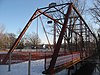
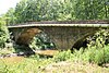
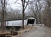
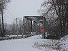
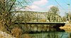
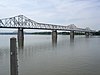
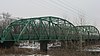
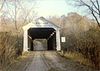
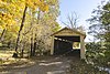
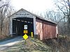
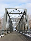
Name Image Built Listed Location County Type 4th Roann Covered Bridge 1877 1981-08-06 Roann 40°54′55″N 85°55′27″W / 40.91528°N 85.92417°W / 40.91528; -85.92417 (Roann Covered Bridge, 4th ) Wabash Howe Truss Adams Mill Covered Bridge 1872, 1900, ca. 1937 1996-01-11 Cutler 40°29′1″N 86°30′42″W / 40.48361°N 86.51167°W / 40.48361; -86.51167 (Adams Mill Covered Bridge ) Carroll Howe Truss, Burr Arch Aqueduct Bridge 1880, 1917, 1920 2000-03-15 Clay City 39°19′36″N 87°10′46″W / 39.32667°N 87.17944°W / 39.32667; -87.17944 (Aqueduct Bridge ) Clay Pratt through truss Beck's Mill Bridge 2007-09-20 Salem 38°32′14″N 86°9′16″W / 38.53722°N 86.15444°W / 38.53722; -86.15444 (Beck's Mill Bridge ) Washington concrete arch Beeson Bridge 1906 1978-12-22 Marshall 39°51′35″N 87°11′49″W / 39.85972°N 87.19694°W / 39.85972; -87.19694 (Beeson Bridge ) Parke Covered Burr Arch Truss Bell Ford Post Patented Diagonal "Combination Bridge" by 1885 2005-03-25 Seymour 38°58′24″N 85°55′46″W / 38.97333°N 85.92944°W / 38.97333; -85.92944 (Bell Ford Post Patented Diagonal "Combination Bridge" ) Jackson Combination Truss Benville Bridge 1908 1996-07-30 San Jacinto 38°58′50″N 85°27′10″W / 38.98056°N 85.45278°W / 38.98056; -85.45278 (Benville Bridge ) Jennings stone-arch bridge Big Rocky Fork Bridge 1900 1978-12-22 Mansfield 39°40′32″N 87°6′6″W / 39.67556°N 87.10167°W / 39.67556; -87.10167 (Big Rocky Fork Bridge ) Parke Covered Burr Arch Truss Billie Creek Bridge 1895 1978-12-22 Rockville 39°45′41″N 87°12′24″W / 39.76139°N 87.20667°W / 39.76139; -87.20667 (Billie Creek Bridge ) Parke Covered Burr Arch Truss Bowsher Ford Bridge 1915 1978-12-22 Rockville 39°55′47″N 87°21′6″W / 39.92972°N 87.35167°W / 39.92972; -87.35167 (Bowsher Ford Bridge ) Parke Covered Burr Arch Truss Bridge Street Bridge 2009-9-24 Bridge St. over the St. Joseph River 41°40′37.2″N 85°59′26.58″W / 41.677000°N 85.9907167°W / 41.677000; -85.9907167 (Bridge Street Bridge ) Elkhart Bridgeton Bridge 1868 1978-12-22 Bridgeton 39°38′58″N 87°10′34″W / 39.64944°N 87.17611°W / 39.64944; -87.17611 (Bridgeton Bridge ) Parke Covered Burr Arch Truss Brown County Bridge No. 36 1908 1993-12-21 Nashville 39°10′59″N 86°18′12″W / 39.18306°N 86.30333°W / 39.18306; -86.30333 (Brown County Bridge No. 36 ) Brown Pratt Through Truss Carrollton Bridge 1927 2003-06-22 Delphi 40°38′54″N 86°39′24″W / 40.64833°N 86.65667°W / 40.64833; -86.65667 (Carrollton Bridge ) Carroll Filled Spandrel Cataract Covered Bridge 1876 2005-04-27 Cataract 39°26′0″N 86°48′48″W / 39.43333°N 86.81333°W / 39.43333; -86.81333 (Cataract Covered Bridge ) Owen Smith Truss Bridge Catlin Bridge 1907 1978-12-22 Rockville 39°47′30″N 87°14′17″W / 39.79167°N 87.23806°W / 39.79167; -87.23806 (Catlin Bridge ) Parke Covered Burr Arch Truss Cavanaugh Bridge 2007-12-19 Brownstown 38°45′48″N 86°8′12″W / 38.76333°N 86.13667°W / 38.76333; -86.13667 (Cavanaugh Bridge ) Jackson /Washington Pratt through truss Cedar Grove Bridge 2014-09-30 Cedar Grove vicinity 39°21′29″N 84°56′25″W / 39.35806°N 84.94028°W / 39.35806; -84.94028 (Cedar Grove Bridge ) Franklin Ceylon Covered Bridge 1879 2007-01-25 Ceylon 40°36′51″N 84°56′35″W / 40.61417°N 84.94306°W / 40.61417; -84.94306 (Ceylon Covered Bridge ) Adams Howe Truss Bridge Chinworth Bridge 1897 1997-01-02 Warsaw 41°14′49″N 85°54′38″W / 41.24694°N 85.91056°W / 41.24694; -85.91056 (Chinworth Bridge ) Kosciusko Pratt through truss Collin's Ford Bridge 1907 1996-07-30 New Marion 39°0′29″N 85°22′14″W / 39.00806°N 85.37056°W / 39.00806; -85.37056 (Collin's Ford Bridge ) Ripley stone-arched bridge Conley's Ford Bridge 1907 1978-12-22 Bridgeton 39°39′34″N 87°7′58″W / 39.65944°N 87.13278°W / 39.65944; -87.13278 (Conley's Ford Bridge ) Parke Covered Burr Arch Truss County Bridge No. 45 1903 2006-09-20 Wheatland 38°40′47″N 87°16′20″W / 38.67972°N 87.27222°W / 38.67972; -87.27222 (County Bridge #45 ) Knox /Daviess Pratt Through Truss County Line Bridge 1916 1994-11-25 Morristown 39°42′35″N 85°37′59″W / 39.70972°N 85.63306°W / 39.70972; -85.63306 (County Line Bridge ) Hancock /Rush Parker through-truss Cox Ford Bridge 1913 1978-12-22 Rockville 39°53′7″N 87°13′25″W / 39.88528°N 87.22361°W / 39.88528; -87.22361 (Cox Ford Bridge ) Parke Covered Burr Arch Truss Crooks Bridge 1856 1978-12-22 Bridgeton 39°43′27″N 87°11′23″W / 39.72417°N 87.18972°W / 39.72417; -87.18972 (Crooks Bridge ) Parke Covered Burr Arch Truss Cumberland Covered Bridge 1877 1978-05-22 Matthews 40°23′19″N 85°29′5″W / 40.38861°N 85.48472°W / 40.38861; -85.48472 (Cumberland Covered Bridge ) Grant Darlington Covered Bridge 1868 1990-11-28 Darlington 40°6′29″N 86°47′37″W / 40.10806°N 86.79361°W / 40.10806; -86.79361 (Darlington Covered Bridge ) Montgomery Howe truss East Laporte Street Footbridge 1898 1981-07-23 Plymouth 41°20′25″N 86°18′15″W / 41.34028°N 86.30417°W / 41.34028; -86.30417 (East Laporte Street Footbridge ) Marshall Z-Span Kingpost Edward's Ford Bridge 1911 1996-07-30 Nebraska 39°2′1″N 85°27′38″W / 39.03361°N 85.46056°W / 39.03361; -85.46056 (Edward's Ford Bridge ) Jennings stone-arch bridge Eikenberry Bridge 1920 2006-09-20 Chili 40°51′19″N 86°3′21″W / 40.85528°N 86.05583°W / 40.85528; -86.05583 (Eikenberry Bridge ) Miami Pratt Through Truss Eugene Covered Bridge 1873 1994-06-10 Eugene 39°58′9″N 87°28′23″W / 39.96917°N 87.47306°W / 39.96917; -87.47306 (Eugene Covered Bridge ) Vermillion Burr Arch Truss Feeder Dam Bridge 1894 2000-03-15 Clay City 39°20′9″N 87°6′49″W / 39.33583°N 87.11361°W / 39.33583; -87.11361 (Feeder Dam Bridge ) Clay Whipple through truss Forsythe Covered Bridge 1888 1983-02-02 Rushville 39°31′2″N 85°31′50″W / 39.51722°N 85.53056°W / 39.51722; -85.53056 (Forsythe Covered Bridge ) Rush Covered Burr Arch Truss System Fort Wayne Street Bridge 2005-09-15 Goshen 41°35′36″N 85°50′55″W / 41.59333°N 85.84861°W / 41.59333; -85.84861 (Fort Wayne Street Bridge ) Elkhart Pennsylvania truss Furnas Mill Bridge 1891 2001-09-16 Edinburgh 39°22′56″N 85°59′53″W / 39.38222°N 85.99806°W / 39.38222; -85.99806 (Furnas Mill Bridge ) Johnson Pratt through truss George Street Bridge 1887 1984-03-01 Aurora 39°3′29″N 84°53′58″W / 39.05806°N 84.89944°W / 39.05806; -84.89944 (George Street Bridge ) Dearborn Whipple truss Harmony Way Bridge 1930 2007-10-03 New Harmony Posey Pratt Through Truss Harry Evans Bridge 1908 1978-12-22 Mecca 39°39′43″N 87°17′40″W / 39.66194°N 87.29444°W / 39.66194; -87.29444 (Harry Evans Bridge ) Parke Covered Burr Arch Truss Hendricks County Bridge Number 316 1886 2003-03-26 Plainfield 39°41′47″N 86°24′7″W / 39.69639°N 86.40194°W / 39.69639; -86.40194 (Hendricks County Bridge Number 316 ) Hendricks Pinned Warren Huffman Mill Covered Bridge 1865 1998-04-01 Fulda 38°6′14″N 86°46′37″W / 38.10389°N 86.77694°W / 38.10389; -86.77694 (Huffman Mill Covered Bridge ) Perry /Spencer Burr arch truss Indiana State Highway Bridge 42-11-3101 1939 2000-03-15 Poland 39°26′40″N 86°59′37″W / 39.44444°N 86.99361°W / 39.44444; -86.99361 (Indiana State Highway Bridge 42-11-3101 ) Clay Parker through truss Indiana State Highway Bridge 46-11-1316 1939 2000-03-15 Bowling Green 39°23′3″N 87°1′14″W / 39.38417°N 87.02056°W / 39.38417; -87.02056 (Indiana State Highway Bridge 46-11-1316 ) Clay Pratt through truss Jackson Bridge 1861 1978-12-22 Rockville 39°52′48″N 87°16′57″W / 39.88000°N 87.28250°W / 39.88000; -87.28250 (Jackson Bridge ) Parke Covered Double Burr Arch Jeffers Bridge 1905 2000-03-15 Clay City 39°21′31″N 87°8′32″W / 39.35861°N 87.14222°W / 39.35861; -87.14222 (Jeffers Bridge ) Clay Pratt Through Truss Jeffries Ford Bridge 1915 1978-12-22 Bridgeton 39°37′49″N 87°12′30″W / 39.63028°N 87.20833°W / 39.63028; -87.20833 (Jeffries Ford Bridge ) Parke Covered Burr Arch Truss La Salle Street Bridge 1907 1999-02-18 South Bend 41°40′45″N 86°14′56″W / 41.67917°N 86.24889°W / 41.67917; -86.24889 (La Salle Street Bridge ) St. Joseph Filled Spandrel Arch Lake Ditch Bridge 1895, 1926 2001-09-16 Monrovia 39°34′35″N 86°31′35″W / 39.57639°N 86.52639°W / 39.57639; -86.52639 (Lake Ditch Bridge ) Morgan Plate girder bridge Lamb's Creek Bridge 1893, 1939 2000-12-28 Martinsville 39°25′26″N 86°28′31″W / 39.42389°N 86.47528°W / 39.42389; -86.47528 (Lamb's Creek Bridge ) Morgan Pratt Through Truss Laughery Creek Bridge 1868, 1878 1976-09-29 Aurora 39°1′28″N 84°53′9″W / 39.02444°N 84.88583°W / 39.02444; -84.88583 (Laughery Creek Bridge ) Dearborn Triple-intersection Pratt Leatherwood Station Bridge 1899 1978-12-22 Montezuma 39°48′54″N 87°17′56″W / 39.81500°N 87.29889°W / 39.81500; -87.29889 (Leatherwood Station Bridge ) Parke Covered Burr Arch Truss Louisville Municipal Bridge, Pylons and Administration Building 1928, 1929 1984-03-08 Jeffersonville Clark Warren through truss; modern-day name George Rogers Clark Memorial Bridge Madison County Bridge No. 149 2008-12-8 Pendleton Madison Mansfield Covered Bridge 1867 1978-12-22 Mansfield 39°40′32″N 87°6′6″W / 39.67556°N 87.10167°W / 39.67556; -87.10167 (Mansfield Bridge ) Parke Covered Burr Arch Truss Marble Creek Bridge ca. 1905 1996-07-30 San Jacinto 38°55′39″N 85°26′31″W / 38.92750°N 85.44194°W / 38.92750; -85.44194 (Marble Creek Bridge ) Ripley stone-arch bridge Marion County Bridge 0501F 2006-09-20 Indianapolis 39°54′43″N 86°6′17″W / 39.91194°N 86.10472°W / 39.91194; -86.10472 (Marion County Bridge 0501F ) Marion Parker Steel Marshall Bridge 1917 1978-12-22 Rockville 39°53′0″N 87°19′35″W / 39.88333°N 87.32639°W / 39.88333; -87.32639 (Marshall Bridge ) Parke Covered Burr Arch Truss McAllister Bridge 1914 1978-12-22 Bridgeton 39°42′34″N 87°11′30″W / 39.70944°N 87.19167°W / 39.70944; -87.19167 (McAllister Bridge ) Parke Covered Burr Arch Truss Mecca Bridge 1873 1978-12-22 Mecca 39°43′45″N 87°19′29″W / 39.72917°N 87.32472°W / 39.72917; -87.32472 (Mecca Bridge ) Parke Covered Burr Arch Truss Medora Covered Bridge 2007-09-19 Medora 38°49′6″N 86°8′49″W / 38.81833°N 86.14694°W / 38.81833; -86.14694 (Medora Covered Bridge ) Jackson Burr arch truss Melcher Bridge 1896 1978-12-22 Montezuma 39°47′20″N 87°20′6″W / 39.78889°N 87.33500°W / 39.78889; -87.33500 (Melcher Bridge ) Parke Covered Burr Arch Truss Mill Creek Bridge 1907 1978-12-22 Rockville 39°54′30″N 87°21′38″W / 39.90833°N 87.36056°W / 39.90833; -87.36056 (Mill Creek Bridge ) Parke Covered Burr Arch Truss Moscow Covered Bridge 1886 1983-02-02 Rushville 39°29′6″N 85°33′17″W / 39.48500°N 85.55472°W / 39.48500; -85.55472 (Moscow Covered Bridge ) Rush Covered two Burr Arch Trusses Narrows Bridge 1882 1978-12-22 Rockville 39°53′28″N 87°11′7″W / 39.89111°N 87.18528°W / 39.89111; -87.18528 (Narrows Bridge ) Parke Covered Burr Arch Truss Neet Bridge 1904 1978-12-22 Bridgeton 39°42′6″N 87°11′54″W / 39.70167°N 87.19833°W / 39.70167; -87.19833 (Neet Bridge ) Parke Covered Burr Arch Truss Nevins Bridge 1920 1978-12-22 Bridgeton 39°41′4″N 87°12′45″W / 39.68444°N 87.21250°W / 39.68444; -87.21250 (Nevins Bridge ) Parke Covered Burr Arch Truss New Hope Bridge 1913 1999-09-09 Columbus 39°15′34″N 85°55′19″W / 39.25944°N 85.92194°W / 39.25944; -85.92194 (New Hope Bridge ) Bartholomew Pratt through truss Newport Covered Bridge 1885 1994-06-10 Newport 39°53′28″N 87°26′0″W / 39.89111°N 87.43333°W / 39.89111; -87.43333 (Newport Covered Bridge ) Vermillion Burr Arch Truss Norris Ford Covered Bridge 1916 1983-02-02 Rushville 39°38′0″N 85°24′59″W / 39.63333°N 85.41639°W / 39.63333; -85.41639 (Norris Ford Covered Bridge ) Rush Covered Burr Arch Truss System North Manchester Covered Bridge 1872 1982-09-30 North Manchester 40°59′45″N 85°45′55″W / 40.99583°N 85.76528°W / 40.99583; -85.76528 (North Manchester Covered Bridge ) Wabash Smith Type 4 Truss Offutt Covered Bridge 1884 1983-02-02 Rushville 39°39′36″N 85°32′22″W / 39.66000°N 85.53944°W / 39.66000; -85.53944 (Offutt Covered Bridge ) Rush Covered Burr Arch Truss System Ohio Street Bridge 1891 1998-12-17 Evansville 37°58′34″N 87°35′16″W / 37.97611°N 87.58778°W / 37.97611; -87.58778 (Ohio Street Bridge ) Vanderburgh Pratt through Truss Patoka Bridges Historic District 1884, 1924 2005-03-25 Oakland City Pike Pratt through truss Paw Paw Creek Bridge No. 52 1874 1983-09-30 Chili 40°52′42″N 85°57′59″W / 40.87833°N 85.96639°W / 40.87833; -85.96639 (Paw Paw Creek Bridge No. 52 ) Miami Bow-String Arch Phillips Bridge 1909 1978-12-22 Montezuma 39°46′20″N 87°19′21″W / 39.77222°N 87.32250°W / 39.77222; -87.32250 (Phillips Bridge ) Parke Covered Multiple King Post Portland Mills Bridge 1856, 1970 1978-12-22 Marshall 39°51′39″N 87°5′20″W / 39.86083°N 87.08889°W / 39.86083; -87.08889 (Portland Mills Bridge ) Parke Covered Burr Arch Truss Possum Bottom Covered Bridge 1876 1994-06-10 Dana 39°47′50″N 87°27′12″W / 39.79722°N 87.45333°W / 39.79722; -87.45333 (Possom Bottom Covered Bridge ) Vermillion Burr Arch Truss Potter's Covered Bridge 1871, 1938 1991-12-19 Noblesville 40°4′21″N 86°0′2″W / 40.07250°N 86.00056°W / 40.07250; -86.00056 (Potter's Covered Bridge ) Hamilton Howe Truss Pugh Ford Bridge 1911 1999-09-09 Taylorsville 39°20′1″N 85°52′16″W / 39.33361°N 85.87111°W / 39.33361; -85.87111 (Pugh Ford Bridge ) Bartholomew Pratt through truss Pulaski County Bridge No. 31 1905, 1914 2003-06-22 Delphi 41°3′33″N 86°49′46″W / 41.05917°N 86.82944°W / 41.05917; -86.82944 (Pulaski County Bridge No. 31 ) Carroll Stearns Truss Putnam County Bridge No. 159 1929 1999-03-12 Reelsville 39°33′17″N 86°57′51″W / 39.55472°N 86.96417°W / 39.55472; -86.96417 (Putnam County Bridge No. 159 ) Putnam Open spandrel Rangeline Road Bridge 1913 1998-04-03 Huntington 40°52′45″N 85°32′34″W / 40.87917°N 85.54278°W / 40.87917; -85.54278 (Rangeline Road Bridge ) Huntington Camelback Through Richland-Plummer Creek Covered Bridge 1883 1993-06-10 Bloomfield 38°59′34″N 86°56′16″W / 38.99278°N 86.93778°W / 38.99278; -86.93778 (Richland-Plummer Creek Covered Bridge ) Greene Burr Arch Truss Roseville Bridge 1910 1978-12-22 Mecca 39°39′9″N 87°17′37″W / 39.65250°N 87.29361°W / 39.65250; -87.29361 (Roseville Bridge ) Parke Covered Burr Arch Truss Rush County Bridge No. 188 1901 2000-12-28 Milroy 39°30′10″N 85°28′1″W / 39.50278°N 85.46694°W / 39.50278; -85.46694 (Rush County Bridge No. 188 ) Rush Pratt through Truss Rush Creek Bridge 1904 1978-12-22 Rockville 39°53′56″N 87°18′53″W / 39.89889°N 87.31472°W / 39.89889; -87.31472 (Rush Creek Bridge ) Parke Covered Burr Arch Truss Scotland Bridge 1901, 1908 1994-03-17 Mechanicsburg 40°10′36″N 86°25′54″W / 40.17667°N 86.43167°W / 40.17667; -86.43167 (Scotland Bridge ) Boone and Clinton true masonry arch Secrest Ferry Bridge 1903 1996-05-30 Gosport 39°19′57″N 86°40′35″W / 39.33250°N 86.67639°W / 39.33250; -86.67639 (Secrest Ferry Bridge ) Monroe /Owen Pennsylvania through truss Sim Smith Bridge 1883 1978-12-22 Montezuma 39°46′24″N 87°19′52″W / 39.77333°N 87.33111°W / 39.77333; -87.33111 (Sim Smith Bridge ) Parke Covered Burr Arch Truss Smith Covered Bridge 1877 1983-02-02 Rushville 39°39′19″N 85°24′34″W / 39.65528°N 85.40944°W / 39.65528; -85.40944 (Smith Covered Bridge ) Rush Covered Burr Arch Truss System Snow Hill Covered Bridge 1895 1995-03-03 Rockdale 39°19′32″N 84°51′6″W / 39.32556°N 84.85167°W / 39.32556; -84.85167 (Snow Hill Covered Bridge ) Franklin Howe Truss Spencerville Covered Bridge 1873 1981-04-02 Spencerville 41°16′53″N 84°54′51″W / 41.28139°N 84.91417°W / 41.28139; -84.91417 (Spencerville Covered Bridge ) De Kalb Smith Type 4 Truss Starke County Bridge No. 39 1915 1993-12-10 Knox 41°18′1″N 86°37′25″W / 41.30028°N 86.62361°W / 41.30028; -86.62361 (Starke County Bridge No. 39 ) Starke Warren Pony Truss State Sanitorium Bridge 1913 1978-12-22 Rockville 39°45′56″N 87°9′43″W / 39.76556°N 87.16194°W / 39.76556; -87.16194 (State Sanitorium Bridge ) Parke Covered Burr Arch Truss Stockheughter Covered Bridge 1891 2002-03-20 Batesville 39°19′59″N 85°16′51″W / 39.33306°N 85.28083°W / 39.33306; -85.28083 (Stockheughter Covered Bridge ) Franklin Howe Truss Covered Bridge Stone Arch Bridge over McCormick's Creek 1934 1993-03-18 Spencer 39°17′25″N 86°43′1″W / 39.29028°N 86.71694°W / 39.29028; -86.71694 (Stone Arch Bridge over McCormick's Creek ) Owen New Deal Resources in Indiana State Parks MPSPark Rustic Thorpe Ford Bridge 1912 1978-12-22 Mecca 39°38′14″N 87°15′54″W / 39.63722°N 87.26500°W / 39.63722; -87.26500 (Thorpe Ford Bridge ) Parke Covered Burr Arch Truss Twin Bridges by 1870, 1887, 1906 2000-03-15 Danville 39°45′15″N 86°30′15″W / 39.75417°N 86.50417°W / 39.75417; -86.50417 (Twin Bridges ) Hendricks Wrought-Iron Baltimore through Wabash and Erie Canal Culvert No. 100 1840 2002-03-20 Lockport 40°42′11″N 86°34′2″W / 40.70306°N 86.56722°W / 40.70306; -86.56722 (Wabash and Erie Canal Culvert #100 ) Carroll masonry arch Water Street/Darden Road Bridge 1885, 1906 1985-03-21 South Bend 41°43′49″N 86°16′7″W / 41.73028°N 86.26861°W / 41.73028; -86.26861 (Water Street/Darden Road Bridge ) St. Joseph Pratt through truss Wells Street Bridge 1884 1988-09-15 Fort Wayne 41°5′13″N 85°8′27″W / 41.08694°N 85.14083°W / 41.08694; -85.14083 (Wells Street Bridge ) Allen Whipple Truss West Union Bridge 1876 1978-12-22 Montezuma 39°51′18″N 87°20′9″W / 39.85500°N 87.33583°W / 39.85500; -87.33583 (West Union Bridge ) Parke Covered Burr Arch Truss West Washington Street Bridge 2008-03-19 Muncie 40°11′42″N 85°23′29″W / 40.19500°N 85.39139°W / 40.19500; -85.39139 (West Washington Street Bridge ) Delaware Concrete Arch Westport Covered Bridge 1880, 1922 1982-06-25 Westport 39°10′1″N 85°32′47″W / 39.16694°N 85.54639°W / 39.16694; -85.54639 (Westport Covered Bridge ) Decatur Burr Arch Wilkins Mill Bridge 1906 1978-12-22 Rockville 39°53′54″N 87°13′59″W / 39.89833°N 87.23306°W / 39.89833; -87.23306 (Wilkins Mill Bridge ) Parke Covered Burr Arch Truss Williams Bridge 1884 1981-11-09 Williams 38°47′48″N 86°39′54″W / 38.79667°N 86.66500°W / 38.79667; -86.66500 (Williams Bridge ) Lawrence Howe Truss Wilson Bridge 1897 2001-06-06 Delphi 40°35′27″N 86°37′16″W / 40.59083°N 86.62111°W / 40.59083; -86.62111 (Wilson Bridge ) Carroll Pratt through truss Zacke Cox Bridge 1908 1978-12-22 Mecca 39°41′43″N 87°17′9″W / 39.69528°N 87.28583°W / 39.69528; -87.28583 (Zacke Cox Bridge ) Parke Covered Burr Arch Truss Brouilletts Creek Covered Bridge 1879 Clinton Vermillion Burr Arch Truss Brownsville Covered Bridge 1837, 1840 Brownsville Union Long truss Burton Lane Bridge 1872, 1899, 1900 Martinsville Morgan Davenport Howe Truss Coal Creek Bridge 1869 Cayuga Parke Covered Burr Arch Truss Ferree Covered Bridge 1873 Rushville Rush Covered Burr Arch Truss System Germany Bridge 1879 Rochester Fulton Hursh Road Bridge (Bridge No. 38) 1879 Cedarville Allen Pratt (Whipple)through Tr J.H. Russell Bridge 1897 Rockville Parke Covered Queen Post Construction Jessup Bridge 1910, 1970 Rockville Parke Covered Burr Arch Truss Longwood Covered Bridge 1884 Connersville Fayette Burr Arch Truss