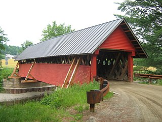
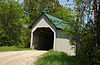
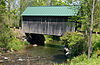
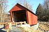
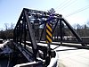
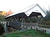
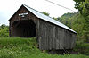
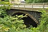
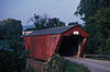
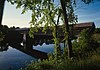
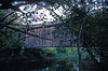
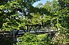
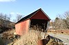
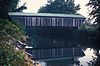
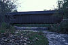
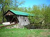
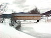
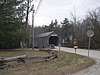
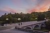
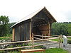
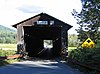
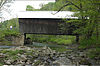
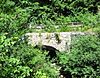
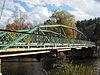
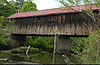
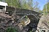
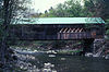
Name Image Built Listed Location County Type Arlington Green Covered Bridge 1852 1973-08-28 Arlington 43°6′16″N 73°13′14″W / 43.10444°N 73.22056°W / 43.10444; -73.22056 (Arlington Green Covered Bridge ) Bennington Town lattice truss Bartonsville Covered Bridge 1871 1973-07-02 Rockingham 43°13′27″N 72°32′12″W / 43.22417°N 72.53667°W / 43.22417; -72.53667 (Bartonsville Covered Bridge ) Windham Town lattice truss, destroyed in 2011 by flash flooding from Hurricane Irene . [2] Bedell Covered Bridge 1866 1975-05-28 Newbury 44°2′53″N 72°4′20″W / 44.04806°N 72.07222°W / 44.04806; -72.07222 (Bedell Covered Bridge ) Orange Burr arch truss; destroyed by windstorm in 1979 Bennington Falls Covered Bridge 1889 1973-08-28 Bennington 42°54′46″N 73°14′3″W / 42.91278°N 73.23417°W / 42.91278; -73.23417 (Bennington Falls Covered Bridge ) Bennington Town lattice truss Best's Covered Bridge 1973-07-02 Windsor 43°27′19″N 72°30′58″W / 43.45528°N 72.51611°W / 43.45528; -72.51611 (Best's Covered Bridge ) Windsor Bloomfield-Nulhegan River Route 102 Bridge 1937 1991-11-14 Bloomfield 44°45′10″N 71°38′48″W / 44.75278°N 71.64667°W / 44.75278; -71.64667 (Bloomfield-Nulhegan River Route 102 Bridge ) Essex Pratt through truss Bowers Covered Bridge 1973-08-28 Windsor 43°27′42″N 72°29′29″W / 43.46167°N 72.49139°W / 43.46167; -72.49139 (Bowers Covered Bridge ) Windsor Tied Arch , washed 200 feet downstream in 2011 in Hurricane Irene flooding; rebuilt [3] Bradley Covered Bridge 1878 1977-06-13 Lyndon 44°32′31″N 72°0′38″W / 44.54194°N 72.01056°W / 44.54194; -72.01056 (Bradley Covered Bridge ) Caledonia Queenpost truss Braley Covered Bridge ca. 1904 1974-06-13 Randolph 43°55′42″N 72°33′26″W / 43.92833°N 72.55722°W / 43.92833; -72.55722 (Braley Covered Bridge ) Orange multiple Kingpost truss Bridge 12 1929 2007-12-20 Enosburg 44°55′11″N 72°45′26″W / 44.91972°N 72.75722°W / 44.91972; -72.75722 (Bridge 12 ) Franklin Parker through truss Bridge 15 1928 2008-8-19 Sharon Windsor Parker through truss Bridge 19 1928 2007-09-28 Brookline 42°59′50″N 72°38′16″W / 42.99722°N 72.63778°W / 42.99722; -72.63778 (Bridge 19 ) Windham Camelback through truss; aka Brookline-Newfane Bridge. Bridge 22 2010-11-30 Bradford Orange Bridge 26 1908 2006-06-07 Weybridge 44°4′23″N 73°11′39″W / 44.07306°N 73.19417°W / 44.07306; -73.19417 (Bridge 26 ) Addison Riveted lattice truss Bridge 31 1928 2006-08-09 Waterbury 44°20′21″N 72°45′51″W / 44.33917°N 72.76417°W / 44.33917; -72.76417 (Bridge 31 ) Washington Parker through truss Bridge 4 2009-11-5 Poultney Rutland Bridge 6 1928 2007-12-20 Johnson 44°38′3″N 72°41′5″W / 44.63417°N 72.68472°W / 44.63417; -72.68472 (Bridge 6 ) Lamoille Pratt through truss Bridge 9 1928 2007-12-20 Sheldon 44°54′42″N 72°58′22″W / 44.91167°N 72.97278°W / 44.91167; -72.97278 (Bridge 9 ) Franklin Parker through truss Bridge No. 27 1918 2006-01-11 Berlin 44°11′22″N 72°38′27″W / 44.18944°N 72.64083°W / 44.18944; -72.64083 (Bridge No. 27 ) Washington Warren pony truss Bridgewater Corners Bridge 1928 1992-10-29 Bridgewater 43°35′12″N 72°39′25″W / 43.58667°N 72.65694°W / 43.58667; -72.65694 (Bridgewater Corners Bridge ) Windsor Pratt Through Truss Bridge Brown Covered Bridge 1880 1974-01-21 Shrewsbury 43°33′58″N 72°55′10″W / 43.56611°N 72.91944°W / 43.56611; -72.91944 (Brown Covered Bridge ) Rutland Town lattice truss Burrington Covered Bridge 1974-06-13 Lyndon 44°33′13″N 71°58′12″W / 44.55361°N 71.97000°W / 44.55361; -71.97000 (Burrington Covered Bridge ) Caledonia Queenpost truss Cedar Swamp Covered Bridge 1864, 1865 1974-09-10 West Salisbury 43°55′05.4″N 73°10′26″W / 43.918167°N 73.17389°W / 43.918167; -73.17389 (Cedar Swamp Covered Bridge ) Addison Town lattice truss; destroyed by fire in 2016 Centre Covered Bridge 1872, 1873 1974-06-20 Lyndon 44°32′36″N 72°0′6″W / 44.54333°N 72.00167°W / 44.54333; -72.00167 (Centre Covered Bridge ) Caledonia Paddleford truss Chamberlin Mill Covered Bridge 1881 1974-07-30 Lyndon 44°30′59″N 72°1′0″W / 44.51639°N 72.01667°W / 44.51639; -72.01667 (Chamberlin Mill Covered Bridge ) Caledonia Queenpost truss Cilley Covered Bridge 1883 1974-09-10 Tunbridge 43°52′59″N 72°30′17″W / 43.88306°N 72.50472°W / 43.88306; -72.50472 (Cilley Covered Bridge ) Orange multiple Kingpost truss Coburn Covered Bridge 1851 1974-10-09 East Montpelier 44°16′51″N 72°27′18″W / 44.28083°N 72.45500°W / 44.28083; -72.45500 (Coburn Covered Bridge ) Washington Queenpost truss Colburn Bridge 1899 1990-10-11 Pittsford 43°42′25″N 73°1′17″W / 43.70694°N 73.02139°W / 43.70694; -73.02139 (Colburn Bridge ) Rutland Masonry arch bridge Cold River Bridge 1928 1991-11-14 Clarendon 43°34′12″N 72°57′59″W / 43.57000°N 72.96639°W / 43.57000; -72.96639 (Cold River Bridge ) Rutland Parker through truss; demolished. Columbia Covered Bridge 1912 1976-12-12 Lemington 44°51′12″N 71°33′5″W / 44.85333°N 71.55139°W / 44.85333; -71.55139 (Columbia Covered Bridge ) Essex Howe truss Comstock Covered Bridge 1883 1974-11-19 Montgomery 44°53′59″N 72°38′39″W / 44.89972°N 72.64417°W / 44.89972; -72.64417 (Comstock Covered Bridge ) Franklin Town lattice truss Cooley Covered Bridge 1849 1974-01-24 Pittsford 43°41′24″N 73°1′45″W / 43.69000°N 73.02917°W / 43.69000; -73.02917 (Cooley Covered Bridge ) Rutland Town lattice truss Cornish-Windsor Covered Bridge 1866 1976-11-21 Windsor 43°28′26″N 72°23′1″W / 43.47389°N 72.38361°W / 43.47389; -72.38361 (Cornish-Windsor Covered Bridge ) Windsor Town lattice truss Creamery Covered Bridge 1879 1973-08-28 Brattleboro 42°50′58″N 72°35′12″W / 42.84944°N 72.58667°W / 42.84944; -72.58667 (Creamery Covered Bridge ) Windham Town lattice truss Dean Covered Bridge ca. 1840 1974-09-10 Brandon 43°46′43″N 73°5′51″W / 43.77861°N 73.09750°W / 43.77861; -73.09750 (Dean Covered Bridge ) Rutland Town lattice truss; destroyed by arsonist in 1986 Depot Covered Bridge ca. 1840 1974-01-21 Pittsford 43°42′34″N 73°2′36″W / 43.70944°N 73.04333°W / 43.70944; -73.04333 (Depot Covered Bridge ) Rutland Town lattice truss Douglas & Jarvis Patent Parabolic Truss Iron Bridge 1887 1974-03-21 Highgate Falls 44°56′3″N 73°2′53″W / 44.93417°N 73.04806°W / 44.93417; -73.04806 (Douglas & Jarvis Patent Parabolic Truss Iron Bridge ) Franklin Parabolic Truss Iron East Fairfield Covered Bridge ca. 1865 1974-11-19 East Fairfield 44°47′8″N 72°51′49″W / 44.78556°N 72.86361°W / 44.78556; -72.86361 (East Fairfield Covered Bridge ) Franklin Queenpost truss East Putney Brook Stone Arch Bridge 1902 1976-12-12 East Putney 42°59′9″N 72°28′9″W / 42.98583°N 72.46917°W / 42.98583; -72.46917 (East Putney Brook Stone Arch Bridge ) Windham Masonry arch East Shoreham Covered Railroad Bridge 1897 1974-06-13 Shoreham 43°51′33″N 73°15′22″W / 43.85917°N 73.25611°W / 43.85917; -73.25611 (East Shoreham Covered Railroad Bridge ) Addison Fairfax Covered Bridge 1974-11-05 Fairfax 44°39′49″N 73°0′39″W / 44.66361°N 73.01083°W / 44.66361; -73.01083 (Fairfax Covered Bridge ) Franklin Town lattice trusses Fisher Covered Railroad Bridge 1908 1974-10-01 Wolcott 44°31′56″N 72°25′43″W / 44.53222°N 72.42861°W / 44.53222; -72.42861 (Fisher Covered Railroad Bridge ) Lamoille Louvered Monitor Type Flint Covered Bridge 1845 1974-09-10 Tunbridge 43°56′56″N 72°27′31″W / 43.94889°N 72.45861°W / 43.94889; -72.45861 (Flint Covered Bridge ) Orange Queenpost truss Follett Stone Arch Bridge Historic District ca. 1894, ca. 1910 1976-12-12 Townshend Windham Four stone arch bridges Foundry Bridge 1889 2007-07-11 Tunbridge 43°54′52″N 72°28′37″W / 43.91444°N 72.47694°W / 43.91444; -72.47694 (Foundry Bridge ) Orange Warren pony truss Fuller Covered Bridge 1890 1974-12-23 Montgomery 44°54′13″N 72°38′23″W / 44.90361°N 72.63972°W / 44.90361; -72.63972 (Fuller Covered Bridge ) Franklin Town lattice trusses Gates Farm Covered Bridge 1897 1974-11-19 Cambridge 44°38′44″N 72°52′23″W / 44.64556°N 72.87306°W / 44.64556; -72.87306 (Gates Farm Covered Bridge ) Lamoille Timber Burr arch truss Gifford Covered Bridge 1974-07-30 East Randolph 43°55′0″N 72°33′25″W / 43.91667°N 72.55694°W / 43.91667; -72.55694 (Gifford Covered Bridge ) Orange multiple Kingpost truss Gilead Brook Bridge 1928 1990-10-11 Bethel 43°52′25″N 72°38′52″W / 43.87361°N 72.64778°W / 43.87361; -72.64778 (Gilead Brook Bridge ) Windsor Warren deck truss bridge Gold Brook Covered Bridge ca. 1844 1974-10-01 Stowe 44°26′25″N 72°40′49″W / 44.44028°N 72.68028°W / 44.44028; -72.68028 (Gold Brook Covered Bridge ) Lamoille timber Howe truss Gorham Covered Bridge 1841 1974-02-12 Proctor 43°40′48″N 73°2′17″W / 43.68000°N 73.03806°W / 43.68000; -73.03806 (Gorham Covered Bridge ) Rutland Town lattice truss Gould's Mill Bridge 1929 2006-02-01 Springfield 43°16′22″N 72°27′16″W / 43.27278°N 72.45444°W / 43.27278; -72.45444 (Gould's Mill Bridge ) Windsor Baltimore through truss Great Eddy Covered Bridge 1833 1974-09-06 Waitsfield 44°11′22″N 72°49′26″W / 44.18944°N 72.82389°W / 44.18944; -72.82389 (Great Eddy Covered Bridge ) Washington Burr truss Green River Covered Bridge ca. 1870, ca. 1875 1973-08-28 Guilford 42°46′31″N 72°40′4″W / 42.77528°N 72.66778°W / 42.77528; -72.66778 (Green River Covered Bridge ) Windham Town lattice truss Greenbanks Hollow Covered Bridge 1974-06-13 Danville 44°22′38″N 72°7′20″W / 44.37722°N 72.12222°W / 44.37722; -72.12222 (Greenbanks Hollow Covered Bridge ) Caledonia Queenpost truss Grist Mill Covered Bridge 1974-06-13 Cambridge 44°38′11″N 72°49′32″W / 44.63639°N 72.82556°W / 44.63639; -72.82556 (Grist Mill Covered Bridge ) Lamoille Timber Burr arch truss Hall Covered Bridge 1867 1973-08-28 Bellows Falls 43°8′12″N 72°29′16″W / 43.13667°N 72.48778°W / 43.13667; -72.48778 (Hall Covered Bridge ) Windham Town lattice truss Halpin Covered Bridge 1974-09-10 Middlebury 44°3′0″N 73°8′28″W / 44.05000°N 73.14111°W / 44.05000; -73.14111 (Halpin Covered Bridge ) Addison Town Lattice Truss Hammond Covered Bridge 1842 1974-01-21 Pittsford 43°43′14″N 73°3′14″W / 43.72056°N 73.05389°W / 43.72056; -73.05389 (Hammond Covered Bridge ) Rutland Town lattice truss Hectorville Covered Bridge ca. 1860, ca. 1890 1974-11-20 Montgomery 44°51′13″N 72°36′50″W / 44.85361°N 72.61389°W / 44.85361; -72.61389 (Hectorville Covered Bridge ) Franklin Town lattice truss Henry Covered Bridge ca. 1835 1973-08-28 Bennington 42°54′45″N 73°15′18″W / 42.91250°N 73.25500°W / 42.91250; -73.25500 (Henry Covered Bridge ) Bennington Town lattice truss Holmes Creek Covered Bridge c. 1870 1974-09-06 Charlotte 44°19′59″N 73°17′40″W / 44.33306°N 73.29444°W / 44.33306; -73.29444 (Holmes Creek Covered Bridge ) Chittenden king post with tied arch Hopkins Covered Bridge 1875 1974-11-20 Enosburg 44°55′15″N 72°40′23″W / 44.92083°N 72.67306°W / 44.92083; -72.67306 (Hopkins Covered Bridge ) Franklin Town lattice truss Howe Covered Bridge 1879 1974-09-10 Tunbridge 43°51′53″N 72°29′58″W / 43.86472°N 72.49944°W / 43.86472; -72.49944 (Howe Covered Bridge ) Orange multiple Kingpost truss Hutchins Covered Bridge 1883 1974-12-30 Montgomery 44°51′30″N 72°36′45″W / 44.85833°N 72.61250°W / 44.85833; -72.61250 (Hutchins Covered Bridge ) Franklin Town lattice trusses Iron Bridge at Howard Hill Road 1890; replaced 2007 1982-09-09 Cavendish 43°24′16″N 72°34′32″W / 43.40444°N 72.57556°W / 43.40444; -72.57556 (Iron Bridge at Howard Hill Road ) Windsor Historic bridge is Pratt through truss, replaced in 2007; now in storage Jaynes Covered Bridge ca. 1877 1974-10-01 Waterville 44°42′43″N 72°45′23″W / 44.71194°N 72.75639°W / 44.71194; -72.75639 (Jaynes Covered Bridge ) Lamoille Jeffersonville Bridge 1931 1991-11-14 Cambridge 44°38′57″N 72°49′51″W / 44.64917°N 72.83083°W / 44.64917; -72.83083 (Jeffersonville Bridge ) Lamoille Parker through truss Kendron Brook Bridge ca. 1810 1992-08-27 Woodstock 43°34′53″N 72°30′55″W / 43.58139°N 72.51528°W / 43.58139; -72.51528 (Kendron Brook Bridge ) Windsor Masonry arch bridge Kidder Covered Bridge ca. 1870 1973-07-02 Grafton 43°10′8″N 72°36′21″W / 43.16889°N 72.60583°W / 43.16889; -72.60583 (Kidder Covered Bridge ) Windham Queenpost through truss Kingsbury Covered Bridge 1904 1974-07-30 East Randolph 43°52′52″N 72°34′56″W / 43.88111°N 72.58222°W / 43.88111; -72.58222 (Kingsbury Covered Bridge ) Orange multiple Kingpost truss Kingsley Covered Bridge ca. 1870 1974-02-12 Clarendon 43°31′25″N 72°56′30″W / 43.52361°N 72.94167°W / 43.52361; -72.94167 (Kingsley Covered Bridge ) Rutland Town lattice truss Lamoille River Route 15-A Bridge 1928 1991-11-14 Morristown 44°33′51″N 72°34′1″W / 44.56417°N 72.56694°W / 44.56417; -72.56694 (Lamoille River Route 15-A Bridge ) Lamoille Pratt through truss; bridge dismantled in 2007 Larkin Covered Bridge 1902 1974-07-30 Tunbridge 43°55′22″N 72°27′56″W / 43.92278°N 72.46556°W / 43.92278; -72.46556 (Larkin Covered Bridge ) Orange multiple kingpost truss Lincoln Covered Bridge 1877 1973-08-28 Woodstock 43°36′2″N 72°34′10″W / 43.60056°N 72.56944°W / 43.60056; -72.56944 (Lincoln Covered Bridge ) Windsor Pratt truss system Longley Covered Bridge 1863 1974-12-30 Montgomery 44°54′25″N 72°39′21″W / 44.90694°N 72.65583°W / 44.90694; -72.65583 (Longley Covered Bridge ) Franklin Town lattice trusses Lower Cox Brook Covered Bridge 1872 1974-10-15 Northfield 44°10′21″N 72°39′12″W / 44.17250°N 72.65333°W / 44.17250; -72.65333 (Lower Cox Brook Covered Bridge ) Washington Queenpost truss Lyme–East Thetford Bridge 1937 2020-03-27 East Thetford 43°48′44″N 72°10′59″W / 43.812144°N 72.1831°W / 43.812144; -72.1831 (Lyme–East Thetford Bridge ) Orange Parker truss Marble Bridge 1915 1991-11-14 Proctor 43°39′40″N 73°2′2″W / 43.66111°N 73.03389°W / 43.66111; -73.03389 (Marble Bridge ) Rutland Reinforced concrete bridge Martin Covered Bridge 1890 1974-10-09 Marshfield 44°17′7″N 72°24′48″W / 44.28528°N 72.41333°W / 44.28528; -72.41333 (Martin Covered Bridge ) Washington Single span Queenpost truss Martin's Mill Covered Bridge ca. 1880 1973-08-28 Hartland 43°31′56″N 72°23′47″W / 43.53222°N 72.39639°W / 43.53222; -72.39639 (Martin's Mill Covered Bridge ) Windsor Town lattice truss Medburyville Bridge ca. 1896 1990-11-08 Wilmington 42°52′16″N 72°55′12″W / 42.87111°N 72.92000°W / 42.87111; -72.92000 (Medburyville Bridge ) Windham Warren through truss Middlebury Gorge Concrete Arch Bridge 1924 1991-11-14 Middlebury 43°58′12″N 73°5′11″W / 43.97000°N 73.08639°W / 43.97000; -73.08639 (Middlebury Gorge Concrete Arch Bridge ) Addison Concrete arch bridge Middlesex-Winooski River Bridge 1928 1991-11-14 Middlesex 44°18′22″N 72°41′48″W / 44.30611°N 72.69667°W / 44.30611; -72.69667 (Middlesex-Winooski River Bridge ) Washington Pratt through truss bridge; destroyed by Hurricane Irene Mill Covered Bridge (Belvidere) 1890 1974-11-19 Belvidere 44°29′31″N 72°44′29″W / 44.49194°N 72.74139°W / 44.49194; -72.74139 (Mill Covered Bridge ) Lamoille Queenpost truss Mill Covered Bridge 1883 1974-07-30 Tunbridge 43°53′29″N 72°29′31″W / 43.89139°N 72.49194°W / 43.89139; -72.49194 (Mill Covered Bridge ) Orange multiple Kingpost truss; destroyed by ice in 1999 and replicated in 2000 Missisquoi River Bridge 1929 1990-10-11 Richford 45°0′49″N 72°35′16″W / 45.01361°N 72.58778°W / 45.01361; -72.58778 (Missisquoi River Bridge ) Franklin Parker through truss bridge Montgomery Covered Bridge ca. 1877, ca. 1887 1974-10-18 Waterville 44°42′20″N 72°45′39″W / 44.70556°N 72.76083°W / 44.70556; -72.76083 (Montgomery Covered Bridge ) Lamoille Morgan Covered Bridge 1887 1974-11-19 Belvidere 44°44′36″N 72°43′37″W / 44.74333°N 72.72694°W / 44.74333; -72.72694 (Morgan Covered Bridge ) Lamoille Mount Orne Covered Bridge 1911 1976-12-12 Lunenburg 44°27′38″N 71°39′12″W / 44.46056°N 71.65333°W / 44.46056; -71.65333 (Mount Orne Covered Bridge ) Essex Howe truss Moxley Covered Bridge 1886, 1887 1974-09-10 Chelsea 43°57′25″N 72°27′49″W / 43.95694°N 72.46361°W / 43.95694; -72.46361 (Moxley Covered Bridge ) Orange Northfield Falls Covered Bridge 1872 1974-08-13 Northfield 44°10′20″N 72°39′18″W / 44.17222°N 72.65500°W / 44.17222; -72.65500 (Northfield Falls Covered Bridge ) Washington Town lattice truss Old Schoolhouse Bridge ca. 1871 1971-03-31 Lyndon 44°30′57″N 72°0′38″W / 44.51583°N 72.01056°W / 44.51583; -72.01056 (Old Schoolhouse Bridge ) Caledonia Orne Covered Bridge 1974-11-20 Coventry 44°51′38″N 72°16′28″W / 44.86056°N 72.27444°W / 44.86056; -72.27444 (Orne Covered Bridge ) Orleans Paddleford truss Ottauquechee River Bridge ca. 1930 1990-10-11 Hartland 43°36′9″N 72°21′17″W / 43.60250°N 72.35472°W / 43.60250; -72.35472 (Ottauquechee River Bridge ) Windsor Warren deck truss bridge; has been replaced by modern steel girder bridge Pine Brook Covered Bridge 1855 1974-06-13 Waitsfield 44°12′21″N 72°47′32″W / 44.20583°N 72.79222°W / 44.20583; -72.79222 (Pine Brook Covered Bridge ) Washington Kingpost truss Poland Covered Bridge 1887 1974-10-09 Cambridge 44°39′4″N 72°48′54″W / 44.65111°N 72.81500°W / 44.65111; -72.81500 (Poland Covered Bridge ) Lamoille Timber Burr truss Power House Covered Bridge 1870 1974-10-09 Johnson 44°37′51″N 72°41′5″W / 44.63083°N 72.68472°W / 44.63083; -72.68472 (Power House Covered Bridge ) Lamoille Pulp Mill Covered Bridge ca. 1820 1974-09-10 Middlebury 44°1′29″N 73°10′41″W / 44.02472°N 73.17806°W / 44.02472; -73.17806 (Pulp Mill Covered Bridge ) Addison Burr arch truss Quechee Gorge Bridge 1911, 1933 1990-10-11 Hartford 43°38′16″N 72°24′32″W / 43.63778°N 72.40889°W / 43.63778; -72.40889 (Quechee Gorge Bridge ) Windsor Metal deck truss bridge Quinlan's Covered Bridge 1849 1974-09-10 East Charlotte 44°16′35″N 73°11′4″W / 44.27639°N 73.18444°W / 44.27639; -73.18444 (Quinlan's Covered Bridge ) Chittenden Burr arch truss Red Covered Bridge 1896 1974-10-16 Morristown 44°31′7″N 72°40′40″W / 44.51861°N 72.67778°W / 44.51861; -72.67778 (Red Covered Bridge ) Lamoille Queenpost truss Rice Farm Road Bridge 1892 1995-11-07 Dummerston 42°54′58″N 72°36′48″W / 42.91611°N 72.61333°W / 42.91611; -72.61333 (Rice Farm Road Bridge ) Windham Warren Through Truss Bridge River Road Covered Bridge 1974-11-19 North Troy 44°57′21″N 72°23′39″W / 44.95583°N 72.39417°W / 44.95583; -72.39417 (River Road Covered Bridge ) Orleans Town Lattice Truss; collapsed from damage caused by fire on February 6, 2021 [4] Sacketts Brook Stone Arch Bridge 1906 1976-12-12 Putney 42°58′29″N 72°31′5″W / 42.97472°N 72.51806°W / 42.97472; -72.51806 (Sacketts Brook Stone Arch Bridge ) Windham Sanderson Covered Bridge ca. 1838 1974-06-13 Brandon 43°47′22″N 73°6′45″W / 43.78944°N 73.11250°W / 43.78944; -73.11250 (Sanderson Covered Bridge ) Rutland Town Lattice Truss Scott Covered Bridge 1870 1973-08-28 Townshend 43°2′53″N 72°41′50″W / 43.04806°N 72.69722°W / 43.04806; -72.69722 (Scott Covered Bridge ) Windham Town lattice truss Scribner Covered Bridge 1974-10-01 Johnson 44°38′20″N 72°38′57″W / 44.63889°N 72.64917°W / 44.63889; -72.64917 (Scribner Covered Bridge ) Lamoille Queenpost Truss Seguin Covered Bridge ca. 1850 1974-09-06 Charlotte 44°17′20″N 73°9′3″W / 44.28889°N 73.15083°W / 44.28889; -73.15083 (Seguin Covered Bridge ) Chittenden Burr arch truss; spelled "Sequin" in the National Register Silk Covered Bridge ca. 1840 1973-08-28 Bennington 42°54′34″N 73°13′33″W / 42.90944°N 73.22583°W / 42.90944; -73.22583 (Silk Covered Bridge ) Bennington Town lattice truss Simpsonville Stone Arch Bridge ca. 1909 1977-04-11 Townshend 43°4′13″N 72°39′19″W / 43.07028°N 72.65528°W / 43.07028; -72.65528 (Simpsonville Stone Arch Bridge ) Windham Slaughter House Covered Bridge 1872 1974-06-13 Northfield 44°10′7″N 72°39′17″W / 44.16861°N 72.65472°W / 44.16861; -72.65472 (Slaughterhouse Covered Bridge ) Washington Queenpost truss South Newfane Bridge 1939 1992-09-08 Newfane 42°56′16″N 72°42′18″W / 42.93778°N 72.70500°W / 42.93778; -72.70500 (South Newfane Bridge ) Windham Pratt through-truss bridge Spaulding Bridge 1905 2006-01-11 Cavendish 43°22′57″N 72°36′31″W / 43.38250°N 72.60861°W / 43.38250; -72.60861 (Spaulding Bridge ) Windsor Parker pony truss Stockbridge Four Corners Bridge 1929 1991-11-14 Stockbridge 43°46′56″N 72°45′30″W / 43.78222°N 72.75833°W / 43.78222; -72.75833 (Stockbridge Four Corners Bridge ) Windsor Pratt through truss; replaced in 2009 Stony Brook Covered Bridge 1899 1974-11-20 Northfield 44°7′16″N 72°41′25″W / 44.12111°N 72.69028°W / 44.12111; -72.69028 (Stony Brook Covered Bridge ) Washington Kingpost truss Swanton Covered Railroad Bridge 1898 1973-06-18 Swanton 44°55′00″N 73°07′41″W / 44.91667°N 73.12806°W / 44.91667; -73.12806 (Swanton Covered Railroad Bridge ) Franklin Town-Pratt dbl lattice truss Taftsville Covered Bridge 1836 1973-08-28 Woodstock 43°38′23″N 72°28′5″W / 43.63972°N 72.46806°W / 43.63972; -72.46806 (Taftsville Covered Bridge ) Windsor Queenpost through truss Thetford Center Covered Bridge 1974-09-17 Thetford 43°49′55″N 72°15′12″W / 43.83194°N 72.25333°W / 43.83194; -72.25333 (Thetford Center Covered Bridge ) Orange Haupt patent truss Union Village Covered Bridge 1974-09-17 Thetford 43°47′19″N 72°15′17″W / 43.78861°N 72.25472°W / 43.78861; -72.25472 (Union Village Covered Bridge ) Orange multiple Kingpost truss Upper Cox Brook Covered Bridge 1872 1974-10-01 Northfield 44°10′25″N 72°39′20″W / 44.17361°N 72.65556°W / 44.17361; -72.65556 (Upper Cox Brook Covered Bridge ) Washington Queenpost truss Upper Falls Covered Bridge ca. 1870 1973-08-28 Perkinsville 43°23′55″N 72°31′21″W / 43.39861°N 72.52250°W / 43.39861; -72.52250 (Upper Falls Covered Bridge ) Windsor Town lattice truss Village Covered Bridge ca. 1877 1974-12-16 Waterville 44°41′24″N 72°46′16″W / 44.69000°N 72.77111°W / 44.69000; -72.77111 (Village Covered Bridge ) Lamoille Warren Covered Bridge 1879, 1880 1974-08-07 Warren 44°6′40″N 72°51′26″W / 44.11111°N 72.85722°W / 44.11111; -72.85722 (Warren Covered Bridge ) Washington Queenpost truss Waterman Covered Bridge 1868 1974-06-13 Johnson 44°36′33″N 72°41′4″W / 44.60917°N 72.68444°W / 44.60917; -72.68444 (Waterman Covered Bridge ) Lamoille Queenpost trusses; collapsed in 1982 and demolished West Dummerston Covered Bridge 1872 1973-05-08 Dummerston 42°56′12″N 72°36′49″W / 42.93667°N 72.61361°W / 42.93667; -72.61361 (West Dummerston Covered Bridge ) Windham Town lattice truss West Hartford Bridge 1929 1992-10-29 Hartford 43°42′44″N 72°25′6″W / 43.71222°N 72.41833°W / 43.71222; -72.41833 (West Hartford Bridge ) Windsor Parker Through Truss; replaced in 2006 West Hill Covered Bridge 1860, 1890 1974-12-31 Montgomery 44°52′3″N 72°38′53″W / 44.86750°N 72.64806°W / 44.86750; -72.64806 (West Hill Covered Bridge ) Franklin Town lattice West Milton Bridge 1902 1992-09-08 Milton 44°37′56″N 73°10′18″W / 44.63222°N 73.17167°W / 44.63222; -73.17167 (West Milton Bridge ) Chittenden Double-span through truss West Townshend Stone Arch Bridge ca. 1910 1977-04-18 West Townshend 43°5′3″N 72°42′36″W / 43.08417°N 72.71000°W / 43.08417; -72.71000 (West Townshend Stone Arch Bridge ) Windham West Woodstock Bridge 1900 1992-08-27 West Woodstock 43°36′51″N 72°32′36″W / 43.61417°N 72.54333°W / 43.61417; -72.54333 (West Woodstock Bridge ) Windsor Pennsylvania through truss Willard Covered Bridge 1973-08-28 Hartland 43°35′37″N 72°21′1″W / 43.59361°N 72.35028°W / 43.59361; -72.35028 (Willard Covered Bridge ) Windsor Town lattice truss Williams River Route 5 Bridge 1929 1991-11-14 Rockingham 43°10′57″N 72°27′36″W / 43.18250°N 72.46000°W / 43.18250; -72.46000 (Williams River Route 5 Bridge ) Windham Warren deck truss bridge Williamsville Covered Bridge ca. 1870 1973-08-14 Newfane 42°56′34″N 72°41′17″W / 42.94278°N 72.68806°W / 42.94278; -72.68806 (Williamsville Covered Bridge ) Windham Town lattice truss Winooski River Bridge 1929 1990-05-30 Richmond 44°25′24″N 73°1′1″W / 44.42333°N 73.01694°W / 44.42333; -73.01694 (Winooski River Bridge ) Chittenden Pennsylvania through truss Woodstock Warren Through Truss Bridge ca. 1925 1992-08-18 Woodstock 43°36′1″N 72°35′22″W / 43.60028°N 72.58944°W / 43.60028; -72.58944 (Woodstock Warren Through Truss Bridge ) Windsor Warren through truss; swept away by Hurricane Irene Worrall Covered Bridge 1870 1973-07-16 Rockingham 43°12′42″N 72°32′9″W / 43.21167°N 72.53583°W / 43.21167; -72.53583 (Worrall Covered Bridge ) Windham Town lattice truss