Middlebury, Vermont

Last updated

Middlebury
Middlebury VT - downtown.JPG
Main Street
MiddleburyLogo.jpg
Addison County Vermont incorporated and unincorporated areas Middlebury highlighted.svg
Location in Addison County and the state of Vermont
Coordinates: 44°0′7″N73°8′44″W / 44.00194°N 73.14556°W / 44.00194; -73.14556
CountryUnited States
State Vermont
County Addison
Chartered1761
Communities Middlebury
East Middlebury
Farmingdale
Area
  Total39.2 sq mi (101.6 km2)
  Land38.8 sq mi (100.6 km2)
  Water0.4 sq mi (1.0 km2)
Elevation
427 ft (130 m)
Population
 (2020)
  Total9,152
  Density230/sq mi (90/km2)
Time zone UTC-5 (Eastern (EST))
  Summer (DST) UTC-4 (EDT)
ZIP Code
05753
Area code 802
FIPS code 50-44350 [1]
GNIS feature ID1462146 [2]
Website www.townofmiddlebury.org

Middlebury is the shire town [3] (county seat) [4] of Addison County, Vermont, United States. As of the 2020 census, the population was 9,152. [5] Middlebury is home to Middlebury College and the Henry Sheldon Museum of Vermont History.

Contents

History

Main Street in 1908 Main Street, Middlebury, VT.jpg
Main Street in 1908

One of the New Hampshire Grants, Middlebury was chartered by Colonial Governor Benning Wentworth on November 2, 1761. The name "Middlebury" came from its location between the towns of Salisbury and New Haven. [6] It was awarded to John Evarts and 62 others. The French and Indian Wars ended in 1763; the first settlers arrived in 1766. John Chipman was the first to clear his land, Lot Seven. [7] During the Revolutionary War, much of the town was burned in Carleton's Raid on November 6, 1778. After the war concluded in 1783, settlers returned to rebuild homes, clear forests and establish farms. The principal crops were grains and hay.

Lithograph of Middlebury from 1886 by L.R. Burleigh with list of landmarks Middlebury, Vt. (2675989344).jpg
Lithograph of Middlebury from 1886 by L.R. Burleigh with list of landmarks

Landowners vied for the lucrative honor of having the village center grow on their properties. A survey dispute with Salisbury led to the forfeiture of Gamaliel Painter's farm to that town, and his transition from farming to developing Middlebury Village near his and Abisha Washburn's mill, together with other mills that surrounded the Otter Creek falls. Industries would include a cotton factory, sawmill, gristmill, pail factory, paper mill, woolen factory, iron foundry, and marble quarry. The Rutland & Burlington Railroad first arrived on September 1, 1849. Around 1830, Middlebury was the second-largest town in Vermont.

Middlebury College, one of the United States' elite liberal arts colleges, was founded in 1800. It is a member of the NESCAC. In the summer, the town plays host to the annual Middlebury College Language Schools, as well as the college's Bread Loaf Writers' Conference, the oldest surviving conference of its kind in the nation.

On January 2, 1838, a group of Patriote refugees from the Lower Canada Rebellion met in Middlebury to plan their future course of action. It was attended by two major Patriote leaders, Louis-Joseph Papineau and Robert Nelson, but they were not able to agree on a unified plan. [8]

On October 22, 2007, central Middlebury was evacuated for a short time because of a train derailment; the Middlebury Union Middle School served as the evacuation headquarters.

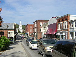
Today, as the largest town by population in Addison County, Middlebury serves as the commercial and business center for the region. Downtown hosts a three-screen movie theater, the post office, and two historic inns, as well as many shops and restaurants. There is considerable development along U.S. Route 7 heading south of town, including two supermarkets, two drugstores, most of the town's gas stations, and several fast-food spots. Of note is Middlebury's A&W, Vermont's only remaining car-hop restaurant and a popular spot with both locals and Middlebury College students.

Geography

Middlebury is located near the center of Addison County in western Vermont. The town is drained by Otter Creek, which flows from south to north along the western edge of the town, with the falls at the center of the village. The Middlebury River flows west to Otter Creek out of the mountains. Chipman Hill, a hill of glacial till, rises 450 feet (140 m) above the village just to the northeast. Foothills of the Green Mountains border the town to the east, with the Champlain Valley to the west.

According to the United States Census Bureau, the town has a total area of 39.2 square miles (101.6 km2), of which 38.8 square miles (100.6 km2) is land and 0.39 square miles (1.0 km2), or 1.00%, is water. [9]

Middlebury is crossed by U.S. Route 7, Vermont Route 23, Vermont Route 30, Vermont Route 116, and Vermont Route 125. It is bordered by the towns of New Haven and Bristol to the north, Ripton to the east, Cornwall and Weybridge to the west, and Salisbury to the south. A new bridge over Otter Creek connecting Cross Street to Bakery Lane opened in November 2010 to serve as a shortcut and alleviate traffic through downtown. [10] The village of East Middlebury is located in the southern part of the town, east of U.S. Route 7.

Climate

This climatic region is typified by large seasonal temperature differences, with warm to hot (and often humid) summers and cold (sometimes severely cold) winters. According to the Köppen Climate Classification system, Middlebury has a humid continental climate, abbreviated "Dfb" on climate maps. [11]

Demographics

Historical population
CensusPop.Note
1790 395
1800 1,263219.7%
1810 2,13869.3%
1820 2,53518.6%
1830 3,46836.8%
1840 3,162−8.8%
1850 3,51711.2%
1860 2,879−18.1%
1870 3,0867.2%
1880 2,993−3.0%
1890 2,793−6.7%
1900 3,0459.0%
1910 2,848−6.5%
1920 2,9142.3%
1930 2,9681.9%
1940 3,1757.0%
1950 4,77850.5%
1960 5,30511.0%
1970 6,53223.1%
1980 7,57416.0%
1990 8,0346.1%
2000 8,1831.9%
2010 8,4963.8%
2020 9,1527.7%
U.S. Decennial Census [12]

As of the census [1] of 2010, there were 8,494 people, 2,860 households, and 1,642 families residing in the town. The population density was 209.7 people per square mile (80.9/km2). There were 2,805 housing units at an average density of 71.9 per square mile (27.7/km2). The racial makeup of the town was 90.3% White, 4.3% Asian, 3.0% Hispanic or Latino of any race, 3.0% from two or more races, 1.3% Black or African American, 0.66% from other races, 0.2% Native American and 0.02% Pacific Islander. [13]

There were 2,657 households, out of which 27.7% had children under the age of 18 living with them, 44.6% were couples living together and joined in either marriage or civil union, 10.4% had a female householder with no husband present, and 42.3% were non-families. 35.3% of all households were made up of individuals, and 14.4% had someone living alone who was 65 years of age or older. The average household size was 2.24 and the average family size was 2.90.

In the town, the population was spread out, with 17.5% under the age of 18, 31.4% from 18 to 24, 18.6% from 25 to 44, 19.3% from 45 to 64, and 13.3% who were 65 years of age or older. The median age was 27 years. For every 100 females, there were 90.7 males. For every 100 females aged 18 and over, there were 87.5 males.

The median income for a household in the town was $37,723, and the median income for a family was $46,691. Males had a median income of $32,645 versus $25,994 for females. The per capita income for the town was $17,926. About 5.3% of families and 9.6% of the population were below the poverty line, including 8.2% of those under age 18 and 6.1% of those aged 65 or over.

Arts and culture

Points of interest

Falls on Otter Creek Otter creek falls.jpg
Falls on Otter Creek

Education

Public

Middlebury College campus Midd wiki 2.JPG
Middlebury College campus

Private

Higher education

Infrastructure

Medical care

Porter Medical Center PorterHospital.jpg
Porter Medical Center

Middlebury and the surrounding area are served by Porter Medical Center. [19]

Transportation

Air

Middlebury State Airport, located east of the town, is for private aviation.

Bus

Bus service is provided by Tri Valley Transit. Premier Coach provides an intercity bus line in a joint venture effort with Greyhound via Vermont Translines. [20] [21]

Highway

  • U.S. Route 7 is the primary north/south highway through the town. It is known as Court Street south of the village, and North Pleasant Street north of the village.
  • Vermont Route 23 is a north/south highway known as Weybridge Street and is located on the west side of town, crossing the college campus.
  • Vermont Route 30 is a north/south highway entering the town on the south town line with Cornwall and ends at Route 7. It is known as Main Street within the town.
  • Vermont Route 116 is a north/south highway located on the east side of town, ending near the East Middlebury village at Route 7. It is known as Case Street in Middlebury except for a short portion known as Ossie Road within the East Middlebury village.
  • Vermont Route 125 is an east/west highway entering the town on the west side through Middlebury College where it is known as College Street. East of Route 7, Route 125 is known as East Main Street up until it exits the town at the Ripton town line.

Rail

Amtrak's Ethan Allen Express serves the city's station, connecting it to Burlington to the north and New York City to the south. Service began in the city in July 2022. [22]

Until 1953, the Rutland Railroad ran passenger service on the Green Mountain Flyer (New York City - Montreal) and the overnight Mount Royal, making stops in the city. [23]

Notable people

Related Research Articles

<span class="mw-page-title-main">Rutland County, Vermont</span> County in Vermont, United States

Rutland County is a county located in the U.S. state of Vermont. As of the 2020 census, the population was 60,572, making it the second-most populous county in Vermont. Its county seat and most populous municipality is the city of Rutland.

<span class="mw-page-title-main">Addison County, Vermont</span> County in Vermont, United States

Addison County is a county located in the U.S. state of Vermont. As of the 2020 census, the population was 37,363. Its shire town is the town of Middlebury.

<span class="mw-page-title-main">Bridport, Vermont</span> Town in Vermont, United States

Bridport is a town in Addison County, Vermont, United States. The town was founded October 9, 1761. The population was 1,225 at the 2020 census. The town is named after Bridport, a town in the west of the county of Dorset, in the United Kingdom.

<span class="mw-page-title-main">Cornwall, Vermont</span> Town in Vermont, United States

Cornwall is a town in Addison County, Vermont, United States. It was founded November 3, 1761. The population was 1,207 at the 2020 census.

<span class="mw-page-title-main">Ferrisburgh, Vermont</span> Town in Vermont, United States

Ferrisburgh is a town in Addison County, Vermont, United States. It was founded June 24, 1762. The population was 2,646 at the 2020 census. The town is sometimes spelled Ferrisburg.

<span class="mw-page-title-main">Hancock, Vermont</span> Town in Vermont, United States

Hancock is a town in Addison County, Vermont, United States. The town was named for John Hancock. The population was 359 at the 2020 census. Hancock is home to the Middlebury College Snow Bowl and contains Middlebury Gap through the Green Mountains.

<span class="mw-page-title-main">New Haven, Vermont</span> Town in Vermont, United States

New Haven is a town in Addison County, Vermont, United States. The population was 1,683 at the 2020 census. In addition to the town center, New Haven contains the communities of Belden, Brooksville, New Haven Junction and New Haven Mills.

<span class="mw-page-title-main">Starksboro, Vermont</span> Town in Vermont, United States

Starksboro is a town in Addison County, Vermont, United States. The population was 1,756 at the 2020 census.

<span class="mw-page-title-main">Vergennes, Vermont</span> City in Vermont, United States

Vergennes is a city located in the northwest quadrant of Addison County, Vermont, United States. The municipality is bordered by the towns of Ferrisburgh, Panton, and Waltham. As of the 2020 census, its population was 2,553. It is the smallest of Vermont's 10 cities in terms of population, though the city of Winooski has the smallest area. It was the first city chartered in the state of Vermont and is the only city in Addison County.

<span class="mw-page-title-main">Clarendon, Vermont</span> Town in Vermont, United States

Clarendon is a town in Rutland County, Vermont, United States. The population was 2,412 at the 2020 census. Clarendon spans U.S. Route 7 and is split by the highway, the Cold River and Mill River, Otter Creek, and the Green Mountains into the hamlets of Clarendon, West Clarendon, East Clarendon, Clarendon Springs, and North Clarendon

<span class="mw-page-title-main">Windsor, Vermont</span> Town in Vermont, United States

Windsor is a town in Windsor County, Vermont, United States. As the "Birthplace of Vermont", the town is where the Constitution of Vermont was adopted in 1777, thus marking the founding of the Vermont Republic, a sovereign state until 1791, when Vermont joined the United States. Over much of its history, Windsor was home to a variety of manufacturing enterprises. Its population was 3,559 at the 2020 census.

<span class="mw-page-title-main">Middlebury (CDP), Vermont</span> Census-designated place in Vermont, United States

Middlebury is the main settlement in the town of Middlebury in Addison County, Vermont, United States, and a census-designated place (CDP). The population was 7,304 at the 2020 census, out of a total population of 9,152 in the town of Middlebury. Most of the village is listed on the National Register of Historic Places as the Middlebury Village Historic District.

<span class="mw-page-title-main">Hyde Park (town), Vermont</span> Town in Vermont, United States

Hyde Park is a town in and the shire town of Lamoille County, Vermont, United States. The town was named for Captain Jedediah Hyde, an early landowner who was a veteran of the American Revolutionary War. The population was 3,020 at the 2020 census. There is also a village of the same name within the town.

<span class="mw-page-title-main">Rutland (city), Vermont</span> City in Vermont, United States

Rutland is the only city in and the seat of Rutland County, Vermont, United States. As of the 2020 census, the city had a total population of 15,807. It is located approximately 65 miles (105 km) north of the Massachusetts state line, 35 miles (56 km) west of New Hampshire state line, and 20 miles (32 km) east of the New York state line. Rutland is the third largest city in the state of Vermont after Burlington and South Burlington. Rutland City is completely surrounded by Rutland Town, which is a separate municipality. The downtown area of the city is listed as a historic district on the National Register of Historic Places.

<span class="mw-page-title-main">Vermont Route 22A</span> Highway in Vermont, USA

Vermont Route 22A (VT 22A) is a 44.738-mile-long (71.999 km) state highway in western Vermont, United States. It is the northward continuation of New York State Route 22A. Its southern end is at the New York state line in Fair Haven and its northern end is in Ferrisburgh at U.S. Route 7 (US 7). As it is an extension of NY 22A, VT 22A is a spur route of NY 22, which runs roughly parallel to VT 22A west of the state border. This is a rather unusual case of one state having a suffixed route of another state's primary route. Vermont does not currently have a "Route 22."

<span class="mw-page-title-main">Vermont Route 125</span> State highway in Addison County, Vermont, US

Vermont Route 125 (VT 125) is a 35.901-mile-long (57.777 km) east–west state highway in Addison County, Vermont, United States. The route begins at an intersection for VT 17 in the town of Addison near the Champlain Bridge. The route runs through the towns of Bridport, Middlebury, Ripton and the Green Mountain National Forest before reaching a junction with VT 100 in Hancock. Parts of VT 125 from Bridport to Middlebury were designated as Vermont Route F-8 by 1926, but was truncated by 1931 to a segment between West Bridport and VT 30A. The section between VT 30A and Middlebury had been designated as Vermont Route 19. VT 19 began at VT 17 in Chimney Point, terminating at VT 30 in Middlebury. VT 125 had been designated between US 7 in Middlebury to VT 100 in Hancock by 1935, but by 1949, had absorbed the entirety of VT 19 to Chimney Point.

<span class="mw-page-title-main">Vermont Route 23</span> State highway in Addison County, Vermont, US

Vermont Route 23 (VT 23) is a 7.370-mile-long (11.861 km) north–south state highway in Addison County, Vermont, United States. It is maintained by the towns of Middlebury and Weybridge and runs north from VT 125 in Middlebury to VT 17 in Weybridge.

<span class="mw-page-title-main">Addison, Vermont</span> Town in Vermont, United States

Addison is a town in Addison County, Vermont, United States. It was founded October 14, 1761. The population was 1,365 at the 2020 census.

<span class="mw-page-title-main">Vermont Route 116</span> North-south state highway in Vermont, US

Vermont Route 116 (VT 116) is a 40.759-mile-long (65.595 km) state highway in Vermont. It travels north from U.S. Route 7 (US 7) in Middlebury, where it almost immediately intersects VT 125, then runs concurrently with VT 17 through much of the town of Bristol. VT 116 then continues north through the towns of Starksboro and Hinesburg before passing through the eastern portion of Shelburne, and Williston before ending in South Burlington at an intersection with US 2.

<span class="mw-page-title-main">Charles Linsley</span> American lawyer

Charles Linsley was a Vermont lawyer and politician. The son-in-law of Daniel Chipman, he was notable for his service as United States Attorney for the District of Vermont (1845-1849), member of the Vermont House of Representatives (1858-1859), and U.S. Collector of Customs for Vermont (1860-1861).

References

  1. 1 2 "U.S. Census website". United States Census Bureau . Retrieved January 31, 2008.
  2. "US Board on Geographic Names". United States Geological Survey. October 25, 2007. Retrieved January 31, 2008.
  3. Title 24, Part I, Chapter 1, §2, Vermont Statutes. Accessed 2007-11-01.
  4. "Find a County". National Association of Counties. Retrieved June 7, 2011.
  5. "Census - Table Results - Middlebury town, Addison County, Vermont". U.S. Census Bureau. Retrieved October 28, 2021.
  6. "Profile for Middlebury, Vermont, VT". ePodunk. Archived from the original on February 24, 2015. Retrieved June 24, 2014.
  7. Glenn M. Andres. "A Walking History of Middlebury".
  8. Fernand Ouellet, "Papineau, Louis-Joseph", Dictionary of Canadian Biography, vol. X (1871–1880), University of Toronto / Université Laval.
  9. "Geographic Identifiers: 2010 Demographic Profile Data (G001): Middlebury town, Addison County, Vermont". U.S. Census Bureau, American Factfinder. Archived from the original on February 12, 2020. Retrieved August 29, 2013.
  10. "Middlebury Celebrates New Bridge".[ dead link ]
  11. "Middlebury, Vermont Köppen Climate Classification (Weatherbase)". Weatherbase.
  12. "U.S. Decennial Census". United States Census Bureau. Retrieved May 16, 2015.
  13. "Middlebury town, Addison County, Vermont". United States Census Bureau. Retrieved June 11, 2016.
  14. "Home". Ilsley Public Library. Retrieved July 24, 2021.
  15. "The Trail Around Middlebury & North Country National Scenic Trail". Middlebury Area Land Trust. Retrieved March 25, 2015.
  16. "Patricia A. Hannaford Career Center | Middlebury, VT". Newsite. Retrieved July 24, 2021.
  17. "Bridge School | Middlebury, Vermont". Bridge School. Retrieved July 24, 2021.
  18. St. Mary's Catholic Elementary School
  19. Porter Medical Center, Middlebury, VT. Portermedical.org. Retrieved on 2014-04-12.
  20. New Vermont Bus Service Coming Soon Archived 2014-10-06 at the Wayback Machine , My Champlain Valley. Retrieved 2014-07-23.
  21. Bus Service VT NH NY, Vermont Translines. Retrieved 2014-07-25.
  22. Shaun Robinson (July 29, 2022). "Back on track: Vermonters celebrate the return of passenger rail service to Burlington". VTDIGGER. Retrieved July 31, 2022.
  23. American Rails, "Mount Royal," https://www.american-rails.com/mt-ryl.html
  24. Educational aid society (1915). American College and Private School Directory, Volume 8. Educational aid society. p. 64. Retrieved June 25, 2014.
  25. 1 2 3 4 5 6 7 "Middlebury, Vermont". City-Data.com. Retrieved June 25, 2014.
  26. “Lea Davison.” Team USA, . Accessed 24 Apr. 2018.
  27. Swift, Samuel (1859). History of the Town of Middlebury. Middlebury, VT: A. H. Copeland. pp.  278–279.
  28. Norton, Kit (November 6, 2018). "Democrat Ruth Hardy claims open Addison Senate seat". VT Digger. Montpelier, VT.
  29. "Peter Hincks, State Treasurer, Dies at 85" . Bennington Banner. Bennington, VT. United Press International. July 8, 1968. p. 14.
  30. Ellingson, Barbara (1997). "Biographical Sketch, Charles Linsley" (PDF). Charles and Emmeline Linsley Papers, 1827-1892. Montpelier, VT: Vermont Historical Society. p. 1. Retrieved July 3, 2018.
  31. "Representative Jarrod Sammis". Vermont General Assembly . Retrieved May 11, 2023.
  32. Marquis, Albert N. (1938). Who's Who in New England. Vol. 3. Chicago, IL: A. N. Marquis Company. p. 1222.
  33. Albers, Jan. "Museum Offers a Look into the Life of local Jewel, Jessica Swift". Henry Sheldon Museum of Vermont History. Retrieved November 18, 2015.
  34. "Middlebury, Vermont". City-Data.com. Retrieved June 25, 2014.
  35. "Steve Vaillancourt for State House District 60". www.pollvault.com.
  36. 1 2 Jefferson, Thomas (2013). Oberg, Barbara B. (ed.). The Papers of Thomas Jefferson. Vol. 40. Princeton, NJ: Princeton University Press. pp. 31–32. ISBN   978-0-691-16037-5 via Google Books.
  37. Flowers, John (August 30, 2012). "A Penchant for Bartering Lands Car Dealership on TV". Addison County Independent . Archived from the original on July 14, 2014. Retrieved December 14, 2017.

Further reading