Jericho, Vermont

Last updated

Jericho, Vermont
JerichoTownHall.JPG
Jericho town hall (2012)
Chittenden County Vermont incorporated and unincorporated areas Jericho highlighted.svg
Location within Chittenden County and Vermont
Usa edcp location map.svg
Red pog.svg
Jericho, Vermont
Location in the United States
Coordinates: 44°28′53″N72°57′54″W / 44.48139°N 72.96500°W / 44.48139; -72.96500
CountryUnited States
State Vermont
County Chittenden
Communities Jericho
Jericho Center
Nashville
Riverside
Underhill Flats  (part)
Area
  Total35.6 sq mi (92.1 km2)
  Land35.4 sq mi (91.7 km2)
  Water0.2 sq mi (0.4 km2)
Elevation
[1]
702 ft (214 m)
Population
 (2020)
  Total5,104
  Density140/sq mi (55/km2)
Time zone UTC-5 (Eastern (EST))
  Summer (DST) UTC-4 (EDT)
ZIP code
05465
Area code 802
FIPS code 50-36700 [2]
GNIS feature ID1462128 [3]
Website www.jerichovt.org

Jericho is a town in Chittenden County, Vermont, United States. As of the 2020 census, the population was 5,104. [4] The town was named after the ancient city of Jericho. [5]

Contents

History

Ira Allen and Remember Baker began surveying the town of Jericho in 1773 for the Onion River Land Company. [6] The Browns were the first European family to settle in Jericho, in 1774, building a cabin near the Browns River. [7]

In 1776, a detachment of the Continental Army was sent to garrison a blockhouse in Jericho along the Onion (Winooski) River. The garrison soon retreated back to Fort Ticonderoga within weeks of their arrival due to fears of British advance south from Canada. The officers involved, including Matthew Lyon, were tried and convicted by court-martial for cowardice and disobeying orders to maintain the post. [8] The location of the Jericho blockhouse is believed to have been along River Road near the intersection with Skunk Hollow. [9]

In 1780 the Brown family was taken captive by a war party of British-allied Mohawks returning to Canada following the Royalton Raid. [7]

Geography

Lee River in Jericho (2008) Lee River, Jericho, Vermont, February 2008.jpg
Lee River in Jericho (2008)

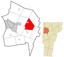
According to the United States Census Bureau, the town has a total area of 35.6 square miles (92.1 km2), of which 35.4 square miles (91.7 km2) is land and 0.15 square miles (0.4 km2), or 0.45%, is water. [4]

The town of Jericho has a connection with the neighboring town of Underhill. The area has four distinct village areas. The historic Old Red Mill, home of the Jericho Historical Society, [10] stands in Jericho village (also known as Jericho Corners) on Route 15 in the northwest part of the town, an area that extends from the Browns River crossing eastward to the post office and the Jericho Elementary School. Jericho Corners is the location of the Galusha House, home of Truman Galusha, a brick Federal-style house built in 1790 and like Jericho's Old Red Mill, listed on the National Register of Historic Places. [11]

Jericho's second village, Jericho Center, on Browns Trace, is home to several historic buildings, churches, and Jericho Center Country Store, Vermont's oldest continuously running general store. The Jericho Center Village has a village green, or "Common", a typical park-like center of a Vermont village, surrounded by historic buildings.

Half of the Underhill Flats area on Route 15 is within Jericho. This area features the multi-use Mills Riverside Park and two general stores (Jolley & Jacob's).

Underhill Center in the town of Underhill has one general store, as well as St. Thomas Catholic Church, a small postal office, and access to Underhill State Park.

Jericho is home to the Chittenden East Wolverines of the Northern Vermont Youth Football League, Cub Scout Pack 620, and one of Vermont's oldest and largest Boy Scout troops, Troop 627.

The two towns share the Underhill-Jericho Fire Department. [12]

Demographics

Historical population
CensusPop.Note
1790 381
1800 72891.1%
1810 1,18562.8%
1820 1,2192.9%
1830 1,65435.7%
1840 1,6841.8%
1850 1,8379.1%
1860 1,669−9.1%
1870 1,7575.3%
1880 1,687−4.0%
1890 1,461−13.4%
1900 1,373−6.0%
1910 1,307−4.8%
1920 1,138−12.9%
1930 1,091−4.1%
1940 1,077−1.3%
1950 1,1355.4%
1960 1,42525.6%
1970 2,34364.4%
1980 3,57552.6%
1990 4,30220.3%
2000 5,01516.6%
2010 5,009−0.1%
2020 5,1041.9%
U.S. Decennial Census [13]

As of the census [2] of 2000, there were 5,015 people, 1,751 households, and 1,402 families residing in the town. The population density was 141.7 people per square mile (54.7/km2). There were 1,774 housing units at an average density of 50.1 per square mile (19.4/km2). The racial makeup of the town was 97.45% White, 0.68% Black or African American, 0.14% Native American, 0.56% Asian, 0.08% Pacific Islander, 0.30% from other races, and 0.80% from two or more races. Hispanic or Latino of any race were 1.12% of the population.

There were 1,751 households, out of which 45.9% had children under the age of 18 living with them, 70.4% were married couples living together, 7.1% had a female householder with no husband present, and 19.9% were non-families. 14.3% of all households were made up of individuals, and 4.3% had someone living alone who was 65 years of age or older. The average household size was 2.86 and the average family size was 3.19.

In the town, the population was spread out, with 30.9% under the age of 18, 4.6% from 18 to 24, 31.7% from 25 to 44, 26.4% from 45 to 64, and 6.4% who were 65 years of age or older. The median age was 37 years. For every 100 females, there were 98.1 males. For every 100 females age 18 and over, there were 92.6 males.

The median income for a household in the town was $65,375, and the median income for a family was $72,500. Males had a median income of $49,375 versus $30,488 for females. The per capita income for the town was $24,941. About 3.6% of families and 4.6% of the population were below the poverty line, including 6.2% of those under age 18 and 3.7% of those age 65 or over.

Education

Schools fall under the umbrella of the Mount Mansfield Modified Union School District. Local school includes Jericho Elementary School serving from kindergarten through fourth grade. Browns River Middle School teaches grades five through eight. There is one high school in Jericho—Mount Mansfield Union High School—which serves students from Jericho, Underhill, Richmond, Huntington, Bolton, Jonesville, and Westford.

Students from Mount Mansfield Union High School are allowed to apply to a vocational school for their junior and senior years. They can apply to either The Center for Technology, Essex (CTE), or the Burlington Technical Center (BTC). CTE is located in Essex Junction and is part of the larger Essex High School (EHS).

MMU has 814 students enrolled as of 2018, making it the eighth most enrolled school in Vermont. [14]

On November 4, 2014, the communities of Bolton, Jericho, Richmond, Underhill ID and Underhill Town voted to form the Mount Mansfield Modified Union School District also known as the MMMUSD. [15] On June 6, 2019, MMUUSD voted to also include the town of Huntington. This school district serves and governs the current town school districts of Bolton (Smilie Memorial School), Huntington (Brewster Pierce Memorial Elementary), Jericho (Jericho Elementary), Richmond (Richmond Elementary), and Underhill (Underhill Central School), Mt Mansfield Union School District (Browns River Middle, Camels Hump Middle and Mt. Mansfield Union High Schools) in grades Pre-K through 12.

Notable people

A fictitious version of Jericho is the setting of the 2022 TV series Wednesday based on the character from The Addams Family. [22]

Related Research Articles

<span class="mw-page-title-main">Montpelier, Vermont</span> Capital city of Vermont, United States

Montpelier is the capital of the U.S. state of Vermont and the county seat of Washington County. The site of Vermont's state government, it is the least populated state capital in the United States. As of the 2020 census, the population was 8,074, with a daytime population growth of about 21,000 due to the large number of jobs within city limits. The Vermont College of Fine Arts is located in the municipality. It was named after Montpellier, a city in the south of France.

<span class="mw-page-title-main">Chittenden County, Vermont</span> County in Vermont, United States

Chittenden County is the most populous county in the U.S. state of Vermont. As of the 2020 census, its population was 168,323. The county seat is Vermont's most populous municipality, the city of Burlington. The county has over a quarter of Vermont's population and more than twice the population of Vermont's second-most populous county, Rutland. The county also has more than twice the population density of Vermont's second-most dense county, Washington. The county is named for Vermont's first governor and one of the framers of its constitution as an independent republic and later U.S. state, Thomas Chittenden.

<span class="mw-page-title-main">Lyndon, Vermont</span> Town in Vermont, United States

Lyndon is a town in Caledonia County, Vermont, United States. As of the 2020 census, the population was 5,491. Lyndon is the home of Lyndon State College. The town contains five unincorporated villages, Lyndonville just east of the geographic center of town, Lyndon Corner in the south, Lyndon Center in the center of town on the west side of Lyndonville, Little Egypt in the north, and East Lyndon in the southeast.

<span class="mw-page-title-main">Bolton, Vermont</span> Town in Vermont, United States

Bolton is a town in Chittenden County, Vermont, United States. The population was 1,301 at the time of the 2020 census. The town is home to Bolton Valley, a popular ski resort.

<span class="mw-page-title-main">Charlotte, Vermont</span> Town in Vermont, United States

Charlotte is a town in Chittenden County, Vermont, United States. The town was named for Queen Charlotte, though unlike Charlotte, North Carolina, Charlottesville, Virginia, and other cities and towns that bear her name, the town's name is pronounced with the accent on the second syllable. The population of the town was 3,912 at the 2020 census.

<span class="mw-page-title-main">Essex, Vermont</span> Town in Vermont, United States

Essex is a town in Chittenden County, Vermont, United States. Vermont Route 289 crosses the town from east to west. The city of Essex Junction, with a population as of 2020 of 10,590, was located within the town as an incorporated village until 2022.

<span class="mw-page-title-main">Hinesburg, Vermont</span> Town in Vermont, United States

Hinesburg is a town in Chittenden County, Vermont, United States. The town was named for Abel Hine, town clerk. The population was 4,698 at the 2020 census.

<span class="mw-page-title-main">Huntington, Vermont</span> Town in Vermont, United States

Huntington is a town in Chittenden County, Vermont, United States. The population was 1,938 at the 2020 census.

<span class="mw-page-title-main">Richmond, Vermont</span> Town in Vermont, United States

Richmond is a town in Chittenden County, Vermont, United States. As of the 2020 census the population was 4,167. The main settlement of Richmond, in the north-central part of town, is a census-designated place (CDP), with a population of 853 at the 2020 census; it was formerly an incorporated village.

<span class="mw-page-title-main">Shelburne, Vermont</span> Town in Vermont, United States

Shelburne is a town in Chittenden County, Vermont, United States. Located along the shores of Lake Champlain, Shelburne's town center lies approximately 7 miles (11 km) south of the city center of Burlington, the largest city in the state of Vermont. As of the 2020 census, the population of Shelburne was 7,717.

<span class="mw-page-title-main">Underhill, Vermont</span> Town in Vermont, United States

Underhill is a town in Chittenden County, Vermont, United States. The population was 3,129 at the 2020 census.

<span class="mw-page-title-main">Westford, Vermont</span> Town in Vermont, United States

Westford is a town in Chittenden County, Vermont, United States. The population was 2,062 at the 2020 census.

<span class="mw-page-title-main">Williston, Vermont</span> Town in Vermont, United States

Williston is a town in Chittenden County, Vermont, United States. Originally rural and laid out with many farms, in recent decades it has developed into a thriving suburb of Burlington, the largest city in the state of Vermont. As of the 2020 census, the population of Williston was 10,103, an increase of over 1,000 people since the 2010 census. Williston is one of the fastest-growing towns in Vermont, and while becoming more populated, it has also developed as a major retail center for the Burlington area as well as much of central and northern Vermont. The town has a National Register Historic District in its unincorporated central village.

<span class="mw-page-title-main">Jeffersonville, Vermont</span> Village in Vermont, United States

Jeffersonville is a village in the town of Cambridge, Vermont, United States. The population was 750 at the 2020 census.

<span class="mw-page-title-main">Randolph, Vermont</span> Town in Vermont, United States

Randolph is a town in Orange County, Vermont, United States. The population was 4,774 at the 2020 census, making Randolph the largest town in Orange County. The town is a commercial center for many of the smaller, rural farming communities that surround it.

<span class="mw-page-title-main">Jericho (village), Vermont</span> Village in Vermont, United States

Jericho is a village in Chittenden County, Vermont, United States. The population was 1,333 at the 2020 census.

<span class="mw-page-title-main">Cambridge, Vermont</span> Town in Vermont, United States

Cambridge is a town in Lamoille County, Vermont, United States. The population was 3,839 at the 2020 United States Census. Cambridge includes the villages of Jeffersonville and Cambridge.

<span class="mw-page-title-main">Milton, Vermont</span> Town in Vermont, United States

Milton is a town in Chittenden County, Vermont, United States. As of the 2020 census, the population was 10,723. According to local legend, the town was named for the English poet John Milton, but the name most likely originated from William FitzWilliam, 4th Earl FitzWilliam, who held the title Viscount Milton and was a supporter of independence for the colonies during the American Revolution.

Mount Mansfield Modified Union School District (MMUUSD), formerly the Mount Mansfield Union School District #17, is a school district headquartered in Jericho, Vermont.

Underhill Flats is an unincorporated village and census-designated place (CDP) in the towns of Underhill and Jericho, Chittenden County, Vermont, United States. It was first listed as a CDP prior to the 2020 census.

References

  1. "Town of Jericho". Geographic Names Information System . United States Geological Survey, United States Department of the Interior . Retrieved April 4, 2024.
  2. 1 2 "U.S. Census website". United States Census Bureau . Retrieved January 31, 2008.
  3. "US Board on Geographic Names". United States Geological Survey. October 25, 2007. Retrieved January 31, 2008.
  4. 1 2 "Census - Geographic Profile - Jericho town, Chittenden County, Vermont". U.S. Census Bureau. Retrieved October 28, 2021.
  5. Gannett, Henry (1905). The Origin of Certain Place Names in the United States. Govt. Print. Off. p. 169.
  6. Wilbur, James Benjamin. Ira Allen: Founder of Vermont, 1751-1814. United States: Houghton Mifflin, 1928. p. 20-1.
  7. 1 2 The History of Jericho, Vermont. United States: Free Press printing Company, printers, 1916. p. 90-4.
  8. Hayden, Chauncey (1916). The History of Jericho, Vermont. Burlington, VT: The Free Press Printing Company. p. 46.
  9. Hathaway, Allen. "Mutiny, Matthew Lyon, and a Missing Fort: Archaeological Identification Studies of Fort Jericho" (PDF). The Journal of Vermont Archaeology: 52–60.
  10. "Jericho Historical Society". Jericho Historical Society.
  11. "National Register of Historic Places - VERMONT (VT), Chittenden County". National Register of Historic Places . Retrieved October 27, 2014.
  12. "Home | Underhill Jericho Fire Department". Home | Underhill Jericho Fire Department.
  13. "U.S. Decennial Census". United States Census Bureau. Retrieved May 16, 2015.
  14. "2018 Largest Public High Schools in Vermont". Niche. Retrieved March 30, 2018.
  15. Niles, Hilary (November 5, 2014). "Chittenden East approves voluntary school merger". VTDigger. Retrieved March 30, 2018.
  16. Hughes, Victoria. "Wilson "Snowflake" Bentley - Vermont Historical Society". vermonthistory.org. Retrieved March 30, 2018.
  17. Adam, White. "Jericho mountain biker has eyes on medal in Rio". The Burlington Free Press . Burlington, VT. Retrieved April 5, 2019.
  18. Carlisle, Lilian Baker (Summer 1982). "Humanities' Needs Deserve Our Fortune: Mary Martha Fletcher and the Fletcher Family Benevolences" (PDF). Vermont History. 50 (3): 129–142.
  19. "Obituary, William B. Gray". Bradford Journal-Opinion . Bradford, VT. March 30, 1994. p. 6 via Small Town Papers, Inc.
  20. Carleton, Hiram (1903). Genealogical and Family History of the State of Vermont. Vol. II. New York, NY: The Lewis Publishing Company. pp. 15–16 via Internet Archive.
  21. "Marathon County, Wisconsin Historical Society". Archived from the original on December 26, 2015. Retrieved October 16, 2014.
  22. Vitale, Micaela Pérez (December 15, 2022). "Wednesday: Is Jericho a Real Town?". MovieWeb . Las Vegas, NV: Watchr Media. Retrieved December 25, 2022.