The area of South Burlington was first granted by the Province of New Hampshire as part of Burlington township on June 7, 1763.[6]
The Town of Burlington was organized circa 1785. In 1865, the unincorporated village of Burlington was chartered as a city. The remaining area of the town of Burlington was incorporated by charter of the State of Vermont as a separate town with the name South Burlington in the same year, 1865.[7] The Town of South Burlington was later incorporated as a city in 1971, becoming the City of South Burlington.
City Center Initiative
The City Center Initiative is a proposal to create a walkable downtown for South Burlington. The city is investing in infrastructure to support gathering spaces, mobility, and economic vitality.[8] The over 300-acre area targeted to be developed and redeveloped is zoned for mixed-use including residential, commercial, and cultural spaces. The main components under design or construction by the city are a city hall, senior center and public library, streets, and parks. Two main streets, Market Street, and Garden Street form the central routes through "City Center". These streets include bicycle and walking facilities. Market Street, already completed, is lined with trees, and include stormwater infiltration surfaces. Along Market Street mixed-use buildings are in construction primarily for use by lower-level retail and upper-level residential units. In addition, a 7+ acre plot has been redeveloped as a public park, with walking paths through a forest, a children's discovery area, and natural art landmarks.[9]
Geography
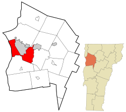
Located in western Chittenden County, South Burlington is bordered by the municipalities of Burlington to the northwest, Winooski and Colchester to the north, Essex to the northeast, Williston to the east, Shelburne to the south, and Shelburne Bay on Lake Champlain to the west. A large portion of Lake Champlain west of Burlington, extending west to the New York state line, is also part of South Burlington. The Winooski River runs along the northern edges of the city on its borders with Winooski, Colchester, and Essex.
According to the U.S. Census Bureau, the city has a total area of 29.6 square miles (76.6km2), of which 16.5 square miles (42.7km2) is land and 13.1 square miles (33.9km2), or 44.25%, is water.[10]
As of the census[2] of 2010, the population density was 1,121.2 peopleper square mile (432.9 people/km2). There were 8,429 housing units at an average density of 507.8 unitsper square mile (196.1 units/km2).
2020 census
The 2020 census reports there were 20,277 people living in South Burlington.[12] There were 8,764 households and the average number of persons residing in one household was 2.15.[13]
Race and ethnicity as of the Census Population Estimates, July 1, 2022, estimates:[14]
70.9% of people 16 and older in South Burlington are in the labor force. By sector, the labor force in South Burlington is concentrated in a few main sectors:
34.2% employed in educational services, health care, and social assistance
11.4% employed in manufacturing
9.1% employed in arts, entertainment, and recreation, and accommodation and food services
9.0% employed in retail
9.0% employed in professional, scientific, and management, and administrative and waste management services[16]
The median household income was $73,605 in 2019[13] and 25.2% of families have total annual income between $100,000–$150,000. The unemployment rate in 2019 was 4.4%.[17]
Economy
South Burlington has a largely service-based economy. There are 191 businesses in retail trade, mainly concentrated around City Center near Dorset Street and Williston Road. There are 131 establishments in health care and assistance and 116 in professional, scientific, and technical service industries.[18] In 2020, South Burlington was first in the state for gross retail and use sales with $1,385,886,972.[19] Real estate, rental, and leasing operations had a sales value of $86,976,000 in 2012.[20]
Some of the major employers in South Burlington are the Vermont National Guard, GE Healthcare, Ben & Jerry's, Fairpoint Communications, Lane Press, and Halyard Brewing Co. South Burlington is home to CommutAir, a regional airline, and is headquartered in the city by the airport.[21] Other important economic forces in South Burlington include the University Mall, Vermont's largest mall, four grocery stores centrally located in City Center, and the Development Plan for City Center.
South Burlington is home to a variety of parks that have various walking trails with various amenities for all ages. All parks have parking available.
Red Rocks Park is a public park and beach on the shores of Lake Champlain.
Farrell Park is a 22-acre park with a playground, picnic area, has access to pedestrian trails and an off-leash dog park.
Overlook Park is a scenic park overlooking Lake Champlain and the Adirondacks.
Veterans Memorial Park (also known as Dorset Park) is the city's most well-known park. It has three baseball fields, one basketball court, a playground, and Cairns Arena, the high school's hockey arena, is close by.
Jaycee Park has a playground, basketball court, and open space for people to use.
Szymanski Park is located in the South End of the city. It has a basketball court, tennis courts, a playground, picnic area, access to recreational and pedestrian trails.
The city government is a council–manager form of government with five at-large city council members. Budgets must be approved by voters.[22] The city budget for 2021 was $26,599,754.[23] The city maintains roads, recreation paths and parks, and recreation, planning and zoning, fire and police departments as well as a city clerk's office and city manager's office. The city clerk is elected by the voters and the city manager is appointed by the city council. The city also has a sewer (water quality), stormwater, and water utility.
Education
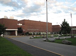
South Burlington High School
Elementary schools
Chamberlin School (public)
Orchard School (public)
Rick Marcotte Central School (public)
The Schoolhouse (private, independent)
Middle schools
Frederick H. Tuttle Middle School (the city's only public middle school)
WPTZ – Although licensed to Plattsburgh, New York, the station relocated their main studio facility to the same building in South Burlington that contains the Ben & Jerry's headquarters in the fall of 2019.
Patrick Leahy Burlington International Airport provides the area with commercial service to major regional hubs and international airports. Despite its name, it is located in South Burlington, although the land it is located on is owned and operated by the neighboring City of Burlington, Vermont's most populous municipality. It originally did not offer scheduled commercial flights to destinations outside the United States, although it now has a Customs Port of Entry.[24] The name dates to a time when it offered flights to Montreal. From 2011 to 2018, there were seasonal flights to Billy Bishop Airport in Toronto. Bus service is provided by Green Mountain Transit.
Interstate 89 has two interchanges serving the city. Exit 13 merges with I-189, which ends at Shelburne Road (U.S. Route 7). The second interchange, Exit 14, is the state of Vermont's largest highway exit and merges onto U.S. Route 2. Exit 14E merges onto Williston Road and Dorset Street in South Burlington. Exit 14W is the main exit into Burlington and becomes Main Street in the Burlington city limits, by the University of Vermont.
Interstate 189 goes east–west, connecting two of the city's main commercial roads, Shelburne Road (U.S. Route 7) and Dorset Street.
VT116 (Vermont Route 116) runs north–south into South Burlington, with the northern terminus being at a junction at U.S. Route 2 (Williston Road).
This page is based on this Wikipedia article Text is available under the CC BY-SA 4.0 license; additional terms may apply. Images, videos and audio are available under their respective licenses.