Morristown, Vermont

Last updated
Morristown, Vermont
RedBridge.jpg
The Red Bridge in Sterling Valley
Morristown vt highlight.png
Morristown, Vermont
Usa edcp location map.svg
Red pog.svg
Morristown, Vermont
Location in the United States
Coordinates: 44°33′13″N72°36′24″W / 44.55361°N 72.60667°W / 44.55361; -72.60667 Coordinates: 44°33′13″N72°36′24″W / 44.55361°N 72.60667°W / 44.55361; -72.60667
Country United States
State Vermont
County Lamoille
CommunitiesCadys Falls
Morristown
Morrisville
Area
[1]
  Total51.68 sq mi (133.85 km2)
  Land51.15 sq mi (132.48 km2)
  Water0.53 sq mi (1.37 km2)
Elevation
948 ft (289 m)
Population
 (2020) [2]
  Total5,434
  Density110/sq mi (41/km2)
Time zone UTC-5 (Eastern (EST))
  Summer (DST) UTC-4 (EDT)
ZIP code
05661
Area code(s) 802
FIPS code 50-46675 [3]
GNIS feature ID1462154 [4]
Website www.morristownvt.org

Morristown is a town in Lamoille County, Vermont, United States. As of the 2020 census, the population was 5,434. [5] Morristown is the largest town by population in Lamoille County, and its central village of Morrisville serves as the county's main commercial center.

Contents

Geography

The Red Bridge Red Bridge, Morristown, Vermont.jpg
The Red Bridge

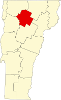
Morristown is in southern Lamoille County, to the east of the main range of the Green Mountains. The Lamoille River flows through the northern part of the town, with Ryder Brook and others joining the river from a broad valley to the south. The village of Morrisville is in the northern part of town along the Lamoille River, east of Lake Lamoille, a small reservoir. Several Vermont state highways converge in Morrisville. Vermont Route 100 leads northwest 3 miles (5 km) to Hyde Park, the Lamoille County shire town, and south 8 miles (13 km) to Stowe, while Vermont Route 12 leads southeast 26 miles (42 km) to Montpelier, the state capital. Vermont Route 15 passes through Morristown north of Morrisville village, leading northwest past Hyde Park 15 miles (24 km) to Jeffersonville and southeast 14 miles (23 km) to Hardwick. Vermont Route 15A leads east out of Morrisville, running 2 miles (3 km) to Route 15.

According to the United States Census Bureau, the town has a total area of 51.7 square miles (133.8 km2), of which 51.2 square miles (132.5 km2) are land and 0.54 square miles (1.4 km2), or 1.02%, are water. [1]

Climate

This climatic region is typified by large seasonal temperature differences, with warm to hot (and often humid) summers and cold (sometimes severely cold) winters. According to the Köppen Climate Classification system, Morristown has a humid continental climate, abbreviated "Dfb" on climate maps. [6]

Demographics

Historical population
CensusPop.
1790 10
1800 1441,340.0%
1810 550281.9%
1820 72632.0%
1830 1,31581.1%
1840 1,50214.2%
1850 1,441−4.1%
1860 1,75121.5%
1870 1,8978.3%
1880 2,09910.6%
1890 2,41114.9%
1900 2,5335.1%
1910 2,6524.7%
1920 2,8136.1%
1930 2,9394.5%
1940 3,1306.5%
1950 3,2253.0%
1960 3,3473.8%
1970 4,05221.1%
1980 4,4489.8%
1990 4,7336.4%
2000 5,1398.6%
2010 5,2271.7%
2020 5,4344.0%
U.S. Decennial Census [7]

At the 2000 census there were 5,139 people, 2,101 households, and 1,317 families living in the town. The population density was 100.1 people per square mile (38.6/km2). There were 2,271 housing units at an average density of 44.2 per square mile (17.1/km2). The racial makeup of the town was 97.51% White, 0.35% African American, 0.35% Native American, 0.47% Asian, 0.12% from other races, and 1.21% from two or more races. Hispanic or Latino of any race were 0.78%. [3]

Of the 2,101 households 31.3% had children under the age of 18 living with them, 46.5% were married couples living together, 12.2% had a female householder with no husband present, and 37.3% were non-families. 27.8% of households were one person and 10.2% were one person aged 65 or older. The average household size was 2.39 and the average family size was 2.92.

The age distribution was 24.2% under the age of 18, 7.6% from 18 to 24, 28.8% from 25 to 44, 24.1% from 45 to 64, and 15.3% 65 or older. The median age was 39 years. For every 100 females, there were 91.7 males. For every 100 females age 18 and over, there were 86.2 males.

The median household income was $33,359 and the median family income was $40,456. Males had a median income of $28,050 versus $21,014 for females. The per capita income for the town was $17,195. About 6.9% of families and 10.3% of the population were below the poverty line, including 11.1% of those under age 18 and 9.9% of those age 65 or over.

Notable people

Related Research Articles

Lamoille County, Vermont County in Vermont, United States

Lamoille County is a county located in the U.S. state of Vermont. As of the 2020 census, the population was 25,945, and it is the third-least populous county in Vermont. Its shire town is the town of Hyde Park, while Morristown is the county's largest town by population as well as its main commercial center. The county was created in 1835 and organized the following year.

Peru, Vermont Town in Vermont, United States

Peru is a town in Bennington County, Vermont, United States. The population was 531 at the 2020 census. Originally known as Bromley, the town name was changed to "Peru" by the land grantees as a way of attracting land buyers to an area that had been described as 36 square miles (93 km2) of "trees, bears and mountain lions".

Danville, Vermont Town in Vermont, United States

Danville is a town in Caledonia County, Vermont, United States. The population was 2,335 at the 2020 census. The primary settlement in town is recorded as the Danville census-designated place (CDP) and had a population of 385 at the 2020 census.

Walden, Vermont Town in Vermont, United States

Walden is a town in Caledonia County, Vermont, United States. The population was 956 at the 2020 census. The community has no ZIP code of its own; mail is routed through the West Danville and East Hardwick post offices.

Enosburg Falls, Vermont Village in Vermont, United States

Enosburg Falls is a village in the town of Enosburgh in Franklin County, Vermont, in the United States. The population was 1,356 at the 2020 census.

Fletcher, Vermont Town in Vermont, United States

Fletcher is a town in Franklin County, Vermont, United States. The population was 1,346 at the 2020 census.

Belvidere, Vermont Town in Vermont, United States

Belvidere is a town in Lamoille County, Vermont, United States. The population was 358 at the 2020 census. Belvidere contains the hamlets of Belvidere Center, Belvidere Corners and Belvidere Junction. In 1963, part of Averys Gore in Franklin County became part of Belvidere, while the other part became part of Montgomery.

Eden, Vermont Town in Vermont, United States

Eden is a town in Lamoille County, Vermont, United States. The population was 1,338 at the 2020 census.

Elmore, Vermont Town in Vermont, United States

Elmore is a town in Lamoille County, Vermont, United States. It was granted by the Vermont Republic in 1780, and was named for Colonel Samuel Elmore (1720–1805), one of the original grantees. The population was 886 at the 2020 census. Elmore contains the villages of East Elmore and Lake Elmore, as well as Elmore State Park, a 700-acre (2.8 km2) recreational area on the 219-acre (0.9 km2) Lake Elmore and on Elmore Mountain to the west.

Jeffersonville, Vermont Village in Vermont, United States

Jeffersonville is a village in the town of Cambridge, Vermont, United States. The population was 750 at the 2020 census.

Morrisville, Vermont Village in Vermont, United States

Morrisville is a village in the town of Morristown, Lamoille County, Vermont, United States. As of the 2020 census, the village population was 2,086. Morrisville has two country clubs, a hospital, a school featuring Greek architecture and an airport. The hospital and one of the country clubs are named after Alexander Copley, a philanthropist who donated much of the money for their construction. Copley also donated a large sum of money for the construction of the town's high school that is currently called Peoples Academy.

Waterville, Vermont Town in Vermont, United States

Waterville is a town in Lamoille County, Vermont, United States. The population was 686 at the 2020 census.

Wolcott, Vermont Town in Vermont, United States

Wolcott is a town in Lamoille County, Vermont, United States. The town was named for General Oliver Wolcott, a signer of the Declaration of Independence. The population was 1,670 at the 2020 census.

Chittenden, Vermont Town in Vermont, United States

Chittenden is a town in Rutland County, Vermont, United States. The population was 1,237 at the 2020 census.

Cavendish, Vermont Town in Vermont, United States

Cavendish is a town in Windsor County, Vermont, United States. The town was likely named after William Cavendish, 4th Duke of Devonshire. The population was 1,392 at the 2020 census. The town of Cavendish includes the unincorporated villages of Cavendish and Proctorsville.

Cambridge, Vermont Town in Vermont, United States

Cambridge is a town in Lamoille County, Vermont, United States. The population was 3,839 at the 2020 United States Census. Cambridge includes the villages of Jeffersonville and Cambridge.

Hyde Park (town), Vermont Town in Vermont, United States

Hyde Park is a town in and the shire town of Lamoille County, Vermont, United States. The town was named for Captain Jedediah Hyde, an early landowner who was a veteran of the American Revolutionary War. The population was 3,020 at the 2020 census. There is also a village of the same name within the town.

Johnson, Vermont Town in Vermont, United States

Johnson is a town in Lamoille County, Vermont, United States. The population was 3,491 at the 2020 census. The town is home to Northern Vermont University-Johnson, a part the Vermont State Colleges system. The Vermont Studio Center is located in the village of Johnson.

Waterbury, Vermont Town in Vermont, United States

Waterbury is a town in Washington County in central Vermont, United States. It is also the name of a village within that town. As of the 2020 census, the population was 5,331.

West Rutland, Vermont Town in Vermont, United States

West Rutland is a town in Rutland County, Vermont, United States. The population was 2,214 at the 2020 census. The town center, located in the south-central portion of the town and where about 87% of the population resides, is defined by the U.S. Census Bureau as a census-designated place (CDP). The town is part of the Rutland micropolitan NECTA.

References

  1. 1 2 "2019 U.S. Gazetteer Files". United States Census Bureau. Retrieved February 10, 2021.
  2. "Census - Geography Profile - Morristown town, Lamoille County, Vermont". data.census.gov. U.S. Census Bureau. Retrieved October 28, 2021.
  3. 1 2 "U.S. Census website". United States Census Bureau . Retrieved 2008-01-31.
  4. "US Board on Geographic Names". United States Geological Survey. 2007-10-25. Retrieved 2008-01-31.
  5. "Total Population: 2010 Census DEC Summary File 1 (P1), Morristown town, Lamoille County, Vermont". data.census.gov. U.S. Census Bureau. Retrieved February 10, 2021.
  6. "Morristown, Vermont Köppen Climate Classification (Weatherbase)". Weatherbase.
  7. "U.S. Decennial Census". United States Census Bureau. Retrieved May 16, 2015.