Wolcott, Vermont

Last updated

Wolcott, Vermont
Pierce Cemetery.jpg
Pierce Cemetery in Wolcott
Wolcott vt highlight.png
Wolcott, Vermont
Usa edcp location map.svg
Red pog.svg
Wolcott, Vermont
Location in the United States
Coordinates: 44°34′32″N72°28′32″W / 44.57556°N 72.47556°W / 44.57556; -72.47556
Country United States
State Vermont
County Lamoille
Communities Wolcott
North Wolcott
Area
[1]
  Total39.2 sq mi (101.4 km2)
  Land38.8 sq mi (100.5 km2)
  Water0.3 sq mi (0.9 km2)
Elevation
1,319 ft (402 m)
Population
 (2020)
  Total1,670
  Density43/sq mi (16.6/km2)
Time zone UTC-5 (Eastern (EST))
  Summer (DST) UTC-4 (EDT)
ZIP code
05680
Area code 802
FIPS code 50-85375 [2]
GNIS feature ID1462269 [3]
Website www.wolcottvt.org

Wolcott is a town in Lamoille County, Vermont, United States. The town was named for General Oliver Wolcott, a signer of the Declaration of Independence. [4] The population was 1,670 at the 2020 census. [5]

Contents

Geography

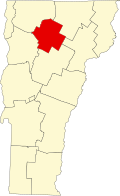
Wolcott is the easternmost town in Lamoille County. It is bordered to the northeast by Orleans County and to the southeast by Caledonia County. The Lamoille River crosses the southern part of the town from east to west, followed by Vermont Route 15, which leads northwest 8 miles (13 km) to Morrisville and southeast 6 miles (10 km) to Hardwick. The unincorporated village of Wolcott is in the southern part of the town, along Route 15.

According to the United States Census Bureau, the town of Wolcott has a total area of 39.2 square miles (101.4 km2), of which 38.8 square miles (100.5 km2) are land and 0.35 square miles (0.9 km2), or 0.88%, are water. [1]

Government

Legislators

The Essex-Orleans Senate district includes the town of Wolcott, as well as parts or all of Essex County, Orleans County, Franklin County and Lamoille County. The district is represented in the Vermont House by Daniel Noyes (D) and Kate Donnally (D). [6]

Demographics

Historical population
CensusPop.Note
1790 32
1800 4746.9%
1810 124163.8%
1820 123−0.8%
1830 492300.0%
1840 82467.5%
1850 90910.3%
1860 1,16127.7%
1870 1,132−2.5%
1880 1,1663.0%
1890 1,158−0.7%
1900 1,066−7.9%
1910 1,049−1.6%
1920 932−11.2%
1930 831−10.8%
1940 772−7.1%
1950 766−0.8%
1960 633−17.4%
1970 6766.8%
1980 98645.9%
1990 1,22924.6%
2000 1,45618.5%
2010 1,67615.1%
2020 1,670−0.4%
U.S. Decennial Census [7]

As of the census [2] of 2000, there were 1,456 people, 552 households, and 401 families residing in the town. The population density was 37.3 people per square mile (14.4/km2). There were 646 housing units at an average density of 16.6 per square mile (6.4/km2). The racial makeup of the town was 98.83% White, 0.07% Black or African American, 0.27% Native American, 0.07% Asian, 0.14% Pacific Islander, and 0.62% from two or more races. Hispanic or Latino of any race were 0.34% of the population.

There were 552 households, out of which 39.9% had children under the age of 18 living with them, 58.2% were married couples living together, 7.4% had a female householder with no husband present, and 27.2% were non-families. 18.8% of all households were made up of individuals, and 5.8% had someone living alone who was 65 years of age or older. The average household size was 2.63 and the average family size was 2.99.

In the town, the population was spread out, with 28.4% under the age of 18, 7.3% from 18 to 24, 34.0% from 25 to 44, 23.4% from 45 to 64, and 6.9% who were 65 years of age or older. The median age was 33 years. For every 100 females, there were 105.6 males. For every 100 females age 18 and over, there were 102.3 males.

Economy

Personal income

The median income for a household in the town was $34,760, and the median income for a family was $38,056. Males had a median income of $27,898 versus $21,905 for females. The per capita income for the town was $15,198. About 10.2% of families and 14.6% of the population were below the poverty line, including 24.8% of those under age 18 and 18.6% of those age 65 or over.

Recreation

The Fisher Covered Railroad Bridge is the easternmost access point for the Lamoille River Paddlers Trail in Wolcott. Boaters can also access the Paddlers Trail three miles downstream at the Elmore (Pond) Road bridge to avoid a portage around the Wolcott Dam. [8]

Notable people

Related Research Articles

<span class="mw-page-title-main">Lamoille County, Vermont</span> County in Vermont, United States

Lamoille County is a county located in the U.S. state of Vermont. As of the 2020 census, the population was 25,945, and it is the third-least populous county in Vermont. Its shire town is the town of Hyde Park, while Morristown is the county's largest town by population as well as its main commercial center. The county was created in 1835 from portions of Orleans, Franklin, Washington, and Chittenden Counties and organized the following year.

<span class="mw-page-title-main">New Haven, Vermont</span> Town in Vermont, United States

New Haven is a town in Addison County, Vermont, United States. The population was 1,683 at the 2020 census. In addition to the town center, New Haven contains the communities of Belden, Brooksville, New Haven Junction and New Haven Mills.

<span class="mw-page-title-main">Fletcher, Vermont</span> Town in Vermont, United States

Fletcher is a town in Franklin County, Vermont, United States. The population was 1,346 at the 2020 census.

<span class="mw-page-title-main">Montgomery, Vermont</span> Town in Vermont, United States

Montgomery is a town in Franklin County, Vermont, United States. The population as of the 2020 census was 1,184. In 1963, part of Avery's Gore in Franklin County became part of Montgomery, with the other section becoming part of Belvidere in Lamoille County.

<span class="mw-page-title-main">Richford, Vermont</span> Town in Vermont, United States

Richford is a town in Franklin County, Vermont, United States, located along the Canada–United States border. The population was 2,346 at the 2020 census.

<span class="mw-page-title-main">Belvidere, Vermont</span> Town in Vermont, United States

Belvidere is a town in Lamoille County, Vermont, United States. The population was 358 at the 2020 census. Belvidere contains the hamlets of Belvidere Center, Belvidere Corners and Belvidere Junction. In 1963, part of Averys Gore in Franklin County became part of Belvidere, while the other part became part of Montgomery.

<span class="mw-page-title-main">Eden, Vermont</span> Town in Vermont, United States

Eden is a town in Lamoille County, Vermont, United States. The population was 1,338 at the 2020 census.

<span class="mw-page-title-main">Elmore, Vermont</span> Town in Vermont, United States

Elmore is a town in Lamoille County, Vermont, United States. It was granted by the Vermont Republic in 1780, and was named for Colonel Samuel Elmore (1720–1805), one of the original grantees. The population was 886 at the 2020 census. Elmore contains the villages of East Elmore and Lake Elmore, as well as Elmore State Park, a 700-acre (2.8 km2) recreational area on the 219-acre (0.9 km2) Lake Elmore and on Elmore Mountain to the west.

<span class="mw-page-title-main">Morristown, Vermont</span> Town in Vermont, United States

Morristown is a town in Lamoille County, Vermont, United States. As of the 2020 census, the population was 5,434. Morristown is the largest town by population in Lamoille County, and its central village of Morrisville serves as the county's main commercial center.

<span class="mw-page-title-main">Waterville, Vermont</span> Town in Vermont, United States

Waterville is a town in Lamoille County, Vermont, United States. The population was 686 at the 2020 census.

<span class="mw-page-title-main">Charleston, Vermont</span> Town in Vermont, United States

Charleston is a town in Orleans County, Vermont, United States. The population was 1,021 at the 2020 census. The town contains two unincorporated villages: East Charleston and West Charleston.

<span class="mw-page-title-main">Glover, Vermont</span> Town in Vermont, United States

Glover is a town in Orleans County, Vermont, in the United States. As of the 2020 census, the town's population was 1,114. It contains two unincorporated villages, Glover and West Glover.

<span class="mw-page-title-main">Morgan, Vermont</span> Town in Vermont, United States

Morgan is the easternmost town in Orleans County, Vermont, United States. The population was 638 at the 2020 census. The town contains two villages: Morgan and Morgan Center.

<span class="mw-page-title-main">Chittenden, Vermont</span> Town in Vermont, United States

Chittenden is a town in Rutland County, Vermont, United States. The population was 1,237 at the 2020 census.

<span class="mw-page-title-main">Milton (CDP), Vermont</span> Census-designated place in Vermont, United States

Milton is an unincorporated village within the town of Milton in Chittenden County, Vermont, United States. The village disincorporated in 2003 and became a census-designated place (CDP) in 2008. As of the 2020 census the population was 3,804, out of a population of 10,723 for the entire town.

<span class="mw-page-title-main">Cambridge, Vermont</span> Town in Vermont, United States

Cambridge is a town in Lamoille County, Vermont, United States. The population was 3,839 at the 2020 United States Census. Cambridge includes the villages of Jeffersonville and Cambridge.

Hyde Park is a village in the town of Hyde Park, Lamoille County, Vermont, United States. The village population was 410 at the 2020 census.

<span class="mw-page-title-main">Hyde Park (town), Vermont</span> Town in Vermont, United States

Hyde Park is a town in and the shire town of Lamoille County, Vermont, United States. The town was named for Captain Jedediah Hyde, an early landowner who was a veteran of the American Revolutionary War. The population was 3,020 at the 2020 census. There is also a village of the same name within the town.

<span class="mw-page-title-main">Johnson, Vermont</span> Town in Vermont, United States

Johnson is a town in Lamoille County, Vermont, United States. The population was 3,491 at the 2020 census. The town is home to Northern Vermont University-Johnson, a part the Vermont State Colleges system. The Vermont Studio Center is located in the village of Johnson. Since 1842, the town has been the home to Johnson Woolen Mills.

<span class="mw-page-title-main">Albany, Vermont</span> Town in Vermont, United States

Albany is a town in Orleans County, Vermont, United States. The population was 976 at the 2020 census. Albany contains four villages: the incorporated village of Albany, and the unincorporated villages of Albany Center, East Albany and South Albany.

References

  1. 1 2 "2019 U.S. Gazetteer Files". United States Census Bureau. Retrieved February 10, 2021.
  2. 1 2 "U.S. Census website". United States Census Bureau . Retrieved January 31, 2008.
  3. "US Board on Geographic Names". United States Geological Survey. October 25, 2007. Retrieved January 31, 2008.
  4. "Profile for Wolcott, Vermont". ePodunk . Retrieved May 9, 2010.
  5. "Census - Geography Profile: Wolcott town, Lamoille County, Vermont". United States Census Bureau . Retrieved January 7, 2022.
  6. "Vermont Legislature: Home | Vermont General Assembly." 2021<http://legislature.vermont.gov/>
  7. "U.S. Decennial Census". United States Census Bureau. Retrieved June 18, 2015.
  8. "Lamoille River Paddlers Trail | A community effort to develop and ..." 2015. September 20, 2016 <http://www.lamoilleriverpaddlerstrail.org/>
  9. "Obituary, Clifton Parker" . Burlington Free Press. Burlington, VT. April 21, 1988. p. 18.

Further reading