North Hyde Park, Vermont | |
|---|---|
 North Hyde Park  North Hyde Park | |
| Coordinates: 44°40′14″N72°35′53″W / 44.67056°N 72.59806°W | |
| Country | United States |
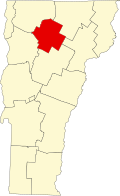
| State | Vermont |
| County | Lamoille |
| Towns | Hyde Park, Johnson, Eden |
| Area | |
• Total | 2.78 sq mi (7.19 km2) |
| • Land | 2.75 sq mi (7.13 km2) |
| • Water | 0.03 sq mi (0.07 km2) |
| Elevation | 873 ft (266 m) |
| Time zone | UTC-5 (Eastern (EST)) |
| • Summer (DST) | UTC-4 (EDT) |
| ZIP Codes | |
| Area code | 802 |
| FIPS code | 50-50725 |
| GNIS feature ID | 1458745 [2] |
North Hyde Park is an unincorporated village and census-designated place (CDP) in the towns of Hyde Park and Johnson, Lamoille County, Vermont, United States. The CDP was first drawn for the 2020 census. North Hyde Park has a post office with ZIP code 05665, which opened on May 29, 1839. [3] [4]