Morrisville is a village in the town of Morristown, Lamoille County, Vermont, United States. As of the 2020 census, the village population was 2,086.[2] Morrisville has two country clubs, a hospital, a school featuring Greek architecture and an airport. Morrisville is the headquarters for Union Bank and Concept2.
Morrisville was settled in 1798. The Morrisville Historic District is listed in the National Register of Historic Places. The hospital and one of the country clubs are named after Alexander Copley, a philanthropist who donated much of the money for their construction. Copley also donated a large sum of money for the construction of the town's high school that is currently called Peoples Academy.[3]
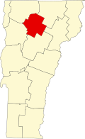
Geography
Morrisville is in the northeastern part of the town of Morristown, slightly southeast of the center of Lamoille County. The village is on both sides of the Lamoille River, with the village center on the south side. It is 3 miles (5km) southeast of Hyde Park, the county seat, 13 miles (21km) northwest of Hardwick, and 9 miles (14km) northeast of Stowe.
According to the United States Census Bureau, the Morrisville has a total area of 2.02 square miles (5.24km2), of which 1.95 square miles (5.06km2) are land and 0.07 square miles (0.18km2), or 3.42%, are water.[1]
Climate
Morrisville, Vermont in 1889
This climatic region is typified by large seasonal temperature differences, with warm to hot (and often humid) summers and cold (sometimes severely cold) winters. According to the Köppen Climate Classification system, Morrisville has a humid continental climate, abbreviated "Dfb" on climate maps.[4]
Climate data for Morrisville 4 SSW, Vermont, 1991–2020 normals: 760ft (230m)
As of the census[2] of 2020, the population was 2,086 with 898 households. There were 1,123 housing units.
Culture
The Vermont Wild of the Federal Hockey League played out of Morrisville's Green Mountain Arena in the 2011–12 season, but they suspended operations after approximately two weeks. The Wild were the first professional hockey team to play in Vermont.
↑ National Park Service. National Register of Historic Places Registration Form: Peoples Academy: Copley Building, Grout Observatory, and Community Bandshell. U.S. Department of the Interior, [1996]. Available at: https://npgallery.nps.gov/GetAsset/0268346d-9a87-463a-bcd6-92165722d3ed
This page is based on this Wikipedia article Text is available under the CC BY-SA 4.0 license; additional terms may apply. Images, videos and audio are available under their respective licenses.