Belvidere, Vermont | |
|---|---|
 | |
 Belvidere, Vermont | |
 Belvidere, Vermont Location in the United States | |
| Coordinates: 44°45′19″N72°40′49″W / 44.75528°N 72.68028°W | |
| Country | |
| State | |
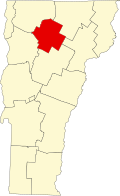
| County | Lamoille |
| Communities | Belvidere Center Belvidere Corners Belvidere Junction |
| Area | |
• Total | 32.14 sq mi (83.24 km2) |
| • Land | 32.09 sq mi (83.10 km2) |
| • Water | 0.05 sq mi (0.13 km2) |
| Elevation | 1,053 ft (321 m) |
| Population (2020) | |
• Total | 358 |
| • Density | 11/sq mi (4.3/km2) |
| Time zone | UTC-5 (Eastern (EST)) |
| • Summer (DST) | UTC-4 (EDT) |
| ZIP code | 05442 |
| Area code | 802 |
| FIPS code | 50-04375 [2] |
| GNIS feature ID | 1462038 [3] |
| Website | townofbelviderevt |
Belvidere is a town in Lamoille County, Vermont, United States. The population was 358 at the 2020 census. [4] Belvidere contains the hamlets of Belvidere Center, Belvidere Corners and Belvidere Junction. In 1963, part of Averys Gore in Franklin County became part of Belvidere, while the other part became part of Montgomery.