Grand Isle County, Vermont

Last updated

Grand Isle County
Grand Isle County Courthouse 01.JPG
Grand Isle County Courthouse in North Hero
Map of Vermont highlighting Grand Isle County.svg
Location within the U.S. state of Vermont
Vermont in United States.svg
Vermont's location within the U.S.
Coordinates: 44°48′58″N73°18′00″W / 44.816036°N 73.299889°W / 44.816036; -73.299889
CountryFlag of the United States.svg United States
StateFlag of Vermont.svg  Vermont
Founded1805
Shire Town North Hero
Largest town Alburgh
Area
  Total195 sq mi (510 km2)
  Land82 sq mi (210 km2)
  Water113 sq mi (290 km2)  58%
Population
 (2020)
  Total7,293
  Density37/sq mi (14/km2)
Time zone UTC−5 (Eastern)
  Summer (DST) UTC−4 (EDT)
Congressional district At-large

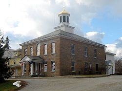
Grand Isle County is a county in the U.S. state of Vermont. As of the 2020 census, the population was 7,293, [1] making it Vermont's second-least populous county. Its shire town (county seat) is North Hero. [2] The county was created in 1802 and organized in 1805. [3] [4]

Contents

Grand Isle County is part of the Burlington metropolitan area. The county does not have a high school; students choose from a number of high schools in neighboring counties.[ citation needed ]

History

Grand Isle County is one of several Vermont counties created from land ceded by the state of New York on January 15, 1777, when Vermont declared itself to be a distinct state from New York. [5] [6] [7] The land was originally contested by Massachusetts, New Hampshire, New France and New Netherland, but it remained undelineated until July 20, 1764, when King George III established the boundary between New Hampshire and New York along the west bank of the Connecticut River, north of Massachusetts and south of the parallel of 45 degrees north latitude. New York assigned the land gained to Albany County. [8] [9] On March 12, 1772, Albany County was partitioned to create Charlotte County, [10] and this situation persisted until Vermont's independence from New York and Britain, which, however, did not end the contest.

On September 3, 1783, as a result of the signing of the Treaty of Paris, the Revolutionary War ended with Great Britain recognizing the independence of the United States. Vermont's border with Quebec was established at 45 degrees north latitude, [11] [12] which explains why this county has no dry-land connection to the rest of the United States.

Massachusetts did not formally withdraw its claim to the region, first made in 1629, until December 16, 1786. [13] New York, still not satisfied with the relinquishment of its land to Vermont, asked the U.S. Congress to arbitrate the matter. Congress ruled against New York on March 7, 1788. [14]

Subsequently, when Vermont petitioned for statehood, Congress ordered a joint commission to settle the border between New York and Vermont. This commission ruled before Vermont's admission, which took place on March 4, 1791, but a small change they permitted has never been acted upon. [15] [16] [17] Grand Isle County was created in 1802 from parts of Franklin and Chittenden Counties. [4]

In the late 19th century the Rutland Railroad ran service from northern New York State by the Canada–U.S. border, along the west side of Vermont to Rutland, Vermont, and south to Chatham, New York. From 1899 a series of causeways provided continuous train service north–south through the Lake Champlain islands, making a direct connection to Burlington. The last service from Alburgh was in 1948. [18]

Geography

According to the U.S. Census Bureau, the county has a total area of 195 square miles (510 km2), of which 82 square miles (210 km2) is land and 113 square miles (290 km2) (58%) is water. [19] It has the highest proportion of water coverage of any county in the state. It is the smallest county in Vermont by area, and the second-smallest by population (only Essex County has fewer people). Four of its five towns (North Hero, South Hero, Grand Isle and Isle La Motte) are situated entirely on islands in Lake Champlain, while Alburgh is on a peninsula (an exclave known as the Alburgh Tongue) extending south into the lake from Quebec. The highest elevation in the county is only 279 feet, on the west side of South Hero. The lake shoreline elevation is generally 99' above sea level.

Adjacent counties

Major highways

Demographics

Historical population
CensusPop.Note
1810 3,445
1820 3,5272.4%
1830 3,6964.8%
1840 3,8835.1%
1850 4,1456.7%
1860 4,2763.2%
1870 4,082−4.5%
1880 4,1241.0%
1890 3,843−6.8%
1900 4,46216.1%
1910 3,761−15.7%
1920 3,7840.6%
1930 3,9444.2%
1940 3,802−3.6%
1950 3,406−10.4%
1960 2,927−14.1%
1970 3,57422.1%
1980 4,61329.1%
1990 5,31815.3%
2000 6,90129.8%
2010 6,9701.0%
2020 7,2934.6%
U.S. Decennial Census [20]
1790–1960 [21] 1900–1990 [22]
1990–2000 [23] 2010–2018 [1]

2000 census

As of the census [24] of 2000, there were 6,901 people, 2,761 households, and 1,954 families living in the county. The population density was 84 people per square mile (32 people/km2). There were 4,663 housing units at an average density of 56 units per square mile (22 units/km2). The racial makeup of the county was 97.41% White, 0.14% Black or African American, 0.87% Native American, 0.23% Asian, 0.04% Pacific Islander, 0.03% from other races, and 1.28% from two or more races. 0.42% of the population were Hispanic or Latino of any race. 18.8% were of French, 14.6% French Canadian, 14.3% English, 10.6% American, 8.9% Irish and 7.4% German ancestry. 95.0% spoke English and 3.8% French as their first language.

There were 2,761 households, out of which 31.20% had children under the age of 18 living with them, 60.10% were married couples living together, 7.10% had a female householder with no husband present, and 29.20% were non-families. 22.20% of all households were made up of individuals, and 8.20% had someone living alone who was 65 years of age or older. The average household size was 2.50 and the average family size was 2.93.

In the county, the population was spread out, with 24.80% under the age of 18, 5.60% from 18 to 24, 28.70% from 25 to 44, 28.50% from 45 to 64, and 12.30% who were 65 years of age or older. The median age was 40 years. For every 100 females, there were 99.90 males. For every 100 females age 18 and over, there were 97.90 males.

The median income for a household in the county was $43,033, and the median income for a family was $48,878. Males had a median income of $35,539 versus $26,278 for females. The per capita income for the county was $22,207. About 5.90% of families and 7.60% of the population were below the poverty line, including 9.20% of those under age 18 and 7.90% of those age 65 or over.

2010 census

As of the 2010 United States Census, there were 6,970 people, 2,902 households, and 2,027 families living in the county. [25] The population density was 85.2 inhabitants per square mile (32.9/km2). There were 5,048 housing units at an average density of 61.7 units per square mile (23.8 units/km2). [26] The racial makeup of the county was 95.3% white, 0.9% American Indian, 0.4% black or African American, 0.3% Asian, 0.1% Pacific islander, 0.3% from other races, and 2.8% from two or more races. Those of Hispanic or Latino origin made up 1.1% of the population. [25] In terms of ancestry, 18.0% were English, 14.2% were Irish, 10.6% were French Canadian, 10.3% were German, 10.3% were American, and 6.9% were Scottish. [27]

Of the 2,902 households, 28.4% had children under the age of 18 living with them, 56.2% were married couples living together, 8.6% had a female householder with no husband present, 30.2% were non-families, and 22.5% of all households were made up of individuals. The average household size was 2.40 and the average family size was 2.79. The median age was 45.5 years. [25]

The median income for a household in the county was $57,436 and the median income for a family was $66,686. Males had a median income of $46,569 versus $36,514 for females. The per capita income for the county was $30,499. About 6.1% of families and 6.4% of the population were below the poverty line, including 9.9% of those under age 18 and 3.7% of those age 65 or over. [28]

Politics

In 1828, Grand Isle County was won by National Republican Party candidate John Quincy Adams and in 1832 was won by Henry Clay.

From William Henry Harrison in 1836 to Winfield Scott in 1852, the county voted for Whig Party candidates.

From John C. Frémont in 1856 to William Howard Taft in 1908, the Republican Party had a 52-year winning streak in the county.

In 1912, Democratic Party candidate Woodrow Wilson won the county, making him the first Democratic presidential candidate to win the county and the first since Lewis Cass in 1848 to win any Vermont county. Wilson also won the county in 1916.

Republican candidates Warren Harding, Calvin Coolidge and Herbert Hoover won the county in 1920, 1924 and 1928, respectively.

Democratic candidate Franklin D. Roosevelt won Grand Isle County in all four of his presidential runs, from 1932 to 1944. During that time, Grand Isle, Chittenden and Franklin Counties became Democratic enclaves in an otherwise Republican-voting Vermont. The county was also won by Harry S. Truman in 1948.

Dwight D. Eisenhower won back Franklin County for the Republicans in the 1952 and 1956 elections.

The county went to Democratic candidates John F. Kennedy in 1960 and Lyndon B. Johnson in 1964.

Richard Nixon carried the county in 1968 and in 1972, as did Gerald Ford in 1976.

In 1980, the county was narrowly won by Democrat Jimmy Carter; in 1984, the county was won by Ronald Reagan, the last Republican presidential candidate to win Grand Isle County.

Since Michael Dukakis in 1988, the county has been won by Democratic candidates.

In the 2004, Grand Isle County chose John Kerry over George W. Bush by 12 points, with Kerry carrying all six municipalities. [29]

In 2008, Barack Obama carried the county by a 28.2% margin over John McCain, with Obama winning by 37% statewide. [30]

United States presidential election results for Grand Isle County, Vermont [31] [32]
Year Republican Democratic Third party
No.%No.%No.%
2020 1,81037.31%2,90559.88%1362.80%
2016 1,48736.19%2,09450.96%52812.85%
2012 1,47136.10%2,53162.11%731.79%
2008 1,49034.90%2,69463.11%851.99%
2004 1,75443.02%2,24655.09%771.89%
2000 1,55042.61%1,83550.44%2536.95%
1996 95831.50%1,55551.13%52817.36%
1992 1,01229.95%1,44442.73%92327.32%
1988 1,31648.24%1,36950.18%431.58%
1984 1,53760.27%98038.43%331.29%
1980 94742.28%99944.60%29413.13%
1976 1,00452.59%86645.36%392.04%
1972 1,25962.39%74336.82%160.79%
1968 75448.36%73046.82%754.81%
1964 50633.67%99666.27%10.07%
1960 79849.35%81950.65%00.00%
1956 97861.82%60438.18%00.00%
1952 97659.15%66540.30%90.55%
1948 72446.32%82252.59%171.09%
1944 66745.44%80154.56%00.00%
1940 71641.65%99858.06%50.29%
1936 71245.41%85254.34%40.26%
1932 64943.94%81154.91%171.15%
1928 83050.55%80148.78%110.67%
1924 86165.23%34325.98%1168.79%
1920 92871.60%35427.31%141.08%
1916 40748.17%43451.36%40.47%
1912 19331.03%21033.76%21935.21%
1908 36464.31%18833.22%142.47%
1904 34373.61%10923.39%143.00%
1900 35668.86%14628.24%152.90%
1896 42669.04%15825.61%335.35%
1892 34964.75%17732.84%132.41%
1888 46571.76%18027.78%30.46%
1884 40762.81%20731.94%345.25%
1880 39760.80%23936.60%172.60%
Gubernatorial elections results
Gubernatorial elections results [33]
Year Republican Democratic Third parties
2020 77.84%3,75519.15% 9243.01% 145
2018 65.49%2,42930.68% 1,1383.83% 142
2016 63.16%2,61534.35% 1,4222.49% 103
2014 50.46%1,49040.50% 1,1969.03% 267
2012 44.79% 1,81151.67%2,0893.54% 143
2010 54.57%1,90642.80% 1,4952.63% 92
2008 59.65%2,52321.37% 90418.98% 803
2006 64.09%2,35033.52% 1,2292.39% 88
2004 63.07%2,55833.60% 1,3633.33% 135
2002 49.81%1,57737.27% 1,18012.92% 409
2000 43.75% 1,59645.48%1,65910.75% 393

Communities

Towns

Village

Census-designated place

Notable person

See also

Related Research Articles

<span class="mw-page-title-main">Windsor County, Vermont</span> County in Vermont, United States

Windsor County is a county located in the U.S. state of Vermont. As of the 2020 census, the population was 57,753. The shire town is the town of Woodstock. The county's largest municipality is the town of Hartford.

<span class="mw-page-title-main">Windham County, Vermont</span> County in Vermont, United States

Windham County is a county located in the U.S. state of Vermont. As of the 2020 census, the population was 45,905. The shire town is Newfane, and the largest municipality is the town of Brattleboro.

<span class="mw-page-title-main">Washington County, Vermont</span> County in Vermont, United States

Washington County is a county located in the U.S. state of Vermont. Named after George Washington, its shire town is the city of Montpelier and the most populous municipality is the city of Barre. As of the 2020 census, the population was 59,807, making it the third-most populous county in Vermont, but the third-least populous capital county in the United States after Hughes County, South Dakota and Franklin County, Kentucky. Washington County comprises the Barre, Vermont micropolitan statistical area. In 2010, the center of population of Vermont was located in Washington County, in the town of Warren.

<span class="mw-page-title-main">Orange County, Vermont</span> County in Vermont, United States

Orange County is a county located in the U.S. state of Vermont. As of the 2020 census, the population was 29,277. Its shire town is the town of Chelsea. Orange County was organized on February 2, 1781, as an original county within the state.

<span class="mw-page-title-main">Lamoille County, Vermont</span> County in Vermont, United States

Lamoille County is a county located in the U.S. state of Vermont. As of the 2020 census, the population was 25,945, and it is the third-least populous county in Vermont. Its shire town is the town of Hyde Park, while Morristown is the county's largest town by population as well as its main commercial center. The county was created in 1835 from portions of Orleans, Franklin, Washington, and Chittenden Counties and organized the following year.

<span class="mw-page-title-main">Franklin County, Vermont</span> County in Vermont, United States

Franklin County is a county located in the U.S. state of Vermont. As of the 2020 census, the population was 49,946. Its county seat is the city of St. Albans. It borders the Canadian province of Quebec. The county was created in 1792 and organized in 1796. Franklin County is part of the Burlington metropolitan area.

<span class="mw-page-title-main">Chittenden County, Vermont</span> County in Vermont, United States

Chittenden County is the most populous county in the U.S. state of Vermont. As of the 2020 census, its population was 168,323. The county seat is Vermont's most populous municipality, the city of Burlington. The county has over a quarter of Vermont's population and more than twice the population of Vermont's second-most populous county, Rutland. The county also has more than twice the population density of Vermont's second-most dense county, Washington. The county is named for Vermont's first governor and one of the framers of its constitution as an independent republic and later U.S. state, Thomas Chittenden.

<span class="mw-page-title-main">Bennington County, Vermont</span> County in Vermont, United States

Bennington County is a county in the U.S. state of Vermont. As of the 2020 census, the population was 37,347. The shire towns are jointly Bennington and Manchester, and the largest municipality is Bennington. The county was created in 1778.

<span class="mw-page-title-main">Addison County, Vermont</span> County in Vermont, United States

Addison County is a county located in the U.S. state of Vermont. As of the 2020 census, the population was 37,363. Its shire town is the town of Middlebury.

<span class="mw-page-title-main">Fruitvale, Texas</span> City in Texas, United States

Fruitvale is a small city in Van Zandt County, Texas, United States. The population was 408 at the 2010 census, and 428 as of 2019. The town draws its name from its location. Missouri Pacific Railroad in the center of the historic fruit-growing district of the Sabine River valley in northeastern Van Zandt County. Its name was originally Bolen Switch, but it was changed around 1901 after a petition of local fruit growers, and a post office was established in 1903. In April 2017, an EF-3 tornado struck the town at EF-2 intensity, causing major damage and several injuries. Fruitvale Independent School District serves the town for head start to 12th grade.

<span class="mw-page-title-main">Fairfax, Vermont</span> Town in Vermont, United States

Fairfax is a town in Franklin County, Vermont, United States. The population was 5,014 at the 2020 census.

<span class="mw-page-title-main">Franklin, Vermont</span> Town in Vermont, United States

Franklin is a town in Franklin County, Vermont, United States. The population was 1,363 at the 2020 census. The original name was "Huntsburgh", but the name was changed to "Franklin" in 1817.

<span class="mw-page-title-main">Grand Isle, Vermont</span> Town in Vermont, United States

Grand Isle is a town on Grand Isle in Grand Isle County, Vermont, United States. The population was 2,086 at the 2020 census.

<span class="mw-page-title-main">Isle La Motte</span> Town in Vermont, United States

Isle La Motte is an island in Lake Champlain in northwestern Vermont, United States. At 7 mi (11 km) by 2 mi (3 km), it lies close to the place that the lake empties into the Richelieu River. It is incorporated as a New England town in Grand Isle County. Its population was 488 at the 2020 census.

<span class="mw-page-title-main">North Hero, Vermont</span> Town in Vermont, United States

North Hero is a town in and the shire town of Grand Isle County, Vermont, United States. The population was 939 at the 2020 census.

<span class="mw-page-title-main">Waterville, Vermont</span> Town in Vermont, United States

Waterville is a town in Lamoille County, Vermont, United States. The population was 686 at the 2020 census.

<span class="mw-page-title-main">Champlain, New York</span> Town in the United States

Champlain is a town in Clinton County, New York, United States. The population was 5,754 at the 2010 census. The town is located on the western shore of Lake Champlain, near the northern end of Lake Champlain and is on the U.S./Canadian border.

<span class="mw-page-title-main">Swanton, Vermont (village)</span> Village in Vermont, United States

Swanton is a village in the town of Swanton in Franklin County, Vermont, United States. It is sometimes called Swanton Village to distinguish it from the surrounding town of the same name. The population was 2,328 at the 2020 census. It was founded in 1888.

<span class="mw-page-title-main">Alburgh (village), Vermont</span> Village in Vermont, United States

Alburgh is a village within the town of the same name in Grand Isle County, Vermont, United States. The population was 571 at the 2020 census. The town's name came from the person primarily responsible for chartering the community, Ira Allen.

<span class="mw-page-title-main">Alburgh (town), Vermont</span> Town in Vermont, United States

Alburgh is a town in Grand Isle County, Vermont, United States, founded in 1781 by Ira Allen. The population was 2,106 at the 2020 United States Census. Alburgh is on the Alburgh Tongue, a peninsula extending from Canada into Lake Champlain, and lies on the only road-based route across Lake Champlain to New York state north of Addison, Vermont.

References

  1. 1 2 "State & County QuickFacts". United States Census Bureau. Retrieved October 28, 2021.
  2. "Find a County". National Association of Counties. Archived from the original on May 31, 2011. Retrieved June 7, 2011.
  3. "Vermont: Individual County Chronologies". Vermont Atlas of Historical County Boundaries. The Newberry Library. 2008. Retrieved June 30, 2015.
  4. 1 2 Aldrich, Lewis Cass (1891). History of Franklin and Grand Isle counties, Vermont. Syracuse, NY: D. Mason & Co. Retrieved June 30, 2015.
  5. Slade, William, Jr., comp. Vermont State Papers: Being a collection of Records and Documents Connected with the Assumption and Establishment of Government by the People of Vermont, Together with the Journal of the Council of Safety, the First Constitution, the Early Journals of the General Assembly, and the Laws from the Year 1779 to 1786, Inclusive. Middlebury, 1823. pp. 70–73.
  6. Van Zandt, Franklin K. Boundaries of the United States and the Several States. Geological Survey Professional Paper 909. Washington, DC; Government Printing Office, 1976. The Standard Compilation for its subject. P. 64.
  7. Williamson, Chilton. Vermont in Quandary: 1763–1825. Growth of Vermont series, Number 4.Montperler: Vermont Historical Series, 1949. PP. 82–84; map facing 95, 100–102, 112–113.
  8. Slade, William, Jr., comp. Vermont State Papers: Being a collection of Records and Documents Connected with the Assumption and Establishment of Government by the People of Vermont, Together with the Journal of the Council of Safety, the First Constitution, the Early Journals of the General Assembly, and the Laws from the Year 1779 to 1786, Inclusive. Middlebury, 1823. pp. 13–19.
  9. Van Zandt, Franklin K. Boundaries of the United States and the Several States. Geological Survey Professional Paper 909. Washington, DC; Government Printing Office, 1976. The Standard Compilation for its subject. P. 63.
  10. New York Colonial Laws, Chapter 1534; Section 5; Paragraph 321)
  11. Van Zandt, Franklin K. Boundaries of the United States and the Several States. Geological Survey Professional Paper 909. Washington, DC; Government Printing Office, 1976. The Standard Compilation for its subject. P. 12.
  12. Parry, Clive, ed. Consolidated Treaty Series. 231 Volumes. Dobbs Ferry, New York; Oceana Publications, 1969–1981. Volume 48; pp. 481; 487; 491–492.
  13. Van Zandt, Franklin K. Boundaries of the United States and the Several States. Geological Survey Professional Paper 909. Washington, DC; Government Printing Office, 1976. The Standard Compilation for its subject. P. 75.
  14. New York Laws, 1788, 11th Session, Chapter 63, pp. 746–747.
  15. United States. Statutes at Large of the United States of America, 1789–1873. volume 1, Chapter 7 (1791); Page 191.
  16. Slade, William, Jr., comp. Vermont State Papers: Being a collection of Records and Documents Connected with the Assumption and Establishment of Government by the People of Vermont, Together with the Journal of the Council of Safety, the First Constitution, the Early Journals of the General Assembly, and the Laws from the Year 1779 to 1786, Inclusive. Middlebury, 1823. P. 193.
  17. Thorne, Kathryn Ford, Compiler & Long, John H., Editor: New York Atlas of Historical County Boundaries; The Newbury Library; 1993.
  18. "Rutland Railroad" http://www.r2parks.net/RUT.html
  19. "2010 Census Gazetteer Files". United States Census Bureau. August 22, 2012. Retrieved June 29, 2015.
  20. "U.S. Decennial Census". United States Census Bureau. Retrieved June 29, 2015.
  21. "Historical Census Browser". University of Virginia Library. Retrieved June 29, 2015.
  22. Forstall, Richard L., ed. (March 27, 1995). "Population of Counties by Decennial Census: 1900 to 1990". United States Census Bureau. Retrieved June 29, 2015.
  23. "Census 2000 PHC-T-4. Ranking Tables for Counties: 1990 and 2000" (PDF). United States Census Bureau. April 2, 2001. Archived (PDF) from the original on October 9, 2022. Retrieved June 29, 2015.
  24. "U.S. Census website". United States Census Bureau . Retrieved May 14, 2011.
  25. 1 2 3 "DP-1 Profile of General Population and Housing Characteristics: 2010 Demographic Profile Data". United States Census Bureau. Archived from the original on February 13, 2020. Retrieved January 20, 2016.
  26. "Population, Housing Units, Area, and Density: 2010 – County". United States Census Bureau. Archived from the original on February 13, 2020. Retrieved January 20, 2016.
  27. "DP02 SELECTED SOCIAL CHARACTERISTICS IN THE UNITED STATES – 2006–2010 American Community Survey 5-Year Estimates". United States Census Bureau. Archived from the original on February 13, 2020. Retrieved January 20, 2016.
  28. "DP03 SELECTED ECONOMIC CHARACTERISTICS – 2006–2010 American Community Survey 5-Year Estimates". United States Census Bureau. Archived from the original on February 13, 2020. Retrieved January 20, 2016.
  29. "2004 Presidential General Election Results – Grand Isle County". uselectionatlas.org.
  30. "2008 Presidential General Election Results". uselectionatlas.org.
  31. Leip, David. "Dave Leip's Atlas of U.S. Presidential Elections". uselectionatlas.org. Retrieved April 13, 2018.
  32. The leading "other" candidate, Progressive Theodore Roosevelt, received 204 votes, while Socialist candidate Eugene Debs received 9 votes, Prohibition candidate Eugene Chafin received 6 votes.
  33. Leip, David. "Dave Leip's Atlas of U.S. Presidential Elections – Sate Data". uselectionatlas.org.
  34. Nguyen, Tina. "BERNIE SANDERS BUYS HIS THIRD HOUSE". Vanity Fair. Retrieved March 21, 2019.

44°48′N73°17′W / 44.80°N 73.29°W / 44.80; -73.29