Middlesex, Vermont

Last updated
Middlesex, Vermont
MiddlesexVT TownHall.jpg
Middlesex Town Hall in Middlesex Village
Washington County Vermont Incorporated and Unincorporated areas Middlesex highlighted.svg
Location in Washington County and the state of Vermont
Usa edcp location map.svg
Red pog.svg
Middlesex, Vermont
Location in the United States
Coordinates: 44°18′40″N72°38′20″W / 44.31111°N 72.63889°W / 44.31111; -72.63889 Coordinates: 44°18′40″N72°38′20″W / 44.31111°N 72.63889°W / 44.31111; -72.63889
Country United States
State Vermont
County Washington
Area
  Total39.9 sq mi (103.2 km2)
  Land39.7 sq mi (102.7 km2)
  Water0.2 sq mi (0.5 km2)
Elevation
797 ft (243 m)
Population
 (2020)
  Total1,779
  Density45/sq mi (17/km2)
Time zone UTC-5 (Eastern (EST))
  Summer (DST) UTC-4 (EDT)
ZIP code
05602
Area code(s) 802
FIPS code 50-44500 [1]
GNIS feature ID1462147 [2]
Website middlesexvermont.org

Middlesex is a town in Washington County, Vermont, United States. The population was 1,779 at the 2020 census. [3]

Contents

Geography

According to the United States Census Bureau, the town has a total area of 39.9 square miles (103.2 km2), of which 39.7 square miles (102.7 km2) is land and 0.2 square mile (0.5 km2), or 0.53%, is water.

History

The town of Middlesex was granted by royal charter on June 8, 1763, by New Hampshire colonial governor Benning Wentworth. The town takes its boundaries from Waterbury, incorporated the previous day, and Worcester, which received its grant the same day as Middlesex. The source of the town's name is uncertain but it is supposed Wentworth, or a staff member, chose the name for its location between Waterbury and Worcester. Another possibility would be that Wentworth chose Middlesex to seek favor from English nobleman Charles Sackville who held the title Lord Middlesex until 1765, when he became Duke of Dorset.

The town remained largely undeveloped through the period of the Vermont Republic and early Vermont statehood, with settlements in the village and Putnamville. The Putnam family were among the first settlers of the town. Seth Putnam was elected first town clerk in 1790; brothers Isaac and Jacob Putnam were elected town surveyors.

Middlesex's bandstand in front of Mount Dumpling Dumpling Bandstand.jpg
Middlesex's bandstand in front of Mount Dumpling

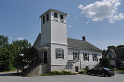
Middlesex village, situated along the Winooski River, is the town's chief settlement and location of the town hall. Middlesex Village obtained a post office in 1821 (that office closed in 1966). Middlesex Center is, as the name suggests, in the near center of the town situated northwest of the Great Brook and Brook Road. Shady Rill is rolling, mostly lowland where three brooks-Herrick, Martins, and Patterson, each named for a local family, converge with the North Branch which runs south to Wrightsville and Montpelier. A northern affiliation Baptist church was built in Shady Rill in 1849. The village of Putnamville is located along the town's eastern border along the North Branch River. A waterfall there once powered grist and saw mills. A post office was opened in Putnamville, incongruously titled Putnamsville, in 1882 (this post office closed in 1935).

Wrightsville, just south of Putnamville, was once a sizable settlement with nearly 30 built structures, and several mills. The Wrightsville Dam, built by the Civilian Conservation Corps 1933-35 in response to the 1927 flood, caused that settlement to be disbanded. The Northbranch Cemetery was moved southwest to Portal Road, and a majority of the mostly Greek Revival houses were moved west up the hill to where the old Hood place presently stands. Off Portal Road and Bolduc Road is Tangletown Road, which takes its name from an area of town nicknamed Tangletown because the woods there are so thick and so alike that settlers reported getting "tangled up" (lost) in the area.

The town had a large bear population well into the late nineteenth century. A recorded story tells of a farmer located between Middlesex Center and Bear Swamp finding one of his sheep killed by a bear. The farmer and his wife immediately walked their property to take stock of their flock. The farmer spotted a bear and killed it, soon afterward his wife called out that she sighted one and he shot that one, the couple returned to the barnyard and spotted a third bear-this one eating another of their sheep, and the farmer shot that bear as well. The area received the nickname Beartown.

Through most of the nineteenth century and well into the mid-twentieth century, the primary economic activity was farming. Dairy farming, sheep herding (for wool), logging, orchards and maple sugaring have all been part of the town's economy. Following the end of World War II, the town slowly transitioned to becoming a place to live for people who worked elsewhere, mostly in Montpelier.

Demographics

Historical population
CensusPop.
1800 262
1810 40153.1%
1820 72681.0%
1830 1,15659.2%
1840 1,2709.9%
1850 1,3657.5%
1860 1,254−8.1%
1870 1,171−6.6%
1880 1,087−7.2%
1890 889−18.2%
1900 883−0.7%
1910 858−2.8%
1920 762−11.2%
1930 751−1.4%
1940 8178.8%
1950 8878.6%
1960 770−13.2%
1970 85711.3%
1980 1,23544.1%
1990 1,51422.6%
2000 1,72914.2%
2010 1,7310.1%
2020 1,7792.8%
U.S. Decennial Census [4] [5]

As of the census [1] of 2000, there were 1,729 people, 663 households, and 485 families residing in the town. The population density was 43.6 people per square mile (16.8/km2). There were 719 housing units at an average density of 18.1 per square mile (7.0/km2). The racial makeup of the town was 97.69% White, 0.35% African American, 0.58% Native American, 0.23% Asian, and 1.16% from two or more races. Hispanic or Latino of any race were 0.40% of the population.

There were 663 households, out of which 37.1% had children under the age of 18 living with them, 60.0% were couples living together and joined in either marriage or civil union, 9.0% had a female householder with no husband present, and 26.7% were non-families. 19.5% of all households were made up of individuals, and 5.3% had someone living alone who was 65 years of age or older. The average household size was 2.61 and the average family size was 2.96.

In the town, the population was spread out, with 26.5% under the age of 18, 6.4% from 18 to 24, 30.5% from 25 to 44, 29.7% from 45 to 64, and 6.8% who were 65 years of age or older. The median age was 39 years. For every 100 females, there were 95.8 males. For every 100 females age 18 and over, there were 95.7 males.

The median income for a household in the town was $51,765, and the median income for a family was $58,527. Males had a median income of $37,083 versus $30,147 for females. The per capita income for the town was $22,965. About 4.3% of families and 6.2% of the population were below the poverty line, including 8.0% of those under age 18 and none of those age 65 or over.

Notable people

The Civilian Conservation Corps (CCC) Christmas dinner, 1933. Camp Green, a CCC camp, was located in the Wrightville area of Middlesex. Corps members built the flood control dam there. CCCcampGreen.png
The Civilian Conservation Corps (CCC) Christmas dinner, 1933. Camp Green, a CCC camp, was located in the Wrightville area of Middlesex. Corps members built the flood control dam there.

Related Research Articles

Montpelier, Vermont Capital city of Vermont, United States

Montpelier is the capital city of the U.S. state of Vermont and the seat of Washington County. The site of Vermont's state government, it is the least populous state capital in the United States. As of the 2020 census, the population was 8,074. However, the daytime population grows to about 21,000, due to the large number of jobs within city limits. The Vermont College of Fine Arts is located in the municipality. It was named after Montpellier, a city in the south of France.

Washington County, Vermont County in Vermont, United States

Washington County is a county located in the U.S. state of Vermont. Named after George Washington, its county seat is the city of Montpelier and the most populous municipality is the city of Barre. As of the 2020 census, the population was 59,807, making it the third-most populous county in Vermont, but the third-least populous capital county in the United States after Hughes County, South Dakota and Franklin County, Kentucky.

Montpelier, Idaho City in Idaho, United States

Montpelier is a city in Bear Lake County, Idaho, United States. The population was 2,597 at the 2010 census, down from 2,785 in 2000. The city is the largest community in the Bear Lake Valley, a farming region north of Bear Lake in southeastern Idaho along the Utah border. It was settled in 1863 by Mormon pioneers on the route of the Oregon Trail. Nearby to the east is the border with Wyoming.

Bristol, Vermont Town in Vermont, United States

Bristol is a town in Addison County, Vermont, United States. The town was chartered on June 26, 1762, by the colonial Governor of New Hampshire, Benning Wentworth. The charter was granted to Samuel Averill and sixty-three associates in the name of Pocock—in honor of a distinguished English admiral of that name. The population was 3,782 at the 2020 census. Main Street is home to most of the businesses of the town. The town is also home to the Lord's Prayer Rock.

Salisbury, Vermont Town in Vermont, United States

Salisbury is a town in Addison County, Vermont, United States. The population was 1,221 at the 2020 census.

Peru, Vermont Town in Vermont, United States

Peru is a town in Bennington County, Vermont, United States. The population was 531 at the 2020 census. Originally known as Bromley, the town name was changed to "Peru" by the land grantees as a way of attracting land buyers to an area that had been described as 36 square miles (93 km2) of "trees, bears and mountain lions".

Ryegate, Vermont Town in Vermont, United States

Ryegate is a town in Caledonia County, Vermont, United States. The population was 1,165 at the 2020 census. The town contains the villages of South Ryegate, East Ryegate, and Ryegate Corner.

Shelburne, Vermont Town in Vermont, United States

Shelburne is a town in Chittenden County, Vermont, United States. Located along the shores of Lake Champlain, Shelburne's town center lies approximately 7 miles (11 km) south of the city center of Burlington, the largest city in the state of Vermont. As of the 2020 census, the population of Shelburne was 7,717.

Enosburg Falls, Vermont Village in Vermont, United States

Enosburg Falls is a village in the town of Enosburgh in Franklin County, Vermont, in the United States. The population was 1,356 at the 2020 census.

Morristown, Vermont Town in Vermont, United States

Morristown is a town in Lamoille County, Vermont, United States. As of the 2020 census, the population was 5,434. Morristown is the largest town by population in Lamoille County, and its central village of Morrisville serves as the county's main commercial center.

Washington, Vermont Town in Vermont, United States

Washington is a town in Orange County, Vermont, in the United States. The population was 1,032 at the 2020 census. The town is believed to be named after George Washington, although the town may also be named after Washington, Connecticut as there are records of individuals moving from that town in Connecticut to Vermont around 1766.

Berlin, Vermont Town in Vermont, United States

Berlin is a town in Washington County, Vermont, United States, founded in 1763.

Calais, Vermont Town in Vermont, United States

Calais is a town in Washington County, Vermont, United States. The population was 1,661 at the 2020 census. Calais is homophonous with callous. Calais contains the unincorporated communities of Adamant, East Calais, North Calais, Kent's Corner, Maple Corner and Pekin.

East Montpelier, Vermont Town in Vermont, United States

East Montpelier is a town in Washington County, Vermont, United States. The population was 2,598 at the 2020 census.

Warren, Vermont Town in Vermont, United States

Warren is a town in Washington County, Vermont, United States. The population was 1,977 at the 2020 census. The center of population of Vermont is located in Warren. It is set between the two ranges of the Green Mountains, with approximately 25% of the town under Green Mountain National Forest ownership. Sugarbush Resort located here is a ski resort, and the town is traversed by the Long Trail, a hiking trail running from the border with Massachusetts to the Canada–US border.

Weathersfield, Vermont Town in Vermont, United States

Weathersfield is a town in Windsor County, Vermont, United States. The population was 2,842 at the 2020 census.

Barre (town), Vermont Town in Vermont, United States

Barre is a town in Washington County, Vermont, United States. The population was 7,923 at the 2020 census, making it the 3rd largest municipality in Washington County and the 16th largest municipality in Vermont. Popularly referred to as "Barre Town", the Town of Barre almost completely surrounds the City of Barre, which is a separate municipality. The original town now known as Barre was first chartered in 1780 as the town of Wildersburgh. In 1793 the name Wildersburgh was unpopular with the inhabitants and the name of the town was changed to Barre. In 1895 the City of Barre was incorporated and separated from the Town of Barre, and both continue to exist as separate municipalities.

Northfield, Vermont Town in Vermont, United States

Northfield is a town in Washington County, Vermont, United States. The town lies in a valley within the Green Mountains and has been home to Norwich University since 1866. It contains the village of Northfield, where over half of the population lives. The town's total population was 5,918 at the 2020 census.

Waterbury (CDP), Vermont Census-designated place in Vermont, United States

Waterbury is an unincorporated village and census-designated place (CDP) in the town of Waterbury, Washington County, Vermont, United States. The population was 1,897 at the 2020 census. The former village of Waterbury was dissolved in 2017, and its governmental functions were merged with the town of Waterbury.

Rutland (town), Vermont Town in Vermont, United States

Rutland is a town in Rutland County, Vermont, in the United States. As of the 2020 census, the population was 3,924. The Town of Rutland completely surrounds the City of Rutland, which is incorporated separately from the town. The villages of the town effectively comprise the inner suburbs of the City of Rutland.

References

  1. 1 2 "U.S. Census website". United States Census Bureau . Retrieved 2008-01-31.
  2. "US Board on Geographic Names". United States Geological Survey. 2007-10-25. Retrieved 2008-01-31.
  3. "Census - Geography Profile: Middlesex town, Washington County, Vermont". United States Census Bureau . Retrieved January 3, 2022.
  4. "Census of Population and Housing". Census.gov. Retrieved June 4, 2015.
  5. "Vermont History Explorer" . Retrieved August 7, 2015.