
Waitsfield is a town in Washington County, Vermont, United States. The population was 1,719 at the 2010 census. It was created by Vermont charter on February 25, 1782. It was granted to militia Generals Benjamin Wait and Roger Enos and others, and named for Wait.

Charlestown is a census-designated place (CDP) and the primary village in the town of Charlestown in Sullivan County, New Hampshire, United States. The population of the CDP was 1,152 at the 2010 census, out of 5,114 people in the entire town of Charlestown.

Springfield is a census-designated place (CDP) comprising the main settlement within the town of Springfield, Windsor County, Vermont, United States. The population of the CDP was 3,979 at the 2010 census, compared with 9,373 for the town as a whole.

Graniteville is a census-designated place (CDP) in the town of Barre, Washington County, Vermont, United States. The population of the CDP was 784 at the 2010 census. Prior to 2010, it was part of the Graniteville-East Barre CDP, which consisted of three unincorporated villages in the town: Graniteville, East Barre, and Websterville.

Bristol is the main settlement in the town of Bristol in Addison County, Vermont, United States, and a census-designated place (CDP). The population was 2,030 at the 2010 census, out of a total population of 3,894 in the town of Bristol.

East Barre is a census-designated place (CDP) in the town of Barre, Washington County, Vermont, United States. The population of the CDP was 826 at the 2010 census. Prior to 2010, East Barre was part of the Graniteville-East Barre CDP, which consisted of three unincorporated villages in the town: Graniteville, East Barre, and Websterville.

Websterville is a census-designated place (CDP) in the town of Barre, Washington County, Vermont, United States. The population of the CDP was 550 at the 2010 census. Prior to 2010, it was part of the Graniteville-East Barre CDP, which consisted of three unincorporated villages in the town: Graniteville, East Barre, and Websterville.

Hickory Hills is a census-designated place (CDP) in Foster Township, Luzerne County, Pennsylvania, United States, southwest of the borough of White Haven. The CDP population was 562 at the 2010 census.

Mocanaqua is an unincorporated community and census-designated place (CDP) in Conyngham Township, Luzerne County, Pennsylvania, United States. The population was 646 at the 2010 census.
Silkworth is a census-designated place (CDP) in Lehman Township, Luzerne County, Pennsylvania, United States. The population was 820 at the 2010 census.
Upper Exeter is a census-designated place (CDP) in Exeter Township, Luzerne County, Pennsylvania, United States. The population was 707 at the 2010 census.

Littlejohn Island is an island and census-designated place (CDP) in the town of Yarmouth in Cumberland County, Maine, United States. The population of the CDP was 118 at the 2010 census.

Worcester is a census-designated place (CDP) forming the central settlement of the town of Worcester in Otsego County, New York, United States. The population of the CDP was 1,113 at the 2010 census.

Windsor is a census-designated place (CDP) comprising the main settlement within the town of Windsor, Windsor County, Vermont, United States. The population of the CDP was 2,066 at the 2010 census, compared with 3,553 for the town as a whole.

Pomeroy is a census-designated place (CDP) in Sadsbury Township, Chester County, Pennsylvania, United States. The population was 401 at the 2010 census.

Westwood is a census-designated place (CDP) in Valley Township, Chester County, Pennsylvania, United States. The population was 950 at the 2010 census.

East Montpelier is a census-designated place (CDP) comprising the central village of the town of East Montpelier, Washington County, Vermont, United States. The population of the CDP was 80 at the 2010 census.
Plainfield is a census-designated place (CDP) comprising the main village of the town of Plainfield, Washington County, Vermont, United States. The population of the CDP was 401 at the 2010 census.

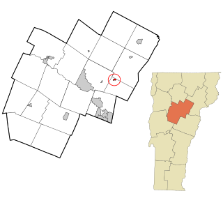
Worcester is a census-designated place (CDP) that comprises the main village in the town of Worcester, Washington County, Vermont, United States. The population of the CDP was 112 at the 2010 census.
Rio Pinar is a census-designated place and unincorporated area in Orange County, Florida, United States. The population was 5,211 at the 2010 census. It is part of the Orlando–Kissimmee Metropolitan Statistical Area and is home to the private Rio Pinar Country Club.

