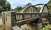
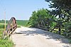
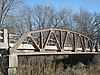
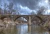
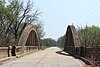
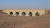
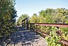
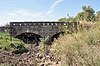
Name Image Built Listed Location County Type Amelia Park Bridge 1914 2004-01-21 Antelope 38°26′47″N 96°57′58″W / 38.44639°N 96.96611°W / 38.44639; -96.96611 (Amelia Park Bridge ) Marion Concrete Bridge Asylum Bridge 1905 1990-01-04 Osawatomie 38°30′18″N 94°57′13″W / 38.50500°N 94.95361°W / 38.50500; -94.95361 (Asylum Bridge ) Miami Reverse Parker through truss Atchison, Topeka, and Santa Fe Pratt Truss Bridge 1909 2003-05-09 Melvern 38°30′19″N 95°38′7″W / 38.50528°N 95.63528°W / 38.50528; -95.63528 (Atchison, Topeka, and Santa Fe Pratt Truss Bridge ) Osage Pratt Truss Austin Bridge 1872, 1910 Chanute 37°39′24.5″N 95°27′11″W / 37.656806°N 95.45306°W / 37.656806; -95.45306 (Austin Bridge ) Neosho Bowstring Truss Battle Creek King Post Truss Bridge 1910 2003-05-09 Long Island 39°56′39″N 99°28′45″W / 39.94417°N 99.47917°W / 39.94417; -99.47917 (Battle Creek King Post Truss Bridge ) Phillips King Post Truss Beaver Creek Native Stone Bridge 1941 2008-03-16 Beaver Barton WPA Stone Arch Bridge Begley Bridge 1926 2003-05-09 Millwood 39°24′39″N 95°7′25″W / 39.41083°N 95.12361°W / 39.41083; -95.12361 (Begley Bridge ) Leavenworth Pratt Truss Blacksmith Creek Bridge 1930 1983-03-10 Topeka 38°59′48″N 95°50′28″W / 38.99667°N 95.84111°W / 38.99667; -95.84111 (Blacksmith Creek Bridge ) Shawnee Bridge No. 218-Off System Bridge 1940 2008-03-16 Beaver Barton Bridge No. 222-Off System Bridge 2008-07-8 Beaver Barton Bridge No. 640-Federal Aid Highway System Bridge 2008-7-8 Beaver Barton Bridge No. 650-Federal Aid Highway System Bridge 2008-7-8 Beaver Barton Brush Creek Bridge 1924 1983-03-10 Baxter Springs 37°4′24″N 94°44′26″W / 37.07333°N 94.74056°W / 37.07333; -94.74056 (Brush Creek Bridge ) Cherokee Brush Creek Bridge ca. 1930 1985-07-02 Coyville 37°40′41″N 95°53′48″W / 37.67806°N 95.89667°W / 37.67806; -95.89667 (Brush Creek Bridge ) Wilson Stone Arch Bucher Bridge 1905 1985-07-02 Rock 37°27′45″N 97°2′19″W / 37.46250°N 97.03861°W / 37.46250; -97.03861 (Bucher Bridge ) Cowley Reinforced Concrete Arch Bullfoot Creek Bridge ca. 1930 1985-07-02 Vesper 38°58′25″N 98°15′39″W / 38.97361°N 98.26083°W / 38.97361; -98.26083 (Bullfoot Creek Bridge ) Lincoln Stone Arch Carey's Ford Bridge 1909 1990-01-04 Osawatomie 38°31′14″N 95°2′1″W / 38.52056°N 95.03361°W / 38.52056; -95.03361 (Carey's Ford Bridge ) Miami Camelback through truss Cedar Creek Bridge 1927 1983-03-10 Elgin 37°0′34″N 96°15′20″W / 37.00944°N 96.25556°W / 37.00944; -96.25556 (Cedar Creek Bridge ) Chautauqua Chapman Creek Pratt Truss Bridge 1905 2003-05-09 Chapman 39°0′31″N 97°2′12″W / 39.00861°N 97.03667°W / 39.00861; -97.03667 (Chapman Creek Pratt Truss Bridge ) Dickinson Pratt Truss Chicken Creek Bridge ca. 1913 1990-03-05 Lone Star 38°51′11″N 95°20′35″W / 38.85306°N 95.34306°W / 38.85306; -95.34306 (Chicken Creek Bridge ) Douglas Masonry arch Clear Creek Camel Truss Bridge 1930 2003-05-09 Baileyville 39°56′22″N 96°11′33″W / 39.93944°N 96.19250°W / 39.93944; -96.19250 (Clear Creek Camel Truss Bridge ) Nemaha Camelback Truss Clements Stone Arch Bridge 1886 1976-12-12 Clements 38°17′42″N 96°44′5″W / 38.29500°N 96.73472°W / 38.29500; -96.73472 (Clements Stone Arch Bridge ) Chase Conroe Bridge 1925 1983-03-10 Junction City 39°2′56″N 96°43′51″W / 39.04889°N 96.73083°W / 39.04889; -96.73083 (Conroe Bridge ) Geary Cottonwood River Bridge 1914 1985-07-02 Cottonwood Falls 38°22′30″N 96°32′26″W / 38.37500°N 96.54056°W / 38.37500; -96.54056 (Cottonwood River Bridge ) Chase Filled Spandrel Cottonwood River Pratt Truss Bridge 1916 2003-05-09 Cedar Point 38°15′36″N 96°50′2″W / 38.26000°N 96.83389°W / 38.26000; -96.83389 (Cottonwood River Pratt Truss Bridge ) Chase Pratt Truss County Line Bowstring 1876 1990-01-04 Hollis , Wayne 39°39′12″N 97°34′21″W / 39.65333°N 97.57250°W / 39.65333; -97.57250 (County Line Bowstring ) Cloud , Republic Bowstring pony truss Creamery Bridge 1931 1983-03-10 Osawatomie 38°30′11″N 94°57′18″W / 38.50306°N 94.95500°W / 38.50306; -94.95500 (Creamery Bridge ) Miami Delaware River Composite Truss Bridge 1936 2003-05-09 Valley Falls 39°21′3″N 95°27′17″W / 39.35083°N 95.45472°W / 39.35083; -95.45472 (Delaware River Composite Truss Bridge ) Jefferson Parker Truss Delaware River Parker Truss Bridge 1926 2003-05-09 Perry 39°4′30″N 95°24′10″W / 39.07500°N 95.40278°W / 39.07500; -95.40278 (Delaware River Parker Truss Bridge ) Jefferson Parker Truss Delaware River Warren Truss Bridge 1913 2004-06-09 Fairview 39°46′59″N 95°42′50″W / 39.78306°N 95.71389°W / 39.78306; -95.71389 (Delaware River Warren Truss Bridge ) Brown Warren Truss Dewlen-Spohnhauer Bridge 1928 1983-03-10 Independence 37°13′28″N 95°40′43″W / 37.22444°N 95.67861°W / 37.22444; -95.67861 (Dewlen-Spohnhauer Bridge ) Montgomery Doniphan County Waddell ca. 1900 1990-01-04 Doniphan 39°38′38″N 95°3′15″W / 39.64389°N 95.05417°W / 39.64389; -95.05417 (Doniphan County Waddell ) Doniphan Waddell A truss East Fork Wolf Creek Pratt Truss Bridge 1899 2003-05-09 Delhi 39°8′52″N 98°34′5″W / 39.14778°N 98.56806°W / 39.14778; -98.56806 (East Fork Wolf Creek Pratt Truss Bridge ) Osborne Pratt Truss East Stone Arch Bridge - Lake Wabaunsee 2009-12-30 Eskridge Wabaunsee Stone arch East Riley Creek Bridge 1899 1989-11-28 Belleville Republic Pratt through truss Eight Mile Creek Warren Truss Bridge by 1920 2003-05-09 Ottawa 38°37′52″N 95°17′8″W / 38.63111°N 95.28556°W / 38.63111; -95.28556 (Eight Mile Creek Warren Truss Bridge ) Franklin Warren Truss Elk Falls Pratt Truss Bridge 1892, 1893 1994-05-06 Elk Falls 37°22′27″N 96°11′2″W / 37.37417°N 96.18389°W / 37.37417; -96.18389 (Elk Falls Pratt Truss Bridge ) Elk Pratt Truss Esch's Spur Bridge ca. 1915 1985-07-02 Dexter 37°8′7″N 96°46′52″W / 37.13528°N 96.78111°W / 37.13528; -96.78111 (Esch's Spur Bridge ) Cowley Stone Arch Fort Fletcher Stone Arch Bridge 1936 2001-05-18 Walker 38°47′53″N 99°4′39″W / 38.79806°N 99.07750°W / 38.79806; -99.07750 (Fort Fletcher Stone Arch Bridge ) Ellis Masonry/stone arch bridge Four Mile Creek Lattice ca. 1890 1990-01-04 Wilsey 38°36′33″N 96°39′21″W / 38.60917°N 96.65583°W / 38.60917; -96.65583 (Four Mile Creek Lattice ) Morris Lattice pony truss Fox Creek Stone Arch Bridge 1898 2006-12-27 Strong City 38°24′8″N 96°32′54″W / 38.40222°N 96.54833°W / 38.40222; -96.54833 (Fox Creek Stone Arch Bridge ) Chase stone arch bridge Hackberry Creek Bridge 1930 1985-07-02 Jetmore 38°14′15″N 100°8′6″W / 38.23750°N 100.13500°W / 38.23750; -100.13500 (Hackberry Creek Bridge ) Hodgeman Open Spandrel Harris Bridge 1916 1985-07-02 Americus 38°33′1″N 96°20′6″W / 38.55028°N 96.33500°W / 38.55028; -96.33500 (Harris Bridge ) Lyon Filled Spandrel Hitschmann Cattle Underpass Bridge 1941 2008-03-16 Hitschmann Barton WPA Stone Arch Bridge Hitschmann Double Arch Bridge 1941 2008-03-16 Hitschmann Barton WPA Stone Arch Bridge Hobbs Creek Truss Leg Bedstead Bridge 1904 2004-10-12 Gypsum 38°38′17″N 97°22′59″W / 38.63806°N 97.38306°W / 38.63806; -97.38306 (Hobbs Creek Truss Leg Bedstead Bridge ) Saline Truss Leg Bedstead Hudgeon Bridge 1923 1985-07-02 Girard 37°22′8″N 94°53′56″W / 37.36889°N 94.89889°W / 37.36889; -94.89889 (Hudgeon Bridge ) Crawford Filled Spandrel Independence Bowstring 1871 1990-01-04 Independence 37°13′29″N 95°41′37″W / 37.22472°N 95.69361°W / 37.22472; -95.69361 (Independence Bowstring ) Montgomery Bowstring through truss Jack Creek Kingpost ca. 1900 1990-01-04 Long Island 39°56′26″N 99°26′25″W / 39.94056°N 99.44028°W / 39.94056; -99.44028 (Jack Creek Kingpost ) Phillips Kingpost truss Jake's Branch of Middle Creek Bridge 1914 1985-07-02 Louisburg 38°31′11″N 94°42′57″W / 38.51972°N 94.71583°W / 38.51972; -94.71583 (Jake's Branch of Middle Creek Bridge ) Miami Reinforced Concrete Arch Jefferson Old Town Bowstring Truss 1875 1990-01-04 Oskaloosa 39°12′48″N 95°18′31″W / 39.21333°N 95.30861°W / 39.21333; -95.30861 (Jefferson Old Town Bowstring Truss ) Jefferson Bowstring pony truss Labette Creek Tributary Bridge 1915 1985-07-02 Parsons 37°20′38″N 95°19′33″W / 37.34389°N 95.32583°W / 37.34389; -95.32583 (Labette Creek Tributary Bridge ) Labette Reinforced Concrete Arch Lakewood Park Bridge 1887 2004-06-09 Salina 38°50′28″N 97°35′22″W / 38.84111°N 97.58944°W / 38.84111; -97.58944 (Lakewood Park Bridge ) Saline Platt Truss Landers Creek Bridge ca. 1917 1985-07-02 Goodrich 38°16′50″N 94°59′30″W / 38.28056°N 94.99167°W / 38.28056; -94.99167 (Landers Creek Bridge ) Linn Stone Arch Little Walnut Creek Bowstring ca. 1880 1990-01-04 Walnut 37°38′43″N 95°2′45″W / 37.64528°N 95.04583°W / 37.64528; -95.04583 (Little Walnut Creek Bowstring ) Crawford Bowstring pony truss Little Walnut River Pratt Truss Bridge 1885 2003-05-09 Bois D'Arc 37°35′46″N 96°55′24″W / 37.59611°N 96.92333°W / 37.59611; -96.92333 (Little Walnut River Pratt Truss Bridge ) Butler Pratt Truss Long Shoals Bridge 1902 1990-01-04 Fulton 37°59′42″N 94°37′18″W / 37.99500°N 94.62167°W / 37.99500; -94.62167 (Long Shoals Bridge ) Bourbon Parker through truss Lyon Creek Rainbow Arch 1925 2020-12-22 Wreford 38°53′05″N 96°54′36″W / 38.88472°N 96.91000°W / 38.88472; -96.91000 (Lyon Creek Rainbow Arch ) Geary Rainbow Arch John Mack Bridge 1930, 1931 1992-01-22 Wichita 37°38′41″N 97°20′7″W / 37.64472°N 97.33528°W / 37.64472; -97.33528 (John Mack Bridge ) Sedgwick Rainbow reinforced concrete Marmaton Bridge 1878, 1879, 1974 1982-05-11 Fort Scott 37°51′33″N 94°40′14″W / 37.85917°N 94.67056°W / 37.85917; -94.67056 (Marmaton Bridge ) Bourbon Maxwell's Slough Bridge 1924 1985-07-02 St. Paul 37°30′18″N 95°10′49″W / 37.50500°N 95.18028°W / 37.50500; -95.18028 (Maxwell's Slough Bridge ) Neosho Filled Spandrel McCauley Bridge 1915 1985-07-02 Auburn 38°53′49″N 95°48′53″W / 38.89694°N 95.81472°W / 38.89694; -95.81472 (McCauley Bridge ) Shawnee Filled Spandrel Middle Creek Tributary Bridge ca. 1930 1985-07-02 Princeton 38°29′32″N 95°22′33″W / 38.49222°N 95.37583°W / 38.49222; -95.37583 (Middle Creek Tributary Bridge ) Franklin Stone Arch Mine Creek Bridge 1927 1983-03-10 Mound City 38°8′29″N 94°41′42″W / 38.14139°N 94.69500°W / 38.14139; -94.69500 (Mine Creek Bridge ) Linn Morton County WPA Bridge 1936 1986-10-22 Richfield 37°19′5″N 101°53′54″W / 37.31806°N 101.89833°W / 37.31806; -101.89833 (Morton County WPA Bridge ) Morton Stone arch bridge Muddy Creek Bridge 1910 1985-07-02 Douglass 37°32′3″N 96°57′4″W / 37.53417°N 96.95111°W / 37.53417; -96.95111 (Muddy Creek Bridge ) Butler Reinforced Concrete Arch Neosho River Bridge 1926 1983-03-10 Hartford 38°18′31″N 95°56′52″W / 38.30861°N 95.94778°W / 38.30861; -95.94778 (Neosho River Bridge ) Coffey North Branch Otter Creek Bridge 1908 1985-07-02 Piedmont 37°41′28″N 96°22′46″W / 37.69111°N 96.37944°W / 37.69111; -96.37944 (North Branch Otter Creek Bridge ) Greenwood Stone Arch North Fork Solomon River Lattice Truss Bridge 1925 2003-05-09 Lenora 39°36′30″N 100°1′48″W / 39.60833°N 100.03000°W / 39.60833; -100.03000 (North Fork Solomon River Lattice Truss Bridge ) Norton Lattice Truss North Gypsum Creek Truss Leg Bedstead Bridge 1902 2003-05-09 Roxbury 38°32′12″N 97°28′39″W / 38.53667°N 97.47750°W / 38.53667; -97.47750 (North Gypsum Creek Truss Leg Bedstead Bridge ) McPherson Truss Leg Bedstead Old Katy Bridge 1895, 1908, 1913 2003-05-09 Wreford 38°57′18″N 96°50′46″W / 38.95500°N 96.84611°W / 38.95500; -96.84611 (Old Katy Bridge ) Geary Pratt Truss Onion Creek Bridge 1911 1990-01-04 Coffeyville 37°1′33″N 95°39′23″W / 37.02583°N 95.65639°W / 37.02583; -95.65639 (Onion Creek Bridge ) Montgomery Parker through truss Otter Creek Bridge 1936 1990-01-04 Cedar Vale 37°9′19″N 96°29′55″W / 37.15528°N 96.49861°W / 37.15528; -96.49861 (Otter Creek Bridge ) Chautauqua Camelback through truss Parsons Filled Arch Bridge 1915 1985-07-02 Parsons 37°19′9″N 95°13′51″W / 37.31917°N 95.23083°W / 37.31917; -95.23083 (Parsons Filled Arch Bridge ) Labette Filled Spandrel Pawnee River Tributary Bridge ca. 1928 1985-07-02 Bazine 38°19′21″N 99°41′42″W / 38.32250°N 99.69500°W / 38.32250; -99.69500 (Pawnee River Tributary Bridge ) Ness Stone Arch Pennsylvania Avenue Rock Creek Bridge 1911 1985-07-02 Independence 37°12′51″N 95°42′24″W / 37.21417°N 95.70667°W / 37.21417; -95.70667 (Pennsylvania Avenue Rock Creek Bridge ) Montgomery Reinforced Concrete Arch Polecat Creek Bridge ca. 1901 1985-07-02 Douglass 37°29′23″N 97°6′33″W / 37.48972°N 97.10917°W / 37.48972; -97.10917 (Polecat Creek Bridge ) Butler Stone Arch Pottawatomie Creek Bridge 1932 1983-03-10 Osawatomie 38°29′7″N 94°57′2″W / 38.48528°N 94.95056°W / 38.48528; -94.95056 (Pottawatomie Creek Bridge ) Miami Pott's Ford Bridge 1884 1990-01-04 Glasco 39°21′1″N 97°51′15″W / 39.35028°N 97.85417°W / 39.35028; -97.85417 (Pott's Ford Bridge ) Cloud Pratt through truss Pumpkin Creek Tributary Bridge ca. 1915 1985-07-02 Mound Valley 37°12′24″N 95°26′19″W / 37.20667°N 95.43861°W / 37.20667; -95.43861 (Pumpkin Creek Tributary Bridge ) Labette Reinforced Concrete Arch Republican River Pegram Truss 1893 1990-01-04 Concordia 39°35′46″N 97°34′16″W / 39.59611°N 97.57111°W / 39.59611; -97.57111 (Republican River Pegram Truss ) Cloud Pegram through truss Riley Creek Bridge 1899 1990-01-04 Belleville 39°47′16″N 97°37′56″W / 39.78778°N 97.63222°W / 39.78778; -97.63222 (Riley Creek Bridge ) Republic Pratt through truss Robidoux Creek Pratt Truss Bridge 1910 2003-05-22 Frankfort 39°43′33″N 96°26′26″W / 39.72583°N 96.44056°W / 39.72583; -96.44056 (Robidoux Creek Pratt Truss Bridge ) Marshall Pratt Truss Rush County Line Bridge 1936 1986-11-04 Otis 38°28′49″N 99°29′10″W / 38.48028°N 99.48611°W / 38.48028; -99.48611 (Rush County Line Bridge ) Rush Stone arch bridge Salt Creek Truss Leg Bedstead Bridge 1903 2003-05-09 Barnard 39°12′17″N 98°2′57″W / 39.20472°N 98.04917°W / 39.20472; -98.04917 (Salt Creek Truss Leg Bedstead Bridge ) Lincoln Truss Leg Bedstead Sand Creek Truss Leg Bedstead Bridge 1906 2003-05-09 Lenora 39°39′13″N 99°54′1″W / 39.65361°N 99.90028°W / 39.65361; -99.90028 (Sand Creek Truss Leg Bedstead Bridge ) Norton Truss Leg Bedstead Shawnee Street Overpass 1932, 1934 1984-03-08 Kansas City 39°4′19″N 94°37′15″W / 39.07194°N 94.62083°W / 39.07194; -94.62083 (Shawnee Street Overpass ) Wyandotte Open spandrel arch Silver Creek Bridge ca. 1908, ca. 1909 1987-01-30 Winfield 37°12′3″N 96°50′34″W / 37.20083°N 96.84278°W / 37.20083; -96.84278 (Silver Creek Bridge ) Cowley Double arch bridge Soden's Grove Bridge 1923 1983-03-10 Emporia 38°23′9″N 96°10′54″W / 38.38583°N 96.18167°W / 38.38583; -96.18167 (Soden's Grove Bridge ) Lyon Southeast Stone Arch Bridge - Lake Wabaunsee 2009-12-30 Eskridge Wabaunsee Stone arch Spencer's Crossing Bridge 1885 1990-01-04 Greeley 38°22′39″N 95°8′51″W / 38.37750°N 95.14750°W / 38.37750; -95.14750 (Spencer's Crossing Bridge ) Anderson Pratt through truss Spring Creek Tributary Bridge ca. 1930 1985-07-02 Lincoln 38°54′32″N 98°14′38″W / 38.90889°N 98.24389°W / 38.90889; -98.24389 (Spring Creek Tributary Bridge ) Lincoln Stone Arch State Street Bridge ca. 1924 1985-07-02 Erie 37°34′21″N 95°14′25″W / 37.57250°N 95.24028°W / 37.57250; -95.24028 (State Street Bridge ) Neosho Reinforced Concrete Arch Stranger Creek Warren Truss Bridge 1925 2004-10-12 Farmington 39°30′41″N 95°18′36″W / 39.51139°N 95.31000°W / 39.51139; -95.31000 (Stranger Creek Warren Truss Bridge ) Atchison Warren Truss, Polygonal Tauy Creek Bridge 1895 1990-10-25 Ottawa 38°39′53″N 95°13′23″W / 38.66472°N 95.22306°W / 38.66472; -95.22306 (Tauy Creek Bridge ) Franklin Warren truss Thomas Arch Bridge ca. 1916 1990-05-10 Auburn 38°52′30″N 95°45′41″W / 38.87500°N 95.76139°W / 38.87500; -95.76139 (Thomas Arch Bridge ) Shawnee Masonry Arch Township Line Bridge 1916 1985-07-02 Rozel 38°12′18″N 99°27′35″W / 38.20500°N 99.45972°W / 38.20500; -99.45972 (Township Line Bridge ) Pawnee Filled Spandrel Verdigris River Bridge 1926 1985-07-02 Madison 38°8′46″N 96°8′19″W / 38.14611°N 96.13861°W / 38.14611; -96.13861 (Verdigris River Bridge ) Greenwood Open Spandrel Vermillion Creek Tributary Stone Arch Bridge ca. 1915 1986-10-22 Onaga 39°25′10″N 96°8′45″W / 39.41944°N 96.14583°W / 39.41944; -96.14583 (Vermillion Creek Tributary Stone Arch Bridge ) Pottawatomie Single span stone arch Walnut Creek Bridge ca. 1920 1985-07-02 Wellsville 38°41′18″N 95°5′5″W / 38.68833°N 95.08472°W / 38.68833; -95.08472 (Walnut Creek Bridge ) Franklin Reinforced Concrete Arch Walnut Creek Bridge 1887 1990-01-04 Heizer 38°25′54″N 98°53′40″W / 38.43167°N 98.89444°W / 38.43167; -98.89444 (Walnut Creek Bridge ) Barton Pratt through truss Walnut Creek Tributary Bridge 1934 1985-07-02 Nekoma 38°41′48″N 99°2′29″W / 38.69667°N 99.04139°W / 38.69667; -99.04139 (Walnut Creek Tributary Bridge ) Rush Reinforced Concrete Arch Washington County Kingpost ca. 1900 1990-01-04 Barnes 39°38′20″N 96°51′28″W / 39.63889°N 96.85778°W / 39.63889; -96.85778 (Washington County Kingpost ) Washington King post truss Wea Creek Bowstring Arch Truss Bridge 1870 2003-05-09 Topeka 39°3′21″N 95°46′40″W / 39.05583°N 95.77778°W / 39.05583; -95.77778 (Wea Creek Bowstring Arch Truss Bridge ) Shawnee Bowstring Truss West Sappa Creek Lattice ca. 1900 1990-01-04 Norton 39°59′13″N 100°5′54″W / 39.98694°N 100.09833°W / 39.98694; -100.09833 (West Sappa Creek Lattice ) Norton Lattice Pony Truss Wilson Pratt Truss Bridge 2009-01-22 Chapman Dickinson Pratt truss Belvidere Medicine River Bridge 1913 Belvidere Kiowa Reinforced Concrete Arch Schleichers Branch Stone Arch Bridge ca. 1898-1900 Humboldt Allen Masonry Arch Bridge