The Lamar Boulevard Bridge is a historic arch bridge carrying Texas State Highway Loop 343 over Lady Bird Lake in downtown Austin, Texas, United States. The bridge features six open-spandrel concrete arches spanning 659 feet (201 m) and carries tens of thousands of vehicles daily across the lake. Completed in 1942, the Lamar Boulevard Bridge was the second permanent bridge to cross the Colorado River, and one of the last Art Deco-style open-spandrel concrete arch bridges built in Texas. The bridge was named an Austin Landmark in 1993 and added to the National Register of Historic Places in 1994.

The Union Arch Bridge, also called the "Cabin John Bridge", is a historic masonry structure in Cabin John, Maryland. It was designed as part of the Washington Aqueduct. The bridge construction began in 1857 and was completed in 1864. The roadway surface was added later. The bridge was designed by Alfred Landon Rives, and built by the United States Army Corps of Engineers under the direction of Lieutenant Montgomery C. Meigs.

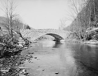
Plunketts Creek Bridge No. 3 was a rubble masonry stone arch bridge over Plunketts Creek in Plunketts Creek Township, Lycoming County in the U.S. state of Pennsylvania. It was built between 1840 and 1875, probably closer to 1840, when the road along the creek between the unincorporated villages of Barbours and Proctor was constructed. Going upstream from the mouth, the bridge was the third to cross the creek, hence its name.

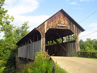
The Grist Mill Covered Bridge, also known as the Scott Covered Bridge, the Bryant Covered Bridge, and the Canyon Covered Bridge, is a covered bridge that carries Canyon Road across the Brewster River, off Vermont Route 108 in Cambridge, Vermont. Built in the 19th century, it is one of a small number of surviving Burr arch truss bridges in the state, and is one of three left in Cambridge. It was listed on the National Register of Historic Places in 1974.

The Cedar Swamp Covered Bridge, also known as the Station Bridge and by various other names, was a historic wooden covered bridge spanning Otter Creek between Cornwall and Salisbury, Vermont. The Town lattice truss bridge was built in 1864-1865 and added to the National Register of Historic Places in 1974. It was destroyed by fire in September 2016.

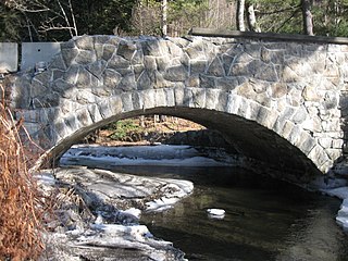
The Great Hollow Road Stone Arch Bridge is a historic stone arch bridge carrying Great Hollow Road over Mink Brook in Hanover, New Hampshire. Built by the town in 1914, it is one of two stone bridges in the town, and a finely crafted and little-altered example of stone masonry of the period. The bridge was listed on the National Register of Historic Places in 1997.

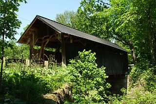
Quinlan's Covered Bridge, also called the Lower Covered Bridge, and Sherman Covered Bridge is a wooden covered bridge that crosses Lewis Creek in Charlotte, Vermont on Monkton Road. It was listed on the National Register of Historic Places in 1974. It is one of nine 19th-century Burr arch covered bridges in the state.

The Yosemite Valley Bridges are eight bridges in the Yosemite Valley of Yosemite National Park, most of them spanning the Merced River. Five of them were built in 1928, with the remainder built between 1921 and 1933. The bridges feature a concrete structure faced with local stone, in an elliptical or three-centered arch configuration. They are notable for their uniform character and for their conformance to tenets of the National Park Service rustic style. Design work for the seven newer bridges was by George D. Whittle of the San Francisco District Office of the U.S. Bureau of Public Roads for the National Park Service. Concrete bridges were chosen at the urging of Thomas Chalmers Vint of the Park Service, in lieu of alternative designs for steel truss bridges, or suspension bridges suggested by the park superintendent.

The Seguin Covered Bridge, also called the Upper Covered Bridge and the Sequin Covered Bridge, is a wooden covered bridge that crosses Lewis Creek in Charlotte, Vermont on Roscoe Road. It was built about 1850, and is a distinctive variant of a Burr arch design. It was listed on the National Register of Historic Places in 1974.

Bridge No. 1860, also known as the Samson Occom Bridge, is a fieldstone arch bridge in Montville, Connecticut, United States. Constructed by the Connecticut State Highway Department in 1936 as a Works Progress Administration project, it is located on Mohegan tribal land in an area that was once a part of Fort Shantok State Park. The bridge carries traffic from Massapeag Side Road over the Shantok Brook, a tributary of the Thames River. Spanning 12 feet (3.7 m) across the brook, the bridge's arch rises about 6 feet (1.8 m) above the water. According to a 2011 Connecticut Department of Transportation report, it carries 1,100 vehicles per day. Samson Occom Bridge was listed on the National Register of Historic Places in 1993.

The Gilsum Stone Arch Bridge carries Surry Road over the Ashuelot River in Gilsum, New Hampshire. Built in 1862–63, it is one of the highest stone arch bridges in the state. It has a span of 47 feet 8 inches (14.53 m), and an average height over the river of 36 feet 6 inches (11.13 m). The roadway is 43 feet 6 inches (13.26 m) above the riverbed. It stands on the site of four previous bridges, where the river passes through a deep gorge. The previous bridge was also a stone arch bridge, which was built in 1860 and collapsed a few months later. It was designed by William Leonard Kingsbury, a local official; its builders are not known because the town's records were destroyed in a fire. The present bridge's vault is carefully constructed from dry-laid granite voussoirs that were shaped for a very precise fit, with larger stones at the lower ends of the arch, and a smaller ones at the crown. Some of the stones were left with rough surfaces, while others were hammered smooth.

The Samuel Morey Memorial Bridge is a historic bridge carrying New Hampshire Route 25A across the Connecticut River between Orford, New Hampshire and Fairlee, Vermont. The steel through-arch bridge was built in 1937–38 to replace an older wooden bridge which had been damaged by flooding in 1936. It spans 432 feet (132 m), stands about 35 feet (11 m) above the river, and its arches rise 85 feet (26 m) above the roadway. It rests on poured concrete abutments that have a light Art Deco or Moderne styling. Wing walls recede from the abutments into the banks in three stepped sections. Below the bridge in the river is visible some riprap, stone remnants of the old bridge's abutments and central pier. The bridge is of a "tied arch" design, in which the two arches are joined together by ties to distribute the active load. This is in contrast to the Justice Harlan Fiske Stone Bridge joining Brattleboro, Vermont and Chesterfield, New Hampshire, which was built about the same time, and distributes the active load to its abutments. The bridge components were manufactured by the American Bridge Company; construction was by Hagen-Thibodeau Construction Company at a contracted cost of just over $209,000.

The Cove Creek Tributary Bridge is a historic bridge in rural Logan County, Arkansas. It is a two-span closed-spandrel stone arch bridge, carrying Arkansas Highway 309 across a tributary of Cove Creek north of Corley in Ozark-St. Francis National Forest. Each of its arches is 11 feet (3.4 m) long, and the structure is an overall 23 feet (7.0 m) in length. Concrete barriers form the sides of the bridge on either side of the roadway. The bridge was built in 1936 under the auspices of the Arkansas Highway Commission.

The Coburn Covered Bridge is a historic covered bridge, carrying Coburn Road over the Winooski River in eastern East Montpelier, Vermont. Built in 1851, it is the town's only surviving 19th-century covered bridge. It was listed on the National Register of Historic Places in 1974.

The West Sixth Street Bridge is a historic stone arch bridge in downtown Austin, Texas. Built in 1887, the bridge is one of the state's oldest masonry arch bridges. It is located at the site of the first bridge in Austin, carrying Sixth Street across Shoal Creek to link the western and central parts of the old city. The bridge was added to the National Register of Historic Places in 2014.
The State Street Bridge in Erie, Kansas brings State Street over a tributary of the Neosho River. It is a reinforced concrete arch bridge which was built in 1924. It was listed on the National Register of Historic Places in 1985.

The Bucher Bridge, located off U.S. Route 77 near the town of Rock in Cowley County, Kansas, was listed on the National Register of Historic Places in 1985. It is located about 1.5 miles (2.4 km) north and 1.75 miles (2.82 km) west of Rock.

The Marshall Avenue Bridge is a bridge carrying Marshall Avenue over Rice Creek in Marshall, Michigan. It was listed on the National Register of Historic Places in 2001. The construction of the bridge, as a multi-span stone masonry arch type, is extremely rare in Michigan because of the lack of good sources of stone material. It is the longest known stone highway bridge in Michigan.

The West Fifth Street Bridge is a historic cantilever concrete girder bridge in downtown Austin, Texas. Built in 1931, the bridge carries Fifth Street across Shoal Creek to link central Austin with neighborhoods that were then the city's western suburbs. It is one of only a handful of curved cantilever girder bridges in Texas, built as part of the city's 1928 master plan for urban development and beautification. The bridge was added to the National Register of Historic Places in 2019.

The Hackberry Creek Bridge, in Hodgeman County, Kansas near Jetmore, Kansas, was built in 1930. It was listed on the National Register of Historic Places in 1985.


