Madison, Kansas

Last updated

Madison, Kansas
Madison-Kansas-depot-atsf-back-side.jpg
Historic ATSF depot (2016)
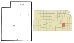
Greenwood County Kansas Incorporated and Unincorporated areas Madison Highlighted.svg
Location within Greenwood County and Kansas
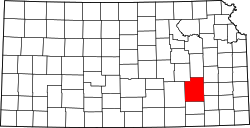
Map of Greenwood Co, Ks, USA.png
Coordinates: 38°07′59″N96°8′14″W / 38.13306°N 96.13722°W / 38.13306; -96.13722 [1]
Country United States
State Kansas
County Greenwood
Founded1872
Incorporated 1885 [2]
Named for Madison Township
Government
[2]
  Type Mayor–Council
Area
[3]
  Total0.59 sq mi (1.52 km2)
  Land0.59 sq mi (1.52 km2)
  Water0.00 sq mi (0.00 km2)
Elevation
[1]
1,145 ft (349 m)
Population
 (2020) [4]
  Total689
  Density1,200/sq mi (450/km2)
Time zone UTC-6 (CST)
  Summer (DST) UTC-5 (CDT)
ZIP codes
66855, 66860
Area code 620
FIPS code 20-44050
GNIS ID 2395809 [1]
Website madisonkansas.org

Madison is a city in Greenwood County, Kansas, United States, [1] along the Verdigris River. As of the 2020 census, the population of the city was 689. [4]

Contents

History

Madison was founded in 1872 northwest of the present town. In 1879, the town was relocated to its present site when the Howard Branch of the Atchison, Topeka & Santa Fe Railroad was built from Emporia to Moline. [5] The first building was the home of W. H. Green, a Civil War veteran. Green came to Kansas in 1867, took up a homestead, and operated a trading post on the original town site. [6] Madison took its name from Madison Township. [7]

Geography

According to the United States Census Bureau, the city has a total area of 0.61 square miles (1.58 km2), all of it land. [8]

Climate

The climate in this area is characterized by hot, humid summers and generally mild to cool winters. According to the Köppen Climate Classification system, Madison has a humid subtropical climate, abbreviated "Cfa" on climate maps. [9]

Demographics

Historical population
CensusPop.Note
1880 123
1890 623406.5%
1900 6839.6%
1910 7215.6%
1920 79510.3%
1930 1,48887.2%
1940 1,198−19.5%
1950 1,2121.2%
1960 1,105−8.8%
1970 1,061−4.0%
1980 1,0993.6%
1990 845−23.1%
2000 8571.4%
2010 701−18.2%
2020 689−1.7%
U.S. Decennial Census

2010 census

As of the census [10] of 2010, there were 701 people, 313 households, and 190 families living in the city. The population density was 1,149.2 inhabitants per square mile (443.7/km2). There were 401 housing units at an average density of 657.4 per square mile (253.8/km2). The racial makeup of the city was 95.1% White, 0.1% African American, 1.7% Native American, 0.1% Asian, 0.6% from other races, and 2.3% from two or more races. Hispanic or Latino of any race were 2.9% of the population.

There were 313 households, of which 26.5% had children under the age of 18 living with them, 49.8% were married couples living together, 7.3% had a female householder with no husband present, 3.5% had a male householder with no wife present, and 39.3% were non-families. 35.5% of all households were made up of individuals, and 14.3% had someone living alone who was 65 years of age or older. The average household size was 2.24 and the average family size was 3.90

The median age in the city was 42.3 years. 25.1% of residents were under the age of 18; 5.2% were between the ages of 18 and 24; 23.4% were from 25 to 44; 27.8% were from 45 to 64; and 18.3% were 65 years of age or older. The gender makeup of the city was 47.6% male and 52.4% female.

2000 census

As of the census [11] of 2000, there were 857 people, 361 households, and 225 families living in the city. The population density was 1,425.4 inhabitants per square mile (550.4/km2). There were 418 housing units at an average density of 695.2 per square mile (268.4/km2). The racial makeup of the city was 96.27% White, 0.12% African American, 0.93% Native American, 0.12% Asian, 0.47% from other races, and 2.10% from two or more races. Hispanic or Latino of any race were 1.40% of the population.

There were 361 households, out of which 28.8% had children under the age of 18 living with them, 52.9% were married couples living together, 7.2% had a female householder with no husband present, and 37.4% were non-families. 34.3% of all households were made up of individuals, and 21.6% had someone living alone who was 65 years of age or older. The average household size was 2.27 and the average family size was 2.93.

In the city, the population was spread out, with 23.9% under the age of 18, 6.7% from 18 to 24, 23.5% from 25 to 44, 22.9% from 45 to 64, and 23.1% who were 65 years of age or older. The median age was 41 years. For every 100 females, there were 90.0 males. For every 100 females age 18 and over, there were 80.6 males.

The median income for a household in the city was $30,536, and the median income for a family was $40,125. Males had a median income of $25,625 versus $18,333 for females. The per capita income for the city was $15,558. About 9.1% of families and 13.1% of the population were below the poverty line, including 17.8% of those under age 18 and 9.6% of those age 65 or over.

Education

The community is served by Madison–Virgil USD 386 public school district. [12]

The Madison Bulldogs won the Kansas State High School boys class 1A basketball championship in 1976 and the 1A football championship in 1984. [13]

See also

Related Research Articles

<span class="mw-page-title-main">Colony, Kansas</span> City in Anderson County, Kansas

Colony is a city in Anderson County, Kansas, United States. As of the 2020 census, the population of the city was 381.

<span class="mw-page-title-main">Sedan, Kansas</span> City in Chautauqua County, Kansas

Sedan is the county seat of and the largest city in Chautauqua County, Kansas, United States. As of the 2020 census, the population of the city was 1,000.

<span class="mw-page-title-main">Bird City, Kansas</span> City in Cheyenne County, Kansas

Bird City is a city in Cheyenne County, Kansas, United States. As of the 2020 census, the population of the city was 437.

<span class="mw-page-title-main">St. Francis, Kansas</span> City in Cheyenne County, Kansas

St. Francis is a city in and the county seat of Cheyenne County, Kansas, United States. As of the 2020 census, the population of the city was 1,263.

<span class="mw-page-title-main">Wakefield, Kansas</span> City in Clay County, Kansas

Wakefield is a city in Clay County, Kansas, United States. As of the 2020 census, the population of the city was 858.

<span class="mw-page-title-main">Gridley, Kansas</span> City in Coffey County, Kansas

Gridley is a city in Coffey County, Kansas, United States. As of the 2020 census, the population of the city was 313.

<span class="mw-page-title-main">Waverly, Kansas</span> City in Coffey County, Kansas

Waverly is a city in Coffey County, Kansas, United States. As of the 2020 census, the population of the city was 574.

<span class="mw-page-title-main">Wilmore, Kansas</span> City in Comanche County, Kansas

Wilmore is a city in Comanche County, Kansas, United States. As of the 2020 census, the population of the city was 37.

<span class="mw-page-title-main">Gove City, Kansas</span> City in Gove County, Kansas

Gove City, more commonly known as Gove, is a city in and the county seat of Gove County, Kansas, United States. As of the 2020 census, the population of the city was 80.

<span class="mw-page-title-main">Virgil, Kansas</span> City in Greenwood County, Kansas

Virgil is a city in Greenwood County, Kansas, United States. As of the 2020 census, the population of the city was 48. It is located approximately 8 miles east of the city of Hamilton.

<span class="mw-page-title-main">Bluff City, Kansas</span> City in Harper County, Kansas

Bluff City is a city in Harper County, Kansas, United States. As of the 2020 census, the population of the city was 45.

<span class="mw-page-title-main">Hoyt, Kansas</span> City in Jackson County, Kansas

Hoyt is a city in Jackson County, Kansas, United States. As of the 2020 census, the population of the city was 593.

<span class="mw-page-title-main">Barnard, Kansas</span> City in Lincoln County, Kansas

Barnard is a city in Lincoln County, Kansas, United States. As of the 2020 census, the population of the city was 64.

<span class="mw-page-title-main">Meade, Kansas</span> City in Meade County, Kansas

Meade is a city in and the county seat of Meade County, Kansas, United States. As of the 2020 census, the population of the city was 1,505.

<span class="mw-page-title-main">Brownell, Kansas</span> City in Ness County, Kansas

Brownell is a city in Ness County, Kansas, United States. As of the 2020 census, the population of the city was 23.

<span class="mw-page-title-main">Utica, Kansas</span> City in Ness County, Kansas

Utica is a city in Ness County, Kansas, United States. As of the 2020 census, the population of the city was 99.

<span class="mw-page-title-main">Bison, Kansas</span> City in Rush County, Kansas

Bison is a city in Rush County, Kansas, United States. As of the 2020 census, the population of the city was 179.

<span class="mw-page-title-main">Brewster, Kansas</span> City in Thomas County, Kansas

Brewster is a city in Thomas County, Kansas, United States. As of the 2020 census, the population of the city was 291.

<span class="mw-page-title-main">Toronto, Kansas</span> City in Woodson County, Kansas, United States

Toronto is a city in Woodson County, Kansas, United States, along the Verdigris River. As of the 2020 census, the population of the city was 206.

<span class="mw-page-title-main">Yates Center, Kansas</span> City in Woodson County, Kansas, United States

Yates Center is a city in and the county seat of Woodson County, Kansas, United States. As of the 2020 census, the population of the city was 1,352.

References

  1. 1 2 3 4 U.S. Geological Survey Geographic Names Information System: Madison, Kansas
  2. 1 2 "City of Madison". The League of Kansas Municipalities. May 28, 2019.
  3. "2019 U.S. Gazetteer Files". United States Census Bureau. Retrieved July 24, 2020.
  4. 1 2 "Profile of Madison, Kansas in 2020". United States Census Bureau. Archived from the original on May 6, 2022. Retrieved May 8, 2022.
  5. Blackmar, Frank Wilson (1912). Kansas: A Cyclopedia of State History, Volume 2. Standard Publishing Company. p. 210.
  6. kancoll.com |title=Cutler's History of Kansas | publisher=A. T. Andreas, Chicago, Illinois |author=William G. Cutler |year=1883 | page=Part9
  7. Kansas State Historical Society (1916). Biennial Report of the Board of Directors of the Kansas State Historical Society. Kansas State Printing Plant. p. 199.
  8. "US Gazetteer files 2010". United States Census Bureau. Archived from the original on January 25, 2012. Retrieved July 6, 2012.
  9. Climate Summary for Madison, Kansas
  10. "U.S. Census website". United States Census Bureau . Retrieved July 6, 2012.
  11. "U.S. Census website". United States Census Bureau . Retrieved January 31, 2008.
  12. "Madison-Virgil USD 386". USD 386. Retrieved January 6, 2017.
  13. "Basketball". KSHSAA. Retrieved January 3, 2017.

Further reading