National Register of Historic Places listings in Greenwood County, Kansas

Last updated
Location of Greenwood County in Kansas Map of Kansas highlighting Greenwood County.svg
Location of Greenwood County in Kansas

This is a list of the National Register of Historic Places listings in Greenwood County, Kansas.

Contents

This is intended to be a complete list of the properties on the National Register of Historic Places in Greenwood County, Kansas, United States. The locations of National Register properties for which the latitude and longitude coordinates are included below, may be seen in a map. [1]

There are 16 properties listed on the National Register in the county.

This National Park Service list is complete through NPS recent listings posted January 31, 2020. [2]
Map all coordinates using: OpenStreetMap  
Download coordinates as: KML  ·  GPX

Current listings

[3] Name on the Register [4] ImageDate listed [5] Location City or townDescription
1 Archeological Site Number 14GR320 July 9, 1982
(#82004880)
Address restricted
Fall River State Park
2 Curry Archeological Site November 20, 1974
(#74000838)
Address restricted
Madison
3 Eureka Atchison, Topeka and Santa Fe Railroad Depot
Eureka Atchison, Topeka and Santa Fe Railroad Depot Eureka Santa Fe Depot.jpg
Eureka Atchison, Topeka and Santa Fe Railroad Depot
January 2, 2013
(#12001119)
416 E. 5th St.
37°49′25″N96°17′21″W / 37.82361°N 96.28916°W / 37.82361; -96.28916 (Eureka Atchison, Topeka and Santa Fe Railroad Depot)
Eureka
4 Eureka Carnegie Library
Eureka Carnegie Library Eureka Carnegie Library 88001170 Greenwood County, KS.jpg
Eureka Carnegie Library
August 10, 1988
(#88001170)
520 N. Main
37°49′29″N96°17′23″W / 37.824722°N 96.289722°W / 37.824722; -96.289722 (Eureka Carnegie Library)
Eureka
5 Eureka Downtown Historic District September 30, 2019
(#100004458)
100-200 blks N. Main and N/2 100 blk. S. Main to Elm and Oak at 3rd to 4th Sts.
37°49′09″N96°17′39″W / 37.8192°N 96.2941°W / 37.8192; -96.2941 (Eureka Downtown Historic District)
Eureka
6 Greenwood Cemetery and Mausoleum February 3, 2020
(#100004925)
00 East Seventh St.
37°49′31″N96°17′22″W / 37.8252°N 96.2894°W / 37.8252; -96.2894 (Greenwood Cemetery and Mausoleum)
Eureka
7 Greenwood Hotel
Greenwood Hotel Greenwood hotel Eureka KS.JPG
Greenwood Hotel
September 6, 2006
(#06000769)
300 N. Main
37°49′17″N96°17′36″W / 37.821389°N 96.293333°W / 37.821389; -96.293333 (Greenwood Hotel)
Eureka
8 Paul Jones Building
Paul Jones Building Paul Jones bldg from S 1.jpg
Paul Jones Building
May 1, 2012
(#12000247)
319 W. River St.
37°49′03″N96°17′53″W / 37.817443°N 96.298057°W / 37.817443; -96.298057 (Paul Jones Building)
Eureka part of the Roadside Kansas Multiple Property Submission (MPS)
9 Lone Cone Site May 17, 1976
(#76000822)
Address restricted
Madison
10 Madison Atchison, Topeka and Santa Fe Railroad Depot
Madison Atchison, Topeka and Santa Fe Railroad Depot Madison-Kansas-depot-atsf-back-side.jpg
Madison Atchison, Topeka and Santa Fe Railroad Depot
December 6, 1991
(#91001774)
Junction of 3rd and Boone Sts.
38°08′23″N96°08′07″W / 38.139722°N 96.135278°W / 38.139722; -96.135278 (Madison Atchison, Topeka and Santa Fe Railroad Depot)
Madison
11 North Branch Otter Creek Bridge July 2, 1985
(#85001426)
1 mile (1.6 km) west and 5 miles (8.0 km) north of Piedmont
37°41′28″N96°22′46″W / 37.691111°N 96.379444°W / 37.691111; -96.379444 (North Branch Otter Creek Bridge)
Piedmont
12 Robertson House
Robertson House RobertsonHouse.JPG
Robertson House
February 7, 2011
(#10001207)
403 N. Plum
37°41′28″N96°22′46″W / 37.691111°N 96.379444°W / 37.691111; -96.379444 (Robertson House)
Eureka
13 Two Duck Site March 26, 1975
(#75000713)
Address restricted
Severy
14 US Post Office-Eureka
US Post Office-Eureka Eureka, Kansas, post office from NE 1.jpg
US Post Office-Eureka
October 17, 1989
(#89001637)
301 N. Oak St.
37°49′20″N96°17′51″W / 37.822222°N 96.2975°W / 37.822222; -96.2975 (US Post Office-Eureka)
Eureka
15 Verdigris River Bridge July 2, 1985
(#85001444)
0.5 miles (0.80 km) north of Madison
38°08′46″N96°08′19″W / 38.146111°N 96.138611°W / 38.146111; -96.138611 (Verdigris River Bridge)
Madison
16 Westside Service Station and Riverside Motel
Westside Service Station and Riverside Motel Westside bar (Eureka, KS) from SE 1.jpg
Westside Service Station and Riverside Motel
May 1, 2012
(#12000248)
325 W. River St.
37°49′02″N96°17′54″W / 37.817283°N 96.298408°W / 37.817283; -96.298408 (Westside Service Station and Riverside Motel)
Eureka part of the Roadside Kansas MPS

See also

Related Research Articles

National Register of Historic Places listings in Dickinson County, Kansas Wikimedia list article

This is a list of the National Register of Historic Places listings in Dickinson County, Kansas.

National Register of Historic Places listings in Atchison County, Kansas Wikimedia list article

This is a list of the National Register of Historic Places listings in Atchison County, Kansas.

National Register of Historic Places listings in Doniphan County, Kansas Wikimedia list article

This is a list of the National Register of Historic Places listings in Doniphan County, Kansas.

National Register of Historic Places listings in Harvey County, Kansas Wikimedia list article

This is a list of the National Register of Historic Places listings in Harvey County, Kansas.

National Register of Historic Places listings in Leavenworth County, Kansas Wikimedia list article

This is a list of the National Register of Historic Places listings in Leavenworth County, Kansas.

National Register of Historic Places listings in Marion County, Kansas Wikimedia list article

This is a list of the National Register of Historic Places listings in Marion County, Kansas.

National Register of Historic Places listings in Douglas County, Kansas Wikimedia list article

This is a list of the National Register of Historic Places listings in Douglas County, Kansas.

National Register of Historic Places listings in Morris County, Kansas Wikimedia list article

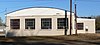
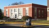
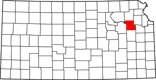
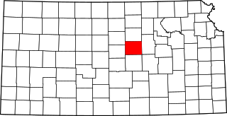
This is a list of the National Register of Historic Places listings in Morris County, Kansas.

National Register of Historic Places listings in Shawnee County, Kansas Wikimedia list article

This is a list of the National Register of Historic Places listings in Shawnee County, Kansas.

National Register of Historic Places listings in Wyandotte County, Kansas Wikimedia list article

This is a list of the National Register of Historic Places listings in Wyandotte County, Kansas.

National Register of Historic Places listings in Barton County, Kansas Wikimedia list article

This is a list of the National Register of Historic Places listings in Barton County, Kansas.

National Register of Historic Places listings in Cowley County, Kansas Wikimedia list article

This is a list of the National Register of Historic Places listings in Cowley County, Kansas.

National Register of Historic Places listings in Ellis County, Kansas Wikimedia list article

This is a list of the National Register of Historic Places listings in Ellis County, Kansas.

National Register of Historic Places listings in Johnson County, Kansas Wikimedia list article

This is a list of the National Register of Historic Places listings in Johnson County, Kansas.

National Register of Historic Places listings in McPherson County, Kansas Wikimedia list article

This is a list of the National Register of Historic Places listings in McPherson County, Kansas.

National Register of Historic Places listings in Saline County, Kansas Wikimedia list article

This is a list of the National Register of Historic Places listings in Saline County, Kansas.

National Register of Historic Places listings in Rice County, Kansas Wikimedia list article

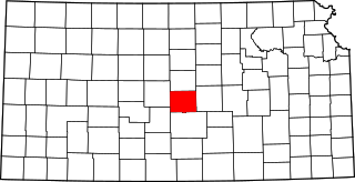
This is a list of the National Register of Historic Places listings in Rice County, Kansas.

National Register of Historic Places listings in Cloud County, Kansas Wikimedia list article

This is a list of the National Register of Historic Places listings in Cloud County, Kansas.

National Register of Historic Places listings in Greenwood County, South Carolina Wikimedia list article

This is a list of the National Register of Historic Places listings in Greenwood County, South Carolina.

National Register of Historic Places listings in Linn County, Kansas Wikimedia list article

This is a list of the National Register of Historic Places listings in Linn County, Kansas.

References

  1. The latitude and longitude information provided in this table was derived originally from the National Register Information System, which has been found to be fairly accurate for about 99% of listings. Some locations in this table may have been corrected to current GPS standards.
  2. "National Register of Historic Places: Weekly List Actions". National Park Service, United States Department of the Interior. Retrieved on January 31, 2020.
  3. Numbers represent an ordering by significant words. Various colorings, defined here, differentiate National Historic Landmarks and historic districts from other NRHP buildings, structures, sites or objects.
  4. "National Register Information System". National Register of Historic Places . National Park Service. March 13, 2009.
  5. The eight-digit number below each date is the number assigned to each location in the National Register Information System database, which can be viewed by clicking the number.