National Register of Historic Places listings in Riley County, Kansas

Last updated

Location of Riley County in Kansas Map of Kansas highlighting Riley County.svg
Location of Riley County in Kansas

This is a list of the National Register of Historic Places listings in Riley County, Kansas.

Contents

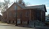
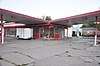
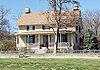
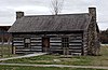
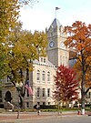
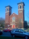
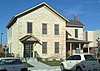
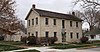
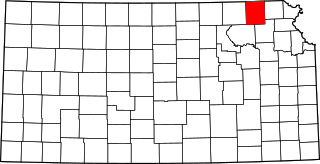
This is intended to be a complete list of the properties and districts on the National Register of Historic Places in Riley County, Kansas, United States. The locations of National Register properties and districts for which the latitude and longitude coordinates are included below, may be seen in a map. [1]

There are 42 properties and districts listed on the National Register in the county.


    This National Park Service list is complete through NPS recent listings posted March 31, 2023. [2]

Map all coordinates using: OpenStreetMap  
Download coordinates as: KML

Current listings

[3] Name on the Register [4] ImageDate listed [5] Location City or townDescription
1 Anderson Hall
Anderson Hall KSU Anderson Hall.jpg
Anderson Hall
November 28, 1980
(#80001471)
Kansas State University campus
39°11′19″N96°34′50″W / 39.188611°N 96.580556°W / 39.188611; -96.580556 (Anderson Hall)
Manhattan
2 The Avalon
The Avalon The Avalon apartment building.jpg
The Avalon
September 30, 2019
(#100004453)
417 Fremont St.
39°11′01″N96°33′45″W / 39.1835°N 96.5626°W / 39.1835; -96.5626 (The Avalon)
Manhattan
3 Bethel A.M.E. Church
Bethel A.M.E. Church Bethel AME Church Manhattan Kansas.jpg
Bethel A.M.E. Church
May 30, 2012
(#12000301)
401 Yuma St.
39°10′30″N96°33′44″W / 39.174929°N 96.562198°W / 39.174929; -96.562198 (Bethel A.M.E. Church)
Manhattan
4 Bluemont Youth Cabin
Bluemont Youth Cabin Bluemont Youth Cabin.jpg
Bluemont Youth Cabin
January 8, 2014
(#13001044)
NE. of 5th & Bertrand Sts. in Goodnow Park
39°11′30″N96°33′46″W / 39.191626°N 96.562695°W / 39.191626; -96.562695 (Bluemont Youth Cabin)
Manhattan Part of the New Deal-Era Resources of Kansas MPS
5 Community House
Community House Community House 2012-11-03 13-13-56.jpg
Community House
November 21, 2006
(#06001051)
120 N. 4th St.
39°10′55″N96°33′42″W / 39.181944°N 96.561667°W / 39.181944; -96.561667 (Community House)
Manhattan
6 Dawson's Conoco Service Station
Dawson's Conoco Service Station Dawson's Conoco Service Station Manhattan Kansas southwest view.jpg
Dawson's Conoco Service Station
September 30, 2021
(#100007027)
1026 Poyntz Ave.
39°10′47″N96°34′23″W / 39.1796°N 96.5731°W / 39.1796; -96.5731 (Dawson's Conoco Service Station)
Manhattan
7 Downtown Manhattan Historic District
Downtown Manhattan Historic District Downtown Manhattan Kansas.jpg
Downtown Manhattan Historic District
October 2, 2007
(#06001240)
Generally including the blocks between Humboldt and Pierre Sts. from 3rd to 5th Sts.
39°10′44″N96°33′42″W / 39.178889°N 96.561667°W / 39.178889; -96.561667 (Downtown Manhattan Historic District)
Manhattan
8 Mattie M. Elliot House
Mattie M. Elliot House Mattie M- Elliot House 2012-11-03 14-36-30.jpg
Mattie M. Elliot House
June 2, 1995
(#95000672)
600 Houston St.
39°10′42″N96°33′55″W / 39.178333°N 96.565278°W / 39.178333; -96.565278 (Mattie M. Elliot House)
Manhattan
9 First Christian Church
First Christian Church First Christian Church Manhattan Kansas south elevation.jpg
First Christian Church
March 10, 2022
(#100007029)
115 Courthouse Plz.
39°10′49″N96°33′49″W / 39.1802°N 96.5635°W / 39.1802; -96.5635 (First Christian Church)
Manhattan
10 First Congregational Church
First Congregational Church First Congregational Church 2012-11-03 13-40-00.jpg
First Congregational Church
November 13, 2008
(#08001068)
700 Poyntz Ave.
39°10′46″N96°34′02″W / 39.179528°N 96.567155°W / 39.179528; -96.567155 (First Congregational Church)
Manhattan
11 Leslie A. Fitz House
Leslie A. Fitz House Leslie A- Fitz House 2012-11-03 14-30-12.jpg
Leslie A. Fitz House
June 8, 2005
(#05000543)
1014 Houston St.
39°10′43″N96°34′21″W / 39.178661°N 96.5725°W / 39.178661; -96.5725 (Leslie A. Fitz House)
Manhattan
12 F.B. Forrester House
F.B. Forrester House F.B. Forrester House Riley Co Kansas front view.jpg
F.B. Forrester House
September 27, 2021
(#100007022)
410 North Juliette Ave.
39°10′58″N96°33′59″W / 39.1829°N 96.5665°W / 39.1829; -96.5665 (F.B. Forrester House)
Manhattan
13 Goodnow House
Goodnow House Isaac Goodnow House Manhattan Kansas.jpg
Goodnow House
February 24, 1971
(#71000326)
2301 Claflin Rd.
39°11′34″N96°35′44″W / 39.192896°N 96.595587°W / 39.192896; -96.595587 (Goodnow House)
Manhattan
14 Grimes House
Grimes House Grimes House (Manhattan, Kansas).jpg
Grimes House
May 9, 1997
(#97000409)
203 North Delaware Ave.
39°10′58″N96°35′14″W / 39.182778°N 96.587222°W / 39.182778; -96.587222 (Grimes House)
Manhattan
15 Hartford House
Hartford House Hartford House.jpg
Hartford House
September 30, 2019
(#100004452)
2309 Claflin Rd.
39°11′35″N96°35′47″W / 39.1930°N 96.5963°W / 39.1930; -96.5963 (Hartford House)
Manhattan
16 Houston and Pierre Streets Residential Historic District
Houston and Pierre Streets Residential Historic District 805 Houston St Manhattan KS.jpg
Houston and Pierre Streets Residential Historic District
February 18, 2009
(#09000031)
Bounded by S. 5th St., Pierre St., S. 9th St., and Houston St.
39°10′40″N96°34′01″W / 39.177789°N 96.566825°W / 39.177789; -96.566825 (Houston and Pierre Streets Residential Historic District)
Manhattan
17 Samuel D. Houston House
Samuel D. Houston House Samuel D. Houston House.jpg
Samuel D. Houston House
January 17, 2007
(#06001246)
3624 Anderson Ave.
39°11′20″N96°37′50″W / 39.188875°N 96.630456°W / 39.188875; -96.630456 (Samuel D. Houston House)
Manhattan
18 Hulse-Daughters House
Hulse-Daughters House Hulse-Daughters House Manhattan Kansas.jpg
Hulse-Daughters House
June 27, 2007
(#07000601)
617 Colorado St.
39°10′41″N96°33′59″W / 39.178056°N 96.566389°W / 39.178056; -96.566389 (Hulse-Daughters House)
Manhattan
19 Jesse Ingraham House
Jesse Ingraham House Jesse Ingraham House.jpg
Jesse Ingraham House
January 8, 2014
(#13001045)
1724 Fairchild Ave.
39°11′03″N96°35′04″W / 39.184280°N 96.584333°W / 39.184280; -96.584333 (Jesse Ingraham House)
Manhattan Part of the Late 19th Century Vernacular Stone Houses in Manhattan, Kansas MPS
20 KSAC Radio Towers
KSAC Radio Towers KSAC Radio Towers Manhattan Kansas.jpg
KSAC Radio Towers
August 27, 1983
(#83000437)
Kansas State University campus
39°11′13″N96°34′53″W / 39.1869051°N 96.5814435°W / 39.1869051; -96.5814435 (KSAC Radio Towers)
Manhattan
21 Francis Byron (Barney) Kimble House
Francis Byron (Barney) Kimble House Francis Byron Kimble House.jpg
Francis Byron (Barney) Kimble House
October 2, 2015
(#15000691)
720 Poyntz Ave.
39°10′46″N96°34′04″W / 39.1794°N 96.5678°W / 39.1794; -96.5678 (Francis Byron (Barney) Kimble House)
Manhattan
22 Landmark Water Tower
Landmark Water Tower Landmark Water Tower.jpg
Landmark Water Tower
October 4, 2017
(#100001704)
Sunset Ave. & Leavenworth St.
39°10′52″N96°35′19″W / 39.181216°N 96.588486°W / 39.181216; -96.588486 (Landmark Water Tower)
Manhattan
23 Lyda-Jean Apartments
Lyda-Jean Apartments Lyda-Jean Apartments 2012-11-03 14-35-04.jpg
Lyda-Jean Apartments
April 28, 2004
(#04000368)
501 Houston St.
39°10′48″N96°33′50″W / 39.18°N 96.563889°W / 39.18; -96.563889 (Lyda-Jean Apartments)
Manhattan
24 Manhattan Carnegie Library Building
Manhattan Carnegie Library Building Manhattan Carnegie Library Building.jpg
Manhattan Carnegie Library Building
June 25, 1987
(#87000970)
5th St. and Poyntz Ave.
39°10′46″N96°33′48″W / 39.179444°N 96.563333°W / 39.179444; -96.563333 (Manhattan Carnegie Library Building)
Manhattan
25 McFarlane-Wareham House
McFarlane-Wareham House McFarlane-Wareham House.jpg
McFarlane-Wareham House
July 21, 2004
(#04000724)
1906 Leavenworth St.
39°11′01″N96°35′13″W / 39.183611°N 96.586944°W / 39.183611; -96.586944 (McFarlane-Wareham House)
Manhattan
26 Persons Barn and Granary
Persons Barn and Granary Persons Barn and Granary.jpg
Persons Barn and Granary
January 22, 2009
(#08001351)
2103 K-18 (Zeandale Road)
39°09′16″N96°30′33″W / 39.154387°N 96.509162°W / 39.154387; -96.509162 (Persons Barn and Granary)
Manhattan On the Lazy T Ranch
27 Pioneer Log Cabin
Pioneer Log Cabin Pioneer Log Cabin (Manhattan, Kansas).jpg
Pioneer Log Cabin
February 3, 2020
(#100002969)
405 N 11th St. (Manhattan City Park)
39°10′53″N96°34′31″W / 39.1813°N 96.5753°W / 39.1813; -96.5753 (Pioneer Log Cabin)
Manhattan
28 Jeremiah Platt House
Jeremiah Platt House Jeremiah Platt House Manhattan Kansas.jpg
Jeremiah Platt House
May 20, 1981
(#81000281)
2005 Claflin Rd.
39°11′33″N96°35′23″W / 39.1925°N 96.589722°W / 39.1925; -96.589722 (Jeremiah Platt House)
Manhattan
29 Riley County Courthouse
Riley County Courthouse Riley (Kansas) County Courthouse 1.jpg
Riley County Courthouse
November 15, 2005
(#05001249)
100 Courthouse Plaza
39°10′54″N96°33′47″W / 39.181667°N 96.563056°W / 39.181667; -96.563056 (Riley County Courthouse)
Manhattan
30 Rocky Ford School
Rocky Ford School Rocky Ford School, Manhattan, from north.jpg
Rocky Ford School
January 20, 2012
(#11001033)
1669 Barnes Rd.
39°13′44″N96°35′01″W / 39.229027°N 96.583611°W / 39.229027; -96.583611 (Rocky Ford School)
Manhattan
31 Damon Runyon House
Damon Runyon House Damon Runyon House 2012-10-16 11-27-19.jpg
Damon Runyon House
December 2, 2004
(#04001282)
400 Osage St.
39°11′04″N96°33′43″W / 39.184444°N 96.561944°W / 39.184444; -96.561944 (Damon Runyon House)
Manhattan
32 Second Baptist Church
Second Baptist Church Second Baptist Church Manhattan Kansas.jpg
Second Baptist Church
May 30, 2012
(#12000302)
831 Yuma St.
39°10′30″N96°34′12″W / 39.174963°N 96.56988°W / 39.174963; -96.56988 (Second Baptist Church)
Manhattan
33 Seven Dolors Catholic Church
Seven Dolors Catholic Church Seven Dolors CC.jpg
Seven Dolors Catholic Church
September 1, 1995
(#95001054)
Northeast of the junction of Juliette and Pierre Sts.
39°10′39″N96°33′57″W / 39.1775°N 96.565833°W / 39.1775; -96.565833 (Seven Dolors Catholic Church)
Manhattan
34 Strasser House
Strasser House Strasser House Manhattan Kansas 2012.jpg
Strasser House
July 6, 2010
(#10000431)
326 Laramie St.
39°11′05″N96°33′41″W / 39.184722°N 96.561389°W / 39.184722; -96.561389 (Strasser House)
Manhattan
35 Robert Ulrich House
Robert Ulrich House Robert Ulrich House 2012-11-03 13-47-52.jpg
Robert Ulrich House
September 20, 1978
(#78001287)
121 N. 8th St.
39°10′49″N96°34′06″W / 39.180278°N 96.568333°W / 39.180278; -96.568333 (Robert Ulrich House)
Manhattan
36 Viking Manufacturing Company Building
Viking Manufacturing Company Building Viking Manufacturing Co (Ag Press) Manhattan Kansas front facade entry.jpg
Viking Manufacturing Company Building
September 27, 2022
(#100008245)
1531 Yuma St.
39°10′31″N96°34′53″W / 39.1752°N 96.5814°W / 39.1752; -96.5814 (Viking Manufacturing Company Building)
Manhattan
37 Daniel and Maude Walters House
Daniel and Maude Walters House Daniel and Maude Walters House.jpg
Daniel and Maude Walters House
October 17, 2012
(#12000868)
100 S. Delaware Ave.
39°10′46″N96°35′13″W / 39.179312°N 96.586862°W / 39.179312; -96.586862 (Daniel and Maude Walters House)
Manhattan
38 E. A. and Ura Wharton House
E. A. and Ura Wharton House E-A- and Ura Wharton House 2012-11-03 13-28-38.jpg
E. A. and Ura Wharton House
June 20, 1995
(#95000740)
608 Houston St.
39°10′50″N96°33′56″W / 39.180556°N 96.565556°W / 39.180556; -96.565556 (E. A. and Ura Wharton House)
Manhattan
39 Wolf House Historic District
Wolf House Historic District Wolf House Historic District.jpg
Wolf House Historic District
March 7, 2019
(#100003425)
630 Fremont St.
39°11′01″N96°33′59″W / 39.1836°N 96.5664°W / 39.1836; -96.5664 (Wolf House Historic District)
Manhattan
40 Woman's Club House
Woman's Club House Woman's Club House 2012-11-03 13-44-12.jpg
Woman's Club House
November 28, 1980
(#80001472)
900 Poyntz Ave.
39°10′46″N96°34′13″W / 39.179444°N 96.570278°W / 39.179444; -96.570278 (Woman's Club House)
Manhattan
41 Young Buck Site January 27, 2015
(#14001211)
Address Restricted
Manhattan vicinity
42 Yuma Street Historic District
Yuma Street Historic District Yuma St Historic District Kaw Blue Masonic Lodge southwest facade.jpg
Yuma Street Historic District
January 3, 2023
(#100008518)
931 Yuma St, and 900 blk. of Yuma St.
39°10′31″N96°34′16″W / 39.1752°N 96.5712°W / 39.1752; -96.5712 (Yuma Street Historic District)
Manhattan

See also

Related Research Articles

<span class="mw-page-title-main">National Register of Historic Places listings in Atchison County, Kansas</span>

This is a list of the National Register of Historic Places listings in Atchison County, Kansas.

<span class="mw-page-title-main">National Register of Historic Places listings in Harvey County, Kansas</span>

This is a list of the National Register of Historic Places listings in Harvey County, Kansas.

<span class="mw-page-title-main">National Register of Historic Places listings in Douglas County, Kansas</span>

This is a list of the National Register of Historic Places listings in Douglas County, Kansas.

<span class="mw-page-title-main">National Register of Historic Places listings in Morris County, Kansas</span>

This is a list of the National Register of Historic Places listings in Morris County, Kansas.

<span class="mw-page-title-main">National Register of Historic Places listings in Sedgwick County, Kansas</span>

This is a list of the National Register of Historic Places listings in Sedgwick County, Kansas.

<span class="mw-page-title-main">National Register of Historic Places listings in Chase County, Kansas</span>

This is a list of the National Register of Historic Places listings in Chase County, Kansas.

<span class="mw-page-title-main">National Register of Historic Places listings in Cowley County, Kansas</span>

This is a list of the National Register of Historic Places listings in Cowley County, Kansas.

<span class="mw-page-title-main">National Register of Historic Places listings in Ellis County, Kansas</span>

This is a list of the National Register of Historic Places listings in Ellis County, Kansas.

<span class="mw-page-title-main">National Register of Historic Places listings in Johnson County, Kansas</span>

This is a list of the National Register of Historic Places listings in Johnson County, Kansas.

<span class="mw-page-title-main">National Register of Historic Places listings in Nemaha County, Kansas</span>

This is a list of the National Register of Historic Places listings in Nemaha County, Kansas.

<span class="mw-page-title-main">National Register of Historic Places listings in Labette County, Kansas</span>

This is a list of the National Register of Historic Places listings in Labette County, Kansas.

<span class="mw-page-title-main">National Register of Historic Places listings in Bourbon County, Kansas</span>

This is a list of the National Register of Historic Places listings in Bourbon County, Kansas.

<span class="mw-page-title-main">National Register of Historic Places listings in Cloud County, Kansas</span>

This is a list of the National Register of Historic Places listings in Cloud County, Kansas.

<span class="mw-page-title-main">National Register of Historic Places listings in Lincoln County, Kansas</span>

This is a list of the National Register of Historic Places listings in Lincoln County, Kansas.

<span class="mw-page-title-main">National Register of Historic Places listings in Sumner County, Kansas</span>

This is a list of the National Register of Historic Places listings in Sumner County, Kansas.

<span class="mw-page-title-main">National Register of Historic Places listings in Miami County, Kansas</span>

This is a list of the National Register of Historic Places listings in Miami County, Kansas.

<span class="mw-page-title-main">National Register of Historic Places listings in Osage County, Kansas</span>

This is a list of the National Register of Historic Places listings in Osage County, Kansas.

<span class="mw-page-title-main">National Register of Historic Places listings in Mitchell County, Kansas</span>

This is a list of the National Register of Historic Places listings in Mitchell County, Kansas.

<span class="mw-page-title-main">National Register of Historic Places listings in Finney County, Kansas</span>

This is a list of the National Register of Historic Places listings in Finney County, Kansas.

<span class="mw-page-title-main">National Register of Historic Places listings in Wabaunsee County, Kansas</span>

This is a list of the National Register of Historic Places listings in Wabaunsee County, Kansas.

References

  1. The latitude and longitude information provided in this table was derived originally from the National Register Information System, which has been found to be fairly accurate for about 99% of listings. Some locations in this table may have been corrected to current GPS standards.
  2. National Park Service, United States Department of the Interior, "National Register of Historic Places: Weekly List Actions", retrieved March 31, 2023.
  3. Numbers represent an alphabetical ordering by significant words. Various colorings, defined here, differentiate National Historic Landmarks and historic districts from other NRHP buildings, structures, sites or objects.
  4. "National Register Information System". National Register of Historic Places . National Park Service. March 13, 2009.
  5. The eight-digit number below each date is the number assigned to each location in the National Register Information System database, which can be viewed by clicking the number.