Randolph, Kansas

Last updated

Randolph, Kansas
Riley County Kansas Incorporated and Unincorporated areas Randolph Highlighted.svg
Location within Riley County and Kansas
Map of Riley Co, Ks, USA.png
Coordinates: 39°25′46″N96°45′34″W / 39.42944°N 96.75944°W / 39.42944; -96.75944 [1]
Country United States
State Kansas
County Riley
Township Jackson
Founded1850s
Platted 1856
Incorporated 1886
Area
[2]
  Total0.25 sq mi (0.65 km2)
  Land0.25 sq mi (0.65 km2)
  Water0.00 sq mi (0.00 km2)
Elevation
[1]
1,253 ft (382 m)
Population
 (2020) [3]
  Total159
  Density640/sq mi (240/km2)
Time zone UTC-6 (CST)
  Summer (DST) UTC-5 (CDT)
ZIP code
66554
Area code 785
FIPS code 20-58475
GNIS ID 2396318 [1]
Website randolphks.com

Randolph is a city in Riley County, Kansas, United States. [1] As of the 2020 census, the population of the city was 159. [3]

Contents

History

Randolph was originally called Waterville, and under the latter name was laid out in 1856. [4] It was renamed Randolph in honor Gardner Randolph, a pioneer settler. [5] [6]

Randolph was originally located a mile east of its present location. When the Tuttle Creek reservoir began filling up in 1962, it affected ten towns and entirely submerged four of them (from north to south): Cleburne at 39°31′49″N96°38′6″W / 39.53028°N 96.63500°W / 39.53028; -96.63500 , Randolph, Garrison Cross and Stockdale. The only town to rebuild elsewhere was Randolph, where the streets are named after the submerged towns.

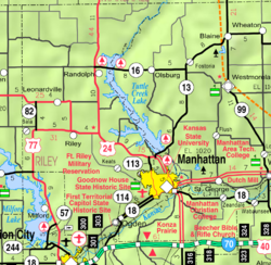
The ruins of the original town are visible on the north side of Kansas Highway 16 as it crosses the lake. The downtown of the original settlement is above the waterline on an island in the marshes at the northern tip of the lake. The island is occasionally accessible by foot when Fancy Creek is low, but the channels of Fancy Creek and the Big Blue River shift frequently making access to the ruins unpredictable. This is locally known as "Old Randolph."[ citation needed ]

Geography

According to the United States Census Bureau, the city has a total area of 0.25 square miles (0.65 km2), all of it land. [7]

Climate

The climate in this area is characterized by hot, humid summers and generally mild to cool winters. According to the Köppen Climate Classification system, Randolph has a humid subtropical climate, abbreviated "Cfa" on climate maps. [8]

Demographics

Historical population
CensusPop.Note
1880 262
1890 30516.4%
1900 37222.0%
1910 45522.3%
1920 401−11.9%
1930 4081.7%
1940 369−9.6%
1950 3916.0%
1960 35−91.0%
1970 106202.9%
1980 13123.6%
1990 129−1.5%
2000 17535.7%
2010 163−6.9%
2020 159−2.5%
U.S. Decennial Census

Randolph is part of the Manhattan, Kansas Metropolitan Statistical Area.

2010 census

As of the census [9] of 2010, there were 163 people, 71 households, and 43 families residing in the city. The population density was 652.0 inhabitants per square mile (251.7/km2). There were 82 housing units at an average density of 328.0 per square mile (126.6/km2). The racial makeup of the city was 96.9% White and 3.1% from two or more races. Hispanic or Latino of any race were 4.9% of the population.

There were 71 households, of which 31.0% had children under the age of 18 living with them, 50.7% were married couples living together, 7.0% had a female householder with no husband present, 2.8% had a male householder with no wife present, and 39.4% were non-families. 33.8% of all households were made up of individuals, and 14.1% had someone living alone who was 65 years of age or older. The average household size was 2.30 and the average family size was 3.00.

The median age in the city was 36.5 years. 25.2% of residents were under the age of 18; 5.5% were between the ages of 18 and 24; 28.2% were from 25 to 44; 28.8% were from 45 to 64; and 12.3% were 65 years of age or older. The gender makeup of the city was 44.2% male and 55.8% female.

2000 census

As of the census [10] of 2000, there were 175 people, 77 households, and 41 families residing in the city. The population density was 700.2 inhabitants per square mile (270.3/km2). There were 83 housing units at an average density of 332.1 per square mile (128.2/km2). The racial makeup of the city was 97.14% White, 0.57% Native American, and 2.29% from two or more races. Hispanic or Latino of any race were 0.57% of the population.

There were 77 households, out of which 26.0% had children under the age of 18 living with them, 45.5% were married couples living together, 6.5% had a female householder with no husband present, and 45.5% were non-families. 41.6% of all households were made up of individuals, and 20.8% had someone living alone who was 65 years of age or older. The average household size was 2.27 and the average family size was 3.24.

In the city, the population was spread out, with 25.7% under the age of 18, 5.7% from 18 to 24, 27.4% from 25 to 44, 21.1% from 45 to 64, and 20.0% who were 65 years of age or older. The median age was 40 years. For every 100 females, there were 101.1 males. For every 100 females age 18 and over, there were 109.7 males.

The median income for a household in the city was $21,875, and the median income for a family was $50,313. Males had a median income of $21,563 versus $21,458 for females. The per capita income for the city was $13,666. About 9.3% of families and 9.3% of the population were below the poverty line, including 3.7% of those under the age of eighteen and 20.7% of those 65 or over.

Education

The community is served by Blue Valley USD 384 public school district.

Notable people

See also

Related Research Articles

<span class="mw-page-title-main">Sun City, Kansas</span> City in Kiowa County, Kansas

Sun City is a city in Barber County, Kansas, United States, along the Medicine Lodge River. As of the 2020 census, the population of the city was 37.

<span class="mw-page-title-main">Waverly, Kansas</span> City in Coffey County, Kansas

Waverly is a city in Coffey County, Kansas, United States. As of the 2020 census, the population of the city was 574.

<span class="mw-page-title-main">Walnut, Kansas</span> City in Crawford County, Kansas

Walnut is a city in Crawford County, Kansas, United States. As of the 2020 census, the population of the city was 187.

<span class="mw-page-title-main">Bucklin, Kansas</span> City in Ford County, Kansas

Bucklin is a city in Ford County, Kansas, United States. As of the 2020 census, the population of the city was 727. It is located along U.S. Route 54 highway.

<span class="mw-page-title-main">Williamsburg, Kansas</span> City in Franklin County, Kansas

Williamsburg is a city in Franklin County, Kansas, United States. As of the 2020 census, the population of the city was 390.

<span class="mw-page-title-main">Gove City, Kansas</span> City in Gove County, Kansas

Gove City, more commonly known as Gove, is a city in and the county seat of Gove County, Kansas, United States. As of the 2020 census, the population of the city was 80.

<span class="mw-page-title-main">Kingman, Kansas</span> City in Kingman County, Kansas

Kingman is a city in and the county seat of Kingman County, Kansas, United States. As of the 2020 census, the population of the city was 3,105.

<span class="mw-page-title-main">Norwich, Kansas</span> City in Kingman County, Kansas

Norwich is a city in Kingman County, Kansas, United States. As of the 2020 census, the population of the city was 444.

<span class="mw-page-title-main">Mound City, Kansas</span> City and County seat in Kansas, United States

Mound City is a city in and the county seat of Linn County, Kansas, United States. As of the 2020 census, the population of the city was 647.

<span class="mw-page-title-main">Meade, Kansas</span> City in Meade County, Kansas

Meade is a city in and the county seat of Meade County, Kansas, United States. As of the 2020 census, the population of the city was 1,505.

<span class="mw-page-title-main">Lyndon, Kansas</span> City in Osage County, Kansas

Lyndon is a city in, and the county seat of Osage County, Kansas, United States. As of the 2020 census, the population of the city was 1,037.

<span class="mw-page-title-main">Ogden, Kansas</span> City in Riley County, Kansas

Ogden is a city in Riley County, Kansas, United States. As of the 2020 census, the population of the city was 1,661. It is located near Fort Riley between Manhattan and Junction City.

<span class="mw-page-title-main">Riley, Kansas</span> City in Riley County, Kansas

Riley is a city in Riley County, Kansas, United States. As of the 2020 census, the population of the city was 938.

<span class="mw-page-title-main">Collyer, Kansas</span> City in Trego County, Kansas, United States

Collyer is a city in Trego County, Kansas, United States. As of the 2020 census, the population of the city was 97. It is located approximately 12 miles west of WaKeeney.

<span class="mw-page-title-main">Sharon Springs, Kansas</span> City in Wallace County, Kansas

Sharon Springs is a city in and the county seat of Wallace County, Kansas, United States. As of the 2020 census, the population of the city was 751.

<span class="mw-page-title-main">Wallace, Kansas</span> City in Wallace County, Kansas

Wallace is a city in Wallace County, Kansas, United States. As of the 2020 census, the population of the city was 41.

<span class="mw-page-title-main">Yates Center, Kansas</span> City in Woodson County, Kansas, United States

Yates Center is a city in and the county seat of Woodson County, Kansas, United States. As of the 2020 census, the population of the city was 1,352.

<span class="mw-page-title-main">Beltrami, Minnesota</span> City in Minnesota, United States

Beltrami is a city in Polk County, Minnesota, United States and was named in honor of Giacomo Costantino Beltrami, an Italian exile, who traveled to the Red river and the upper Mississippi in 1823. Officially incorporated in 1902, there had been settlers in the area since 1870. It is part of the Grand Forks, ND-MN Metropolitan Statistical Area. The population was 88 at the 2020 census.

<span class="mw-page-title-main">Randolph, Missouri</span> City in Missouri, United States

Randolph is a city in Clay County, Missouri, United States. The population was 57 at the 2020 census. It is completely surrounded by Kansas City and is a part of the Kansas City metropolitan area.

<span class="mw-page-title-main">Lebo, Kansas</span> City in Coffey County, Kansas

Lebo is a city in Coffey County, Kansas, United States. As of the 2020 census, the population of the city was 885.

References

  1. 1 2 3 4 U.S. Geological Survey Geographic Names Information System: Randolph, Kansas
  2. "2019 U.S. Gazetteer Files". United States Census Bureau. Retrieved July 24, 2020.
  3. 1 2 "Profile of Randolph, Kansas in 2020". United States Census Bureau. Archived from the original on April 26, 2022. Retrieved April 26, 2022.
  4. Blackmar, Frank Wilson (1912). Kansas: A Cyclopedia of State History, Volume 2. Standard Publishing Company. pp.  548.
  5. Kansas State Historical Society (1916). Biennial Report of the Board of Directors of the Kansas State Historical Society. Kansas State Printing Plant. pp.  275.
  6. "Profile for Randolph, Kansas". ePodunk . Retrieved June 22, 2014.
  7. "US Gazetteer files 2010". United States Census Bureau. Archived from the original on July 2, 2012. Retrieved July 6, 2012.
  8. Climate Summary for Randolph, Kansas
  9. "U.S. Census website". United States Census Bureau . Retrieved July 6, 2012.
  10. "U.S. Census website". United States Census Bureau . Retrieved January 31, 2008.