Bala, Kansas

Last updated

Bala, Kansas
CDP
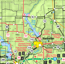
Map of Riley Co, Ks, USA.png
USA Kansas location map.svg
Red pog.svg
Bala
Usa edcp location map.svg
Red pog.svg
Bala
Coordinates: 39°18′39″N96°57′01″W / 39.31083°N 96.95028°W / 39.31083; -96.95028 [1]
Country United States
State Kansas
Counties Riley
Founded1862
Named for Bala
Elevation
[1]
1,293 ft (394 m)
Population
 (2020) [2]
  Total29
Time zone UTC-6 (CST)
  Summer (DST) UTC-5 (CDT)
Area code 785
FIPS code 20-03800
GNIS ID 2804655 [1]

Bala is a census-designated place (CDP) in Bala Township, Riley County, Kansas, United States. [1] As of the 2020 census, the population was 29. [2]

Contents

History

Bala settled about 1862. It was a shipping point on the Chicago, Rock Island and Pacific Railroad. [3] It is named after Bala, in Wales. [4]

A post office was opened in Bala in 1871, and remained in operation until it was discontinued in 1966. [5]

Demographics

Historical population
CensusPop.Note
2020 29
U.S. Decennial Census

Education

The community is served by Riley County USD 378 public school district. [6]

Related Research Articles

<span class="mw-page-title-main">Clay County, Kansas</span> County in Kansas, United States

Clay County is a county located in the U.S. state of Kansas. Its county seat and most populous city is Clay Center. As of the 2020 census, the county population was 8,117. The county was named for Henry Clay, an influential U.S. Senator from Kentucky.

<span class="mw-page-title-main">Riley County, Kansas</span> County in Kansas, United States

Riley County is a county located in the U.S. state of Kansas. Its county seat and largest city is Manhattan. As of the 2020 census, the population was 71,959. The county was named after Bennet Riley, the 7th governor of California, and a Mexican–American War hero. Riley County is home to Fort Riley and Kansas State University.

<span class="mw-page-title-main">Fort Riley (CDP), Kansas</span> Unincorporated community in Geary and Riley Counties of Kansas

Fort Riley is a census-designated place (CDP) in Geary and Riley counties in the U.S. state of Kansas, on the grounds of Fort Riley. As of the 2020 census, the population was 9,230. Fort Riley is part of the Manhattan, Kansas Metropolitan Statistical Area.

<span class="mw-page-title-main">Silverdale, Kansas</span> Unincorporated community in Cowley County, Kansas

Silverdale is a census-designated place (CDP) in Silverdale Township, Cowley County, Kansas, United States. As of the 2020 census, the population was 61.

<span class="mw-page-title-main">Talmage, Kansas</span> Unincorporated community in Dickinson County, Kansas

Talmage is a census-designated place (CDP) in Dickinson County, Kansas, United States. As of the 2020 census, the population was 78.

<span class="mw-page-title-main">Rock, Kansas</span> Unincorporated community in Cowley County, Kansas

Rock is a census-designated place (CDP) in Cowley County, Kansas, United States. As of the 2020 census, the population was 94.

<span class="mw-page-title-main">Yoder, Kansas</span> Unincorporated community in Reno County, Kansas

Yoder is a census-designated place (CDP) in Reno County, Kansas, United States. As of the 2020 census, the population was 165. It is located approximately 10 miles southeast of the city of Hutchinson on K-96. Although Yoder is unincorporated, with no city government, it does have a U.S. Post Office and its own ZIP code (67585). Yoder is the hub of a local Amish community.

<span class="mw-page-title-main">Peck, Kansas</span> Unincorporated community in Sedgwick and Sumner Counties of Kansas

Peck is a census-designated place (CDP) in Sedgwick and Sumner counties in the U.S. state of Kansas. As of the 2020 census, the population areas was 162. It is located about 2 miles west of the Kansas Star Casino at Meridian Ave and 119th St S, next to the Union Pacific Railroad.

<span class="mw-page-title-main">Norway, Kansas</span> Unincorporated community in Republic County, Kansas

Norway is a census-designated place (CDP) in Republic County, Kansas, United States. As of the 2020 census, the population was 17. It is located south of Scandia at Norway Lane and K-148 highway.

<span class="mw-page-title-main">Asherville, Kansas</span> Unincorporated community in Mitchell County, Kansas

Asherville is a census-designated place (CDP) in Mitchell County, Kansas, United States. As of the 2020 census, the population was 19.

<span class="mw-page-title-main">Welda, Kansas</span> Unincorporated community in Anderson County, Kansas

Welda is a census-designated place (CDP) in Anderson County, Kansas, United States. As of the 2020 census, the population was 149.

<span class="mw-page-title-main">Opolis, Kansas</span> Unincorporated community in Crawford County, Kansas

Opolis is a census-designated place (CDP) in Crawford County, Kansas, United States. As of the 2020 census, the population was 104.

<span class="mw-page-title-main">Zeandale, Kansas</span> Unincorporated community in Riley County, Kansas

Zeandale is a census-designated place (CDP) in Riley County, Kansas, United States. As of the 2020 census, the population was 62. It is located about 6.8 miles (10.9 km) east of Manhattan at the intersection of Tabor Valley Rd and K-18 highway.

<span class="mw-page-title-main">Sycamore, Kansas</span> Unincorporated community in Montgomery County, Kansas

Sycamore is a census-designated place (CDP) in northern Montgomery County, Kansas, United States. As of the 2020 census, the population was 70. It is located along U.S. Route 75 north of the city of Independence.

<span class="mw-page-title-main">Eastabuchie, Mississippi</span> Community in Mississippi, United States

Eastabuchie is a census-designated place and unincorporated community in southwestern Jones County, Mississippi. It is located along U.S. Route 11, just north of the Forrest County line. the community has a post office with the ZIP code 39436. Eastabuchie is part of the Laurel Micropolitan Statistical Area.

<span class="mw-page-title-main">Wakarusa, Kansas</span> Unincorporated community in Shawnee County, Kansas

Wakarusa is a census-designated place (CDP) in Shawnee County, Kansas, United States. As of the 2020 census, the population was 242. It is located 11 miles (18 km) south of downtown Topeka. Wakarusa is also the name of an unincorporated community in adjacent Douglas County, Kansas, 6.6 mi (10.6 km) southwest of downtown Lawrence and the name of the township that includes Lawrence, Kansas.

<span class="mw-page-title-main">Ionia, Kansas</span> Unincorporated community in Jewell County, Kansas

Ionia is a census-designated place (CDP) in Ionia Township, Jewell County, Kansas, United States. As of the 2020 census, the population was 17.

<span class="mw-page-title-main">Idana, Kansas</span> CDP in Kansas, United States

Idana is a census-designated place (CDP) in Clay County, Kansas, United States. As of the 2020 census, the population was 54. It is located approximately 6.5 miles west of Clay Center, and 1.5 miles south of US Route 24 along 16th Rd.

<span class="mw-page-title-main">Wells, Kansas</span> Unincorporated community in Ottawa County, Kansas

Wells is a census-designated place (CDP) in Ottawa County, Kansas, United States. As of the 2020 census, the population was 45.

<span class="mw-page-title-main">Keats, Kansas</span> Unincorporated community in Riley County, Kansas

Keats is a census-designated place (CDP) in Wildcat Township, Riley County, Kansas, United States. As of the 2020 census, the population was 96. It is located five miles west of Manhattan.

References

  1. 1 2 3 4 U.S. Geological Survey Geographic Names Information System: Bala, Kansas
  2. 1 2 "Profile of Bala, Kansas (CDP) in 2020". United States Census Bureau. Archived from the original on April 26, 2022. Retrieved April 26, 2022.
  3. Blackmar, Frank Wilson (1912). Kansas: A Cyclopedia of State History, Embracing Events, Institutions, Industries, Counties, Cities, Towns, Prominent Persons, Etc. Standard Publishing Company. pp.  132.
  4. "Profile for Bala, Kansas". ePodunk . Retrieved June 22, 2014.
  5. "Kansas Post Offices, 1828-1961". Kansas Historical Society. Archived from the original on October 9, 2013. Retrieved June 22, 2014.
  6. "2020 Census - School District Reference Map: Riley County, KS" (PDF). U.S. Census Bureau . Retrieved November 2, 2024. - Text list

Further reading