Related Research Articles

Riley County is a county located in the U.S. state of Kansas. As of the 2020 census, the population was 71,959. The largest city and county seat is Manhattan.

Geary County is a county located in the U.S. state of Kansas. As of the 2020 census, the county population was 36,739. Its county seat and most populous city is Junction City. The county is named in honor of Governor John W. Geary.

Fort Riley is a unincorporated community that covers part of Fort Riley, a US Army installation in Geary and Riley counties in the U.S. state of Kansas. As of the 2020 census, the population of the community and nearby areas was 9,230.
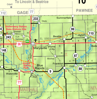
Home is an unincorporated community in southern Franklin Township, Marshall County, Kansas, United States. Home lies along U.S. Route 36 – the Pony Express Highway – and a Union Pacific rail line, east of the city of Marysville.

Stet is an unincorporated community on the Ray/Carroll County line and part of the Kansas City metropolitan area. It is located approximately fourteen miles northwest of Carrollton at the intersection of Missouri Supplemental Routes K and JJ.
Zeandale is an unincorporated community in Riley County, Kansas, United States. It is located about 6.8 miles (10.9 km) east of Manhattan at the intersection of Tabor Valley Rd and K-18 highway.

Dunavant is an unincorporated community in Jefferson County, Kansas, United States.

Beefhide is an unincorporated community spanning across a county line between Letcher County and Pike County, Kentucky, United States.
Bala is an unincorporated community in Bala Township, Riley County, Kansas, United States.
Rest is an unincorporated community in Wilson County, Kansas, United States.
Duluth is an unincorporated community in Pottawatomie County, Kansas, United States.
Saint Clere is an unincorporated community in Pottawatomie County, Kansas, United States.
Lasita is an unincorporated community in Riley County, Kansas, United States.
Walsburg is an unincorporated community in Riley County, Kansas, United States.
Winkler is an unincorporated community in Riley County, Kansas, United States.
Keats is an unincorporated community in Wildcat Township, Riley County, Kansas, United States. It is located five miles west of Manhattan.
Jollytown is an unincorporated community in Gilmore Township, Greene County, in the U.S. state of Pennsylvania.
Chasetown is an unincorporated community in Brown County, Ohio.
Outcrop is an unincorporated community in Fayette County, Pennsylvania.
Waterton, Colorado is a populated place located along the Platte River in Platte Canyon of Jefferson County, Colorado. Cañon Spur in Waterton was a Denver, South Park and Pacific Railroad (DSP&P) station. It was a settlement named Enterprise, with a post office from 1879 to 1881. Its name was changed to Platte Cañon, legally changed to Watertown in 1916, and is now known as Waterton. It is located near Kassler, another DSP&P station, established in 1872.
References
- ↑ U.S. Geological Survey Geographic Names Information System: May Day, Kansas
- ↑ "Post Offices". Jim Forte Postal History. Retrieved 5 January 2017.
- ↑ Moyer, Armond; Moyer, Winifred (1958). The origins of unusual place-names. Keystone Pub. Associates. p. 83.
