National Register of Historic Places listings in Osage County, Kansas

Last updated

Location of Osage County in Kansas Map of Kansas highlighting Osage County.svg
Location of Osage County in Kansas

This is a list of the National Register of Historic Places listings in Osage County, Kansas.

Contents

This is intended to be a complete list of the properties and districts on the National Register of Historic Places in Osage County, Kansas, United States. The locations of National Register properties and districts for which the latitude and longitude coordinates are included below, may be seen in a map. [1]

There are 15 properties and districts listed on the National Register in the county.


    This National Park Service list is complete through NPS recent listings posted February 9, 2024. [2]

Map all coordinates using: OpenStreetMap

Current listings

[3] Name on the Register [4] ImageDate listed [5] Location City or townDescription
1 Arvonia School
Arvonia School Arvonia Schoolhouse, Arvonia, Kansas.jpg
Arvonia School
July 3, 2012
(#12000387)
S. Arvonia Rd.
38°28′42″N95°52′15″W / 38.4783°N 95.8708°W / 38.4783; -95.8708 (Arvonia School)
Lebo One of Kansas' earliest architect-designed schools, built in 1872.
2 Arvonia Township Hall
Arvonia Township Hall Arvonia Township Hall Kansas front entrance.jpg
Arvonia Township Hall
January 11, 2017
(#100000516)
S. Arvonia Rd.
38°28′49″N95°52′10″W / 38.4803°N 95.8695°W / 38.4803; -95.8695 (Arvonia Township Hall)
Lebo
3 Atchison, Topeka, and Santa Fe Pratt Truss Bridge
Atchison, Topeka, and Santa Fe Pratt Truss Bridge Atchison, Topeka and Santa Fe Pratt Truss Bridge Kansas south view.jpg
Atchison, Topeka, and Santa Fe Pratt Truss Bridge
May 9, 2003
(#03000364)
SE Pine St., 0.1 miles (0.16 km) south of intersection with E. Emporia St.
38°30′19″N95°38′07″W / 38.5053°N 95.6353°W / 38.5053; -95.6353 (Atchison, Topeka, and Santa Fe Pratt Truss Bridge)
Melvern
4 Banner Hereford Farm
Banner Hereford Farm
June 12, 1998
(#98000659)
19355 S. Berryton Rd.
38°42′56″N95°38′31″W / 38.7156°N 95.6419°W / 38.7156; -95.6419 (Banner Hereford Farm)
Scranton
5 Calvinistic Methodist Church
Calvinistic Methodist Church Calvinistic Methodist Church (Lebo, Kansas).jpg
Calvinistic Methodist Church
July 3, 2012
(#12000388)
8090 W. 9th St.
38°28′45″N95°52′12″W / 38.4792°N 95.8701°W / 38.4792; -95.8701 (Calvinistic Methodist Church)
Lebo
6 Cow-Killer Archeological Site June 24, 1975
(#75000719)
Address restricted
Melvern
7 Samuel Hunt Grave
Samuel Hunt Grave Samuel Hunt Grave headstone Burlingame Kansas.jpg
Samuel Hunt Grave
May 11, 1995
(#95000586)
K-31, east of crossing of Interstate 335 (the Kansas Turnpike)
38°45′15″N95°55′32″W / 38.7542°N 95.9256°W / 38.7542; -95.9256 (Samuel Hunt Grave)
Burlingame Township
8 Karnes Stone Barn
Karnes Stone Barn Karnes Stone Barn Carbondale Kansas front.jpg
Karnes Stone Barn
January 21, 2004
(#03001468)
4204 E. 129th St.
38°50′02″N95°35′30″W / 38.8339°N 95.5917°W / 38.8339; -95.5917 (Karnes Stone Barn)
Carbondale
9 Lyndon Carnegie Library
Lyndon Carnegie Library Carnegie Library, Lyndon, KS.jpg
Lyndon Carnegie Library
June 25, 1987
(#87000965)
127 E. 6th
38°36′27″N95°40′58″W / 38.6075°N 95.6828°W / 38.6075; -95.6828 (Lyndon Carnegie Library)
Lyndon
10 Osage City Santa Fe Depot
Osage City Santa Fe Depot OsageDepot.jpg
Osage City Santa Fe Depot
May 11, 1989
(#89000386)
508 Market
38°38′11″N95°49′38″W / 38.6364°N 95.8272°W / 38.6364; -95.8272 (Osage City Santa Fe Depot)
Osage City
11 Osage County Courthouse
Osage County Courthouse Osage County Courthouse Kansas.jpg
Osage County Courthouse
April 18, 2007
(#07000320)
717 Topeka Ave.
38°36′37″N95°41′00″W / 38.6103°N 95.6833°W / 38.6103; -95.6833 (Osage County Courthouse)
Lyndon
12 Rapp School District No. 50
Rapp School District No. 50 Rapp School, Osage County, Kansas.JPG
Rapp School District No. 50
July 28, 1995
(#95000944)
U.S. Route 56, northwest of Osage City
38°39′07″N95°54′46″W / 38.6519°N 95.9128°W / 38.6519; -95.9128 (Rapp School District No. 50)
Osage City
13 Schuyler Grade School
Schuyler Grade School Schuyler Grade School Burlingame Kansas.jpg
Schuyler Grade School
April 15, 2011
(#11000193)
117 S. Dacotah St.
38°45′12″N95°50′13″W / 38.7533°N 95.8369°W / 38.7533; -95.8369 (Schuyler Grade School)
Burlingame
14 Luther Severy & Son Stock Farm
Luther Severy & Son Stock Farm Luther Severy & Son Stock Farm Osage Co KS barn and outbuildings.jpg
Luther Severy & Son Stock Farm
January 4, 2023
(#100008526)
11506 West 285th St.
38°33′01″N95°56′52″W / 38.5502°N 95.9477°W / 38.5502; -95.9477 (Luther Severy & Son Stock Farm)
Reading vicinity
15 Star Block
Star Block Star Block Osage City Kansas wide view.jpg
Star Block
December 22, 2020
(#100005954)
520 and 522 Market St.
38°38′05″N95°49′35″W / 38.6347°N 95.8265°W / 38.6347; -95.8265 (Star Block)
Osage City

See also

Related Research Articles

<span class="mw-page-title-main">National Register of Historic Places listings in Atchison County, Kansas</span>

This is a list of the National Register of Historic Places listings in Atchison County, Kansas.

<span class="mw-page-title-main">National Register of Historic Places listings in Doniphan County, Kansas</span>

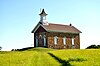
This is a list of the National Register of Historic Places listings in Doniphan County, Kansas.

<span class="mw-page-title-main">National Register of Historic Places listings in Harvey County, Kansas</span>

This is a list of the National Register of Historic Places listings in Harvey County, Kansas.

<span class="mw-page-title-main">National Register of Historic Places listings in Douglas County, Kansas</span>

This is a list of the National Register of Historic Places listings in Douglas County, Kansas.

<span class="mw-page-title-main">National Register of Historic Places listings in Riley County, Kansas</span>

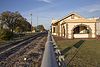
This is a list of the National Register of Historic Places listings in Riley County, Kansas.

<span class="mw-page-title-main">National Register of Historic Places listings in Morris County, Kansas</span>

This is a list of the National Register of Historic Places listings in Morris County, Kansas.

<span class="mw-page-title-main">National Register of Historic Places listings in Sedgwick County, Kansas</span>

This is a list of the National Register of Historic Places listings in Sedgwick County, Kansas.

<span class="mw-page-title-main">National Register of Historic Places listings in Chase County, Kansas</span>

This is a list of the National Register of Historic Places listings in Chase County, Kansas.

<span class="mw-page-title-main">National Register of Historic Places listings in Ellis County, Kansas</span>

This is a list of the National Register of Historic Places listings in Ellis County, Kansas.

<span class="mw-page-title-main">National Register of Historic Places listings in Johnson County, Kansas</span>

This is a list of the National Register of Historic Places listings in Johnson County, Kansas.

<span class="mw-page-title-main">National Register of Historic Places listings in Nemaha County, Kansas</span>

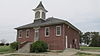
This is a list of the National Register of Historic Places listings in Nemaha County, Kansas.

<span class="mw-page-title-main">National Register of Historic Places listings in Geary County, Kansas</span>

This is a list of the National Register of Historic Places listings in Geary County, Kansas.

<span class="mw-page-title-main">National Register of Historic Places listings in Labette County, Kansas</span>

This is a list of the National Register of Historic Places listings in Labette County, Kansas.

<span class="mw-page-title-main">National Register of Historic Places listings in Cloud County, Kansas</span>

This is a list of the National Register of Historic Places listings in Cloud County, Kansas.

<span class="mw-page-title-main">National Register of Historic Places listings in Miami County, Kansas</span>

This is a list of the National Register of Historic Places listings in Miami County, Kansas.

<span class="mw-page-title-main">National Register of Historic Places listings in Osage County, Oklahoma</span>

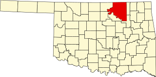
This is a list of the National Register of Historic Places listings in Osage County, Oklahoma.

<span class="mw-page-title-main">National Register of Historic Places listings in Cherokee County, Kansas</span>

This is a list of the National Register of Historic Places listings in Cherokee County, Kansas.

<span class="mw-page-title-main">National Register of Historic Places listings in Republic County, Kansas</span>

This is a list of the National Register of Historic Places listings in Republic County, Kansas.

<span class="mw-page-title-main">National Register of Historic Places listings in Osage County, Missouri</span>

This is a list of the National Register of Historic Places listings in Osage County, Missouri.

<span class="mw-page-title-main">National Register of Historic Places listings in Vernon County, Missouri</span>

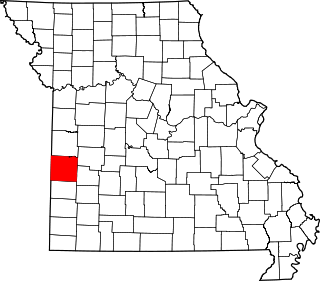
This is a list of the National Register of Historic Places listings in Vernon County, Missouri.

References

  1. The latitude and longitude information provided in this table was derived originally from the National Register Information System, which has been found to be fairly accurate for about 99% of listings. Some locations in this table may have been corrected to current GPS standards.
  2. National Park Service, United States Department of the Interior, "National Register of Historic Places: Weekly List Actions", retrieved February 9, 2024.
  3. Numbers represent an alphabetical ordering by significant words. Various colorings, defined here, differentiate National Historic Landmarks and historic districts from other NRHP buildings, structures, sites or objects.
  4. "National Register Information System". National Register of Historic Places . National Park Service. March 13, 2009.
  5. The eight-digit number below each date is the number assigned to each location in the National Register Information System database, which can be viewed by clicking the number.