National Register of Historic Places listings in Barton County, Kansas

Last updated

Location of Barton County in Kansas Map of Kansas highlighting Barton County.svg
Location of Barton County in Kansas

This is a list of the National Register of Historic Places listings in Barton County, Kansas.

Contents

This is intended to be a complete list of the properties on the National Register of Historic Places in Barton County, Kansas, United States. The locations of National Register properties for which the latitude and longitude coordinates are included below, may be seen in a map. [1]

There are 20 properties listed on the National Register in the county. Three properties were once listed, but have since been removed.


    This National Park Service list is complete through NPS recent listings posted November 17, 2023. [2]

Map all coordinates using: OpenStreetMap

Current listings

[3] Name on the Register [4] ImageDate listed [5] Location City or townDescription
1 Abel House March 2, 2001
(#01000180)
2601 Paseo Drive
38°22′39″N98°46′21″W / 38.3775°N 98.7725°W / 38.3775; -98.7725 (Abel House)
Great Bend
2 A.S. Allen Buildings January 5, 2018
(#100001944)
1401 Main St. & 2006 Forest
38°21′56″N98°45′54″W / 38.3656°N 98.7651°W / 38.3656; -98.7651 (A.S. Allen Buildings)
Great Bend
3 Beaver Creek Native Stone Bridge
Beaver Creek Native Stone Bridge Barton Co Beaver Creek NE 50 Ave bridge, W keystone 1.jpg
Beaver Creek Native Stone Bridge
April 16, 2008
(#08000296)
NE. 50 Ave. S. and NE 230 Rd.
38°41′42″N98°40′58″W / 38.6949°N 98.6827°W / 38.6949; -98.6827 (Beaver Creek Native Stone Bridge)
Beaver
4 Bridge No. 218-Off System Bridge
Bridge No. 218-Off System Bridge Barton County bridge 218 from SE 2.jpg
Bridge No. 218-Off System Bridge
April 16, 2008
(#08000297)
NE. 60 Ave. S. and NE. 220 Rd.
38°40′53″N98°39′59″W / 38.6814°N 98.6663°W / 38.6814; -98.6663 (Bridge No. 218-Off System Bridge)
Beaver
5 Bridge No. 222-Off System Bridge
Bridge No. 222-Off System Bridge Barton County bridge 222 from SE 1.jpg
Bridge No. 222-Off System Bridge
July 2, 2008
(#08000608)
NE. 60 Ave., S. and NE. 210 Rd., 1/8 mile east on 210 Rd.
38°40′01″N98°39′50″W / 38.6669°N 98.6638°W / 38.6669; -98.6638 (Bridge No. 222-Off System Bridge)
Beaver
6 Bridge No. 640-Federal Aid Highway System Bridge
Bridge No. 640-Federal Aid Highway System Bridge Barton Co bridge NE 60 Ave N of 210 Rd from SE 2.jpg
Bridge No. 640-Federal Aid Highway System Bridge
July 2, 2008
(#08000611)
NE 60 Ave., 1/8 mile north of NE 210 Rd.
38°40′03″N98°39′51″W / 38.6675°N 98.6641°W / 38.6675; -98.6641 (Bridge No. 640-Federal Aid Highway System Bridge)
Beaver
7 Crest Theater
Crest Theater Crest Theater In Great Bend, Kansas.jpg
Crest Theater
February 9, 2005
(#05000003)
1905 Lakin Ave.
38°21′59″N98°45′50″W / 38.3664°N 98.7639°W / 38.3664; -98.7639 (Crest Theater)
Great Bend
8 Great Bend Army Air Field Hangar
Great Bend Army Air Field Hangar Great Bend Army Air Field hangar from S 1.jpg
Great Bend Army Air Field Hangar
October 5, 2015
(#15000686)
9047 6th St.
38°20′50″N98°51′12″W / 38.3472°N 98.8533°W / 38.3472; -98.8533 (Great Bend Army Air Field Hangar)
Great Bend
8 Great Bend Central Business District July 21, 2022
(#100007923)
Roughly bounded by buildings fronting all sides of the courthouse square; 1100 and 1200 blks. of Kansas Ave., 1024, 1104-1222 Main St., 1200 and 1300 blks., 1409 Williams St., 2006-2111 Forest Ave.
38°21′56″N98°45′54″W / 38.3656°N 98.7651°W / 38.3656; -98.7651 (Great Bend Central Business District)
Great Bend
9 High Rise Apartments September 23, 2020
(#100005621)
1101 Kansas Ave.
38°21′45″N98°45′50″W / 38.3626°N 98.7638°W / 38.3626; -98.7638 (High Rise Apartments)
Great Bend
10 Hoisington High School
Hoisington High School Hoisington, Kansas HS from SE 1.jpg
Hoisington High School
November 15, 2005
(#05001248)
218 E. 7th St.
38°31′13″N98°46′34″W / 38.5203°N 98.7762°W / 38.5203; -98.7762 (Hoisington High School)
Hoisington
11 Manweiler-Maupin Chevrolet
Manweiler-Maupin Chevrolet Manweiler Chevrolet sign 1.jpg
Manweiler-Maupin Chevrolet
October 9, 2012
(#12000842)
271 S. Main St.
38°30′43″N98°46′40″W / 38.5119°N 98.7779°W / 38.5119; -98.7779 (Manweiler-Maupin Chevrolet)
Hoisington Part of the Roadside Kansas MPS
12 Nagel House
Nagel House Nagel Lustron house from ESE 1.jpg
Nagel House
March 2, 2001
(#01000181)
1411 Wilson St.
38°21′58″N98°47′44″W / 38.3660°N 98.7955°W / 38.3660; -98.7955 (Nagel House)
Great Bend
13 Norden Bombsight Storage Vaults
Norden Bombsight Storage Vaults Great Bend Norden bombsight vaults from ENE 1.jpg
Norden Bombsight Storage Vaults
October 5, 2015
(#15000687)
9047 6th St.
38°20′47″N98°51′10″W / 38.3465°N 98.8528°W / 38.3465; -98.8528 (Norden Bombsight Storage Vaults)
Great Bend Part of the Norden bombsight program
14 Pawnee Rock
Pawnee Rock Pawnee Rock 2013-09-26 14-17-58.jpg
Pawnee Rock
December 29, 1970
(#70000247)
0.2 miles north of Pawnee Rock off U.S. 56
38°16′20″N98°58′53″W / 38.2722°N 98.9814°W / 38.2722; -98.9814 (Pawnee Rock)
Pawnee Rock
15 US Post Office-Hoisington
US Post Office-Hoisington Hoisington, Kansas post office from NE 1.jpg
US Post Office-Hoisington
October 17, 1989
(#89001642)
121 E. 2nd St.
38°30′53″N98°46′35″W / 38.5147°N 98.7764°W / 38.5147; -98.7764 (US Post Office-Hoisington)
Hoisington
16 Walnut Creek Bridge January 4, 1990
(#89002178)
Over Walnut Creek, northwest of Heizer
38°25′54″N98°53′40″W / 38.4317°N 98.8944°W / 38.4317; -98.8944 (Walnut Creek Bridge)
Heizer
17 Walnut Creek Crossing April 26, 1972
(#72000488)
Along Walnut Creek above its confluence with the Arkansas River, east of Great Bend [6]
38°21′28″N98°42′07″W / 38.3578°N 98.7019°W / 38.3578; -98.7019 (Walnut Creek Crossing)
Great Bend Township
18 Wolf Hotel
Wolf Hotel Wolf Hotel name.jpg
Wolf Hotel
November 7, 2002
(#02001295)
104 E. Santa Fe
38°21′13″N98°34′50″W / 38.3536°N 98.5806°W / 38.3536; -98.5806 (Wolf Hotel)
Ellinwood
19 Wolf Park Band Shell
Wolf Park Band Shell Wolf Park Band Shell Barton Co KS west elevation.jpg
Wolf Park Band Shell
August 4, 2003
(#03000706)
Lots 12 and 13, Block 2, 200 block of N. Main
38°21′23″N98°34′49″W / 38.3564°N 98.5803°W / 38.3564; -98.5803 (Wolf Park Band Shell)
Ellinwood

Former listings

[3] Name on the RegisterImageDate listedDate removedLocationCity or townDescription
1 Bridge No. 650-Federal Aid Highway System Bridge
Bridge No. 650-Federal Aid Highway System Bridge Barton County bridge 650 from W 1.jpg
Bridge No. 650-Federal Aid Highway System Bridge
July 2, 2008
(#08000612)
March 26, 2018NE 60 Ave., 1/12 mile south of NE 220 Rd.
38°40′52″N98°39′51″W / 38.6811°N 98.6643°W / 38.6811; -98.6643 (Bridge No. 650-Federal Aid Highway System Bridge)
Beaver Apparently no longer extant [7]
2 Hitschmann Cattle Underpass Bridge April 16, 2008
(#08000298)
July 7, 2015NE. 110 Ave. S. & NE. 190 Rd.
38°38′16″N98°34′20″W / 38.6378°N 98.5722°W / 38.6378; -98.5722 (Hitschmann Cattle Underpass Bridge)
Hitschmann
3 Hitschmann Double Arch Bridge April 16, 2008
(#08000299)
July 7, 2015NE. 110 Ave. S. & NE. 190 Rd.
38°38′16″N98°34′20″W / 38.6378°N 98.5722°W / 38.6378; -98.5722 (Hitschmann Double Arch Bridge)
Hitschmann

See also

Related Research Articles

<span class="mw-page-title-main">National Register of Historic Places listings in Harvey County, Kansas</span>

This is a list of the National Register of Historic Places listings in Harvey County, Kansas.

<span class="mw-page-title-main">National Register of Historic Places listings in Douglas County, Kansas</span>

This is a list of the National Register of Historic Places listings in Douglas County, Kansas.

<span class="mw-page-title-main">National Register of Historic Places listings in Morris County, Kansas</span>

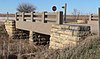
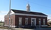
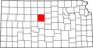
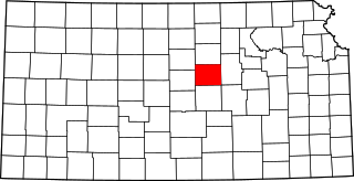
This is a list of the National Register of Historic Places listings in Morris County, Kansas.

<span class="mw-page-title-main">National Register of Historic Places listings in Sedgwick County, Kansas</span>

This is a list of the National Register of Historic Places listings in Sedgwick County, Kansas.

<span class="mw-page-title-main">National Register of Historic Places listings in Cowley County, Kansas</span>

This is a list of the National Register of Historic Places listings in Cowley County, Kansas.

<span class="mw-page-title-main">National Register of Historic Places listings in Johnson County, Kansas</span>

This is a list of the National Register of Historic Places listings in Johnson County, Kansas.

<span class="mw-page-title-main">National Register of Historic Places listings in Russell County, Kansas</span>

This is a list of the National Register of Historic Places listings in Russell County, Kansas.

<span class="mw-page-title-main">National Register of Historic Places listings in Lyon County, Kansas</span>

This is a list of the National Register of Historic Places listings in Lyon County, Kansas.

<span class="mw-page-title-main">National Register of Historic Places listings in Saline County, Kansas</span>

This is a list of the National Register of Historic Places listings in Saline County, Kansas.

<span class="mw-page-title-main">National Register of Historic Places listings in Butler County, Kansas</span>

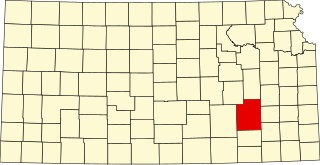
This is a list of the National Register of Historic Places listings in Butler County, Kansas.

<span class="mw-page-title-main">National Register of Historic Places listings in Labette County, Kansas</span>

This is a list of the National Register of Historic Places listings in Labette County, Kansas.

<span class="mw-page-title-main">National Register of Historic Places listings in Bourbon County, Kansas</span>

This is a list of the National Register of Historic Places listings in Bourbon County, Kansas.

<span class="mw-page-title-main">National Register of Historic Places listings in Cloud County, Kansas</span>

This is a list of the National Register of Historic Places listings in Cloud County, Kansas.

<span class="mw-page-title-main">National Register of Historic Places listings in Lincoln County, Kansas</span>

This is a list of the National Register of Historic Places listings in Lincoln County, Kansas.

<span class="mw-page-title-main">National Register of Historic Places listings in Greenwood County, Kansas</span>

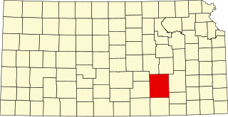
This is a list of the National Register of Historic Places listings in Greenwood County, Kansas.

<span class="mw-page-title-main">National Register of Historic Places listings in Sumner County, Kansas</span>

This is a list of the National Register of Historic Places listings in Sumner County, Kansas.

<span class="mw-page-title-main">National Register of Historic Places listings in Pottawatomie County, Kansas</span>

This is a list of the National Register of Historic Places listings in Pottawatomie County, Kansas.

<span class="mw-page-title-main">National Register of Historic Places listings in Finney County, Kansas</span>

This is a list of the National Register of Historic Places listings in Finney County, Kansas.

<span class="mw-page-title-main">National Register of Historic Places listings in Ford County, Kansas</span>

This is a list of the National Register of Historic Places listings in Ford County, Kansas.

<span class="mw-page-title-main">National Register of Historic Places listings in Jackson County, Missouri</span>

This is a list of the National Register of Historic Places listings in Jackson County, Missouri.

References

  1. The latitude and longitude information provided in this table was derived originally from the National Register Information System, which has been found to be fairly accurate for about 99% of listings. Some locations in this table may have been corrected to current GPS standards.
  2. National Park Service, United States Department of the Interior, "National Register of Historic Places: Weekly List Actions", retrieved November 17, 2023.
  3. 1 2 Numbers represent an alphabetical ordering by significant words. Various colorings, defined here, differentiate National Historic Landmarks and historic districts from other NRHP buildings, structures, sites or objects.
  4. "National Register Information System". National Register of Historic Places . National Park Service. March 13, 2009.
  5. The eight-digit number below each date is the number assigned to each location in the National Register Information System database, which can be viewed by clicking the number.
  6. Location derived from its NRHP nomination form; the NRIS lists the site as "Address Restricted"
  7. See 2017 photos, showing a concrete box at this location.