National Register of Historic Places listings in McPherson County, Kansas

Last updated

Location of McPherson County in Kansas Map of Kansas highlighting McPherson County.svg
Location of McPherson County in Kansas

This is a list of the National Register of Historic Places listings in McPherson County, Kansas.

Contents

This is intended to be a complete list of the properties and districts on the National Register of Historic Places in McPherson County, Kansas, United States. The locations of National Register properties and districts for which the latitude and longitude coordinates are included below, may be seen in a map. [1]

There are 26 properties and districts listed on the National Register in the county.


    This National Park Service list is complete through NPS recent listings posted March 15, 2024. [2]

Current listings

[3] Name on the Register [4] ImageDate listed [5] Location City or townDescription
1 Berquist & Nelson Drugstore Building
Berquist & Nelson Drugstore Building Berquist & Nelson Drugstore Bldg Lindsborg Kansas McPherson Co. 1.jpg
Berquist & Nelson Drugstore Building
April 22, 2009
(#09000228)
105 N. Main St.
38°34′25″N97°40′33″W / 38.5736°N 97.6759°W / 38.5736; -97.6759 (Berquist & Nelson Drugstore Building)
Lindsborg
2 Bethany Lutheran Church and Parsonage
Bethany Lutheran Church and Parsonage Bethany Lutheran Church McPherson Co KS west facade.jpg
Bethany Lutheran Church and Parsonage
May 11, 2023
(#100008966)
320-340 North Main St.
38°34′38″N97°40′33″W / 38.5773°N 97.6759°W / 38.5773; -97.6759 (Bethany Lutheran Church and Parsonage)
Lindsborg
3 Canton Township Carnegie Library
Canton Township Carnegie Library CantonCarnegieLibrary.jpg
Canton Township Carnegie Library
June 25, 1987
(#87000960)
300 N. Main
38°23′17″N97°25′35″W / 38.3881°N 97.4264°W / 38.3881; -97.4264 (Canton Township Carnegie Library)
Canton
4 Farmers State Bank
Farmers State Bank Farmers State Bank in Lindsborg Kansas KS USA.jpg
Farmers State Bank
October 16, 2008
(#08000985)
101 S. Main St.
38°34′24″N97°40′33″W / 38.5733°N 97.6758°W / 38.5733; -97.6758 (Farmers State Bank)
Lindsborg
5 Hans Hanson House
Hans Hanson House Hans Hanson House Marquette KS.jpg
Hans Hanson House
February 19, 1982
(#82002665)
211 E. 5th St.
38°33′24″N97°49′54″W / 38.5567°N 97.8317°W / 38.5567; -97.8317 (Hans Hanson House)
Marquette
6 Hjerpe Grocery
Hjerpe Grocery Hjerpe Grocery McPherson Co KS west facade.jpg
Hjerpe Grocery
July 11, 2010
(#10000447)
110 & 112 N. Main St.
38°34′26″N97°40′31″W / 38.5739°N 97.6753°W / 38.5739; -97.6753 (Hjerpe Grocery)
Lindsborg
7 Holmberg and Johnson Blacksmith Shop
Holmberg and Johnson Blacksmith Shop Holmberg and Johnson Blacksmith Shop McPherson Co Kansas.jpg
Holmberg and Johnson Blacksmith Shop
April 22, 2009
(#09000230)
122 N. Main St.
38°34′26″N97°40′33″W / 38.5739°N 97.6758°W / 38.5739; -97.6758 (Holmberg and Johnson Blacksmith Shop)
Lindsborg
8 Inman I.O.O.F. Hall
Inman I.O.O.F. Hall Nman I.O.O.F Hall McPherson Co KS west facade.jpg
Inman I.O.O.F. Hall
April 15, 2011
(#11000195)
100 N. Main.
38°13′55″N97°46′32″W / 38.2319°N 97.7756°W / 38.2319; -97.7756 (Inman I.O.O.F. Hall)
Inman
9 Johnson House
Johnson House Johnson House McPherson Co KS southeast facade.jpg
Johnson House
March 19, 1998
(#98000251)
226 W. Lincoln
38°34′51″N97°40′43″W / 38.5808°N 97.6786°W / 38.5808; -97.6786 (Johnson House)
Lindsborg
10 Kuns-Collier House
Kuns-Collier House Kuns-Collier House McPherson Co KS east facade.jpg
Kuns-Collier House
March 8, 2006
(#06000114)
302 S. Walnut St.
38°22′01″N97°40′10″W / 38.3669°N 97.6694°W / 38.3669; -97.6694 (Kuns-Collier House)
McPherson
11 P.J. Lindquist Building
P.J. Lindquist Building P. J. Lindquist Bldg McPherson Co KS.jpg
P.J. Lindquist Building
June 8, 2015
(#15000318)
116 S. Main St.
38°34′22″N97°40′33″W / 38.5727°N 97.6759°W / 38.5727; -97.6759 (P.J. Lindquist Building)
Lindsborg
12 McPherson Community Building
McPherson Community Building McPherson Community Building McPherson Co KS northeast facade.jpg
McPherson Community Building
June 29, 2018
(#100002628)
122 E. Marlin St.
38°22′13″N97°39′57″W / 38.3704°N 97.6659°W / 38.3704; -97.6659 (McPherson Community Building)
McPherson
13 McPherson County Courthouse
McPherson County Courthouse McPherson County Courthouse.jpg
McPherson County Courthouse
November 21, 1976
(#76002264)
Maple and Kansas Aves.
38°22′12″N97°40′07″W / 38.37°N 97.6686°W / 38.37; -97.6686 (McPherson County Courthouse)
McPherson
14 McPherson Opera House
McPherson Opera House McPherson Opera House.jpg
McPherson Opera House
March 16, 1972
(#72001452)
221 S. Main St.
38°22′02″N97°39′59″W / 38.3672°N 97.6664°W / 38.3672; -97.6664 (McPherson Opera House)
McPherson
15 North Gypsum Creek Truss Leg Bedstead Bridge
North Gypsum Creek Truss Leg Bedstead Bridge North Gypsum Creek Truss Leg Bedstead Bridge McPherson Co Kansas view south bridge truss and understructure.jpg
North Gypsum Creek Truss Leg Bedstead Bridge
May 9, 2003
(#03000367)
Sioux Rd., 0.2 miles east of intersection with 24th Ave., 1.0 mile south and 2.8 miles west of Roxbury
38°32′12″N97°28′39″W / 38.5367°N 97.4775°W / 38.5367; -97.4775 (North Gypsum Creek Truss Leg Bedstead Bridge)
Roxbury
16 Paint Creek Archeological Site June 20, 1972
(#72001449)
Western bank of Paint Creek, 1.5 miles (2.4 km) south of its confluence with the Smoky Hill River [6]
38°30′05″N97°42′55″W / 38.5014°N 97.7153°W / 38.5014; -97.7153 (Paint Creek Archeological Site)
Lindsborg Formerly known as the Salina 1 Site [7]
17 Anton Pearson House and Studio
Anton Pearson House and Studio Anton Pearson House northwest facade and arch McPherson Co Kansas.jpg
Anton Pearson House and Studio
April 2, 2021
(#100006324)
505 South Main St.
38°34′03″N97°40′33″W / 38.5675°N 97.6758°W / 38.5675; -97.6758 (Anton Pearson House and Studio)
Lindsborg
18 Power Plant No. 1
Power Plant No. 1 Power Plant - 1 McPherson Co KS front.jpg
Power Plant No. 1
October 10, 2007
(#07001067)
414 W. Elizabeth St.
38°22′06″N97°40′16″W / 38.3683°N 97.6711°W / 38.3683; -97.6711 (Power Plant No. 1)
McPherson
19 Rosberg-Holmgren-Clareen Block
Rosberg-Holmgren-Clareen Block Clareen Bldg McPherson Co KS.jpg
Rosberg-Holmgren-Clareen Block
April 22, 2009
(#09000229)
109-111-113 N. Main St.
38°34′25″N97°40′33″W / 38.5737°N 97.6759°W / 38.5737; -97.6759 (Rosberg-Holmgren-Clareen Block)
Lindsborg Formerly listed as the Clareen-Peterson Restaurant Building; expanded and renamed October 11, 2016
20 Heinrich H. Schroeder Barn September 21, 2005
(#05001051)
632 29th Ave.
38°16′03″N97°23′18″W / 38.2675°N 97.3883°W / 38.2675; -97.3883 (Heinrich H. Schroeder Barn)
Canton
21 Sharps Creek Archeological Site June 22, 1972
(#72001450)
Eastern side of Sharps Creek, 1.5 miles (2.4 km) above its confluence with the Smoky Hill River [8]
38°30′25″N97°45′42″W / 38.5069°N 97.7616°W / 38.5069; -97.7616 (Sharps Creek Archeological Site)
Lindsborg
22 Smoky Valley Roller Mill
Smoky Valley Roller Mill Old mill - Lindsborg KS - 2.jpg
Smoky Valley Roller Mill
February 23, 1972
(#72001451)
Mill St.
38°34′39″N97°40′39″W / 38.5775°N 97.6775°W / 38.5775; -97.6775 (Smoky Valley Roller Mill)
Lindsborg
23 Swedish Pavilion
Swedish Pavilion Swedish Pavilion - Lindsborg KS.jpg
Swedish Pavilion
March 20, 1973
(#73002129)
Mill St.
38°34′02″N97°40′27″W / 38.5672°N 97.6742°W / 38.5672; -97.6742 (Swedish Pavilion)
Lindsborg
24 Teichgraeber-Runbeck House
Teichgraeber-Runbeck House Teichgraeber-Runbeck House McPherson Co KS front.jpg
Teichgraeber-Runbeck House
November 15, 2005
(#05001239)
116 Mill St.
38°33′57″N97°40′29″W / 38.5658°N 97.6747°W / 38.5658; -97.6747 (Teichgraeber-Runbeck House)
Lindsborg
25 US Post Office-Lindsborg
US Post Office-Lindsborg Lindsborg US Post Office McPherson Co KS front entrance.jpg
US Post Office-Lindsborg
October 17, 1989
(#89001646)
125 E. Lincoln St.
38°34′27″N97°39′50″W / 38.5742°N 97.6639°W / 38.5742; -97.6639 (US Post Office-Lindsborg)
Lindsborg
26 John R. Wright House
John R. Wright House John R. Wright House McPherson CO KS east facade.jpg
John R. Wright House
May 2, 2002
(#02000427)
322 W. Marlin St.
38°22′14″N97°40′13″W / 38.3706°N 97.6703°W / 38.3706; -97.6703 (John R. Wright House)
McPherson

See also

Related Research Articles

<span class="mw-page-title-main">National Register of Historic Places listings in Doniphan County, Kansas</span>

This is a list of the National Register of Historic Places listings in Doniphan County, Kansas.

<span class="mw-page-title-main">National Register of Historic Places listings in Harvey County, Kansas</span>

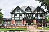
This is a list of the National Register of Historic Places listings in Harvey County, Kansas.

<span class="mw-page-title-main">National Register of Historic Places listings in Douglas County, Kansas</span>

This is a list of the National Register of Historic Places listings in Douglas County, Kansas.

<span class="mw-page-title-main">National Register of Historic Places listings in Morris County, Kansas</span>

This is a list of the National Register of Historic Places listings in Morris County, Kansas.

<span class="mw-page-title-main">National Register of Historic Places listings in Sedgwick County, Kansas</span>

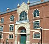
This is a list of the National Register of Historic Places listings in Sedgwick County, Kansas.

<span class="mw-page-title-main">National Register of Historic Places listings in Cowley County, Kansas</span>

This is a list of the National Register of Historic Places listings in Cowley County, Kansas.

<span class="mw-page-title-main">National Register of Historic Places listings in Johnson County, Kansas</span>

This is a list of the National Register of Historic Places listings in Johnson County, Kansas.

<span class="mw-page-title-main">National Register of Historic Places listings in Nemaha County, Kansas</span>

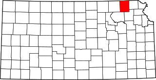
This is a list of the National Register of Historic Places listings in Nemaha County, Kansas.

<span class="mw-page-title-main">National Register of Historic Places listings in Rice County, Kansas</span>

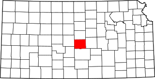
This is a list of the National Register of Historic Places listings in Rice County, Kansas.

<span class="mw-page-title-main">National Register of Historic Places listings in Bourbon County, Kansas</span>

This is a list of the National Register of Historic Places listings in Bourbon County, Kansas.

<span class="mw-page-title-main">National Register of Historic Places listings in Cloud County, Kansas</span>

This is a list of the National Register of Historic Places listings in Cloud County, Kansas.

<span class="mw-page-title-main">National Register of Historic Places listings in Miami County, Kansas</span>

This is a list of the National Register of Historic Places listings in Miami County, Kansas.

<span class="mw-page-title-main">National Register of Historic Places listings in Waldo County, Maine</span>

This is a list of the National Register of Historic Places listings in Waldo County, Maine.

<span class="mw-page-title-main">National Register of Historic Places listings in McPherson County, South Dakota</span>

This is a list of the National Register of Historic Places listings in McPherson County, South Dakota.

<span class="mw-page-title-main">National Register of Historic Places listings in Osage County, Kansas</span>

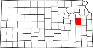
This is a list of the National Register of Historic Places listings in Osage County, Kansas.

<span class="mw-page-title-main">National Register of Historic Places listings in Mitchell County, Kansas</span>

This is a list of the National Register of Historic Places listings in Mitchell County, Kansas.

<span class="mw-page-title-main">National Register of Historic Places listings in Finney County, Kansas</span>

This is a list of the National Register of Historic Places listings in Finney County, Kansas.

<span class="mw-page-title-main">National Register of Historic Places listings in Brown County, Kansas</span>

This is a list of the National Register of Historic Places listings in Brown County, Kansas.

<span class="mw-page-title-main">National Register of Historic Places listings in Wabaunsee County, Kansas</span>

This is a list of the National Register of Historic Places listings in Wabaunsee County, Kansas.

<span class="mw-page-title-main">National Register of Historic Places listings in Jackson County, Missouri</span>

This is a list of the National Register of Historic Places listings in Jackson County, Missouri.

References

  1. The latitude and longitude information provided in this table was derived originally from the National Register Information System, which has been found to be fairly accurate for about 99% of listings. Some locations in this table may have been corrected to current GPS standards.
  2. National Park Service, United States Department of the Interior, "National Register of Historic Places: Weekly List Actions", retrieved March 15, 2024.
  3. Numbers represent an alphabetical ordering by significant words. Various colorings, defined here, differentiate National Historic Landmarks and historic districts from other NRHP buildings, structures, sites or objects.
  4. "National Register Information System". National Register of Historic Places . National Park Service. March 13, 2009.
  5. The eight-digit number below each date is the number assigned to each location in the National Register Information System database, which can be viewed by clicking the number.
  6. Wedel, Waldo. "Salina 1: A Protohistoric Village Site in McPherson County, Kansas". Nebraska History Magazine 15.3 (1934): 239-251: 239.
  7. Roper, Donna C. "The Whiteford Family of Salina". Kansas History 25.4 (2002): 244-257: 247.
  8. Wedel, Waldo. "The Council Circles of Central Kansas: Were They Solstice Registers?" American Antiquity 32.1 (1967): 54-63: 55.