
Unami Creek is a 16.5-mile-long (26.6 km) tributary of Perkiomen Creek in Lehigh, Bucks, and Montgomery counties, Pennsylvania in the United States.
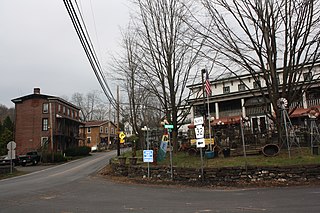
Point Pleasant is an unincorporated community in Tinicum and Plumstead Townships of Bucks County, Pennsylvania, United States. It lies on both sides of Tohickon Creek by the creek's confluence with the Delaware River; the creek is the dividing line between the townships. The ZIP code for the post office in Point Pleasant is 18950.

The Raystown Branch Juniata River is the largest and longest tributary of the Juniata River in south-central Pennsylvania in the United States.
The Kansas City Bridge Company was a bridge building company that built many bridges throughout the Midwest United States in the early 1900s. The company was founded in 1893 and ceased business around 1960.

Standing Stone Creek is a 34.2-mile-long (55.0 km) tributary of the Juniata River in Huntingdon and Centre counties, Pennsylvania, in the United States.

Corn Creek Campsite is located in the Desert National Wildlife Range and was used from around 1900–1924 for ranching and is listed on the United States National Register of Historic Places. Nearby is Mormon Well Spring another listed historic place.
Muddy Creek is a tributary of the Susquehanna River in York County, Pennsylvania, in the United States.
The South Dakota Department of Transportation (SDDOT) is a state government organization in charge of maintaining public roadways of the U.S. state of South Dakota. South Dakota has 82,447 miles of highways, roads and streets, as well as 5,905 bridges. The SDDOT is responsible for 7,830 miles of the roadway system.
Garbutt, New York is a hamlet located between the village of Scottsville and the hamlet of Mumford. It sits at the intersection of Scottsville-Mumford Road and Union Street in the Town of Wheatland in Monroe County, New York, United States. Garbutt grew rapidly through the mid-nineteenth century, but starting in the late nineteenth and early twentieth centuries the collapse of the local economy caused the population to severely decline.

Scott Creek Bridge-North, Maryland and Pennsylvania Railroad is a historic railroad bridge in Peach Bottom Township, York County, Pennsylvania. It was built about 1909. The girder bridge with stone abutments was built by the Maryland and Pennsylvania Railroad and crosses Scott Creek.

The Church Hill Road Covered Bridge is a covered bridge in Columbiana County, Ohio. It was originally located over Middle Fork Little Beaver Creek in Elk Township. The bridge was constructed in 1870 and was relocated in 1982 behind a restaurant on Ohio State Route 154 in Elkton, Ohio.
Crystal Bridge in Crystal, North Dakota is a bridge which was built in 1927 over the Cart Creek. It was listed on the National Register of Historic Places in 1997.

Hunting Creek Railroad Bridge is a historic stone railroad bridge located at Morganton, Burke County, North Carolina. It was built about 1860, and is a two-span, stone arch bridge. It measures 130 feet long and stands about 24 feet above the creek. It was replaced by another bridge by at least 1890.
The Bear Tavern Road–Jacob's Creek Crossing Rural Historic District covers the farms along Bear Tavern Road north of its intersection with Jacob's Creek Road, as well as the bridge and intersection itself. Bear Tavern Road dates to 1729 and George Washington led the Continental Army along it in 1776, on his way from crossing the Delaware to the Battle of Trenton. The district still reflects its 18th and 19th century patterns of development.
The Minerva Creek Bridge is located in Liberty Township north of Clemons, Iowa, United States. It spans Minerva Creek for 68 feet (21 m). The Marshall County Board of Supervisors awarded a $14,090 contract to the N.M. Stark and Company of Des Moines to build six concrete bridges. They were all designed by W.W. Morehouse, the Marshall County Engineer. This single-span concrete Luten arch bridge was completed the same year for $2,550. It was the longest of the six bridges in the contract. The bridge was listed on the National Register of Historic Places in 1998.

Squaw Creek Bridge 2 is located in Harrison Township in rural Boone County, Iowa, United States. It spans Ioway Creek for 88 feet (27 m). The Marsh arch bridge was designed by Des Moines engineer James B. Marsh, and built by the N.E. Marsh & Son Construction Company of Des Moines in 1918. The bridge was listed on the National Register of Historic Places in 1998.

The Hammond Bridge is a historic structure located west of Hamilton, Iowa, United States. It spans North Cedar Creek for 178 feet (54 m). Samuel B. Hammond, for whom the bridge is named, requested the Marion County Board of Supervisors in January 1894 to build a bridge near his property. In April of that year they examined the site, and in June they contracted with S.F. Collins to build the Howe covered through truss. He completed it later that year. The stream has been channelized so the truss no longer spans the main water flow. In October 1977 a truck accident closed the bridge for two years, and it reopened in September 1979. The bridge was listed on the National Register of Historic Places in 1998. While it remains in place, a newer span was built to carry the vehicle traffic over the creek.

The Dunkerton Bridge is a historic structure located in Dunkerton, Iowa, United States. The span carried a local street over Crane Creek for 212 feet (65 m). The three-span, filled spandrel arch bridge was built by the Marsh Engineering Company of Des Moines in 1909. It replaced an older span at a different location. The bridge served as the major entry point into the town from the north. This bridge was also replaced by a newer bridge to the east, and this span now carries pedestrian traffic between Charma Park and Marble Street into downtown Dunkerton. It was listed on the National Register of Historic Places in 1998.
The Fish Creek Bridge is a historic structure that was originally located east of Salem, Iowa, United States. The span carried Hickory Road over Fish Creek for 50 feet (15 m). It is a small-scale, wrought-iron bridge that the Henry County Board of Supervisors bought from the George E. King Bridge Company of Des Moines in 1893 for $410.80. It was believed to have been fabricated by their parent company, King Iron Bridge Company of Cleveland, and assembled by local laborers. Its historical significance derived from its being an uncommon variant of the Pratt truss. It was listed on the National Register of Historic Places in 1998. Subsequently, the bridge has been replaced at its original location, and the historic structure was moved to Oakland Mills Park.

The West Sixth Street Bridge is a historic stone arch bridge in downtown Austin, Texas. Built in 1887, the bridge is one of the state's oldest masonry arch bridges. It is located at the site of the first bridge in Austin, carrying Sixth Street across Shoal Creek to link the western and central parts of the old city. The bridge was added to the National Register of Historic Places in 2014.


