National Register of Historic Places listings in Montgomery County, Kansas

Last updated

Location of Montgomery County in Kansas Map of Kansas highlighting Montgomery County.svg
Location of Montgomery County in Kansas

This is a list of the National Register of Historic Places listings in Montgomery County, Kansas.

Contents

This is intended to be a complete list of the properties and districts on the National Register of Historic Places in Montgomery County, Kansas, United States. The locations of National Register properties and districts for which the latitude and longitude coordinates are included below, may be seen in a map. [1]

There are 35 properties and districts listed on the National Register in the county.


    This National Park Service list is complete through NPS recent listings posted April 7, 2023. [2]

Map all coordinates using: OpenStreetMap  
Download coordinates as: KML

Current listings

[3] Name on the Register [4] ImageDate listed [5] Location City or townDescription
1 Archeological Site Number 14MY1 July 9, 1982
(#82004886)
Address restricted
2 Archeological Site Number 14MY365 July 9, 1982
(#82004885)
Address restricted
Independence
3 Archeological Site Number 14MY1320 July 9, 1982
(#82004883)
Address restricted
Independence
4 Archeological Site Number 14MY1385 July 9, 1982
(#82004884)
Address restricted
Liberty
5 Charles M. Ball House
Charles M. Ball House Charles M Ball House.jpg
Charles M. Ball House
February 7, 2011
(#10001209)
702 Spruce St.
37°02′14″N95°37′20″W / 37.037222°N 95.622222°W / 37.037222; -95.622222 (Charles M. Ball House)
Coffeyville
6 Bethel African Methodist Episcopal Church
Bethel African Methodist Episcopal Church Bethel AME Church SE Corner View.jpg
Bethel African Methodist Episcopal Church
July 28, 1995
(#95000943)
202 W. 12th St.
37°01′56″N95°37′02″W / 37.032222°N 95.617222°W / 37.032222; -95.617222 (Bethel African Methodist Episcopal Church)
Coffeyville
7 Blakeslee Motor Company Building
Blakeslee Motor Company Building Blakeslee Motor Company Building, Independence, KS.jpg
Blakeslee Motor Company Building
August 25, 1989
(#89001145)
211 W. Myrtle
37°13′27″N95°42′32″W / 37.224056°N 95.708779°W / 37.224056; -95.708779 (Blakeslee Motor Company Building)
Independence
8 Booth Hotel
Booth Hotel Booth Hotel, Independence, KS.jpg
Booth Hotel
April 28, 1983
(#83000435)
201-209 W. Main St.
37°13′23″N95°42′30″W / 37.223041°N 95.708404°W / 37.223041; -95.708404 (Booth Hotel)
Independence
9 Booth Theater
Booth Theater Booth Theater, Independence, KS.jpg
Booth Theater
October 13, 1988
(#88001903)
119 W. Myrtle St.
37°13′27″N95°42′28″W / 37.224138°N 95.70775°W / 37.224138; -95.70775 (Booth Theater)
Independence
10 Brown Barn April 8, 2009
(#09000191)
5879 County Road 4300
37°08′19″N95°40′27″W / 37.138611°N 95.674167°W / 37.138611; -95.674167 (Brown Barn)
Independence Agriculture-Related Resources of Kansas MPS
11 W.P. Brown Mansion
W.P. Brown Mansion W.P. BROWN MANSION.jpg
W.P. Brown Mansion
December 12, 1976
(#76000833)
S. Walnut and Eldridge Sts.
37°01′13″N95°36′50″W / 37.020278°N 95.613889°W / 37.020278; -95.613889 (W.P. Brown Mansion)
Coffeyville
12 Cedar Manor Farm January 8, 2014
(#13001041)
2326 Cty. Rd. 6400
37°33′36″N95°55′29″W / 37.559919°N 95.924591°W / 37.559919; -95.924591 (Cedar Manor Farm)
Fredonia Part of the Agriculture-Related Resources of Kansas MPS
13 Cherryvale Carnegie Free Library August 18, 1987
(#87000961)
329 E. Main
37°16′01″N95°32′55″W / 37.266944°N 95.548611°W / 37.266944; -95.548611 (Cherryvale Carnegie Free Library)
Cherryvale
14 Coffeyville Carnegie Public Library Building
Coffeyville Carnegie Public Library Building Coffeyville, KS public library building funded by Andrew Carnegie.jpg
Coffeyville Carnegie Public Library Building
June 25, 1987
(#87000962)
415 W. Eighth
37°02′09″N95°37′23″W / 37.035833°N 95.623056°W / 37.035833; -95.623056 (Coffeyville Carnegie Public Library Building)
Coffeyville
15 Condon National Bank
Condon National Bank CONDON NATIONAL BANK.jpg
Condon National Bank
January 12, 1973
(#73000771)
811 Walnut St.
37°02′08″N95°36′55″W / 37.035556°N 95.615278°W / 37.035556; -95.615278 (Condon National Bank)
Coffeyville
16 Cook's Hotel
Cook's Hotel Cook's Hotel, Independence, KS.jpg
Cook's Hotel
March 8, 2006
(#06000115)
113 West Myrtle
37°13′27″N95°42′27″W / 37.224172°N 95.707489°W / 37.224172; -95.707489 (Cook's Hotel)
Independence
17 Dewlen-Spohnhauer Bridge
Dewlen-Spohnhauer Bridge Dewlen-Spohnhauer Bridge NRHP 83000436 Montgomery County, KS.jpg
Dewlen-Spohnhauer Bridge
March 10, 1983
(#83000436)
Old U.S. Route 160
37°13′28″N95°40′43″W / 37.224444°N 95.678611°W / 37.224444; -95.678611 (Dewlen-Spohnhauer Bridge)
Independence
18 Eastep Site January 30, 2013
(#12001240)
Address restricted
Independence
19 Elk River Archeological District September 13, 1978
(#78001279)
Address restricted
Elk City
20 Federal Building-US Post Office
Federal Building-US Post Office Federal Building, Independence, KS.jpg
Federal Building-US Post Office
October 19, 1988
(#88002009)
123 N. 8th
37°13′27″N95°42′30″W / 37.224081°N 95.708431°W / 37.224081; -95.708431 (Federal Building-US Post Office)
Independence
21 First Congregational Church
First Congregational Church First Congregational Church, Independence, KS.jpg
First Congregational Church
October 8, 2014
(#14000831)
400 N. 9th
37°13′36″N95°42′33″W / 37.2267°N 95.7092°W / 37.2267; -95.7092 (First Congregational Church)
Independence
22 Hotel Dale
Hotel Dale Hotel Dale (Dale Apartments).jpg
Hotel Dale
January 31, 2008
(#07001483)
206 W. 8th St.
37°02′10″N95°37′02″W / 37.036111°N 95.617222°W / 37.036111; -95.617222 (Hotel Dale)
Coffeyville
23 Independence Bowstring
Independence Bowstring Bowstring Bridge, Independence, KS.jpg
Independence Bowstring
January 4, 1990
(#89002180)
Over the Verdigris River, north of junction of Burns and Myrtle Sts.
37°13′29″N95°41′37″W / 37.224722°N 95.693611°W / 37.224722; -95.693611 (Independence Bowstring)
Independence
24 Independence Downtown Historic District
Independence Downtown Historic District Independence, Kans., Penn. Ave. and Myrtle St LCCN2007662154.tif
Independence Downtown Historic District
July 19, 2006
(#06000624)
Chestnut, Laurel, Myrtle, Main, Maple between 5th and 9th
37°13′30″N95°42′18″W / 37.225°N 95.705°W / 37.225; -95.705 (Independence Downtown Historic District)
Independence
25 Independence Junior High School
Independence Junior High School Independence Junior High School, Independence, KS.jpg
Independence Junior High School
December 30, 2009
(#09001165)
300 W. Locust St.
37°13′41″N95°42′37″W / 37.228°N 95.710139°W / 37.228; -95.710139 (Independence Junior High School)
Independence
26 Independence Public Carnegie Library
Independence Public Carnegie Library Independence, KS public library funded by Andrew Carnegie.jpg
Independence Public Carnegie Library
January 11, 1988
(#87002231)
220 E. Maple
37°13′21″N95°42′16″W / 37.222483°N 95.704322°W / 37.222483; -95.704322 (Independence Public Carnegie Library)
Independence
27 Infinity Archeological Site March 24, 1971
(#71000320)
Southwest of the confluence of the Elk River and Card Creek [6]
37°15′09″N95°51′20″W / 37.252500°N 95.855556°W / 37.252500; -95.855556 (Infinity Archeological Site)
Independence
28 William Inge Boyhood Home
William Inge Boyhood Home 101 -- Roof and overview.png
William Inge Boyhood Home
January 5, 2018
(#100001947)
514 N 4th St.
37°13′42″N95°42′09″W / 37.228231°N 95.702451°W / 37.228231; -95.702451 (William Inge Boyhood Home)
Independence
29 Memorial Hall
Memorial Hall Memorial Hall, Independence, KS.jpg
Memorial Hall
June 10, 2005
(#05000554)
Junction of Pennsylvania Ave. and E. Locust St.
37°13′38″N95°42′22″W / 37.227242°N 95.706157°W / 37.227242; -95.706157 (Memorial Hall)
Independence
30 Midland Theater
Midland Theater West 8th Street, looking east, Coffeyville, Kansas (8734327847).jpg
Midland Theater
February 9, 2005
(#05000007)
212-214 W. 8th St.
37°02′17″N95°36′58″W / 37.038056°N 95.616111°W / 37.038056; -95.616111 (Midland Theater)
Coffeyville
31 Onion Creek Bridge
Onion Creek Bridge Onion Creek Bridge.jpg
Onion Creek Bridge
January 4, 1990
(#89002172)
Over Onion Creek, south of Coffeyville
37°01′33″N95°39′23″W / 37.025833°N 95.656389°W / 37.025833; -95.656389 (Onion Creek Bridge)
Coffeyville
32 Pennsylvania Avenue Rock Creek Bridge
Pennsylvania Avenue Rock Creek Bridge Rock Creek Bridge, Independence, KS.jpg
Pennsylvania Avenue Rock Creek Bridge
July 2, 1985
(#85001437)
Pennsylvania Ave. over Rock Creek
37°12′51″N95°42′26″W / 37.214250°N 95.707258°W / 37.214250; -95.707258 (Pennsylvania Avenue Rock Creek Bridge)
Independence
33 Terminal Building June 14, 1982
(#82002666)
717 Walnut
37°02′11″N95°36′54″W / 37.036389°N 95.615°W / 37.036389; -95.615 (Terminal Building)
Coffeyville
34 Union Implement and Hardware Building-Masonic Temple
Union Implement and Hardware Building-Masonic Temple Union Implement and Hardware Building, Independence, KS.jpg
Union Implement and Hardware Building-Masonic Temple
October 13, 1988
(#88002008)
121-123 W. Main
37°13′23″N95°42′28″W / 37.222963°N 95.707879°W / 37.222963; -95.707879 (Union Implement and Hardware Building-Masonic Temple)
Independence
35 Washington School April 14, 2015
(#15000147)
300 E. Myrtle St.
37°13′30″N95°42′11″W / 37.224935°N 95.703107°W / 37.224935; -95.703107 (Washington School)
Independence

See also

Related Research Articles

<span class="mw-page-title-main">National Register of Historic Places listings in Montgomery County, Alabama</span>

This is a list of the National Register of Historic Places listings in Montgomery County, Alabama.

<span class="mw-page-title-main">National Register of Historic Places listings in Montgomery County, New York</span>

List of the National Register of Historic Places listings in Montgomery County, New York

<span class="mw-page-title-main">National Register of Historic Places listings in Miami County, Ohio</span>

This is a list of the National Register of Historic Places listings in Miami County, Ohio.

<span class="mw-page-title-main">National Register of Historic Places listings in Darke County, Ohio</span>

This is a list of the National Register of Historic Places listings in Darke County, Ohio.

<span class="mw-page-title-main">National Register of Historic Places listings in Montgomery County, Maryland</span>

This is a list of the National Register of Historic Places listings in Montgomery County, Maryland.

<span class="mw-page-title-main">National Register of Historic Places listings in Harvey County, Kansas</span>

This is a list of the National Register of Historic Places listings in Harvey County, Kansas.

<span class="mw-page-title-main">National Register of Historic Places listings in Douglas County, Kansas</span>

This is a list of the National Register of Historic Places listings in Douglas County, Kansas.

<span class="mw-page-title-main">National Register of Historic Places listings in Morris County, Kansas</span>

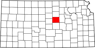
This is a list of the National Register of Historic Places listings in Morris County, Kansas.

<span class="mw-page-title-main">National Register of Historic Places listings in Sedgwick County, Kansas</span>

This is a list of the National Register of Historic Places listings in Sedgwick County, Kansas.

<span class="mw-page-title-main">National Register of Historic Places listings in Johnson County, Kansas</span>

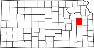
This is a list of the National Register of Historic Places listings in Johnson County, Kansas.

<span class="mw-page-title-main">National Register of Historic Places listings in Saline County, Kansas</span>

This is a list of the National Register of Historic Places listings in Saline County, Kansas.

<span class="mw-page-title-main">National Register of Historic Places listings in Montgomery County, Virginia</span>

This is a list of the National Register of Historic Places listings in Montgomery County, Virginia.

<span class="mw-page-title-main">National Register of Historic Places listings in Montgomery County, Indiana</span>

This is a list of the National Register of Historic Places listings in Montgomery County, Indiana.

<span class="mw-page-title-main">National Register of Historic Places listings in Osage County, Kansas</span>

This is a list of the National Register of Historic Places listings in Osage County, Kansas.

<span class="mw-page-title-main">National Register of Historic Places listings in Mitchell County, Kansas</span>

This is a list of the National Register of Historic Places listings in Mitchell County, Kansas.

<span class="mw-page-title-main">National Register of Historic Places listings in Finney County, Kansas</span>

This is a list of the National Register of Historic Places listings in Finney County, Kansas.

<span class="mw-page-title-main">National Register of Historic Places listings in Montgomery County, Arkansas</span>

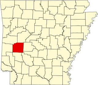
This is a list of the National Register of Historic Places listings in Montgomery County, Arkansas.

<span class="mw-page-title-main">National Register of Historic Places listings in Jackson County, Missouri</span>

This is a list of the National Register of Historic Places listings in Jackson County, Missouri.

<span class="mw-page-title-main">National Register of Historic Places listings in Montgomery County, North Carolina</span>

This list includes properties and districts listed on the National Register of Historic Places in Montgomery County, North Carolina. Click the "Map of all coordinates" link to the right to view an online map of all properties and districts with latitude and longitude coordinates in the table below.

<span class="mw-page-title-main">National Register of Historic Places listings in Montgomery County, Missouri</span>

This is a list of the National Register of Historic Places listings in Montgomery County, Missouri.

References

  1. The latitude and longitude information provided in this table was derived originally from the National Register Information System, which has been found to be fairly accurate for about 99% of listings. Some locations in this table may have been corrected to current GPS standards.
  2. National Park Service, United States Department of the Interior, "National Register of Historic Places: Weekly List Actions", retrieved April 7, 2023.
  3. Numbers represent an alphabetical ordering by significant words. Various colorings, defined here, differentiate National Historic Landmarks and historic districts from other NRHP buildings, structures, sites or objects.
  4. "National Register Information System". National Register of Historic Places . National Park Service. March 13, 2009.
  5. The eight-digit number below each date is the number assigned to each location in the National Register Information System database, which can be viewed by clicking the number.
  6. Hawley, Marlin F., and Richard E. Hughes. "A Source Study of Obsidian from the Infinity Site (14MY305), Kansas". Plains Anthropologist 44.169 (1999): 297-305: 297.