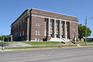
Montgomery County is a county located in Southeast Kansas. Its county seat is Independence, and its most populous city is Coffeyville. As of the 2020 census, the county population was 31,486. The county was named after Richard Montgomery, a major general during the American Revolutionary War.

The Huron River is a 130-mile-long (210 km) river in southeastern Michigan, rising out of the Huron Swamp in Springfield Township in northern Oakland County and flowing into Lake Erie, as it forms the boundary between present-day Wayne and Monroe counties. Thirteen parks, game areas, and recreation areas are associated with the river, which passes through the cities of Dexter, Ann Arbor, Ypsilanti, Belleville, Flat Rock and Rockwood that were developed along its banks.

The Owyhee River is a tributary of the Snake River located in northern Nevada, southwestern Idaho and southeastern Oregon in the United States. It is 280 miles (450 km) long. The river's drainage basin is 11,049 square miles (28,620 km2) in area, one of the largest subbasins of the Columbia Basin. The mean annual discharge is 995 cubic feet per second (28.2 m3/s), with a maximum of 50,000 cu ft/s (1,400 m3/s) recorded in 1993 and a minimum of 42 cu ft/s (1.2 m3/s) in 1954.

The Elk River is in southwestern Oregon in the United States. About 29 miles (47 km) long, the river drains a remote 92-square-mile (240 km2) area of the Coast Range into the Pacific Ocean.
The Middle Santiam River is a tributary of the South Santiam River, 38.5 miles (62.0 km) long, in western Oregon in the United States. It drains a remote area of the Cascade Range east of Sweet Home in the watershed of the Willamette River.
Salt Creek is a 43.4-mile-long (69.8 km) stream in northeastern Illinois. It is an important tributary of the Des Plaines River, part of the Illinois River and ultimately the Mississippi River watersheds. It rises in northwest Cook County at Wilke Marsh in Palatine and flows in a meandering course generally southward through DuPage County, returning to central Cook County and emptying into the Des Plaines River in Riverside, Illinois. Most of the creek's watershed is urbanized, densely populated and flood-prone.

The Black River is a tributary of the White River, about 300 miles (480 km) long, in southeastern Missouri and northeastern Arkansas in the United States. Via the White River, it is part of the Mississippi River watershed. Black River Technical College is named for the river.

The Neosho River is a tributary of the Arkansas River in eastern Kansas and northeastern Oklahoma in the United States. Its tributaries also drain portions of Missouri and Arkansas. The river is about 463 miles (745 km) long. Via the Arkansas, it is part of the Mississippi River watershed. Its name is an Osage word meaning "clear water." The lower section is also known as the Grand River.
The Elk River is a 35.2-mile-long (56.6 km) tributary of the Neosho River in southwestern Missouri and northeastern Oklahoma in the United States. Its tributaries also drain a small portion of northwestern Arkansas. Via the Neosho and Arkansas rivers, the Elk is part of the Mississippi River watershed.

The Verdigris River is a tributary of the Arkansas River in southeastern Kansas and northeastern Oklahoma in the United States. It is about 310 miles (500 km) long. Via the Arkansas, it is part of the Mississippi River watershed.

The Walnut River is a tributary of the Arkansas River, 154 miles (248 km) long, in the Flint Hills region of Kansas in the United States. Via the Arkansas, it is part of the Mississippi River watershed.
Carp River is a 40.2-mile-long (64.7 km) river in Chippewa and Mackinac counties in the U.S. state of Michigan. 21.7 miles (34.9 km) of the river were added to the National Wild and Scenic Rivers System in 1992.
The Middle Fork of the Vermilion River is a tributary of the Vermilion River in Illinois. The Middle Fork rises in Ford County and flows southeast to join the Vermilion near Danville.
Salt Creek is a major tributary to the Sangamon River, which it joins at the boundary between Mason and Menard County, Illinois. There are at least two other Salt Creeks in Illinois, Salt Creek, and in Effingham County, Illinois.

The Caney River is a 180-mile-long (290 km) river in southern Kansas and northeastern Oklahoma. The river is a tributary of the Verdigris River, and is usually a flatwater stream.

The Beaver and Erie Canal, also known as the Erie Extension Canal, was part of the Pennsylvania Canal system and consisted of three sections: the Beaver Division, the Shenango Division, and the Conneaut Division. The canal ran 136 miles (219 km) north–south near the western edge of the state from the Ohio River to Lake Erie through Beaver County, Lawrence County, Mercer County, Crawford County, and Erie County, Pennsylvania.
The Fall River is a Lake Oroville source tributary that drains the south portion of the Middle Fork Feather Watershed. The river enters the lake along the shore of the North Arm 0.39 mi (0.63 km) from the mouth of the North Fork Feather River at the tip of the arm and elevation 928 ft (283 m). The river is notable as the source of water for Feather Falls in the Lake Oroville State Recreation Area.

The Albion Mountains are a mountain range in the U.S. states of Idaho (~99%) and Utah (~1%), spanning Cassia County, Idaho and barely reaching into Box Elder County, Utah. The highest point in the range is Cache Peak at 10,339 feet (3,151 m), and the range is a part of the Basin and Range Province. Most of the mountains are part of the Albion Division of the Minidoka Ranger District of Sawtooth National Forest.
Fall River is a river in southeast Kansas that flows through Greenwood, Elk, and Wilson Counties. The source of the river is in west Greenwood County approximately 4.5 miles northwest of Eureka. It is a tributary of the Verdigris River and its confluence with the Verdigris is approximately 2 miles south of Neodesha. It is also known as the South Verdigris River.
