Longton, Kansas

Last updated

Longton, Kansas
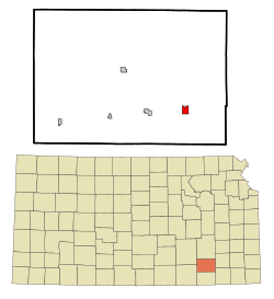
Elk County Kansas Incorporated and Unincorporated areas Longton Highlighted.svg
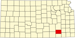
Location within Elk County and Kansas
Map of Elk Co, Ks, USA.png
Coordinates: 37°22′40″N96°04′56″W / 37.37778°N 96.08222°W / 37.37778; -96.08222 [1]
Country United States
State Kansas
County Elk
Founded1870
Incorporated 1870 [2]
Named for Longton, England
Government
[2]
  Type Mayor–Council
Area
[3]
  Total1.18 sq mi (3.06 km2)
  Land1.18 sq mi (3.04 km2)
  Water0.01 sq mi (0.02 km2)
Elevation
[1]
919 ft (280 m)
Population
 (2020) [4]
  Total288
  Density240/sq mi (94/km2)
Time zone UTC-6 (CST)
  Summer (DST) UTC-5 (CDT)
ZIP code
67352
Area code 620
FIPS code 20-42650
GNIS ID 2395760 [1]
Website cityoflongton.com

Longton is a city in Elk County, Kansas, United States, [1] along the Elk River. As of the 2020 census, the population of the city was 288. [4]

Contents

History

Longton was founded in 1870. [5] It was named after Longton, England. [6] [7]

The first post office in Longton was established in August, 1870. [8]

Geography

According to the United States Census Bureau, the city has a total area of 1.16 square miles (3.00 km2), of which, 1.15 square miles (2.98 km2) is land and 0.01 square miles (0.03 km2) is water. [9]

Climate

The climate in this area is characterized by hot, humid summers and generally mild to cool winters. According to the Köppen Climate Classification system, Longton has a humid subtropical climate, abbreviated "Cfa" on climate maps. [10]

Demographics

Historical population
CensusPop.Note
1880 255
1890 624144.7%
1900 564−9.6%
1910 6118.3%
1920 583−4.6%
1930 74427.6%
1940 629−15.5%
1950 478−24.0%
1960 401−16.1%
1970 304−24.2%
1980 39630.3%
1990 389−1.8%
2000 3941.3%
2010 348−11.7%
2020 288−17.2%
U.S. Decennial Census

2010 census

As of the census [11] of 2010, there were 348 people, 147 households, and 97 families residing in the city. The population density was 302.6 inhabitants per square mile (116.8/km2). There were 189 housing units at an average density of 164.3 per square mile (63.4/km2). The racial makeup of the city was 94.3% White, 1.4% Native American, 1.4% from other races, and 2.9% from two or more races. Hispanic or Latino of any race were 4.0% of the population.

There were 147 households, of which 34.7% had children under the age of 18 living with them, 46.3% were married couples living together, 13.6% had a female householder with no husband present, 6.1% had a male householder with no wife present, and 34.0% were non-families. 32.0% of all households were made up of individuals, and 19% had someone living alone who was 65 years of age or older. The average household size was 2.37 and the average family size was 2.93.

The median age in the city was 38.3 years. 29.6% of residents were under the age of 18; 7.5% were between the ages of 18 and 24; 22.4% were from 25 to 44; 23.2% were from 45 to 64; and 17.2% were 65 years of age or older. The gender makeup of the city was 50.3% male and 49.7% female.

2000 census

As of the census [12] of 2000, there were 394 people, 163 households, and 98 families residing in the city. The population density was 342.6 inhabitants per square mile (132.3/km2). There were 193 housing units at an average density of 167.8 per square mile (64.8/km2). The racial makeup of the city was 94.67% White, 2.28% Native American, 0.25% Pacific Islander, 0.76% from other races, and 2.03% from two or more races. Hispanic or Latino of any race were 3.30% of the population.

There were 163 households, out of which 35.0% had children under the age of 18 living with them, 44.8% were married couples living together, 10.4% had a female householder with no husband present, and 39.3% were non-families. 38.0% of all households were made up of individuals, and 24.5% had someone living alone who was 65 years of age or older. The average household size was 2.42 and the average family size was 3.25.

In the city, the population was spread out, with 32.0% under the age of 18, 7.6% from 18 to 24, 21.3% from 25 to 44, 20.6% from 45 to 64, and 18.5% who were 65 years of age or older. The median age was 36 years. For every 100 females, there were 87.6 males. For every 100 females age 18 and over, there were 84.8 males.

The median income for a household in the city was $20,469, and the median income for a family was $29,625. Males had a median income of $23,750 versus $16,477 for females. The per capita income for the city was $10,802. About 13.9% of families and 20.1% of the population were below the poverty line, including 23.9% of those under age 18 and 23.9% of those age 65 or over.

Education

The community is served by Elk Valley USD 283 public school district.

Related Research Articles

<span class="mw-page-title-main">Elk County, Kansas</span> County in Kansas, United States

Elk County is a county located in the U.S. state of Kansas. Its county seat and most populous city is Howard. As of the 2020 census, the county population was 2,483. The county was named for the Elk River.

<span class="mw-page-title-main">Wakefield, Kansas</span> City in Clay County, Kansas

Wakefield is a city in Clay County, Kansas, United States. As of the 2020 census, the population of the city was 858.

<span class="mw-page-title-main">Glasco, Kansas</span> City in Cloud County, Kansas

Glasco is a city in Cloud County, Kansas, United States. As of the 2020 census, the population of the city was 441.

<span class="mw-page-title-main">Waverly, Kansas</span> City in Coffey County, Kansas

Waverly is a city in Coffey County, Kansas, United States. As of the 2020 census, the population of the city was 574.

<span class="mw-page-title-main">Offerle, Kansas</span> City in Edwards County, Kansas

Offerle is a city in Edwards County, Kansas, United States. As of the 2020 census, the population of the city was 179. It is located along Highway 50.

<span class="mw-page-title-main">Elk Falls, Kansas</span> City in Elk County, Kansas

Elk Falls is a city in Elk County, Kansas, United States, along the Elk River. As of the 2020 census, the population of the city was 113.

<span class="mw-page-title-main">Grenola, Kansas</span> City in Elk County, Kansas

Grenola is a city in Elk County, Kansas, United States. As of the 2020 census, the population of the city was 151.

<span class="mw-page-title-main">Howard, Kansas</span> City in Elk County, Kansas

Howard is a city in and the county seat of Elk County, Kansas, United States. As of the 2020 census, the population of the city was 570.

<span class="mw-page-title-main">Severy, Kansas</span> City in Greenwood County, Kansas

Severy is a city in Greenwood County, Kansas, United States. As of the 2020 census, the population of the city was 205.

<span class="mw-page-title-main">Hanston, Kansas</span> City in Hodgeman County, Kansas

Hanston is a city in Hodgeman County, Kansas, United States. As of the 2020 census, the population of the city was 259.

<span class="mw-page-title-main">Holton, Kansas</span> City in Jackson County, Kansas

Holton is a city in and the county seat of Jackson County, Kansas, United States. As of the 2020 census, the population of the city was 3,401.

<span class="mw-page-title-main">Deerfield, Kansas</span> City in Kearny County, Kansas

Deerfield is a city in Kearny County, Kansas, United States. As of the 2020 census, the population of the city was 711. It is located along Highway 50.

<span class="mw-page-title-main">Norwich, Kansas</span> City in Kingman County, Kansas

Norwich is a city in Kingman County, Kansas, United States. As of the 2020 census, the population of the city was 444.

<span class="mw-page-title-main">Elk City, Kansas</span> City in Montgomery County, Kansas

Elk City is a city in Montgomery County, Kansas, United States, along the Elk River. As of the 2020 census, the population of the city was 260.

<span class="mw-page-title-main">Richfield, Kansas</span> City in Morton County, Kansas

Richfield is a city in Morton County, Kansas, United States. As of the 2020 census, the population of the city was 30.

<span class="mw-page-title-main">Galesburg, Kansas</span> City in Neosho County, Kansas

Galesburg is a city in Neosho County, Kansas, United States. As of the 2020 census, the population of the city was 149.

<span class="mw-page-title-main">Utica, Kansas</span> City in Ness County, Kansas

Utica is a city in Ness County, Kansas, United States. As of the 2020 census, the population of the city was 99.

<span class="mw-page-title-main">McCracken, Kansas</span> City in Rush County, Kansas

McCracken is a city in Rush County, Kansas, United States. As of the 2020 census, the population of the city was 152.

<span class="mw-page-title-main">Collyer, Kansas</span> City in Trego County, Kansas, United States

Collyer is a city in Trego County, Kansas, United States. As of the 2020 census, the population of the city was 97. It is located approximately 12 miles west of WaKeeney.

<span class="mw-page-title-main">Yates Center, Kansas</span> City in Woodson County, Kansas, United States

Yates Center is a city in and the county seat of Woodson County, Kansas, United States. As of the 2020 census, the population of the city was 1,352.

References

  1. 1 2 3 4 U.S. Geological Survey Geographic Names Information System: Longton, Kansas
  2. 1 2 "City of Longton". The League of Kansas Municipalities. May 29, 2019.
  3. "2019 U.S. Gazetteer Files". United States Census Bureau. Retrieved July 24, 2020.
  4. 1 2 "Profile of Longton, Kansas in 2020". United States Census Bureau. Archived from the original on May 4, 2022. Retrieved May 4, 2022.
  5. "Elk County". Blue Skyways. Kansas State Library. Retrieved June 9, 2014.
  6. Kansas State Historical Society (1916). Biennial Report of the Board of Directors of the Kansas State Historical Society. Kansas State Printing Plant. p. 185.
  7. Gannett, Henry (1905). The Origin of Certain Place Names in the United States. U.S. Government Printing Office. p. 190.
  8. "Kansas Post Offices, 1828-1961 (archived)". Kansas Historical Society. Archived from the original on October 9, 2013. Retrieved June 8, 2014.
  9. "US Gazetteer files 2010". United States Census Bureau. Archived from the original on July 2, 2012. Retrieved July 6, 2012.
  10. Climate Summary for Longton, Kansas
  11. "U.S. Census website". United States Census Bureau . Retrieved July 6, 2012.
  12. "U.S. Census website". United States Census Bureau . Retrieved January 31, 2008.

Further reading