Oak Valley, Kansas | |
|---|---|
 | |
 Oak Valley  Oak Valley | |
| Coordinates: 37°20′36″N96°00′36″W / 37.34333°N 96.01000°W [1] | |
| Country | United States |
| State | Kansas |
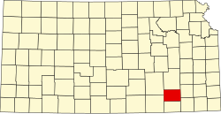
| County | Elk |
| Elevation | 869 ft (265 m) |
| Time zone | UTC-6 (CST) |
| • Summer (DST) | UTC-5 (CDT) |
| Area code | 620 |
| FIPS code | 20-51925 |
| GNIS ID | 469858 [1] |
Oak Valley is an unincorporated community in Elk County, Kansas, United States. [1] It is located along U.S. Route 160 between Longton and Elk City.