A post office was opened in Wayside in 1887, and remained in operation until it was discontinued in 1984.[3]
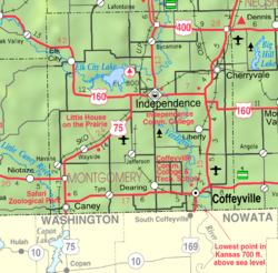
Approximately 2 miles east of Wayside, along Laura Ingalls Wilder Rd, is the original location of the Little House on the Prairie,[4] the Kansas home of Laura Ingalls Wilder; a reconstruction of the house, along with a museum and relocated period buildings, are located at this site. Their 3rd daughter, Carrie, was born here on August 3, 1870.[5]
This page is based on this Wikipedia article Text is available under the CC BY-SA 4.0 license; additional terms may apply. Images, videos and audio are available under their respective licenses.