Lebo, Kansas

Last updated

Lebo, Kansas
Aerial view of Lebo Kansas 9-14-2014.JPG
Aerial view of Lebo (2014)
Lebo, Kansas logo.png
Coffey County Kansas Incorporated and Unincorporated areas Lebo Highlighted.svg
Location within Coffey County and Kansas
Map of Coffey Co, Ks, USA.png
Coordinates: 38°24′57″N95°51′44″W / 38.41583°N 95.86222°W / 38.41583; -95.86222 [1]
Country United States
State Kansas
County Coffey
Founded1883
Incorporated 1886
Area
[2]
  Total1.04 sq mi (2.71 km2)
  Land0.96 sq mi (2.48 km2)
  Water0.09 sq mi (0.23 km2)
Elevation
[1]
1,165 ft (355 m)
Population
 (2020) [3]
  Total885
  Density850/sq mi (330/km2)
Time zone UTC-6 (CST)
  Summer (DST) UTC-5 (CDT)
ZIP code
66856
Area code 620
FIPS code 20-39125
GNIS ID 2395666 [1]
Website leboks.org

Lebo is a city in Coffey County, Kansas, United States. [1] As of the 2020 census, the population of the city was 885. [3]

Contents

History

Lebo was founded in 1883. [4] It was named for Capt. Joe Lebo, a pioneer settler. [5]

The first post office in Lebo was established on June 4, 1883. [6]

Geography

According to the United States Census Bureau, the city has a total area of 1.05 square miles (2.72 km2), of which 0.96 square miles (2.49 km2) is land and 0.09 square miles (0.23 km2) is water. [7]

Climate

The climate in this area is characterized by hot, humid summers and generally mild to cool winters. According to the Köppen Climate Classification system, Lebo has a humid subtropical climate, abbreviated "Cfa" on climate maps. [8]

Area attractions

Attractions of interest to travelers include Lebo Lake, John Redmond Reservoir, Melvern Reservoir, Coffey County Lake, Beto Junction, historic Arvonia town and the Coffey County Museum.

Demographics

Historical population
CensusPop.Note
1890 538
1900 60512.5%
1910 560−7.4%
1920 5722.1%
1930 5903.1%
1940 522−11.5%
1950 57510.2%
1960 498−13.4%
1970 58918.3%
1980 96664.0%
1990 835−13.6%
2000 96115.1%
2010 940−2.2%
2020 885−5.9%
U.S. Decennial Census

2010 census

As of the census [9] of 2010, there were 940 people, 371 households, and 272 families living in the city. The population density was 979.2 inhabitants per square mile (378.1/km2). There were 411 housing units at an average density of 428.1 per square mile (165.3/km2). The racial makeup of the city was 98.9% White, 0.3% African American, 0.2% Native American, 0.1% from other races, and 0.4% from two or more races. Hispanic or Latino of any race were 1.4% of the population.

There were 371 households, of which 35.3% had children under the age of 18 living with them, 59.0% were married couples living together, 9.4% had a female householder with no husband present, 4.9% had a male householder with no wife present, and 26.7% were non-families. 22.4% of all households were made up of individuals, and 9.1% had someone living alone who was 65 years of age or older. The average household size was 2.53 and the average family size was 2.94.

The median age in the city was 40.4 years. 26.1% of residents were under the age of 18; 8.2% were between the ages of 18 and 24; 22.9% were from 25 to 44; 26% were from 45 to 64; and 16.8% were 65 years of age or older. The gender makeup of the city was 52.1% male and 47.9% female.

2000 census

As of the census [10] of 2000, there were 961 people, 371 households, and 271 families living in the city. The population density was 969.2 inhabitants per square mile (374.2/km2). There were 387 housing units at an average density of 390.3 per square mile (150.7/km2). The racial makeup of the city was 96.88% White, 0.42% Native American, 1.56% from other races, and 1.14% from two or more races. Hispanic or Latino of any race were 2.81% of the population.

There were 371 households, out of which 35.8% had children under the age of 18 living with them, 60.6% were married couples living together, 7.8% had a female householder with no husband present, and 26.7% were non-families. 23.2% of all households were made up of individuals, and 12.1% had someone living alone who was 65 years of age or older. The average household size was 2.59 and the average family size was 3.04.

In the city, the population was spread out, with 28.6% under the age of 18, 6.6% from 18 to 24, 27.2% from 25 to 44, 22.7% from 45 to 64, and 15.0% who were 65 years of age or older. The median age was 36 years. For every 100 females, there were 99.8 males. For every 100 females age 18 and over, there were 90.0 males.

The median income for a household in the city was $39,297, and the median income for a family was $45,089. Males had a median income of $31,058 versus $19,821 for females. The per capita income for the city was $16,532. About 4.6% of families and 5.2% of the population were below the poverty line, including 1.8% of those under age 18 and 10.7% of those age 65 or over.

Education

The community is served by Lebo–Waverly USD 243 public school district, and has two schools in the city: Lebo High School and Lebo Grade School.

See also

Related Research Articles

<span class="mw-page-title-main">Coffey County, Kansas</span> County in Kansas, United States

Coffey County is a county located in Eastern Kansas. Its county seat and most populous city is Burlington. As of the 2020 census, the county population was 8,360. It was named after A.M. Coffey, a territorial legislator and Free-Stater during Bleeding Kansas era.

<span class="mw-page-title-main">Cedar Vale, Kansas</span> City in Chautauqua County, Kansas

Cedar Vale is a city in Chautauqua County, Kansas, United States. As of the 2020 census, the population of the city was 476.

<span class="mw-page-title-main">Burlington, Kansas</span> City in Coffey County, Kansas, United States

Burlington is a city in and the county seat of Coffey County, Kansas, United States. As of the 2020 census, the population of the city was 2,634.

<span class="mw-page-title-main">Gridley, Kansas</span> City in Coffey County, Kansas

Gridley is a city in Coffey County, Kansas, United States. As of the 2020 census, the population of the city was 313.

<span class="mw-page-title-main">LeRoy, Kansas</span> City in Coffey County, Kansas

LeRoy is a city in Coffey County, Kansas, United States. As of the 2020 census, the population of the city was 451.

<span class="mw-page-title-main">New Strawn, Kansas</span> City in Coffey County, Kansas

New Strawn is a city in Coffey County, Kansas, United States. As of the 2020 census, the population of the city was 414.

<span class="mw-page-title-main">Waverly, Kansas</span> City in Coffey County, Kansas

Waverly is a city in Coffey County, Kansas, United States. As of the 2020 census, the population of the city was 574.

<span class="mw-page-title-main">Williamsburg, Kansas</span> City in Franklin County, Kansas

Williamsburg is a city in Franklin County, Kansas, United States. As of the 2020 census, the population of the city was 390.

<span class="mw-page-title-main">Gove City, Kansas</span> City in Gove County, Kansas

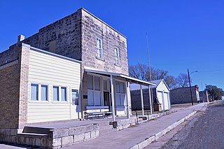
Gove City, more commonly known as Gove, is a city in and the county seat of Gove County, Kansas, United States. As of the 2020 census, the population of the city was 80.

<span class="mw-page-title-main">Copeland, Kansas</span> City in Gray County, Kansas

Copeland is a city in Gray County, Kansas, United States. As of the 2020 census, the population of the city was 251.

<span class="mw-page-title-main">Montezuma, Kansas</span> City in Gray County, Kansas

Montezuma is a city in Gray County, Kansas, United States. As of the 2020 census, the population of the city was 975.

<span class="mw-page-title-main">Kingman, Kansas</span> City in Kingman County, Kansas

Kingman is a city in and the county seat of Kingman County, Kansas, United States. As of the 2020 census, the population of the city was 3,105.

<span class="mw-page-title-main">Norwich, Kansas</span> City in Kingman County, Kansas

Norwich is a city in Kingman County, Kansas, United States. As of the 2020 census, the population of the city was 444.

<span class="mw-page-title-main">Easton, Kansas</span> City in Kansas, United States

Easton is a city in Leavenworth County, Kansas, United States, and part of the Kansas City metropolitan area. As of the 2020 census, the population of the city was 213.

<span class="mw-page-title-main">Mound City, Kansas</span> City and County seat in Kansas, United States

Mound City is a city in and the county seat of Linn County, Kansas, United States. As of the 2020 census, the population of the city was 647.

<span class="mw-page-title-main">Meade, Kansas</span> City in Meade County, Kansas

Meade is a city in and the county seat of Meade County, Kansas, United States. As of the 2020 census, the population of the city was 1,505.

<span class="mw-page-title-main">Lyndon, Kansas</span> City in Osage County, Kansas

Lyndon is a city in, and the county seat of Osage County, Kansas, United States. As of the 2020 census, the population of the city was 1,037.

<span class="mw-page-title-main">Melvern, Kansas</span> City in Osage County, Kansas

Melvern is a city in Osage County, Kansas, United States, along the Marais des Cygnes River. As of the 2020 census, the population of the city was 356.

<span class="mw-page-title-main">Olivet, Kansas</span> City in Osage County, Kansas

Olivet is a city in Osage County, Kansas, United States. As of the 2020 census, the population of the city was 73. It is located near the south side of Melvern Lake.

<span class="mw-page-title-main">Lowell, Oregon</span> City in Oregon, United States

Lowell is a city in Lane County, in the U.S. state of Oregon. As of the 2010 census, the city population was 1,045. The city is on the north shore of Dexter Reservoir on the Middle Fork Willamette River. The most used route to Lowell is along Lowell Bridge, a covered bridge that crosses the reservoir from Oregon Route 58.

References

  1. 1 2 3 4 U.S. Geological Survey Geographic Names Information System: Lebo, Kansas
  2. "2019 U.S. Gazetteer Files". United States Census Bureau. Retrieved July 24, 2020.
  3. 1 2 "Profile of Lebo, Kansas in 2020". United States Census Bureau. Archived from the original on June 4, 2022. Retrieved June 4, 2022.
  4. Kansas State Historical Society (1916). Biennial Report of the Board of Directors of the Kansas State Historical Society. Kansas State Printing Plant. p. 165.
  5. Heim, Michael (2007). Exploring Kansas Highways. p. 9. ISBN   9780974435886.
  6. "Kansas Post Offices, 1828-1961 (archived)". Kansas Historical Society. Archived from the original on October 9, 2013. Retrieved June 6, 2014.
  7. "US Gazetteer files 2010". United States Census Bureau. Archived from the original on January 25, 2012. Retrieved July 6, 2012.
  8. Climate Summary for Lebo, Kansas
  9. "U.S. Census website". United States Census Bureau . Retrieved July 6, 2012.
  10. "U.S. Census website". United States Census Bureau . Retrieved January 31, 2008.

Further reading