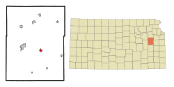
Colony is a city in Anderson County, Kansas, United States. As of the 2020 census, the population of the city was 381.

Powhattan is a city in Brown County, Kansas, United States. As of the 2020 census, the population of the city was 69.

Peru is a city in Chautauqua County, Kansas, United States. As of the 2020 census, the population of the city was 101.

Waverly is a city in Coffey County, Kansas, United States. As of the 2020 census, the population of the city was 574.

Hepler is a city in Crawford County, Kansas, United States. As of the 2020 census, the population of the city was 90.

Norcatur is a city in Decatur County, Kansas, United States. As of the 2020 census, the population of the city was 159.

Ford is a city in Ford County, Kansas, United States. As of the 2020 census, the population of the city was 203.

Park is a city in Gove County, Kansas, United States. As of the 2020 census, the population of the city was 112.

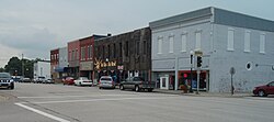
Hoyt is a city in Jackson County, Kansas, United States. As of the 2020 census, the population of the city was 593.

Mission is a city in Johnson County, Kansas, United States, and part of the Kansas City Metropolitan Area. As of the 2020 census, the population of the city was 9,954.

Parker is a city in Linn County, Kansas, United States. As of the 2020 census, the population of the city was 241.

Dearing is a city in Montgomery County, Kansas, United States. As of the 2020 census, the population of the city was 382.
Elk City is a city in Montgomery County, Kansas, United States, along the Elk River. As of the 2020 census, the population of the city was 260.

Lenora is a city in Norton County, Kansas, United States. As of the 2020 census, the population of the city was 207.

Logan is a city in Phillips County, Kansas, United States. As of the 2020 census, the population of the city was 460.
Iuka is a city in Pratt County, Kansas, United States. As of the 2020 census, the population of the city was 151.

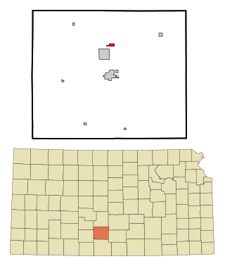
Chase is a city in Rice County, Kansas, United States. As of the 2020 census, the population of the city was 396.
Raymond is a city in Rice County, Kansas, United States. It is named after Emmons Raymond, former Director of the Atchison, Topeka and Santa Fe Railway. As of the 2020 census, the population of the city was 85.

Randolph is a city in Riley County, Kansas, United States. As of the 2020 census, the population of the city was 159.

Bel Aire is a city in Sedgwick County, Kansas, United States, and a suburb of Wichita. As of the 2020 census, the population of the city was 8,262.