Salt Springs Township | |
|---|---|
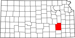
 Location in Greenwood County | |
| Coordinates: 37°40′15″N096°02′31″W / 37.67083°N 96.04194°W | |
| Country | United States |
| State | Kansas |
| County | Greenwood |
| Area | |
• Total | 74.22 sq mi (192.22 km2) |
| • Land | 70.4 sq mi (182.3 km2) |
| • Water | 3.83 sq mi (9.92 km2) 5.16% |
| Elevation | 1,053 ft (321 m) |
| Population (2000) | |
• Total | 463 |
| • Density | 6.5/sq mi (2.5/km2) |
| GNIS feature ID | 0474887 |
Salt Springs Township is a township in Greenwood County, Kansas, United States. As of the 2000 census, its population was 463.