Greenwood County is a county located in the southeast portion of the U.S. state of Kansas. Its county seat and most populous city is Eureka. As of the 2020 census, the county population was 6,016. The county was named for Alfred Greenwood, a U.S. congressman from Arkansas that advocated Kansas statehood.

Madison is a city in Greenwood County, Kansas, United States, along the Verdigris River. As of the 2020 census, the population of the city was 689.

Berryton is an unincorporated community in Shawnee County, Kansas, United States. It is located east of the Topeka Regional Airport.

Nekoma is an unincorporated community in Rush County, Kansas, United States. It lies along K-96 southwest of the city of La Crosse.

Falun is an unincorporated community in southwestern Saline County, Kansas, United States. As of the 2020 census, the population of the community and nearby areas was 83. It lies southwest of Salina and northwest of Lindsborg at the intersection of Forsse Road and Hedberg Road, about 7.5 miles west of Interstate 135 highway, or about 8 miles west of Assaria. It lies next to an abandoned railroad.
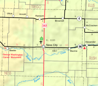
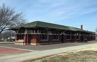
Arnold is an unincorporated community in Ness County, Kansas, United States. It lies along K-4, north-northwest of the city of Ness City.

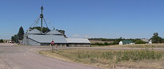
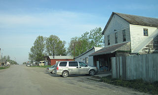
Beeler is an unincorporated community in Ness County, Kansas, United States. It lies along K-96, west of the city of Ness City, the county seat of Ness County. It has a post office with the ZIP code 67518.
Angora is an unincorporated community in northern Morrill County, Nebraska, United States. It lies along U.S. Route 385, north of the city of Bridgeport, the county seat of Morrill County. The community was established in 1900 by the Chicago, Burlington, and Quincy Railroad; it was named for the Turkish city of Ankara, which was then known as Angora. The Angora post office was established in 1901, and it remains open with the assigned ZIP code of 69331.

Neal is an unincorporated community in eastern Greenwood County, Kansas, United States. As of the 2020 census, the population of the community and nearby areas was 37. It is located approximately 10 miles east of the city of Eureka along U.S. Route 54 highway.

Denmark is an unincorporated community and census-designated place in northeastern Lee County, Iowa, United States. It lies along Iowa Highway 16, north of the city of Fort Madison, the county seat of Lee County. Its elevation is 722 feet (220 m) above sea level. Although Denmark is unincorporated, it has a post office with the ZIP code of 52624, that opened on April 7, 1846. The town also has a branch of Farmers Savings Bank that opened in 1935. The community is part of the Fort Madison–Keokuk, IA-MO Micropolitan Statistical Area. As of the 2020 census, its population was 425.
Argyle is an unincorporated community in southwestern Lee County, Iowa, United States. As of the 2020 census, its population was 91.
Pilot Grove is an unincorporated community in northern Lee County, Iowa, United States. It lies along local roads northwest of the city of Fort Madison, the county seat of Lee County. Its elevation is 643 feet (196 m).
Kirkland is an unincorporated community in central Yavapai County, Arizona, United States, near the Weaver Mountains. It is southwest of the city of Prescott, the county seat of Yavapai County. Its elevation is 3,930 feet (1,198 m). Although Kirkland is unincorporated, it has a post office, with the ZIP code of 86332.

Cat Spring is an unincorporated community in southern Austin County, Texas, United States. According to the Handbook of Texas, it had a population of 76 in 2000. Cat Spring was one of the first German/American settlements in Texas, and the location of Texas' first agricultural society.
Waka is an unincorporated community in western Ochiltree County, Texas, United States. It lies along State Highway 15 southwest of the city of Perryton, the county seat of Ochiltree County. Its elevation is 3,045 feet (928 m). Although Waka is unincorporated, it has a post office, with the ZIP code of 79093; the ZCTA for ZIP code 79093 had a population of 76 at the 2000 census.
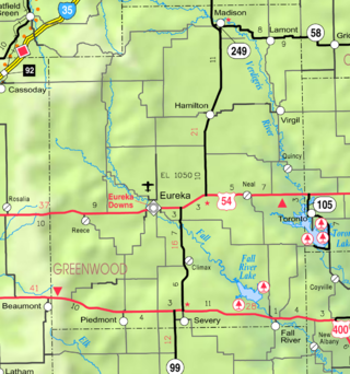
Piedmont is an unincorporated community in Greenwood County, Kansas, United States. As of the 2020 census, the population of the community and nearby areas was 52. It is located approximately 7 miles (11 km) west of the city of Severy.

Edson is an unincorporated community in Sherman County, Kansas, United States. As of the 2020 census, the population of the community and nearby areas was 17. Edson is located near Interstate 70, 9 miles (14 km) east of Goodland.
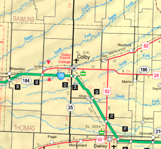
Levant is an unincorporated community in Thomas County, Kansas, United States. As of the 2020 census, the population of the community and nearby areas was 68. It is located approximately 7.5 miles (12.1 km) west of Colby.

Weskan is an unincorporated community in Wallace County, Kansas, United States. As of the 2020 census, the population of the community and nearby areas was 158. It is located along U.S. Route 40, 11.5 miles (18.5 km) west-southwest of Sharon Springs. It is the closest community to Mount Sunflower, the highest point in Kanas.

Madison–Virgil USD 386 is a public unified school district headquartered in Madison, Kansas, United States. The district includes the communities of Madison, Virgil, Lamont, and nearby rural areas.


