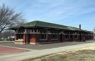
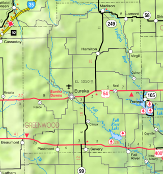
Thrall is a ghost town in Greenwood County, Kansas, United States. [1]
Contents

Thrall is a ghost town in Greenwood County, Kansas, United States. [1]
A post office opened in Thrall in 1885, closed in 1905, reopened in 1926, and reclosed in 1962. [2]
Thrall's elevation is 1,371 feet (418 meters). [3]

Riley County is a county located in the U.S. state of Kansas. Its county seat and largest city is Manhattan. As of the 2020 census, the population was 71,959. The county was named after Bennet Riley, the 7th governor of California, and a Mexican–American War hero. Riley County is home to Fort Riley and Kansas State University.

Hodgeman County is a county located in the U.S. state of Kansas. Its county seat and most populous city is Jetmore. As of the 2020 census, the county population was 1,723. It was named for Amos Hodgman, a member of the 7th Regiment Kansas Volunteer Cavalry.
Greenwood County is a county located in the southeast portion of the U.S. state of Kansas. Its county seat and most populous city is Eureka. As of the 2020 census, the county population was 6,016. The county was named for Alfred Greenwood, a U.S. congressman from Arkansas that advocated Kansas statehood.

Fort Hays, originally named Fort Fletcher, was a United States Army fort near Hays, Kansas. Active from 1865 to 1889 it was an important frontier post during the American Indian Wars of the late 19th century. Reopened as a historical park in 1929, it is now operated by the Kansas Historical Society as the Fort Hays State Historic Site.

Thurman is a ghost town in Chase County, Kansas, United States. It was located southeast of Matfield Green in the rural Flint Hills.
Wonsevu is an unincorporated community in southwest Chase County, Kansas, United States. It is located at the intersection of Cedar Creek Rd and E Rd, which is 4.5 miles (7.2 km) north of the Chase-Butler county line and 3.75 miles (6.04 km) east of the Chase-Marion county line in the Flint Hills.
Oil Hill, Kansas is a ghost town in Butler County, Kansas, United States.

Gnadenau was a communal village of German-speaking Mennonite immigrants from Russia in Marion County, Kansas, United States. It is currently a ghost town that was located approximately 2 miles (3.2 km) southeast of Hillsboro. No buildings remain at this former community site. The Gnadenau Cemetery still exists.
Peoria is an unincorporated community in Franklin County, Kansas, United States.
Oursler is a ghost town in Marion County, Kansas, United States. It is currently a ghost town that was located approximately 3.5 miles southeast of Marion next to a former railroad. No buildings remain of this former community.
Cave Springs is a ghost town in Elk County, Kansas, United States.
Fiat is a ghost town in Paw Paw Township, Elk County, Kansas, United States.
Ivanpah is a ghost town in Greenwood County, Kansas, United States.
Teterville is a ghost town in Greenwood County, Kansas, United States. It is located approximately 11 miles east of Cassoday. No buildings remain of this former community.
Utopia is a ghost town in Greenwood County, Kansas, United States.
Johnstown is a ghost town in McPherson County, Kansas, United States.

Bradford is a ghost town in Wabaunsee County, Kansas, United States. It was located between Eskridge and Harveyville.
Wingate is a ghost town in Butler County, Kansas, United States. No buildings remain at this former community site.
Ellinor is a ghost town in Toledo Township, Chase County, Kansas, United States. It was located southwest of Saffordville, where the BNSF Railway splits.

Comiskey is a ghost town in Morris County, Kansas, United States. It was located approximately 6 miles (9.7 km) east of Council Grove, next to the county line.
Municipalities and communities of Greenwood County, Kansas, United States | ||
|---|---|---|
| Cities |  | |
| Unincorporated communities | ||
| Ghost towns | ||
| Townships | ||
| Footnotes | †This community is designated a Census-Designated Place (CDP) by the United States Census Bureau. | |
38°00′36″N96°19′16″W / 38.01000°N 96.32111°W
| | This article about a location in Greenwood County, Kansas is a stub. You can help Wikipedia by expanding it. |