Salem Township | |
|---|---|
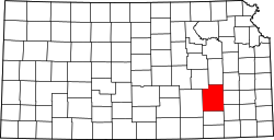
 Location in Greenwood County | |
| Coordinates: 38°01′15″N096°26′01″W / 38.02083°N 96.43361°W | |
| Country | United States |
| State | Kansas |
| County | Greenwood |
| Area | |
• Total | 90.72 sq mi (234.96 km2) |
| • Land | 89.91 sq mi (232.87 km2) |
| • Water | 0.81 sq mi (2.1 km2) 0.89% |
| Elevation | 1,565 ft (477 m) |
| Population (2000) | |
• Total | 35 |
| • Density | 0.52/sq mi (0.2/km2) |
| GNIS feature ID | 0474421 |
Salem Township is a township in Greenwood County, Kansas, United States. As of the 2000 census, its population was 35.