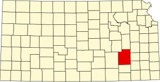
Greenwood County is a county located in the southeast portion of the U.S. state of Kansas. Its county seat and most populous city is Eureka. As of the 2020 census, the county population was 6,016. The county was named for Alfred Greenwood, a U.S. congressman from Arkansas that advocated Kansas statehood.

The provinces of Sweden are historical, geographical and cultural regions. Sweden has 25 provinces; they have no administrative function, but remain historical legacies and a means of cultural identification as pertains, for example, to dialects and folklore.

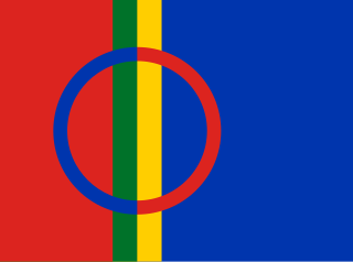
Lapland is the largest and northernmost region of Finland. The 21 municipalities in the region cooperate in a Regional Council. Lapland borders the region of North Ostrobothnia in the south. It also borders the Gulf of Bothnia, Norrbotten County in Sweden, Troms and Finnmark County in Norway, and Murmansk Oblast and the Republic of Karelia in Russia. Topography varies from vast mires and forests of the South to fells in the North. The Arctic Circle crosses Lapland, so polar phenomena such as the midnight sun and polar night can be viewed in Lapland.

Lapland, also known by its Swedish name Lappland, is a province in northernmost Sweden. It borders Jämtland, Ångermanland, Västerbotten, Norrbotten, Norway and Finland. Nearly a quarter of Sweden's land area is in Lappland.

Southeast Kansas is a region of the U.S. state of Kansas. It can be roughly defined by Woodson County in the northwest, Bourbon County in the northeast, Cherokee County in the southeast, and Montgomery County in the southwest. Geographically it is dominated by a broad rolling landscape located between the Flint Hills to the west and includes the Ozarks to the southeast. Some notable towns there include Pittsburg, Parsons, Coffeyville, Independence, Chanute, Fort Scott, and Iola.

Fred Schuyler Jackson was a U.S. Representative from Kansas.
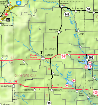
Lamont is an unincorporated community in northeastern Greenwood County, Kansas, United States. It is located approximately 5.5 miles east of the city of Madison along K-58 highway.

Neal is an unincorporated community in eastern Greenwood County, Kansas, United States. As of the 2020 census, the population of the community and nearby areas was 37. It is located approximately 10 miles east of the city of Eureka along U.S. Route 54 highway.
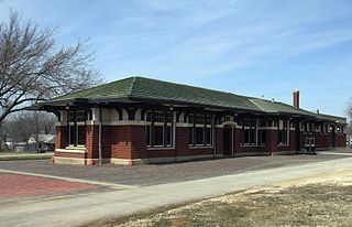
This is a list of the National Register of Historic Places listings in Greenwood County, Kansas.
Piedmont is an unincorporated community in Greenwood County, Kansas, United States. As of the 2020 census, the population of the community and nearby areas was 52. It is located approximately 7 miles (11 km) west of the city of Severy.
Quincy is an unincorporated community in Greenwood County, Kansas, United States. It is located between Eureka and Yates Center in a rural area.
Reece is an unincorporated community in Greenwood County, Kansas, United States. It is located approximately 7.5 miles west of the city of Eureka.

Thrall is a ghost town in Greenwood County, Kansas, United States.
Ivanpah is a ghost town in Greenwood County, Kansas, United States.
Teterville is a ghost town in Greenwood County, Kansas, United States. It is located approximately 11 miles east of Cassoday. No buildings remain of this former community.
Utopia is a ghost town in Greenwood County, Kansas, United States.
Fall River Lake is a reservoir in Greenwood County, Kansas, United States.
Tonovay is an unincorporated community in Greenwood County, Kansas, United States. It is located approximately 5 miles east of the city of Eureka along K-99 highway.