List of bridges on the National Register of Historic Places in Illinois

Last updated

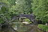
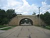
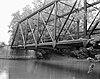
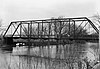
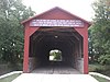
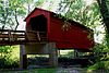
This is a list of bridges and tunnels on the National Register of Historic Places in the U.S. state of Illinois. [1]

NameImageBuiltListedLocationCountyType
Airtight Bridge Airtight Bridge.jpg 19141981-11-30 Charleston
39°32′57″N88°5′36″W / 39.54917°N 88.09333°W / 39.54917; -88.09333 (Airtight Bridge)
Coles Pratt through-truss
Babylon Bend Bridge ca. 18901980-10-29 Ellisville
40°35′6″N90°20′53″W / 40.58500°N 90.34806°W / 40.58500; -90.34806 (Babylon Bend Bridge)
Fulton Pratt
Bernadotte Bridge 19031980-10-29 Smithfield Fulton Pratt
Blakeman Bridge Blakeman Bridge.jpg 19071981-11-30 Charleston
39°26′58″N88°9′1″W / 39.44944°N 88.15028°W / 39.44944; -88.15028 (Blakeman Bridge)
Coles triple arch, concrete
Bolivia Road Bridge 19012004-01-28 Bolivia
39°46′9″N89°20′44″W / 39.76917°N 89.34556°W / 39.76917; -89.34556 (Bolivia Road Bridge)
Sangamon Parker Through Truss
Bridge at Thirteenth Street 2016-04-26 St. Francisville
38°35′34.5″N87°39′12″W / 38.592917°N 87.65333°W / 38.592917; -87.65333 (Bridge at Thirteenth Street)
Lawrence
Buckeye Bridge Whites-ferry or-buckeye fulton-co-il bridge.jpg 19101980-10-29 Smithfield
40°31′54″N90°18′40″W / 40.53167°N 90.31111°W / 40.53167; -90.31111 (Buckeye Bridge)
Fulton Parker
Camelback Bridge Camelback Bridge, Normal, Illinois.jpeg 1997-05-15 Normal
40°29′53.5″N88°59′1″W / 40.498194°N 88.98361°W / 40.498194; -88.98361 (Camelback Bridge)
McLean King post
Cemetery Road Bridge Image Cemetery Road Bridge.jpeg 18941998-05-20 Washington
40°41′51″N89°24′41″W / 40.69750°N 89.41139°W / 40.69750; -89.41139 (Cemetery Road Bridge)
Tazewell Stone double arch bridge
Chain of Rocks Bridge ChainOfRocksBridge StLouisMO.jpg 1929, 19362006-12-01 Madison Madison Warren Truss
Chicago & North Western Railway Stone Arch Bridge 18821993-08-19 Roscoe
42°24′57″N88°59′51″W / 42.41583°N 88.99750°W / 42.41583; -88.99750 (Chicago & North Western Railway Stone Arch Bridge)
Winnebago Stone arch bridge
Duncan Mills Bridge ca. 19101980-10-29 Lewistown Fulton Parker
Eads Bridge Eadsillinois.JPG 1867, 18741966-10-15 East St. Louis
38°37′45″N90°11′8″W / 38.62917°N 90.18556°W / 38.62917; -90.18556 (Eads Bridge)
St. Clair Cantilever deck arch
Embarras River Bridge Old Embarras River Bridge at Newton.jpg 18901998-05-20 Newton
38°59′43″N88°9′43″W / 38.99528°N 88.16194°W / 38.99528; -88.16194 (Embarras River Bridge)
Jasper Pratt through truss
Fall Creek Stone Arch Bridge Fall Creek Stone Arch Bridge HABS1.jpg 18551996-11-07 Payson
39°47′6″N91°18′8″W / 39.78500°N 91.30222°W / 39.78500; -91.30222 (Fall Creek Stone Arch Bridge)
Adams stone arch bridge
Fountain Creek Bridge 18491978-12-22 Waterloo
38°19′33″N90°11′45″W / 38.32583°N 90.19583°W / 38.32583; -90.19583 (Fountain Creek Bridge)
Monroe
General Dean Suspension Bridge General Dean Suspension Bridge.jpg 18591973-04-03 Carlyle
38°36′40″N89°21′26″W / 38.61111°N 89.35722°W / 38.61111; -89.35722 (General Dean Suspension Bridge)
Clinton
Harrison Street Bridge 18981981-11-30 Charleston
39°29′8″N88°6′57″W / 39.48556°N 88.11583°W / 39.48556; -88.11583 (Harrison Street Bridge)
Coles Camelback Parker truss
Hazen Bridge Hazen Bridge.jpg 18931994-05-06 Mahomet
40°15′9″N88°23′1″W / 40.25250°N 88.38361°W / 40.25250; -88.38361 (Hazen Bridge)
Champaign Pratt through truss
Illinois Central Stone Arch Railroad Bridges Dixon Il ICRR Second St Bridge7.jpg 1852, 18551987-12-02 Dixon Lee
Indian Ford Bridge Fulton County Indian Ford Bridge1.jpg ca. 19171980-10-29 London Mills
40°41′25″N90°17′24″W / 40.69028°N 90.29000°W / 40.69028; -90.29000 (Indian Ford Bridge)
Fulton Pratt
London Mills Bridge Fulton County London Mills Bridge1.jpg 18831980-10-29 London Mills
40°42′36″N90°16′0″W / 40.71000°N 90.26667°W / 40.71000; -90.26667 (London Mills Bridge)
Fulton Pratt
Lyndon Bridge Lyndon Il Lyndon Bridge1.jpg 1894, 19122003-05-09 Lyndon
41°42′40″N89°55′27″W / 41.71111°N 89.92417°W / 41.71111; -89.92417 (Lyndon Bridge)
Whiteside Parker Pratt through truss
Mary's River Covered Bridge Mary's River Covered Bridge.jpg 18541974-12-31 Chester
37°56′55″N89°45′57″W / 37.94861°N 89.76583°W / 37.94861; -89.76583 (Mary's River Covered Bridge)
Randolph Burr Arch design
Ninth Street Seven Arch Stone Bridge 1868, 1869, 19022004-08-20 Lockport
41°35′36″N88°3′53″W / 41.59333°N 88.06472°W / 41.59333; -88.06472 (Ninth Street Seven Arch Stone Bridge)
Will Stone Arch Bridge
Old Stone Arch Bridge ca. 18321978-11-28 Clark Center
39°22′13″N87°45′29″W / 39.37028°N 87.75806°W / 39.37028; -87.75806 (Old Stone Arch Bridge)
Clark
Old Stone Arch, National Road Old Stone Arch Bridge, National Road, Marshall, IL, US.jpg 1975-02-20 Marshall
39°23′13″N87°42′30″W / 39.38694°N 87.70833°W / 39.38694; -87.70833 (Old Stone Arch, National Road)
Clark
Oquawka Wagon Bridge Oquawka Wagon Bridge.jpg 18661975-02-24 Oquawka Henderson Burr Arch Truss
Red Covered Bridge Red Covered Bridge in Princeton IL.jpg 18631975-04-23 Princeton
41°24′59″N89°28′43″W / 41.41639°N 89.47861°W / 41.41639; -89.47861 (Red Covered Bridge)
Bureau
Savanna-Sabula Bridge MSRiverBridgeSavannaSabulaMay2004.jpg 19311999-08-27 Savanna
42°6′14″N90°10′1″W / 42.10389°N 90.16694°W / 42.10389; -90.16694 (Savanna-Sabula Bridge)
Carroll Cantilever through truss
Seville Bridge Seville Bridge3 NRHP 80001359 Fulton County, IL.jpg ca. 18801980-10-29 Seville Fulton Parker
Sixth, Seventh, and Tenth Street Stone Arch Bridges Sixth Street Stone Arch Bridge.jpg 2001-08-08 Charleston Coles Stone arch bridge
Stone Arch Bridge 2012-09-19-champaign-stone-arch-bridge-019-1.jpg 18601981-05-14 Champaign
40°6′46″N88°14′14″W / 40.11278°N 88.23722°W / 40.11278; -88.23722 (Stone Arch Bridge)
Champaign
Stone Arch Bridge Stony Creek Bridge at Danville.jpg 1895, 18961986-05-16 Danville
40°7′28″N87°37′4″W / 40.12444°N 87.61778°W / 40.12444; -87.61778 (Stone Arch Bridge)
Jersey Segmental Arch
Stone Quarry Bridge Stone Quarry Bridge.jpg 18831981-11-30 Charleston
39°30′47″N88°6′57″W / 39.51306°N 88.11583°W / 39.51306; -88.11583 (Stone Quarry Bridge)
Coles double intersection Pratt
Sugar Creek Covered Bridge Sugar Creek Covered Bridge.JPG 18271978-01-09 Chatham
39°38′25″N89°39′43″W / 39.64028°N 89.66194°W / 39.64028; -89.66194 (Sugar Creek Covered Bridge)
Sangamon Wooden-trussed bridge
Sylvan Road Bridge Ravine Bluffs Development Bridge, cropped, (HAER, ILL, 16-GLENC, 3-7).jpg 19151978-06-23 Glencoe
42°8′40″N87°45′48″W / 42.14444°N 87.76333°W / 42.14444; -87.76333 (Sylvan Road Bridge)
Cook Frank Lloyd Wright's only bridge
Tartar's Ferry Bridge Tarter-ferry-rd-bridge fulton-county-illinois.jpg ca. 18801980-10-29 Smithfield Fulton Parker
Third Street Bridge (Delavan, Illinois) Delavan, Illinois Third Street bridge from S 2.jpg 19071999-05-20 Delavan
40°22′24.6″N89°32′40.5″W / 40.373500°N 89.544583°W / 40.373500; -89.544583 (Third Street Bridge)
Tazewell Double int. Warren Double Po
Thompson Mill Covered Bridge Thompson Mill Covered Bridge from southwest.jpg 18681975-03-13 Cowden
39°15′30″N88°49′5″W / 39.25833°N 88.81806°W / 39.25833; -88.81806 (Thompson Mill Covered Bridge)
Shelby
Waltmire Bridge Waltmire Bridge (Mackinaw River) from NE 1.jpg 19101999-02-05 Tremont
40°26′57.4″N89°29′31″W / 40.449278°N 89.49194°W / 40.449278; -89.49194 (Waltmire Bridge)
Tazewell Pratt Through Truss
Elrod Bridge ca. 1890
removed 1995-12-08
Smithfield Fulton
Wolf Covered Bridge 1848, 1874
removed 1995-12-08
Yates City
40°51′24″N90°6′36″W / 40.85667°N 90.11000°W / 40.85667; -90.11000 (Wolf Covered Bridge)
Knox Pratt truss

Notes

Map all coordinates using: OpenStreetMap

[1]

  1. 1 2 "National Register Information System". National Register of Historic Places . National Park Service. July 9, 2010.

Related Research Articles

The National Register of Historic Places (NRHP) is the United States federal government's official list of districts, sites, buildings, structures, and objects deemed worthy of preservation for their historical significance or "great artistic value". A property listed in the National Register, or located within a National Register Historic District, may qualify for tax incentives derived from the total value of expenses incurred in preserving the property.

This is a list of properties and historic districts that are listed on the National Register of Historic Places (NRHP) in Puerto Rico. There are 368 NRHP listings in Puerto Rico, with one or more NRHP listings in each of Puerto Rico's 78 municipalities.

<span class="mw-page-title-main">National Register of Historic Places listings in Minnesota</span>

This is a list of sites in Minnesota which are included in the National Register of Historic Places. There are more than 1,700 properties and historic districts listed on the NRHP; each of Minnesota's 87 counties has at least 2 listings. Twenty-two sites are also National Historic Landmarks.

<span class="mw-page-title-main">National Register of Historic Places listings in Florida</span>

There are more than 1,800 properties and districts listed on the National Register of Historic Places in Florida. They are distributed through 66 of the state's 67 counties. Of these, 42 are National Historic Landmarks.
     This National Park Service list is complete through NPS recent listings posted August 4, 2023.

<span class="mw-page-title-main">National Register of Historic Places listings in California</span>

Buildings, sites, districts, and objects in California listed on the National Register of Historic Places:

<span class="mw-page-title-main">National Register of Historic Places listings in Arizona</span>

This is a directory of properties and districts listed on the National Register of Historic Places in Arizona. There are about fourteen hundred listed sites in the state, and each of its fifteen counties has at least ten listings on the National Register. Forty-seven of the state's sites are further designated as National Historic Landmarks.

<span class="mw-page-title-main">National Register of Historic Places listings in American Samoa</span>

This is a list of the buildings, sites, districts, and objects listed on the National Register of Historic Places in American Samoa. There are currently 31 listed sites spread across the three districts of American Samoa. There are no sites listed on the unorganized atoll of Swains Island.

This is a list of properties and districts listed on the National Register of Historic Places in Alaska. There are approximately 400 listed sites in Alaska. Each of the state's 30 boroughs and census areas has at least two listings on the National Register, except for the Kusilvak Census Area, which has none.

<span class="mw-page-title-main">National Register of Historic Places listings in Arkansas</span>

This is a list of properties and historic districts in Arkansas that are listed on the National Register of Historic Places. There are more than 2,600 listings in the state, including at least 8 listings in each of Arkansas's 75 counties.

<span class="mw-page-title-main">National Register of Historic Places listings in Illinois</span>

This is a list of properties and districts in Illinois that are on the National Register of Historic Places. There are over 1,900 in total. Of these, 85 are National Historic Landmarks. There are listings in all of the state's 102 counties.
     This National Park Service list is complete through NPS recent listings posted August 4, 2023.

<span class="mw-page-title-main">National Register of Historic Places listings in Indiana</span>

This is a list of properties and districts in Indiana that are listed on the National Register of Historic Places. There are over 1,900 in total. Of these, 39 are National Historic Landmarks. Each of Indiana's 92 counties has at least two listings.

<span class="mw-page-title-main">National Register of Historic Places listings in Maine</span>

There are approximately 1,600 properties and districts listed on the National Register of Historic Places in the U.S. State of Maine. Each of the state's 16 counties has more than forty listings on the National Register.

<span class="mw-page-title-main">National Register of Historic Places listings in New Jersey</span>

This is a list of properties and districts listed on the National Register of Historic Places in New Jersey. There are more than 1,700 listed sites in New Jersey. Of these, 58 are further designated as National Historic Landmarks. All 21 counties in New Jersey have listings on the National Register.
     This National Park Service list is complete through NPS recent listings posted August 4, 2023.

<span class="mw-page-title-main">National Register of Historic Places listings in New Hampshire</span>

This is a directory of properties and districts listed on the National Register of Historic Places in New Hampshire. There are more than 800 listed sites in New Hampshire. Each of the 10 counties in New Hampshire has at least 30 listings on the National Register.

<span class="mw-page-title-main">National Register of Historic Places listings in Rhode Island</span>

This is a list of properties and districts listed on the National Register of Historic Places in Rhode Island. As of May 29, 2015, there are more than 750 listed sites in Rhode Island. All 5 of the counties in Rhode Island have listings on the National Register.

This is a list of properties on the National Register of Historic Places in the U.S. state of Vermont.

<span class="mw-page-title-main">National Register of Historic Places listings in Franklin County, New York</span>

List of the National Register of Historic Places listings in Franklin County, New York

The National Register of Historic Places listings in Syracuse, New York are described below. There are 116 listed properties and districts in the city of Syracuse, including 19 business or public buildings, 13 historic districts, 6 churches, four school or university buildings, three parks, six apartment buildings, and 43 houses. Twenty-nine of the listed houses were designed by architect Ward Wellington Ward; 25 of these were listed as a group in 1996.