List of bridges on the National Register of Historic Places in Kentucky

Last updated

This is a list of bridges and tunnels on the National Register of Historic Places in the U.S. state of Kentucky. [1]

NameImageBuiltListedLocationCountyType
Barren River L & N Railroad Bridge ca. 19001980-11-26 Bowling Green
37°0′10″N86°25′56″W / 37.00278°N 86.43222°W / 37.00278; -86.43222 (Barren River L & N Railroad Bridge)
Warren Camelback
Beech Fork Bridge, Mackville Road 18841989-02-10 Springfield
37°42′15″N85°8′46″W / 37.70417°N 85.14611°W / 37.70417; -85.14611 (Beech Fork Bridge, Mackville Road)
Washington Pratt thru truss
Bennett's Mill Covered Bridge Perspective, due north. - Bennett's Mill Bridge, Spanning Tygart's Creek, East Tygart's Creek Road (CR 1215), Lynn, Greenup County, KY HAER KY-49-1.tif ca. 18551976-03-26 Greenup
38°37′50″N82°55′37″W / 38.63056°N 82.92694°W / 38.63056; -82.92694 (Bennett's Mill Covered Bridge)
Greenup
Cabin Creek Covered Bridge CabinCreekCoveredBridge.jpg ca. 18671976-03-26 Tollesboro
38°37′13″N83°37′16″W / 38.62028°N 83.62111°W / 38.62028; -83.62111 (Cabin Creek Covered Bridge)
Lewis Burr Truss
Cartwright Creek Bridge 18841989-02-10 Springfield
37°39′34″N85°16′23″W / 37.65944°N 85.27306°W / 37.65944; -85.27306 (Cartwright Creek Bridge)
Washington Single span metal truss
Cincinnati Southern Railroad Culvert 18761998-04-09 Danville
37°41′54″N84°46′48″W / 37.69833°N 84.78000°W / 37.69833; -84.78000 (Cincinnati Southern Railroad Culvert)
Boyle stone culvert
Clifton Road Culvert ca. 1821, 18651997-11-21 Clifton
37°38′31″N84°41′44″W / 37.64194°N 84.69556°W / 37.64194; -84.69556 (Clifton Road Culvert)
Boyle stone culvert
College Street Bridge 19151980-11-26 Bowling Green
36°59′48″N86°25′50″W / 36.99667°N 86.43056°W / 36.99667; -86.43056 (College Street Bridge)
Warren
Colville Covered Bridge Colville Bridge02.jpg 18771974-12-30 Millersburg
38°19′29″N84°12′12″W / 38.32472°N 84.20333°W / 38.32472; -84.20333 (Colville Covered Bridge)
Bourbon Burr truss
Covington and Cincinnati Suspension Bridge CovingtonKY JARoeblingBridge.jpg 1856, 18671975-05-15 Covington
39°5′32″N84°30′34″W / 39.09222°N 84.50944°W / 39.09222; -84.50944 (Covington and Cincinnati Suspension Bridge)
Kenton Suspension bridge
Doe Run Trestle Doe Run Trestle.jpg 1989-02-10 Springfield
37°46′40″N85°17′40″W / 37.77778°N 85.29444°W / 37.77778; -85.29444 (Doe Run Trestle)
Washington
East Main Street Bridge East Main Street Bridge in Corbin.jpg 1890, 19051986-03-28 Corbin
36°57′11.3″N84°5′40.3″W / 36.953139°N 84.094528°W / 36.953139; -84.094528 (East Main Street Bridge)
Knox, Whitley Pratt through truss
General U.S. Grant Bridge Demolished 20011927, 19392001-05-31 South Portsmouth
38°43′29″N82°59′53″W / 38.72472°N 82.99806°W / 38.72472; -82.99806 (General U.S. Grant Bridge)
Greenup Cable suspension bridge
Goddard Bridge GoddardBridge.jpg 19331975-08-22 Goddard
38°21′44″N83°36′56″W / 38.36222°N 83.61556°W / 38.36222; -83.61556 (Goddard Bridge)
Fleming
Goose Creek Foot Bridge Goose Creek Foot Bridge, southern side.jpg 19281985-04-19 Greensburg
37°15′36″N85°30′1″W / 37.26000°N 85.50028°W / 37.26000; -85.50028 (Goose Creek Foot Bridge)
Green
Hillsboro Covered Bridge HillsboroCoveredBridge.jpg ca. 18651976-03-26 Hillsboro
38°15′17″N83°39′11″W / 38.25472°N 83.65306°W / 38.25472; -83.65306 (Hillsboro Covered Bridge)
Fleming
Hornsby Bridge 19031988-12-27 Eminence
38°19′4″N85°12′16″W / 38.31778°N 85.20444°W / 38.31778; -85.20444 (Hornsby Bridge)
Shelby
Johnson Creek Covered Bridge JohnsonCreekCoveredBridge.jpg 18741976-09-27 Mount Olivet
38°28′52″N83°58′37″W / 38.48111°N 83.97694°W / 38.48111; -83.97694 (Johnson Creek Covered Bridge)
Robertson Smith Truss
KY 2541 Bridge 18841988-01-27 Greenup
38°34′50″N82°50′25″W / 38.58056°N 82.84028°W / 38.58056; -82.84028 (KY 2541 Bridge)
Greenup Pratt through truss. Demolished.
Lee's Creek Covered Bridge DoverBridge.JPG 18351976-03-26 Dover
38°44′59″N83°52′44″W / 38.74972°N 83.87889°W / 38.74972; -83.87889 (Lee's Creek Covered Bridge)
Mason Queenpost design
Long Lick Creek Bridge 1989-02-10 Willisburg
37°48′38″N85°12′45″W / 37.81056°N 85.21250°W / 37.81056; -85.21250 (Long Lick Creek Bridge)
Washington Single span metal truss
Louisville Municipal Bridge, Pylons and Administration Building Clarkmemorial.jpg 1928, 19291984-03-08 Louisville Clark, Jefferson Warren through truss
Maysville-Aberdeen Bridge SimonKentonBridge.jpg 1930, 19311983-06-30 Maysville
38°39′19″N83°45′27″W / 38.65528°N 83.75750°W / 38.65528; -83.75750 (Maysville-Aberdeen Bridge)
Mason Steel Suspension
Mitchellsburg Louisville and Nashville Railroad Culvert 1998-04-09 Mitchellsburg
37°36′5″N84°57′10″W / 37.60139°N 84.95278°W / 37.60139; -84.95278 (Mitchellsburg Louisville and Nashville Railroad Culvert)
Boyle brick and stone culvert
Mount Zion Covered Bridge MOUNT ZION COVERED BRIDGE, WASHINGTON COUNTY,KY.jpg 18711976-03-26 Mooresville
37°49′40″N85°15′23″W / 37.82778°N 85.25639°W / 37.82778; -85.25639 (Mount Zion Covered Bridge)
Washington Burr truss
Newport and Cincinnati Bridge Purplepeoplebridge.jpg 1868, 1872, 18962001-04-17 Newport
39°6′3″N84°30′2″W / 39.10083°N 84.50056°W / 39.10083; -84.50056 (Newport and Cincinnati Bridge)
Campbell Subdivided Pratt truss
Oldtown Covered Bridge OLDTOWN COVERED BRIDGE.jpg 1976-03-26 Oldtown
38°25′53″N82°53′42″W / 38.43139°N 82.89500°W / 38.43139; -82.89500 (Oldtown Covered Bridge)
Greenup
Pauley Bridge 19401992-03-26 Pikeville
37°29′33″N82°32′8″W / 37.49250°N 82.53556°W / 37.49250; -82.53556 (Pauley Bridge)
Pike Suspension bridge
Richardsville Road Bridge 1980-11-26 Bowling Green
37°1′14″N86°26′51″W / 37.02056°N 86.44750°W / 37.02056; -86.44750 (Richardsville Road Bridge)
Warren Bowstring
Ringos Mill Covered Bridge RingosMill.jpg 18671976-03-26 Flemingsburg
38°16′6″N83°36′38″W / 38.26833°N 83.61056°W / 38.26833; -83.61056 (Ringos Mill Covered Bridge)
Fleming
Singing Bridge Singing Bridge Frankfort KY 3.jpg 18931976-05-10 (Listed as a contributing structure to the Frankfort Commercial Historic District) Frankfort
38°11′48″N84°52′44″W / 38.19667°N 84.87889°W / 38.19667; -84.87889 (Singing Bridge)
Franklin
Stone Bridge at Chaplin Creek ca. 19101998-04-09 Parksville
37°35′51″N84°54′38″W / 37.59750°N 84.91056°W / 37.59750; -84.91056 (Stone Bridge at Chaplin Creek)
Boyle stone bridge
Switzer Covered Bridge Switzer CB P6170422.jpg 18551974-09-06 Switzer
38°15′14″N84°45′8″W / 38.25389°N 84.75222°W / 38.25389; -84.75222 (Switzer Covered Bridge)
Franklin
Tank Pond Railroad Underpass 19151998-04-09 Mitchellsburg
37°35′44″N84°54′39″W / 37.59556°N 84.91083°W / 37.59556; -84.91083 (Tank Pond Railroad Underpass)
Boyle engineering structure
Town Branch Bridge 19321989-05-18 Prestonsburg
37°39′49″N82°46′23″W / 37.66361°N 82.77306°W / 37.66361; -82.77306 (Town Branch Bridge)
Floyd Open-spandrel rainbow arch
Valley Pike Covered Bridge ValleyPikeBridge.jpg 1976-03-26 Maysville
38°40′27″N83°52′20″W / 38.67417°N 83.87222°W / 38.67417; -83.87222 (Valley Pike Covered Bridge)
Mason Single Kingpost truss
Walcott Covered Bridge WalcottCoveredBridge.jpg ca. 18801975-06-10 Brooksville
38°44′0″N84°6′2″W / 38.73333°N 84.10056°W / 38.73333; -84.10056 (Walcott Covered Bridge)
Bracken Queen & King post type truss
West Prestonsburg Bridge 19281989-05-18 Prestonsburg
37°40′20″N82°46′46″W / 37.67222°N 82.77944°W / 37.67222; -82.77944 (West Prestonsburg Bridge)
Floyd Rainbow arch single span
Yatesville Covered Bridge 19071976-03-26 Fallsburg
38°8′41″N82°41′5″W / 38.14472°N 82.68472°W / 38.14472; -82.68472 (Yatesville Covered Bridge)
Lawrence Howe truss
East Fork Covered Bridge 1924
removed 1982-04-09
Fallsburg Lawrence
Sherburne Covered Suspension Bridge 1867, 1868
removed 1990-02-06
Sherburne Fleming

Related Research Articles

The National Register of Historic Places (NRHP) is the United States federal government's official list of districts, sites, buildings, structures, and objects deemed worthy of preservation for their historical significance or "great artistic value". A property listed in the National Register, or located within a National Register Historic District, may qualify for tax incentives derived from the total value of expenses incurred in preserving the property.

This is a list of properties and historic districts that are listed on the National Register of Historic Places (NRHP) in Puerto Rico. There are 368 NRHP listings in Puerto Rico, with one or more NRHP listings in each of Puerto Rico's 78 municipalities.

<span class="mw-page-title-main">National Register of Historic Places listings in Minnesota</span>

This is a list of sites in Minnesota which are included in the National Register of Historic Places. There are more than 1,700 properties and historic districts listed on the NRHP; each of Minnesota's 87 counties has at least 2 listings. Twenty-two sites are also National Historic Landmarks.

<span class="mw-page-title-main">National Register of Historic Places listings in Florida</span>

There are more than 1,800 properties and districts listed on the National Register of Historic Places in Florida. They are distributed through 66 of the state's 67 counties. Of these, 42 are National Historic Landmarks.
     This National Park Service list is complete through NPS recent listings posted August 4, 2023.

<span class="mw-page-title-main">National Register of Historic Places listings in California</span>

Buildings, sites, districts, and objects in California listed on the National Register of Historic Places:
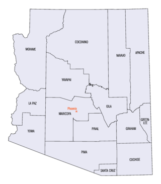
<span class="mw-page-title-main">National Register of Historic Places listings in Arizona</span>

This is a directory of properties and districts listed on the National Register of Historic Places in Arizona. There are about fourteen hundred listed sites in the state, and each of its fifteen counties has at least ten listings on the National Register. Forty-seven of the state's sites are further designated as National Historic Landmarks.
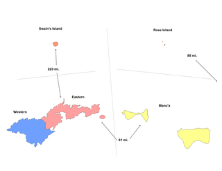
<span class="mw-page-title-main">National Register of Historic Places listings in American Samoa</span>

This is a list of the buildings, sites, districts, and objects listed on the National Register of Historic Places in American Samoa. There are currently 31 listed sites spread across the three districts of American Samoa. There are no sites listed on the unorganized atoll of Swains Island.

This is a list of properties and districts listed on the National Register of Historic Places in Alaska. There are approximately 400 listed sites in Alaska. Each of the state's 30 boroughs and census areas has at least two listings on the National Register, except for the Kusilvak Census Area, which has none.

<span class="mw-page-title-main">National Register of Historic Places listings in Arkansas</span>

This is a list of properties and historic districts in Arkansas that are listed on the National Register of Historic Places. There are more than 2,600 listings in the state, including at least 8 listings in each of Arkansas's 75 counties.

<span class="mw-page-title-main">National Register of Historic Places listings in Illinois</span>

This is a list of properties and districts in Illinois that are on the National Register of Historic Places. There are over 1,900 in total. Of these, 85 are National Historic Landmarks. There are listings in all of the state's 102 counties.
     This National Park Service list is complete through NPS recent listings posted August 4, 2023.

<span class="mw-page-title-main">National Register of Historic Places listings in Idaho</span>

This is a directory of properties and districts included among the National Register of Historic Places listings in Idaho. There are approximately 1,000 sites in Idaho listed on the National Register. Each of the state's 44 counties has at least one listing on the National Register.

<span class="mw-page-title-main">National Register of Historic Places listings in Indiana</span>

This is a list of properties and districts in Indiana that are listed on the National Register of Historic Places. There are over 1,900 in total. Of these, 39 are National Historic Landmarks. Each of Indiana's 92 counties has at least two listings.
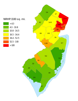
<span class="mw-page-title-main">National Register of Historic Places listings in New Jersey</span>

This is a list of properties and districts listed on the National Register of Historic Places in New Jersey. There are more than 1,700 listed sites in New Jersey. Of these, 58 are further designated as National Historic Landmarks. All 21 counties in New Jersey have listings on the National Register.
     This National Park Service list is complete through NPS recent listings posted August 4, 2023.

<span class="mw-page-title-main">National Register of Historic Places listings in New Hampshire</span>

This is a directory of properties and districts listed on the National Register of Historic Places in New Hampshire. There are more than 800 listed sites in New Hampshire. Each of the 10 counties in New Hampshire has at least 30 listings on the National Register.
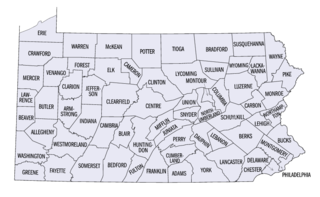
<span class="mw-page-title-main">National Register of Historic Places listings in Pennsylvania</span>

This is a list of properties and districts listed on the National Register of Historic Places in Pennsylvania. As of 2015, there are over 3,000 listed sites in Pennsylvania. All 67 counties in Pennsylvania have listings on the National Register.

This is a list of properties on the National Register of Historic Places in the U.S. state of Vermont.

<span class="mw-page-title-main">National Register of Historic Places listings in Franklin County, New York</span>

List of the National Register of Historic Places listings in Franklin County, New York
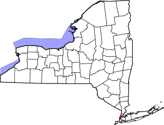
<span class="mw-page-title-main">National Register of Historic Places listings in Manhattan</span>

There are 577 properties and districts listed on the National Register of Historic Places in New York County, New York, which consists of Manhattan Island, the Marble Hill neighborhood on the mainland north of the Harlem River Ship Canal, and adjacent smaller islands around it. One listing, appears on more than one of the lists described below.

References

Map all coordinates using: OpenStreetMap
  1. "National Register Information System". National Register of Historic Places . National Park Service. July 9, 2010.