Mooresville | |
|---|---|
 Western terminus of Kentucky Highway 458 at Moorseville | |
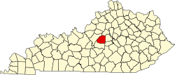
 Mooresville Location within the state of Kentucky  Mooresville Mooresville (the United States) | |
| Coordinates: 37°47′56″N85°15′55″W / 37.79889°N 85.26528°W | |
| Country | United States |
| State | Kentucky |
| County | Washington |
| Elevation | 784 ft (239 m) |
| Time zone | UTC-5 (Eastern (EST)) |
| • Summer (DST) | UTC-4 (EST) |
| GNIS feature ID | 498568 [1] |
Mooresville is an unincorporated community located in Washington County, Kentucky, United States. Its post office is closed. [2]