Maud | |
|---|---|
 Kentucky Highway 55 at Maud, facing northwest | |
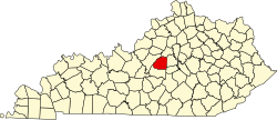
 Maud Location within the state of Kentucky  Maud Maud (the United States) | |
| Coordinates: 37°49′17″N85°17′48″W / 37.82139°N 85.29667°W | |
| Country | United States |
| State | Kentucky |
| County | Washington |
| Elevation | 561 ft (171 m) |
| Time zone | UTC-5 (Eastern (EST)) |
| • Summer (DST) | UTC-4 (EST) |
| GNIS feature ID | 508561 [1] |
Maud is an unincorporated community located in Washington County, Kentucky, United States. Its post office is closed. [2]