Saint Catharine, Kentucky | |
|---|---|
 Saint Catharine, Kentucky | |
| Coordinates: 37°42′31″N85°15′28″W / 37.70861°N 85.25778°W | |
| Country | United States |
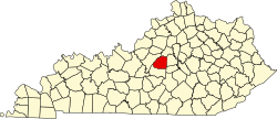
| State | Kentucky |
| County | Washington |
| Elevation | 787 ft (240 m) |
| Time zone | UTC-5 (Eastern (EST)) |
| • Summer (DST) | UTC-4 (EDT) |
| ZIP code | 40061 |
| Area code | 859 |
| GNIS feature ID | 1890844 [1] |
Saint Catharine (also Saint Catherine) is an unincorporated community in Washington County, Kentucky, United States. [1] Its ZIP code is 40061. [2]
A post office has been in operation at Saint Catharine since 1900. [3] The community took its name from St. Catharine College. [4]