Warren County, Kentucky

Last updated

Warren County
Warren County Kentucky new courthouse.jpg
Warren County Justice Center in Bowling Green
Map of Kentucky highlighting Warren County.svg
Location within the U.S. state of Kentucky
Kentucky in United States.svg
Kentucky's location within the U.S.
Coordinates: 36°59′N86°25′W / 36.99°N 86.42°W / 36.99; -86.42
CountryFlag of the United States.svg United States
StateFlag of Kentucky.svg Kentucky
FoundedDecember 19, 1796
Named after Joseph Warren
Seat Bowling Green
Largest cityBowling Green
Area
  Total
548 sq mi (1,420 km2)
  Land542 sq mi (1,400 km2)
  Water6.0 sq mi (16 km2)  1.1%
Population
 (2020)
  Total
134,554
  Estimate 
(2024)
147,936 Increase2.svg
  Density250/sq mi (95/km2)
Time zone UTC−6 (Central)
  Summer (DST) UTC−5 (CDT)
Congressional district 2nd
Website www.warrencountyky.gov

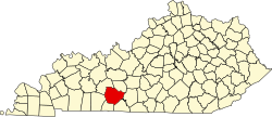
Warren County is a county located in the south central portion of the U.S. state of Kentucky. As of the 2020 census, the population was 134,554, [1] making it the fifth-most populous county in Kentucky. The county seat is Bowling Green. [2] Warren County is now classified as a wet county after voters approved the measure in 2018. The measure became law in January 2019 that allows alcohol to be sold county wide. [3]

Contents

Warren County is included in the Bowling Green, KY Metropolitan Statistical Area. It is located in the Pennyroyal Plateau and Western Coal Fields regions. [4]

History

Warren County was the location of several Native American villages and ancient burial mounds constructed by earlier cultures. The first white men to enter the area were the long hunters in the 1770s. [5] General Elijah Covington was among the first landowners. [6] McFadden's Station, one of the earliest settlements, was established in 1785 by Andrew McFadden/McFadin on the northern bank of the Barren River at the Cumberland Trace. [7]

Warren County became the 23rd county of Kentucky in 1796, from a section of Logan County. [8] [9] It was named after General Joseph Warren of the Revolutionary War. He dispatched William Dawes and Paul Revere on their famous midnight ride to warn residents of the approaching British troops. He was also a hero of the Battle of Bunker Hill. [10]

Through riverboat trade, Warren County thrived in the agricultural market. In 1859, the Louisville and Nashville Railroad (currently CSX Transportation) was laid through the county. [5]

During the Civil War, most residents are said to have favored the Union. [5] [11] Because of its strategic value, Warren County was occupied by Confederate forces in September 1861. It was occupied in turn by the Union Army on February 14, 1862, following the Confederate retreat to Tennessee. [5] During the Confederate withdrawal, they destroyed railroad bridges in Barren County, the Bowling Green train depot and other railroad buildings to hinder Union pursuit. [12]

The completion of Interstate 65 and Green River Parkway, later renamed the William H. Natcher Parkway, (and in 2019 was renamed as the I-165) in the 1960s and 1970s, brought an industrial boom that transformed the farm-oriented county into a more urban one. [5]

In 1997, Bowling Green became a Tree City USA, sponsored by the National Arbor Day Foundation. [13]

Geography

According to the United States Census Bureau, the county has a total area of 548 square miles (1,420 km2), of which 542 square miles (1,400 km2) is land and 6.0 square miles (16 km2) (1.1%) is water. [14]

Geographic features

The Green River forms the northern boundary of the county, and was a means of transportation for settlers. Tributaries of the Green River that flow through Warren County are the Barren and Gasper rivers, Drake's and Jennings creeks and Bay's Fork. In the north the land is possibly the most rugged, since it lies between the Green and Barren rivers, with very tall ridges near Riverside and Richardsville. The major drainage in Warren county is Barren River, which flows through Bowling Green and is surrounded by steep ridges in some areas. Several sizable hills rise in Bowling Green proper. They were favored for forts and other development: a reservoir, hospital, and Civil War fort were built on one; much of Western Kentucky University's campus on another; Hobson Grove, a historic Italian Renaissance style civil war era plantation estate on another; and a second civil war fort on another. In the east the land is rolling (much like central Kentucky's landscape) near Drakes Creek. The land in the south and southwest of the county is predominantly flat. In the western side of the county, the land is hilly with steep ridges and rocky and cliff-ridden near Gasper River. Shanty Hollow Lake is in the northwest corner of the county.

The flat elevated areas in the west and the flatland in the south and southwest have soil that is fertile and supports tobacco, hay, corn and soybean crop production. The rest of the land is predominantly clay soil; it is rocky and not very suitable for agriculture. Many residents rear livestock and horses, or hunt in these areas.

Transit

Major highways

Adjacent counties

Demographics

Graph of Warren County population by decade Warrenpopdec.GIF
Graph of Warren County population by decade
Historical population
CensusPop.Note
1800 4,686
1810 11,937154.7%
1820 11,776−1.3%
1830 10,949−7.0%
1840 15,44641.1%
1850 15,123−2.1%
1860 17,32014.5%
1870 21,74225.5%
1880 27,53126.6%
1890 30,1589.5%
1900 29,970−0.6%
1910 30,5792.0%
1920 30,8580.9%
1930 33,6769.1%
1940 36,6318.8%
1950 42,75816.7%
1960 45,4916.4%
1970 57,88427.2%
1980 71,82824.1%
1990 76,6736.7%
2000 92,52220.7%
2010 113,79223.0%
2020 134,55418.2%
2024 (est.)147,936 [15] 9.9%
U.S. Decennial Census [16]
1790-1960 [17] 1900-1990 [18]
1990-2000 [19] 2010-2020 [1]

As of the census of 2000, [20] there were 92,522 people, 35,365 households and 23,411 families residing in the county. The population density was 170 per square mile (66/km2). There were 38,350 housing units at an average density of 70 per square mile (27/km2). The racial makeup of the county was 86.98% White, 8.58% Black or African American, 0.24% Native American, 1.35% Asian, 0.08% Pacific Islander, 1.33% from other races, and 1.45% from two or more races. 2.67% of the population were Hispanic or Latino of any race.

There were 35,365 households, of which 31.40% had children under the age of 18 living with them, 51.40% were married couples living together, 11.20% had a female householder with no husband present, and 33.80% were non-families. 26.10% of all households were made up of individuals, and 8.30% had someone living alone who was 65 years of age or older. The average household size was 2.46 and the average family size was 2.97.

The age distribution was 23.10% under the age of 18, 16.20% from 18 to 24, 29.10% from 25 to 44, 21.10% from 45 to 64, and 10.50% who were 65 years of age or older. The median age was 32 years. For every 100 females, there were 96.20 males. For every 100 females age 18 and over, there were 93.00 males.

The median household income was $36,151, and the median family income was $45,142. Males had a median income of $32,063 versus $22,777 for females. The per capita income for the county was $18,847. About 10.80% of families and 15.40% of the population were below the poverty line, including 17.80% of those under age 18 and 13.80% of those age 65 or over.

Politics

United States presidential election results for Warren County, Kentucky [21]
Year Republican Democratic Third party(ies)
No.%No.%No.%
1880 1,70340.54%2,25353.63%2455.83%
1884 1,86638.32%2,93760.32%661.36%
1888 2,59041.27%3,58757.15%991.58%
1892 2,05338.68%2,86754.02%3877.29%
1896 2,86641.96%3,71654.41%2483.63%
1900 2,92845.33%3,45553.48%771.19%
1904 2,73742.75%3,48454.42%1812.83%
1908 2,92943.11%3,74255.07%1241.82%
1912 1,34220.29%3,44752.12%1,82527.59%
1916 3,00241.15%4,22857.96%650.89%
1920 5,47443.45%7,01055.64%1150.91%
1924 5,63444.12%7,00554.85%1321.03%
1928 7,93160.90%5,09239.10%10.01%
1932 4,56933.65%8,93265.78%770.57%
1936 4,34734.74%8,11364.83%540.43%
1940 4,19535.55%7,56964.14%360.31%
1944 4,94439.52%7,52860.18%370.30%
1948 3,91933.52%6,76857.89%1,0048.59%
1952 7,26750.44%7,10649.32%340.24%
1956 8,12353.06%7,14346.66%440.29%
1960 9,07454.89%7,45745.11%00.00%
1964 5,91537.36%9,88762.45%290.18%
1968 8,08445.76%5,20029.44%4,38124.80%
1972 12,48166.78%5,93431.75%2761.48%
1976 9,43948.93%9,65750.06%1951.01%
1980 12,18453.90%9,64342.66%7773.44%
1984 16,16766.87%7,93732.83%740.31%
1988 16,70363.07%9,68436.57%970.37%
1992 14,74849.33%11,52938.56%3,61912.11%
1996 15,78453.68%11,64239.59%1,9806.73%
2000 20,23561.36%12,18036.94%5601.70%
2004 25,10063.21%14,32636.08%2850.72%
2008 25,99358.88%17,66940.02%4831.09%
2012 26,38460.10%16,80538.28%7141.63%
2016 28,67359.18%16,96635.01%2,8155.81%
2020 31,79157.38%22,47940.58%1,1312.04%
2024 34,86261.28%21,06537.03%9641.69%

The county voted "No" on 2022 Kentucky Amendment 2, an anti-abortion ballot measure, by 55% to 45%, and backed Donald Trump with 57% of the vote to Joe Biden's 41% in the 2020 presidential election. [22]

Elected officials

Elected officials as of January 3, 2025 [23] [24]
U.S. House Brett Guthrie (R) KY2
Ky. Senate David P. Givens (R) 9
Max Wise (R) 16
Mike Wilson (R) 32
Ky. House Robert Duvall (R) 17
Michael Meredith (R) 19
Kevin Jackson (R) 20
Shawn McPherson (R) 22

Education

Two public school districts operate in the county: [25]

High schools include:

County schools
Bowling Green ISD

There is also a state-operated public school for gifted students

There are also private schools including

Colleges and universities

Public Library System

Attractions

Communities

Cities

Census-designated place

Other unincorporated places

North Warren

South Warren

See also

References

  1. 1 2 "State & County QuickFacts". United States Census Bureau. Retrieved June 28, 2022.
  2. "Find a County". National Association of Counties. Retrieved June 7, 2011.
  3. "Wet & Dry Counties in Kentucky" (PDF). Kentucky Office of Alcoholic Beverage Control. Archived from the original (PDF) on March 15, 2007. Retrieved March 21, 2007.
  4. "Warren County, Kentucky - Kentucky Atlas and Gazetteer". www.uky.edu.
  5. 1 2 3 4 5 Hoffman, Dr. Wayne (1989). "The History of Bowling Green and Warren County" (PDF). Archived (PDF) from the original on November 23, 2016.
  6. Hay, Melba Porter; Wells, Dianne; Appleton, Thomas H. Jr.; Appleton, Thomas H. (April 6, 2002). Roadside History: A Guide to Kentucky Highway Markers. University Press of Kentucky. ISBN   9780916968298.
  7. "McFadin's Station - Kentucky Historical Markers on Waymarking.com". www.waymarking.com. Retrieved March 15, 2019.
  8. "Warren County". The Kentucky Encyclopedia. 2000. Retrieved August 23, 2014.
  9. Collins, Lewis (1882). Collins' Historical Sketches of Kentucky: History of Kentucky, Volume 2. Collins & Company. p. 26.
  10. Martin, McKenzie. "Warren County". ExploreKYHistory. Retrieved March 15, 2019.
  11. "Civil War Dispatch - Western Kentucky University". www.wkms.org. November 23, 2011. Retrieved March 15, 2019.
  12. Martin, McKenzie. "Civil War Occupations". ExploreKYHistory. Retrieved March 15, 2019.
  13. "Tree Cities". www.arborday.org. Retrieved March 13, 2019.
  14. "2010 Census Gazetteer Files". United States Census Bureau. August 22, 2012. Archived from the original on August 12, 2014. Retrieved August 20, 2014.
  15. "Annual Estimates of the Resident Population for Counties: April 1, 2020 to July 1, 2024". United States Census Bureau. Retrieved March 13, 2025.
  16. "U.S. Decennial Census". United States Census Bureau. Retrieved August 20, 2014.
  17. "Historical Census Browser". University of Virginia Library. Retrieved August 20, 2014.
  18. "Population of Counties by Decennial Census: 1900 to 1990". United States Census Bureau. Retrieved August 20, 2014.
  19. "Census 2000 PHC-T-4. Ranking Tables for Counties: 1990 and 2000" (PDF). United States Census Bureau. Archived (PDF) from the original on March 27, 2010. Retrieved August 20, 2014.
  20. "U.S. Census website". United States Census Bureau . Retrieved January 31, 2008.
  21. Leip, David. "Dave Leip's Atlas of U.S. Presidential Elections". uselectionatlas.org. Retrieved July 6, 2018.
  22. "November 8, 2022 - Official 2022 General Election Results" (PDF). Commonwealth of Kentucky State Board of Elections. Archived from the original (PDF) on December 24, 2022. Retrieved December 30, 2024.
  23. "Senate Members - County". apps.legislature.ky.gov. Kentucky General Assembly . Retrieved January 3, 2025.
  24. "House Members - County". apps.legislature.ky.gov. Kentucky General Assembly . Retrieved January 3, 2025.
  25. "2020 CENSUS - SCHOOL DISTRICT REFERENCE MAP: Warren County, KY" (PDF). United States Census Bureau. Archived (PDF) from the original on June 14, 2021. Retrieved June 14, 2021. - Text list - For more detailed boundaries of the independent school districts see: "Appendix B: Maps Of Independent School Districts In Operation In FY 2014-FY 2015 Using 2005 Tax District Boundaries – Bowling Green ISD" (PDF). Research Report No. 415 – Kentucky's Independent School Districts: A Primer. Frankfort, KY: Office of Education Accountability, Legislative Research Commission. September 15, 2015. p. 94 (PDF p. 108/174). Archived (PDF) from the original on December 10, 2020.

36°59′N86°25′W / 36.99°N 86.42°W / 36.99; -86.42