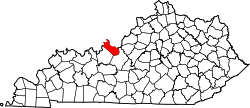
Meade County | |
---|---|
Coordinates: 37°59′N86°13′W / 37.98°N 86.22°W | |
Country | United States |
State | Kentucky |
Founded | 1823 |
Named for | James Meade |
Seat | Brandenburg |
Largest city | Brandenburg |
Area | |
• Total | 325 sq mi (840 km2) |
• Land | 305 sq mi (790 km2) |
• Water | 19 sq mi (50 km2) 5.9% |
Population (2020) | |
• Total | 30,003 |
• Estimate (2023) | 30,131 |
• Density | 92/sq mi (36/km2) |
Time zone | UTC−5 (Eastern) |
• Summer (DST) | UTC−4 (EDT) |
Congressional district | 2nd |
Website | meadeky.gov |
Meade County is a county located in the U.S. state of Kentucky. As of the 2020 census, the population was 30,003. [1] Its county seat is Brandenburg. [2] The county was founded December 17, 1823, and named for Captain James M. Meade, who was killed in action at the Battle of River Raisin during the War of 1812. [3] [4] [5] Meade County is part of the Elizabethtown-Fort Knox, KY Metropolitan Statistical Area, which is included in the Louisville/Jefferson County-Elizabethtown-Madison, KY-IN Combined Statistical Area.
According to the United States Census Bureau, the county has a total area of 325 square miles (840 km2), of which 305 square miles (790 km2) is land and 19 square miles (49 km2) (5.9%) is water. [6] All 56 miles (90 km) of the county's northern border faces Indiana, across from the Ohio River.
Census | Pop. | Note | %± |
---|---|---|---|
1830 | 4,131 | — | |
1840 | 5,780 | 39.9% | |
1850 | 7,393 | 27.9% | |
1860 | 8,898 | 20.4% | |
1870 | 9,485 | 6.6% | |
1880 | 10,323 | 8.8% | |
1890 | 9,484 | −8.1% | |
1900 | 10,533 | 11.1% | |
1910 | 9,783 | −7.1% | |
1920 | 9,442 | −3.5% | |
1930 | 8,042 | −14.8% | |
1940 | 8,827 | 9.8% | |
1950 | 9,422 | 6.7% | |
1960 | 18,938 | 101.0% | |
1970 | 18,796 | −0.7% | |
1980 | 22,854 | 21.6% | |
1990 | 24,170 | 5.8% | |
2000 | 26,349 | 9.0% | |
2010 | 28,602 | 8.6% | |
2020 | 30,003 | 4.9% | |
2023 (est.) | 30,131 | [7] | 0.4% |
U.S. Decennial Census [8] 1790–1960 [9] 1900–1990 [10] 1990–2000 [11] 2010–2020 [1] |
As of the census [12] of 2000, there were 26,349 people, 9,470 households, and 7,396 families residing in the county. The population density was 85 per square mile (33/km2). There were 10,293 housing units at an average density of 33 per square mile (13/km2). The racial makeup of the county was 92.37% White, 4.13% Black or African American, 0.59% Native American, 0.53% Asian, 0.13% Pacific Islander, 0.83% from other races, and 1.43% from two or more races. 2.15% of the population were Hispanic or Latino of any race.
There were 9,470 households, out of which 42.20% had children under the age of 18 living with them, 64.10% were married couples living together, 9.70% had a female householder with no husband present, and 21.90% were non-families. Of all households 18.40% were made up of individuals, and 6.50% had someone living alone who was 65 years of age or older. The average household size was 2.77 and the average family size was 3.15.
In the county, the population was spread out, with 29.80% under the age of 18, 9.10% from 18 to 24, 32.70% from 25 to 44, 20.30% from 45 to 64, and 8.10% who were 65 years of age or older. The median age was 32 years. For every 100 females, there were 100.40 males. For every 100 females age 18 and over, there were 98.30 males.
The median income for a household in the county was $36,966, and the median income for a family was $40,592. Males had a median income of $30,835 versus $22,038 for females. The per capita income for the county was $16,000. About 9.30% of families and 11.30% of the population were below the poverty line, including 13.80% of those under age 18 and 12.30% of those age 65 or over.
Year | Republican | Democratic | Third party(ies) | |||
---|---|---|---|---|---|---|
No. | % | No. | % | No. | % | |
2024 | 10,630 | 75.29% | 3,279 | 23.22% | 210 | 1.49% |
2020 | 10,185 | 72.17% | 3,632 | 25.74% | 296 | 2.10% |
2016 | 8,660 | 70.80% | 3,026 | 24.74% | 545 | 4.46% |
2012 | 6,606 | 60.52% | 4,122 | 37.76% | 188 | 1.72% |
2008 | 6,691 | 59.71% | 4,343 | 38.76% | 172 | 1.53% |
2004 | 7,152 | 65.31% | 3,724 | 34.01% | 75 | 0.68% |
2000 | 5,319 | 58.64% | 3,596 | 39.64% | 156 | 1.72% |
1996 | 2,855 | 38.33% | 3,653 | 49.04% | 941 | 12.63% |
1992 | 2,641 | 35.86% | 3,387 | 45.99% | 1,337 | 18.15% |
1988 | 3,441 | 52.57% | 3,079 | 47.04% | 25 | 0.38% |
1984 | 3,820 | 60.19% | 2,503 | 39.44% | 24 | 0.38% |
1980 | 2,740 | 45.22% | 3,205 | 52.90% | 114 | 1.88% |
1976 | 1,755 | 36.05% | 3,030 | 62.24% | 83 | 1.71% |
1972 | 2,492 | 60.93% | 1,541 | 37.68% | 57 | 1.39% |
1968 | 1,385 | 32.98% | 1,926 | 45.86% | 889 | 21.17% |
1964 | 1,055 | 25.51% | 3,076 | 74.37% | 5 | 0.12% |
1960 | 1,826 | 43.36% | 2,385 | 56.64% | 0 | 0.00% |
1956 | 1,670 | 45.23% | 2,016 | 54.60% | 6 | 0.16% |
1952 | 1,265 | 38.22% | 2,040 | 61.63% | 5 | 0.15% |
1948 | 773 | 27.99% | 1,915 | 69.33% | 74 | 2.68% |
1944 | 1,040 | 36.11% | 1,828 | 63.47% | 12 | 0.42% |
1940 | 995 | 31.88% | 2,114 | 67.73% | 12 | 0.38% |
1936 | 785 | 26.47% | 2,102 | 70.87% | 79 | 2.66% |
1932 | 1,050 | 29.46% | 2,488 | 69.81% | 26 | 0.73% |
1928 | 1,610 | 48.54% | 1,700 | 51.25% | 7 | 0.21% |
1924 | 1,106 | 37.43% | 1,802 | 60.98% | 47 | 1.59% |
1920 | 1,468 | 39.75% | 2,195 | 59.44% | 30 | 0.81% |
1916 | 803 | 37.11% | 1,317 | 60.86% | 44 | 2.03% |
1912 | 337 | 16.58% | 1,145 | 56.35% | 550 | 27.07% |
Most of the county is zoned to Meade County Schools, [14] which operates Meade County High School.
However people living on Fort Knox are instead zoned to the Department of Defense Education Activity (DoDEA), [14] which operates Fort Knox Middle High School.
Fort Knox is a United States Army installation in Kentucky, south of Louisville and north of Elizabethtown. It is adjacent to the United States Bullion Depository, which is used to house a large portion of the United States' official gold reserves, and with which it is often conflated. The 109,000-acre base covers parts of Bullitt, Hardin and Meade counties. It currently holds the Army Human Resources Center of Excellence, including the Army Human Resources Command. It is named in honor of Henry Knox, Chief of Artillery in the American Revolutionary War and the first United States Secretary of War.
Union County is a county in the U.S. state of Kentucky. As of the 2020 census, the population was 13,668. Its county seat is Morganfield. The county was created effective January 15, 1811.
Spencer County is a county located in the U.S. state of Kentucky. As of the 2020 census, the total population was 19,490. Its county seat is Taylorsville. The county was founded in 1824 and named for Spier Spencer.
LaRue County is a county in the central region of the U.S. state of Kentucky, outside the Bluegrass Region and larger population centers. As of the 2020 census, the population was 14,867. Its county seat is Hodgenville, which is best known as the birthplace of United States President Abraham Lincoln. The county was established on March 4, 1843, from the southeast portion of Hardin County. It was named for John P. LaRue, an early settler. LaRue County is included in the Elizabethtown-Fort Knox, KY Metropolitan Statistical Area, which is also included in the Louisville/Jefferson County-Elizabethtown-Bardstown, KY-IN Combined Statistical Area. It is a dry county.
Kenton County is a county located in the northern part of the Commonwealth of Kentucky. As of the 2020 census, the population was 169,064, making it the third most populous county in Kentucky. Its county seats are Covington and Independence. It was, until November 24, 2010, the only county in Kentucky to have two legally recognized county seats. The county was formed in 1840 and is named for Simon Kenton, a frontiersman notable in the early history of the state.
Jefferson County is a county located in the north central portion of the U.S. state of Kentucky. As of the 2020 census, the population was 782,969. It is the most populous county in the commonwealth.
Hardin County is a county located in the central part of the U.S. state of Kentucky. Its county seat is Elizabethtown. The county was formed in 1792. Hardin County is part of the Elizabethtown-Fort Knox, KY Metropolitan Statistical Area, as well as the Louisville/Jefferson County—Elizabethtown-Bardstown, KY-IN Combined Statistical Area. As of the 2020 census, the population was 110,702.
Bullitt County is a county located in the north central portion of the U.S. state of Kentucky. As of the 2020 census, the population was 82,217. Its county seat is Shepherdsville. The county was founded in 1796. Located just south of the city of Louisville, Bullitt County is included in the Louisville/Jefferson County, KY-IN Metropolitan Statistical Area, commonly known as Kentuckiana. The western fifth of the county is part of the United States Army post of Fort Knox and is reserved for military training.
Breckinridge County is a county located in the Commonwealth of Kentucky. As of the 2020 census, the population was 20,432. Its county seat is Hardinsburg, Kentucky. The county was named for John Breckinridge (1760–1806), a Kentucky Attorney General, state legislator, United States Senator, and United States Attorney General. It was the 38th Kentucky county in order of formation. Breckinridge County is now a wet county, following a local-option election on January 29, 2013, but it had been a dry county for the previous 105 years.
Elizabethtown is a home rule-class city and the county seat of Hardin County, Kentucky, United States. The population was 28,531 at the 2010 census, and was estimated at 31,394 by the U.S. Census Bureau in 2020, making it the 11th-largest city in the state. It is included in the Elizabethtown–Fort Knox, Kentucky Metropolitan Statistical Area, which is included in the Louisville/Jefferson County–Elizabethtown–Madison, Kentucky-Indiana Combined Statistical Area. The Elizabethtown Metropolitan area had a 2019 estimated population of 153,057, making it the 5th-largest metropolitan area in the state.
Radcliff is a home rule-class city in Hardin County, Kentucky, in the United States. The population was 23,042 as of the 2020 Census, up from 21,692 from the 2010 census.
Vine Grove is a home rule-class city in Hardin County, Kentucky, United States. The population was 6,559 as of the 2020 Census, up from 4,520 at the 2010 census. It is part of the Elizabethtown–Fort Knox Metropolitan Statistical Area.
West Point is a home rule-class city in Hardin County, Kentucky, United States, near the edge of Fort Knox military reservation on Dixie Highway. It is located in a former meander bend of the Ohio River. The population was 952 as of the 2020 Census, up from 797 from the 2010 census, but still down from 1,100 at the 2000 census.
Nortonville is a home rule-class city in Hopkins County, Kentucky, in the United States. The population was 1,204 as of the 2010 census.
Hardin is a home rule-class city in Marshall County, Kentucky, United States. The population was 580 at the 2020 census.
Brandenburg is a home rule-class city on the Ohio River in Meade County, Kentucky, in the United States. The city is 40 miles (64 km) southwest of Louisville. It is the seat of its county. The population was 2,894 at the 2020 census.
Ekron is a home rule-class city in Meade County, Kentucky, United States. The population was 175 at the 2020 census.
Muldraugh is a home rule-class city in Meade and Hardin counties in the U.S. state of Kentucky. It lies on U.S. Route 31W north of Elizabethtown. The city limits are completely encompassed by the Fort Knox army base. The population was 1,040 as of the 2020 census. The city is part of the Elizabethtown–Fort Knox Metropolitan Area.
Upton is a home rule-class city in Hardin and LaRue counties in the U.S. state of Kentucky. The population was 704 as of the 2020 Census, up from 683 from the 2010 census. Its entire area is included in the Elizabethtown–Fort Knox Metropolitan Statistical Area.
The Elizabethtown–Fort Knox Metropolitan Statistical Area, as defined by the United States Census Bureau, is an area consisting of two counties in Kentucky, anchored by the city of Elizabethtown and the nearby Fort Knox Army post. As of the 2020 census, the MSA had a population of 155,572.