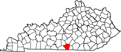
Cumberland County, Kentucky

Last updated

Cumberland County
Cumberland County Kentucky courthouse.jpg
Cumberland County courthouse in Burkesville
Map of Kentucky highlighting Cumberland County.svg
Location within the U.S. state of Kentucky
Kentucky in United States.svg
Kentucky's location within the U.S.
Coordinates: 36°47′N85°23′W / 36.78°N 85.39°W / 36.78; -85.39
CountryFlag of the United States.svg United States
StateFlag of Kentucky.svg  Kentucky
Founded1798
Named for Cumberland River
Seat Burkesville
Largest cityBurkesville
Government
   Judge/Executive Luke King
Area
  Total
311 sq mi (810 km2)
  Land305 sq mi (790 km2)
  Water5.7 sq mi (15 km2)  1.8%
Population
 (2020)
  Total
5,888
  Estimate 
(2023)
6,000 Increase2.svg
  Density19/sq mi (7.3/km2)
Time zone UTC−6 (Central)
  Summer (DST) UTC−5 (CDT)
Congressional district 1st
Website explorecumberlandcounty.com

Cumberland County is a county located in the Pennyroyal Plateau region of the U.S. state of Kentucky. As of the 2020 census, the population was 5,888. [1] Its county seat is Burkesville. [2] The county was formed in 1798 and named for the Cumberland River, which in turn may have been named after the Duke of Cumberland [3] or the English county of Cumberland. [4]

Contents

History

Cumberland County was created in 1798 from land given by Green County. [5] In 1829, the first commercial oil well in the United States was dug three miles north of Burkesville. It is usually not recognized as a commercial well because the drillers were looking for salt brine, but the oil was bottled and sold.

It was the first county in the United States to elect a female sheriff, Pearl Carter Pace.

Burkesville is the first town downstream from Wolf Creek Dam, so it is considered flood-proof, but there have been concerns about leaks at the dam. The U.S. Army Corps of Engineers completed repairs in 2013.

Geography

According to the U.S. Census Bureau, the county has a total area of 311 square miles (810 km2), of which 305 square miles (790 km2) is land and 5.7 square miles (15 km2) (1.8%) is water. [6] Major waterways include the Cumberland River and a small branch of Dale Hollow Lake which covers the southern end of the county.

Adjacent counties

Demographics

Historical population
CensusPop.Note
1800 3,284
1810 6,19188.5%
1820 8,05830.2%
1830 8,6247.0%
1840 6,090−29.4%
1850 7,00515.0%
1860 7,3404.8%
1870 7,6904.8%
1880 8,89415.7%
1890 8,452−5.0%
1900 8,9626.0%
1910 9,8469.9%
1920 10,6488.1%
1930 10,204−4.2%
1940 11,92316.8%
1950 9,309−21.9%
1960 7,835−15.8%
1970 6,850−12.6%
1980 7,2896.4%
1990 6,784−6.9%
2000 7,1475.4%
2010 6,856−4.1%
2020 5,888−14.1%
2023 (est.)6,000 [7] 1.9%
U.S. Decennial Census [8]
1790-1960 [9] 1900-1990 [10]
1990-2000 [11] 2010-2021 [12]

As of the census [13] of 2000, there were 7,147 people, 2,976 households, and 2,038 families residing in the county. The population density was 23 per square mile (8.9/km2). There were 3,567 housing units at an average density of 12 per square mile (4.6/km2). The racial makeup of the county was 95.28% White, 3.41% Black or African American, 0.14% Native American, 0.04% Asian, 0.06% Pacific Islander, 0.15% from other races, and 0.91% from two or more races. 0.60% of the population were Hispanic or Latino of any race.

There were 2,976 households, out of which 29.40% had children under the age of 18 living with them, 53.00% were married couples living together, 11.20% had a female householder with no husband present, and 31.50% were non-families. 28.90% of all households were made up of individuals, and 14.50% had someone living alone who was 65 years of age or older. The average household size was 2.37 and the average family size was 2.89.

In the county, the population was spread out, with 23.60% under the age of 18, 6.90% from 18 to 24, 26.80% from 25 to 44, 24.80% from 45 to 64, and 17.90% who were 65 years of age or older. The median age was 40 years. For every 100 females there were 92.70 males. For every 100 females age 18 and over, there were 89.10 males.

The median income for a household in the county was $21,572, and the median income for a family was $28,701. Males had a median income of $21,313 versus $16,548 for females. The per capita income for the county was $12,643. About 16.40% of families and 23.80% of the population were below the poverty line, including 30.30% of those under age 18 and 33.00% of those age 65 or over.

Ancestry/ethnicity

As of 2017 the largest self-identified ancestry groups/ethnic groups in Cumberland County, Kentucky were: [14]

Largest ancestries (2017)Percent
English 32.8%
"American" 15.7%
Irish 10.2%
German 4.4%
Scots-Irish 1.1%
Italian 1.1%
Scottish 1.1%
French (except Basque) 1.0%
Polish 0.9%

[14]

Communities

City

Census-designated place

Other unincorporated places

Politics

United States presidential election results for Cumberland County, Kentucky [15]
Year Republican Democratic Third party(ies)
No.%No.%No.%
2024 2,92284.89%48314.03%371.07%
2020 2,76983.68%50815.35%320.97%
2016 2,50281.60%45914.97%1053.42%
2012 2,21677.65%59920.99%391.37%
2008 2,05673.51%69724.92%441.57%
2004 2,35672.74%84826.18%351.08%
2000 2,22073.85%73624.48%501.66%
1996 1,65462.13%75328.29%2559.58%
1992 1,86660.96%91729.96%2789.08%
1988 2,23174.49%75325.14%110.37%
1984 2,72977.77%76621.83%140.40%
1980 2,21671.92%82126.65%441.43%
1976 1,65365.41%85333.76%210.83%
1972 2,29476.42%68622.85%220.73%
1968 2,11667.82%64620.71%35811.47%
1964 1,79456.70%1,34842.60%220.70%
1960 2,69776.25%84023.75%00.00%
1956 2,58471.76%1,00027.77%170.47%
1952 2,42672.44%90927.14%140.42%
1948 1,94769.31%79428.27%682.42%
1944 2,61978.27%71721.43%100.30%
1940 2,53374.30%87225.58%40.12%
1936 2,12769.40%93530.51%30.10%
1932 2,36965.53%1,23534.16%110.30%
1928 2,59382.79%53817.18%10.03%
1924 2,14369.60%91829.81%180.58%
1920 2,38071.60%93128.01%130.39%
1916 1,39467.60%65331.67%150.73%
1912 97256.91%57733.78%1599.31%

Like all of the heavily Unionist eastern Pennyroyal, a region of largely small farms that did not rely heavily on slavery, Cumberland County provided an exceptionally large number of soldiers for the Union Army during the Civil War. [16] Reflecting that, the county became and has remained overwhelmingly Republican following the end of the Reconstruction Era. As of 2012, Cumberland County had the fewest registered Democrats, 844, out of all of Kentucky's counties. [17]

The last Democrat to carry Cumberland County at the Presidential level was Horatio Seymour in 1868. Lyndon Johnson, in his 1964 landslide, is the only Democrat to receive 40% of the county's vote in a presidential election since 1896.

Cumberland County was a dry county prior to a special election held June 28, 2016, where the measure passed 1,441 votes to 1,069 votes.

Elected officials

Elected officials as of January 3, 2025 [18] [19]
U.S. House James Comer (R) KY1
Ky. Senate Rick Girdler (R) 15
Ky. House Amy Neighbors (R)21

Notable people

See also

References

  1. "Census - Geography Profile: Cumberland County, Kentucky". United States Census Bureau . Retrieved December 30, 2022.
  2. "Find a County". National Association of Counties. Archived from the original on May 31, 2011. Retrieved June 7, 2011.
  3. Gannett, Henry (1905). The Origin of Certain Place Names in the United States. Govt. Print. Off. pp.  97.
  4. The Register of the Kentucky State Historical Society, Volume 1. Kentucky State Historical Society. 1903. pp.  35.
  5. Collins, Lewis (1882). Collins' Historical Sketches of Kentucky: History of Kentucky, Volume 2. Collins & Company. p. 26.
  6. "2010 Census Gazetteer Files". United States Census Bureau. August 22, 2012. Archived from the original on August 12, 2014. Retrieved August 13, 2014.
  7. "Annual Estimates of the Resident Population for Counties: April 1, 2020 to July 1, 2023". United States Census Bureau. Retrieved March 14, 2024.
  8. "U.S. Decennial Census". United States Census Bureau. Retrieved August 13, 2014.
  9. "Historical Census Browser". University of Virginia Library. Archived from the original on August 11, 2012. Retrieved August 13, 2014.
  10. "Population of Counties by Decennial Census: 1900 to 1990". United States Census Bureau. Retrieved August 13, 2014.
  11. "Census 2000 PHC-T-4. Ranking Tables for Counties: 1990 and 2000" (PDF). United States Census Bureau. Archived (PDF) from the original on March 27, 2010. Retrieved August 13, 2014.
  12. "State & County QuickFacts". United States Census Bureau. Archived from the original on June 7, 2011. Retrieved March 6, 2014.
  13. "U.S. Census website". United States Census Bureau . Retrieved January 31, 2008.
  14. 1 2 "American FactFinder - Results". Archived from the original on February 13, 2020. Retrieved May 25, 2019.
  15. Leip, David. "Dave Leip's Atlas of U.S. Presidential Elections". uselectionatlas.org. Retrieved July 1, 2018.
  16. Copeland, James E.; ‘Where Were the Kentucky Unionists and Secessionists’; The Register of the Kentucky Historical Society, volume 71, no. 4 (October 1973), pp. 344-363
  17. VOTER REGISTRATION STATISTICS REPORT; Kentucky Secretary of State
  18. "Senate Members - County". apps.legislature.ky.gov. Kentucky General Assembly . Retrieved January 3, 2025.
  19. "House Members - County". apps.legislature.ky.gov. Kentucky General Assembly . Retrieved January 3, 2025.
  20. Applegate, Kris; Miller, Jarenda (2009). Around Lake Cumberland. Arcadia Publishing. p. 35. ISBN   978-0-7385-6819-5.
  21. "Montana Governor Edwin Lee Norris". National Governors Association. Archived from the original on December 2, 2012. Retrieved October 10, 2012.

36°47′N85°23′W / 36.78°N 85.39°W / 36.78; -85.39