
Masonville is an unincorporated community and census-designated place (CDP) in Daviess County, Kentucky, United States. The population was 2,129 as of the 2020 census, doubling from 1,014 in the 2010 census. It is included in the Owensboro Metropolitan Statistical Area.

Calhoun is a home rule-class city in McLean County, Kentucky, United States. The population was 725 at the 2020 census. It is the county seat of McLean County. It is included in the Owensboro, Kentucky Metropolitan Statistical Area.

Island is a home rule-class city in McLean County, Kentucky, in the United States. The population was 429 at the 2020 census. It is included in the Owensboro metropolitan area.

Livermore is a home rule-class city located at the confluence of the Green and Rough rivers in McLean County in the U.S. state of Kentucky. The population was 1,230 as of the 2020 census, down from 1,365 in 2010. It is included in the Owensboro metropolitan area.

Sacramento is a home rule-class city in McLean County, Kentucky, in the United States. The population was 429 as of the 2020 census. It is included in the Owensboro metropolitan area.

The Clarksville Metropolitan Statistical Area is defined by the United States Census Bureau as an area consisting of four counties – two in Tennessee and two in Kentucky – anchored by the city of Clarksville, Tennessee. The 2021 estimate placed the population at 329,864. As of 2020, the Clarksville Metropolitan Statistical Area was the 159th largest MSA in the United States.
The Charleston Metropolitan Statistical Area, as defined by the United States Census Bureau, is an area consisting of three counties in West Virginia, anchored by the city of Charleston. It is the largest metropolitan area entirely within the state of West Virginia. The Huntington Metro Area adds to the Charleston–Huntington, WV-OH-KY CSA and spans three states, while the core county of the Charleston area, Kanawha County, is more populous than the West Virginia portion of the Huntington area.
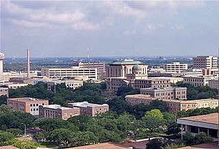
College Station–Bryan is a metropolitan area centering on the twin cities of Bryan and College Station, Texas, in the Brazos Valley region of Texas. The 2010 census placed the population of the three-county metropolitan area at 255,519. The 2019 population estimate was 273,101.

The Wheeling, WV–OH Metropolitan Statistical Area, as defined by the United States Census Bureau, is an area consisting of two counties in the Northern Panhandle of West Virginia and one in eastern Ohio, anchored by the city of Wheeling. As of the 2010 census, the MSA had a population of 147,950. This represents a decline of 3.4% from the 2000 census population of 153,172.

The Asheville metropolitan area is a metropolitan area centered on the principal city of Asheville, North Carolina. The U.S. Office of Management and Budget defines the Asheville, NC Metropolitan Statistical Area, a metropolitan statistical area used by the United States Census Bureau and other entities, as comprising the four counties of Buncombe, Haywood, Henderson, and Madison. The area's population was 424,858 according to the 2010 census, and 469,454 according to the 2020 census.

The Morgantown Metropolitan Statistical Area, as defined by the United States Census Bureau, is an area consisting of two counties in North-Central West Virginia, anchored by the city of Morgantown. As of the 2020 census, the MSA had a population of 140,038.

The Parkersburg–Vienna metropolitan area, officially the Parkersburg–Vienna, WV Metropolitan Statistical Area as defined by the United States Census Bureau, is an area consisting of two counties in West Virginia, anchored by the cities of Parkersburg and Vienna. As of the 2020 census, the MSA had a population of 89,490. Prior to the 2020 census, the metro area included the city of Marietta, Ohio and Washington County, which has since been redefined as its own micropolitan area. They now form the Parkersburg–Marietta–Vienna, WV–OH Combined Statistical Area.

The Ogden-Clearfield, UT Metropolitan Statistical Area, as defined by the United States Office of Management and Budget, is an area consisting of four counties in north central Utah, anchored by the cities of Ogden and Clearfield. As of the 2010 census, the MSA had a population of 547,184. On February 28, 2013 the White House released a Bulletin Revising delineations of CSA's and MSA's, which led to the addition of Box Elder County to the Ogden-Clearfield Metropolitan Statistical Area, bringing the MSA population to 597,159. This county was removed in the latest definitions and added to the newly created Brigham City, micropolitan statistical area.

The Idaho Falls Metropolitan Statistical Area, as defined by the United States Census Bureau, is an area consisting of three counties in eastern Idaho, anchored by the city of Idaho Falls. As of the 2020 census, the MSA had a population of 154,855. It is just north of the Pocatello, Idaho Metropolitan Area.

The Montgomery, Alabama Metropolitan Statistical Area is a metropolitan area in central Alabama. As of 2020, the MSA had a population of 386,047, ranking it 142nd among United States Metropolitan Statistical Areas. That number is up +3.07% from the 2010 census number of 374,536.

The Waterloo–Cedar Falls Metropolitan Statistical Area, as defined by the United States Census Bureau, is an area consisting of three counties in Iowa, anchored by the cities of Waterloo and Cedar Falls. As of the 2000 census, the MSA had a population of 163,706 . As of the 2010 Census, the MSA had a population of 169,484.

The Springfield Metropolitan Statistical Area, as defined by the United States Census Bureau, is an area consisting of two counties in Central Illinois, anchored by the city of Springfield. As of the 2000 census, the MSA had a population of 201,437.
The Paducah, KY–IL Metropolitan Statistical Area, as defined by the United States Census Bureau, is an area consisting of five counties – three in the Jackson Purchase region of Kentucky, a fourth Kentucky county bordering the Purchase, and one in Southern Illinois – anchored by the city of Paducah, Kentucky. The Paducah KY-IL Micropolitan Statistical Area was upgraded to Metropolitan Statistical Area (MSA) status on July 21, 2023, by the Office of Management and Budget.. Carlisle County, Kentucky, was added to the area following the 2020 Census of the Population. The total MSA population from the 2020 United States Census was 103,486.

The Elizabethtown–Fort Knox Metropolitan Statistical Area, as defined by the United States Census Bureau, is an area consisting of two counties in Kentucky, anchored by the city of Elizabethtown and the nearby Fort Knox Army post. As of the 2020 census, the MSA had a population of 155,572.

The Green Bay metropolitan statistical area, as defined by the United States Census Bureau, is a metropolitan area in northeastern Wisconsin anchored by the City of Green Bay. It is Wisconsin's fourth largest metropolitan statistical area by population. As of the 2020 Census, the MSA had a combined population of 328,268.

